3 Volumes
Tourist Trips: Philadelphia and the Quaker Colonies
The states of Pennsylvania, Delaware, and New Jersey all belonged to William Penn the Quaker in one way or another. New Jersey was first, Delaware the last. Penn was the largest private landholder in American history.
Regional Overview: The Sights of the City, Loosely Defined
Philadelphia,defined here as the Quaker region of three formerly Quaker states, contains an astonishing number of interesting places to visit. Three centuries of history leave their marks everywhere. Begin by understanding that William Penn was the largest private landholder in history, and he owned all of it.
Pre-Revolutionary Ben Franklin
Poor Richard was able to retire at the age of 42, and spent the rest of his life as a rich man, dying at the age of 82 with an eye-popping estate.
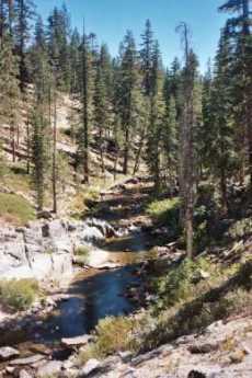
Philadelphia's River Region
A concentration of articles around the rivers and wetland in and around Philadelphia, Pennsylvania.
Gunk, 27 Million Tons of It
|
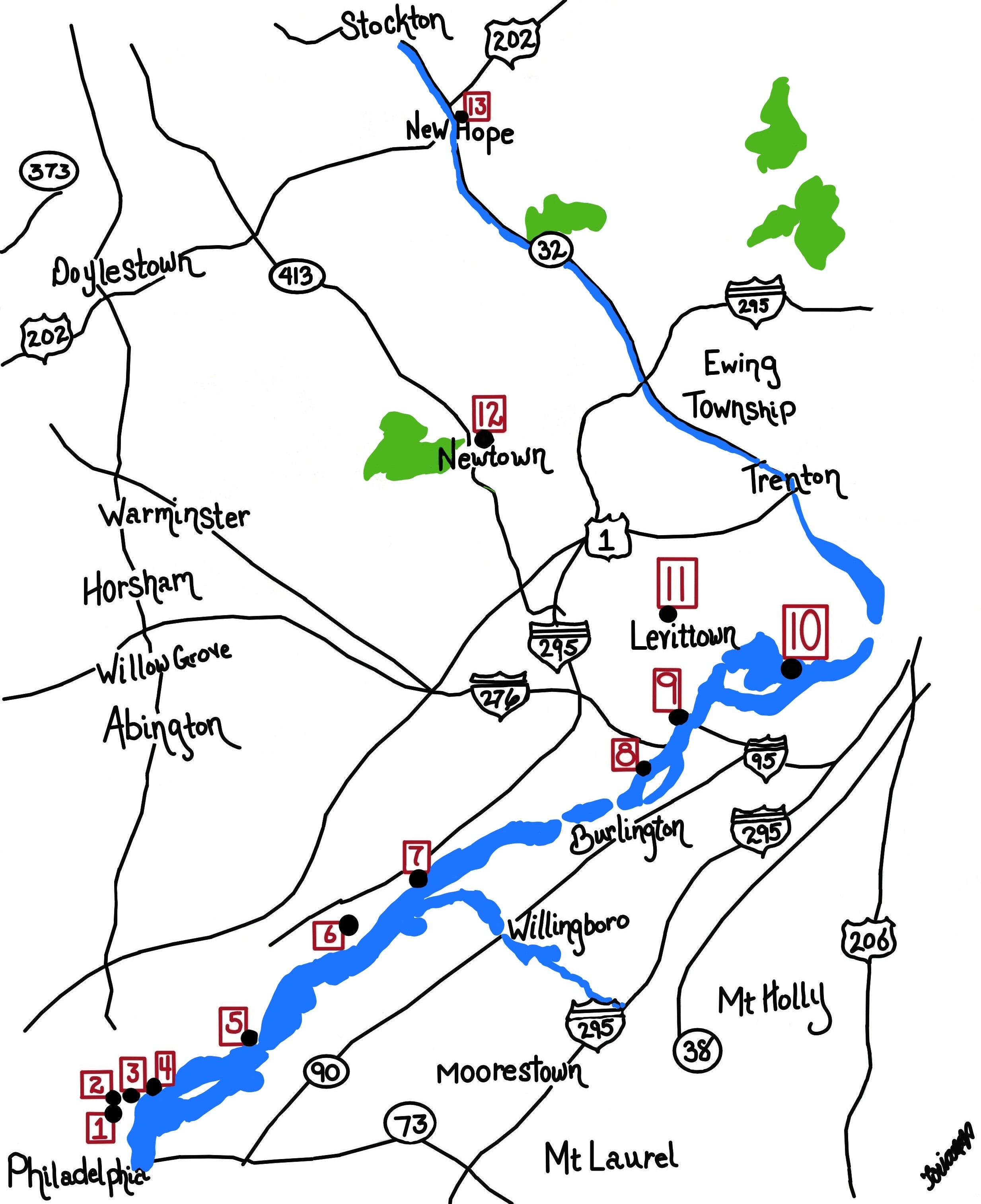
| Henry Hudson |
When Henry Hudson reached the mouth of Delaware Bay in 1609, the river was so full of snags he simply went up to what is now the Hudson River in New York rather than try to wiggle his little sailboat up Delaware. By 1900, there had been enough dredging and removal of islands that the channel was 17 feet deep all of the ninety miles up to Philadelphia. One of the consequences was that the new river edge was down at Delaware (Columbus) Avenue, rather than up at Front Street. When you make it deeper, the width of a shallow river often narrows.
Now, the proposal is to deepen the channel to 42 feet, a number mandated by the present size of cargo container ships. Another limiting factor is the construction of the bridges, so the Port of Philadelphia is moving South of the Walt Whitman bridge. That's potentially of great value to the longshoremen who live in that region, although whether it will really bring prosperity is up to them, depending on whether they restrain their aggressive wage and work-rule proposals. There are serious students of the Philadelphia economy who maintain that the economic decline of Philadelphia is more traceable to the intransigence of the longshore unions than to any other factor. Since that comment is specifically made in comparison with the railroad brotherhoods, it is a dramatic accusation indeed.
If you deepen the channel to 42 feet, 800 feet wide (1300 feet at bends in the river), you can be calculated to bring up 27 million tons of sludge. You have to dump that stuff somewhere else, and the current plan is for Philadelphia to build a retaining wall out into the river next to the Packer Avenue terminal area, and dump Philadelphia's share of the stuff behind it. In time, the water will drain out of the gunk, and quite a few acres of dry land would make its appearance. Some engineers question whether the force of the river would permit this. Environmentalists have objections to this project relating to stirring up pollutants lying dormant on the river floor, but without likely effect on the tin ears of those who are presently congratulating themselves on obtaining Federal money to accomplish this "big dig".
The really serious obstructions are coming from the State of New Jersey, which would acquire 9 million tons of gunk as their fair share. Right now, New Jersey is raising taxes and cutting state spending because of a budget deficit, so they are not anxious to take on another big project, particularly one whose benefits will have to be shared with Pennsylvania. Pennsylvania was momentarily sympathetic with this problem until it was learned that New Jersey is actively promoting a FIFTY-foot channel in the Hudson River. Immediately it becomes obvious that there is not enough money for two projects, and there are more New Jersey voters up near the port of New York than down around the Port of Philadelphia. Both New Jersey and Pennsylvania have Democrat governors, while New York has a Republican one. Ordinarily, this would be a decisive point, but the preponderant location of voters up in North Jersey seems to trump that. Keep watching the Saturday papers, on the editorial page down below the fold, the place newspapers ordinarily reserve for retractions, apologies, and local political truths.
What's going on here is attempted exploitation of geographical advantages. Philadelphia is at one of three navigable openings in the Atlantic coast barrier islands adjoining the New York-Washington megalopolis, or five openings if you call it a Boston-Richmond megopolis. Obviously, a seaway opening in the middle is superior to one at the ends, so it really comes down to a New York and Philadelphia competition, with Baltimore a poor third because European ships have to go down to Norfolk and then come come back up the Chesapeake, like Lord Admiral Howe in 1777. There's a huge amount of rail and truck traffic North and South, so crossing the T with ocean traffic arriving in the middle could make quite an economic center. Passenger rail traffic from Philadelphia to Pittsburgh and beyond is pretty anemic, but freight traffic is healthy and could be more so with cargo supplied by container ships. This is the dream, New York is the enemy, New Jersey is the villain, and the longshoremen are the main beneficiary. It is even possible to imagine eighty dollars per hundred in wages for Workman's compensation, but that would be cynical.
Because of the New Jersey problem, proposals have been made to fill up abandoned coal mines with dredging sludge and let the water seep out wherever it, please. Somehow, this isn't thought to be practical, and other suggestions seem to be very welcome, a rather unusual circumstance in itself.
Let's ask ourselves whether we want to return Philadelphia to its old industrial mightiness, or whether we want to encourage the development of a service economy, computers and all that. One way to measure success in the container cargo race is to count the unloading cranes. Philadelphia has about five of them, and most of the time they are sticking straight up, unused. There are many times that many in Seattle, and in Yokohama, there are over a hundred. The port of Kobe has far more, too many to count as you go past on the bullet train. However, there's a secret truth about container ships. When they get to Seattle, there is no cargo to fill them with for a return voyage, and in fact, the empty container pile-up is a rather serious problem. Bill Gates is shipping lots of software to Japan, but it doesn't fill cargo containers, and the economy of the region is going to have high transportation costs until someone figures out a bulk cargo product to ship from Seattle. This is exactly the situation of a century ago when the New York Central, the Baltimore and Ohio, and the Pennsylvania RR were battling it out for transcontinental supremacy. The Pennsy won that battle because oil was discovered in Bradford Pennsylvania, and refineries were built on the Schuylkill to process the oil. The Pennsy had thus found a round-trip cargo for filling its empty East-bound freight cars, and it beat out the other two railroads which didn't. Cheaper freight rates became possible, and therefore other industries prospered in the region.
Right here is a topic which somebody at the Wharton School had better start talking about. No matter how much software and other service industry prosperity a city region may support, it has to find a way to supply bulk cargo to all those container ships that are bringing in the BMW's for the service industry hotshots to drive.
Meanwhile, what does New Jersey do with 9 million tons of gunk?
The Swamps of Philadelphia
|
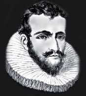
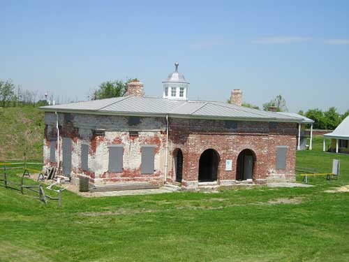
| Fort Mifflin |
Fort Mifflin has been restored, somewhat, and gets a surprising number of visitors at Hallowe'en. The explanation offered is that it seems somewhat spooky. A far greater number of people go to Philadelphia International Airport, or the several sports stadia constructed nearby in a project whose financing is described as "borrowing to expand the tax base". In so doing, visitors travel at some height above the edge of the now-closed Philadelphia Naval Base, with a large number of very large naval vessels in storage, the so-called Mothball Fleet. All visitors are naturally impressed with a view of the wide expanse of the deep and impressive Delaware River. How could such a mighty river be the site of mud islands and narrow channels so shallow that British sailboats couldn't navigate past the Friesian Horses sunk on the bottom?
Well, as water spreads out, it gets shallower. Conversely, as water is compressed into narrower channels, the channel gets deeper, eventually deep enough for nuclear aircraft carriers. So, think back to the days when the Dutch sailed around here, finding the first solid land along the Schuylkill at Gray's Landing, opposite where the University of Pennsylvania now has a row of medical skyscrapers on the West Bank. Everything South of that point was once swamp, so there were miles and miles of shallow water before you got to the Delaware; you could sort of say that the Delaware River was five miles wide at that point. Lots of fish, and ducks, muskrats and beaver.
The main highway to the South, the one that Washington and Jefferson traveled regularly, ran near Gray's Landing, along the edge of the great Philadelphia swamp. Later on, the railroads were built along the same path, and the industrial devastation of that area was accelerated immediately. It was a natural place for "landfill", which is to say it was a good place to dump garbage. By 1940, you had to drive for miles through garbage dumps to reach the Municipal Stadium, where the Army-Navy football game, attended by 105,000 spectators, was played in the freezing winds. The Naval Yard had been moved from the foot of Federal Street to a filled-in island near Fort Mifflin and provided a railroad spur on which the President of the United States regularly parked his private railroad car as he attended The Game. Some enormous liquor distilleries were built near the garbage dumps, and it was difficult to prove which was responsible for the greater odor. World War II caused a great proliferation of war industries on the banks of the river to the South, and the gasoline refineries in the area added to the aroma and river pollution.
In time, the garbage dumps were covered with dirt, and thousands of houses were built where the mosquitoes used to swarm. When the wartime river traffic declined, unemployment set in, and housing got cheaper, even abandoned. With abandoned housing comes slums, and there, in a nutshell, you have South Philadelphia, waiting for an industrial revival. Meanwhile, the swamps are mostly gone, and the river is a lot deeper.
Draining Suburbia
|
| Creek |
Philadelphia's triangle of land between two large rivers once was laced with streams, brooks, and creeks. These were great places to catch fish, especially trout, and they had what poets call mossy banks. Nowadays, these streams are enclosed in culverts or their exposed banks are sharp cliffs of clay. Few people have heard of Indian Brook, which was once the brook that ran through town but is now the brook underneath Overbrook.
The Conservancy has given thoughtful consideration to the consequences of building hard surfaces on top of what was once spongy soil. The streets, the roofs, the driveways of progress, of development, cause immediate runoff of water after a rainstorm instead of allowing seepage into the soil and gravel of the wilderness. The rain of a storm quickly surges into the storm sewers, and surges into the neighboring creeks, scouring the banks in a flood surge. The grass slopes cannot withstand such a housing, leading to sharp clay banks, which become undermined by later storms, toppling trees. The clay material from the banks makes the streams muddy, and the deposits of clay suffocate the insect larvae and fish eggs on the stream bottom. It's perhaps true that there are fewer mosquitoes, but there are no fish. The matter is compounded by the heating of the water as it drains over large sunlit surfaces like shopping mall parking lots, and the different water temperature in the streams changes the insect and fish content, too.
It's almost hopeless to do anything useful in the downtown city areas, where the former streams are not only enclosed in pipes but run underneath skyscrapers. There may even be too much disruption involved to contemplate doing anything useful in towns which allowed storm sewage and sanitary sewage to flow in the same pipes. But it would be a comparatively simple thing to divert rainwater into gravel driveways or out over lawn areas since the goal is to slow its flow into the streams rather than dispose of it. Local ordinances could require such forethought for new construction, and perhaps make construction permits conditional on it. Many suburban homeowners would probably follow suit voluntarily, and gradually the situation might come under control with education and minor pain.
There are other approaches that would get results quicker. In present China, "infrastructure" is upgraded much more directly. One recent visitor was discussing the problem of construction in an area where there was a Chinese town. He was told not to worry about it. The next time he visited the area, that town would be gone.
Tony Junker: Tunnell's Boys
|
|
| Henry Hudson |
When you take the ferry across the mouth of Delaware Bay from Lewes to Cape May, you are out of sight of land for half an hour. But the Army Corps of Engineers have thoroughly dredged it out. By contrast, when Henry Hudson first discovered the river while searching for a Northwest passage to the Indies, it was so full of snags and shoals that he just gave up and sailed on to what is now New York harbor. So, for centuries the river pilots were an essential part of ocean commerce to Philadelphia. As you might well imagine, the earliest pilots were members of local Indian tribes. Eventually, a proud colony of professional pilots grew up at Lewes, Delaware. Since radio communication is a comparatively recent development in this ancient trade, they had to devise ways for an incoming ship to select a pilot, and establish rules to be enforced by the Port Wardens about how to go about it.
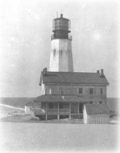
|
In the mid-Eighteenth Century, the system was to hang a black ball from the Cape Henlopen lighthouse whenever a ship was sighted. Little companies of ten or fifteen pilots would then jump into very fast schooners designed for the purpose, and race to be first out to the ladder hanging from the incoming ship's side. The rule was, the first to arrive and present his certificate got the job. Tony Junker, an actively practicing Philadelphia architect has immersed himself in tales and adventures among the pilots, and Tunnell's Boys is an exciting new novel about this dangerous, wet and uncomfortable, profession.
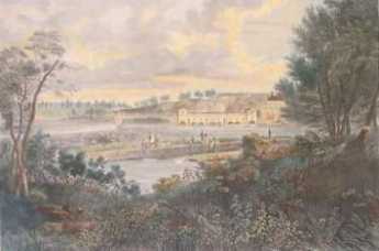
Pennsbury Manor
|
| Fairmount |
William Penn once had his pick of the best home sites in three states, because of course he more or less owned all three (states, that is). Aside from Philadelphia townhouses, he first picked Faire Mount, where the Philadelphia Art Museum now stands. For some reason, he gave up that idea and built Pennsbury, his country estate, across the river from what is now Trenton. It's in the crook of a sharp bend in the river but is rather puzzlingly surrounded by what most of us would call swamps. The estate has been elegantly restored and is visited by hosts of visitors, sometimes two thousand in a day. On other days it is deserted, so it's worth telephoning in advance to plan a trip.
|
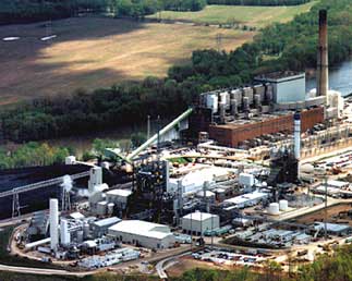
| Gasified Garbage |
After World War II, a giant steel plant was placed nearby in Morrisville, thriving on shiploads of iron ore from Labrador, but now closed. Morrisville had a brief flurry of prosperity, now seemingly lost forever. However, as you drive through the area you can see huge recycling and waste disposal plants, and you can tell from the verdant soil heaps that the recycled waste is filling in the swamps. It doesn't take much imagination to foresee swamps turning into lakes surrounded by lawns, on top of which will be many exurban houses. How much of this will be planned communities and how much simply sold off to local developers, surely depends on the decisions of some remote corporate Board of Directors.
However, it's intriguing to imagine the dreams of best-case planners. Radiating from Pennsbury, there are two strips of charming waterfront extending for miles, north to Washingtons Crossing, and West to Bristol. If you arrange for a dozen lakes in the middle of this promontory, surround them with lawns nurtured by recycled waste, you could imagine a resort community, a new city, an upscale exurban paradise, or all three combined. It's sad to think that whether this happens here or on the comparable New Jersey side of the river depends on state taxes. Inevitably, that means that lobbying and corruption will rule the day and the pace of progress.
Meanwhile, take a trip from Washingtons Crossing to Bristol, by way of Pennsbury. It can be done in an hour, plus an extra hour or so to tour Penn's mansion if the school kids aren't there. Add a tour of Bristol to make it a morning, and some tours of the remaining riverbank mansions, to make a day of it.
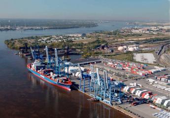
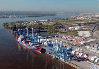
Port of Philadelphia
|
| Ports of Philadelphia |
When federal appropriations are doled out, it is a great advantage for the Port of Philadelphia to appeal to six U.S. Senators. However, the overlapping control of port operations can come close to paralysis. In short, we may have less chance of agreement on what we want -- but a greater chance of getting it. Right now, the ports of the world are struggling to adjust to revolutions of containerized cargo and gigantic oil tankers, plus political pressure from concern about the environment.
Some of the main arenas of our gladiator fights are as follows:
DRPA: The Delaware River Port Authority operates several large bridges, the PATCO high-speed subway line, and the cruise terminal, all leading to control of potentially large sources of revenue. The 1992 Congress expanded its charter to include the economic development of the port region.
SJPC: The South Jersey Port Corporation owns two marine terminals in Camden, and is planning a third in Paulsboro.
DSPC: The Delaware State Port Corporation operates the Port of Wilmington, DE.
PRPA: The Philadelphia Regional Port Authority has little to do with city politics, but is an arm of the state government of Pennsylvania, operating 7 marine cargo facilities, and planning more.
In addition, every county, city, and town along the riverbank has some degree of authority. Every business and union involved in regional or international trade is desperate to protect its interest in the politics of port regulation. Lately, the Homeland Security Agency has taken a large role. Scientists, engineers, fishermen, oil refinery operators, economists, and others abound. The news media convey their own opinions and the opinions of others. Opinions abound because most issues about ports are important.
In addition to the traditional cargoes of coal, petroleum, iron ore and forest products, which are mostly declining in importance, the rising cargoes include meat, cocoa beans, and South American fruit. General, or casual, cargo tends to be more valuable than bulk cargo, but greatly complicates the Homeland Security risks. The ratio of imports to exports is important because it is expensive to have a ship return empty. Shippers will, therefore, favor a port where there are expectations of return cargo. Oil tankers are particularly likely to return empty since their ballast is mostly river water; but, who knows, perhaps global warming will make dirty river water seem valuable to some tropical oil producer. A quirky problem is that most of the crude oil entering East Coast ports are currently coming from Nigeria, a notoriously corrupt nation. This has led to a thriving business of car-jacking in the Philadelphia suburbs, with the stolen cars promptly packed in empty containers returning to Africa.
Of the 360 major American ports, the Delaware River ranks second in total tonnage shipped, and eighth in the dollar value of the cargo. Every year, 2600 ships call into our port, which claims to employ 75,000 people. According to Bill McLaughlin of the PRPA, the future of the port will depend on the settlement of three major disputes:
1. Deepening the Channel. The historical natural level of the river is 17 feet, artificially deepened to 40 feet up to the level of the Walt Whitman Bridge. It sludges up by two or three feet every few years, so dredging is a continuous issue. The enlargement of tankers and container ships has led to a need to deepen the channel to 45 feet. It is true that the Wissahickon schist pokes up at Marcus Hook and will have to be blasted out, but mainly the issue is dredging up the gunk on the river bottom, and hauling it away somewhere. In Delaware Bay below Pea Patch Island, the bottom is sandy and hence valuable. The State of Delaware has plans for riverfront development, and would actually like to have the 8 million tons of sand, so no problem. The 7 million tons of clay and silt which must be dredged out of the upper Delaware River channel for a 45-foot depth is more of a problem, but users can be found for most of it. Or so the Pennsylvania representatives maintain; the New Jersey representatives led by Congressman Rob Andrews say it would be an environmental disaster to dump a thimbleful on New Jersey. Feelings get pretty hot in these things. The Haddonfield representative is portrayed as selling out his district in order to further his own state-wide aspirations, acting on the orders of North Jersey politicians who dominate New Jersey politics, who want to lessen competition with the Port of New York, which also shares a border with New Jersey. Feelings are not soothed to see the Port of New York deepening its channel to fifty feet while resisting forty-five in the Delaware port.
The document currently at the center of this interstate dispute is called PCA, the Project Cooperation Agreement. New Jersey won't agree to sign the proposal, which contains clauses to remove the DRPA from authority and replace it with PRPA(essentially transferring control and revenues from Philadelphia to the State of Pennsylvania) as the "non-federal sponsor". PRPA would then enter into a contract with the Army Corps of Engineers to get the work done.The price, probably low-balled, is $219 million, to be compared with the Port of New York's dredging price (probably high-balled) of $50 billion. There are, of course, a great many features of this political negotiation which are unlikely to appear in print.
2. Southport. The grand plan for the Philadelphia Port is to center on an intermodal complex of piers, railroads, and highways which would extend as a continuous terminal from the Walt Whitman Bridge to the old Naval Yard. No doubt this idea is linked to the round-the-world concept of Philadelphia as a way station from India to Vancouver, overcoming the empty return cargo problem by never looking back. Good luck.
3. Monetizing the Port. Like the turnpikes, ports could be sold to private investors. Of course, that could extend to selling the property to foreign investors, triggering the nationalist reaction readily observed when port management was once offered to Abu Dahbi. It could well give a new meaning to the expression, being sold down the river, but who knows maybe it's a good idea. When you criticize motives it never bothers real political pros, because it's simple to say you don't have such motives, and who knows. But the people seriously involved in government finances say they most fear that the do-gooders will be allowed to sell or lease publicly-owned facilities to improve the financial balance sheet. And then the pros will just take the money and use it to pay interest on more borrowing.
WWW.Philadelphia-Reflections.com/blog/1337.htm
New Jersey Ponders a Rising Sea Level
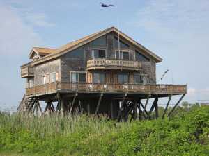
|
| Future House Styles? |
A certain gentleman in a professional position to dominate conversations about rising sea levels, is afraid of being sued and requests his name be withheld from the following. Let's just call it hearsay, suitable only for conversational banter.
If the icecap now sitting atop Greenland should melt, it can rather easily be calculated that sea level would rise to the point where the Delaware River would be 83 feet deep. The Army Corps of Engineers would then probably have more urgent matters to attend to, but at least they would no longer have to cope with deepening the channel to 40 feet. If the Antarctic ice cap should then melt on top of it, the sea level would rise an additional 220 feet, resulting in a Delaware River 300 feet deep. There might be some dry real estate on top of Blue Mountain, but not much else on the Atlantic seaboard would be dry, so there would likely be the additional problem of keeping other people from climbing up to sit in your perch. Perhaps the Hawks would bring you something to eat.
A more immediate issue relates to the barrier islands. It is thought the crumbling of mountains into the sea accounts for the sandy beaches of the Atlantic and Gulf coasts; the more recent mountains along the West coast have not progressed to the point of piling up enough sand to start the process. The cycle of barrier islands is as follows.
Barrier islands, if left undisturbed, will gradually migrate toward the land mass behind them, filling up the intervening bay, and eventually adding to the mainland. But that's not the end of the cycle, because the continuous wave and tidal action will generate a new barrier island further out to sea. When the new island reaches a critical equilibrium with the waves and storms, it begins the cycle of deterioration all over again. Presumably, the sandy lowlands of southern New Jersey, the Delmarva Peninsula, and most of Florida are the result of many cycles of barrier islands adding themselves to the mainland. Presumably, the process will run out of sand someday, but not soon enough to worry about.
When affluent people build showplaces on the barrier islands, a great deal of concrete is laid on the island surface for roadways and parking lots, as well as jetties and other desperate efforts to prevent erosion from destroying the beaches, beachfront property, and real estate values. This process is much more active and rapid than most sunbathers seem to imagine. There are channel markers and monuments of the 18th century that are a mile or more out to sea in the 21st century. Almost a mile of beachfront has disappeared at Cape May and Cape Henlopen in Delaware. Lots of other real estate has been swallowed, but records of historical markers at the mouth of the bay have been more diligently maintained. The residents demand that sand be dredged and dumped on their beaches to keep even with the destructive forces at work. All of this ultimately useless resistance to Nature costs a great deal of money. Those who observe the contest between the protests of King Canute and the resistance of other New Jersey taxpayers to rising taxes estimate that around 2040 the cost of interrupting the barrier island cycle will become so burdensome that taxpayers will successfully put a stop to resisting natural beach erosion. The political uproar will surely be horrendous, so there is a good reason for oceanographers to avoid going public with these inconvenient truths. And all of this doomsday talk, by the way, ignores the issue of global warming, which will surely make it all the worse.
Hidden River
.jpg)
|
| Schuylkill River |
In Dutch, Schuylkill means "hidden river", thus making it redundant to speak of the Schuylkill River. As soon as you become aware of this little factoid, you start to come across Philadelphians who do indeed speak of the Schuylkill in a way that acknowledges the origin of the term. To give it emphasis, it is common to speak of the "Skookle". The point comes up because cruises have started to leave from the dock at 24th and Walnut Streets, where it becomes quite noticeable that the Schuylkill really is rather hidden as it winds seven miles south to the airport, in contrast to the wide-open vista we all are accustomed to seeing from the Art Museum northwards.
The bluff at Gray's Ferry, where the University of Pennsylvania's new buildings now dominate the scene, was originally the beginning of dry land, or the end of the rather large swamp, through which the river winds its way essentially shaded by trees along the riverbank. Never mind the junkyards and auto parks you happen to know lurk behind the trees on the west side or the oil tanks which loom above the trees on the south bank. As evening closed in on the riverboat, the gaily lit towers of center city were looming in the stern, but some fishermen along the bank proudly held up a respectable string of six or seven rather large catfish. If you are there in the evening, the river has the same feeling of wilderness that the Dutch traders would have experienced three hundred years earlier. No swans, however. There were many reports in the Seventeenth Century of large flocks of swans sailing around the entrance of the Schuylkill into the Delaware River. A noted local ornithologist on the recent cruise remarked that forty or fifty species of birds are found there. Even a flock of owls still live within the city limits. You don't see owls, even if you are an ornithologist; their presence is made known by taking recordings of the sounds of the night.
|
| Fort Mifflin |
The geography of swampy South Philadelphia was created by the abrupt bend in the Delaware River at what is now thought of like the airport region. As the river flows at the bend, sediment is deposited in mud flats that once created Fort Mifflin of Revolutionary War fame, and later Hog Island of the Naval Yard, home of the hoagie. Swans are beautiful creatures, but they seem to like a lot of mud. The lower Schuylkill is tidal, and the industrial waste of the region is cleaned out of the land by cutting drainage ditches laterally from the river, flooding the lowlands as the tide rises, and draining it again as the tide falls. This cleansing seems to be working, as judged by the return of spawning fish. And maybe mosquitos, as well, but it would seem rude to inquire.
The Bartram family seems to have known how to make use of river bends and riverbanks, placing the stone barn and farmhouse higher up the bank, but below the bluff of Gray's Ferry forces a bend in the Schuylkill, below which of course flatlands were created. It's a peaceful place, now made available for tours and excursions by placing a landing dock on metal pilings so that it can ride up and down with the tides. The great advantage is that riverboat landings are no longer restricted to two a day, at high tide, with limited time to visit before the tide falls again. Bartram recognized how popular strange plants from the New World would be in England, and his exotic plants were quite a commercial success. Nowadays the big sellers are Franklinia Trees, available the first week in May. The last Franklin (named of course for his friend Benjamin) ever found growing in the wild, was the one John Bartram found and nurtured. Every Franklinia is thus a descendant of this one. They look rather like dogwood but bloom in the early fall. If it suits the fancy, a dogwood next to a Korean dogwood which blooms in June, next to a Franklinia, can make a continuous display of bloom from May to October. And best of all, no one will appreciate it, unless they are in the know.
Wildlife in Haddonfield
A local clinical psychologist once kept a very large pig in his basement which eventually grew to such a size that getting it out of the basement was an engineering problem. The animal was given to his daughter when it was a cute little piglet; it eventually became a family crisis when the little girl had a fit over the suggestion it should be evicted. From this family, we learn that Haddonfield still has laws on its books prohibiting pigs and roosters, for obvious reasons if anybody wanted to keep them. There are no known horses or cows, but an occasional deer wanders by to eat the shrubbery. Dogs and cats don't exactly count.
But there are plenty of red foxes, quite large and bold, who seem to make the golf course their home and sneak around town by way of the stream beds and creeks. As do opossums and raccoons, who also have the storm sewers at their disposal. Possums like to climb on the outside of screen doors and windows, so they frequently startle the householders. Raccoons are unbelievably cute, especially when a set of little coons follow their mother single file, usually at night. They have a habit of eating through the roof and nesting in the chimney, causing quite a ruckus the first time in the fall when a fireplace is lit. Raccoons will kill a dog, by lying on their backs and clawing out the dog's underbelly, so not everybody is fond of them. As far as mammals are concerned, grey squirrels simply overrun Haddonfield, and spend a lot of time scolding the cats and dogs.
|
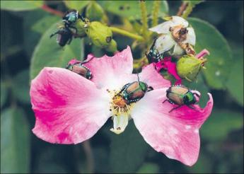
| Japanese Beetles feasting |
Some years ago, Japanese beetles were introduced to America first in nearby Moorestown, and now devastate the rose bushes. Their grubs burrow under the lawns, quickly followed by moles who like to snack on them, and either way the lawns suffer. The cure is to spread around the spores of milky spore disease, their natural enemy, and eventually, the roses and lawns recover. It isn't enough to spread milky spore on your own property, because the beetles will fly in from neighboring properties. I must confess to sending my ten-year-old son out at night with a can of milky spore, dusting it for half a mile in every direction. It seems to have worked, but that ten-year-old is now in his fifties, so it doesn't work quickly. There may be snakes and alligators, but no one has demonstrated one lately. Snapping turtles abound in the creeks ten miles from Haddonfield, so it wouldn't be surprising if some of them became venturesome. The local creeks are stocked with trout every spring, but you had better get there quickly before they are all gone. Catfish persist, however.
Birds love Haddonfield, and many species migrate back and forth, landing here. Robins like the earthworms in lawns, cardinals, and crows make a lot of noise, swallows, sparrows and unidentified little black jobs are abundant. Blue Jays hate cats and vice versa. But the best part is the owls. You can live your whole life in Haddonfield without seeing an owl, but they are watching you from the treetops. Ornithologists say you can't estimate the owl population unless you put out tape recorders at night, and then you hear an amazing number of them. I've finally found a mating pair in the top of one of my trees, hiding among the branches. They are a lot bigger than most people expect. My personal pair are about three feet long. This past summer a park ranger in Jackson Hole, Wyoming made the disconcerting observation that the nests of eagles usually contain a couple dogs' collars. Since owls are at least as high up the food chain as eagles and lots more plentiful, it's something to worry about if you let your dogs and cats run loose in Haddonfield. The neighbors are pretty fierce about unleashed pets, too.

|
| Beaver |
And this morning, March 31, I looked out the window and some passing workmen were chasing a beaver, trying to take its picture. That's right, a beaver, about three feet long, with a big flat tail. I meant to ask him where he came from, but he disappeared in the neighbor's bushes. In regions where there are a lot of beavers, people generally hate them. A pair of beavers can take down a big tree in half an hour, and a colony of beavers can turn a forest into a desert in a couple of seasons. But unless this fellow comes back, I'm not going to worry about it.
Water Works, Emblem of the Past
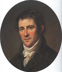
|
| Benjamin Henry Latrobe |
Philadelphia didn't really want the national capital to move to Washington DC, but the yellow fever epidemics, brought from Haiti by refugees, made it politically impossible to reverse the decision to move. We now know that Yellow Fever is transmitted by mosquitoes, but there were enough trash and pollution lying about the that it was plausible that polluted water was the cause. With no time to waste, water was piped in, through wooden pipes, from the comparatively pristine Schuylkill to a pumping station in Center Square, where City Hall now stands. Even today, no one wants a water tower in the neighborhood, so Benjamin Henry Latrobe made it look like a Roman Temple, thereby introducing classical architecture to Philadelphia, and starting quite a trend. The new system worked well enough from 1801 to 1815, when the new city outgrew it. Therefore, a new pumping system was built at the base of Faire Mount, where William Penn once planned to have a mansion, and was attached to Latrobe's wooden pipe system. In a unique and ingenious way,
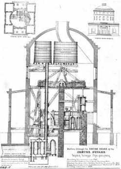
|
| Latrobe Water Works |
Frederic Graff pumped Schuylkill water up to a series of reservoirs on top of Faire Mount, utilizing a water stack to maintain constant pressure. The classical architecture was continued, parks and decorative gardens were placed around it, and admirers came from around the world to marvel. Meanwhile, Latrobe's original building could now be torn down, providing room for City Hall, which was planned to be the tallest building in the world, although the French sort of cheated and put up Eiffel Tower, which in a sense really isn't a building. Meanwhile, Philadelphia and the rest of America kept growing and growing, leading to industrial plants along the Schuylkill all the way up to Pottsville, where the anthracite came from. The pure sparkling municipal water of which Philadelphia was so proud soon became a stinking sewer, and the Civil War encampments accelerated the process.
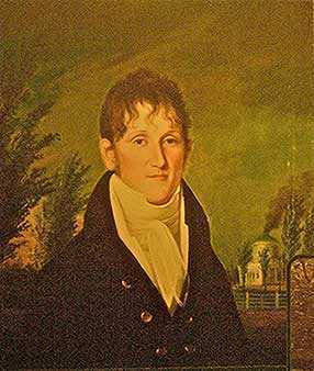
|
| Frederic Graff |
Following the lead of the Philadelphia College of Physicians, the concept of Fairmount Park emerged from clearing the banks of the river, and the Wissahickon Creek, of industry. The Philadelphia Water Works thus became the southern anchor of the largest city park in the world, including the building of Laurel Hill Cemetery, which had sanitary overtones which were embarrassing to discuss. Philadelphia led the world in adapting to this particular feature of the Industrial Revolution, and the insights of Louis Pasteur. By 1890, however, the system was again outmoded, and Philadelphia water became the butt of every joke. Between 1815 and 1840 the wooden pipes were replaced by iron ones. Robert Morris's old estate of Lemon Hill was acquired by Fairmount Park and used to construct a second reservoir on the neighboring hill. More about that second reservoir, in another blog.
Eventually, there would be more reservoirs at Belmont and Green Lane. But the city's new reputation for foul water was deserved. Deaths from typhoid fever rose to 80 per 100,000 residents before a water filtration system was installed; deaths from typhoid promptly fell to 2 per 100,000. Statistics on hepatitis were not available, but virus diseases must have been a serious hazard under primitive conditions of filtration, aeration and chlorination -- as they still are in many third-world countries, and in most southern European nations before 1950. As late as 1950 in Philadelphia, it was considered witty for a dowager to accept a drink from her hostess, saying "I'll drink absolutely anything, except Philadelphia water -- and 'Coke' ". The implication was that alcohol sterilizes water, which of course it doesn't, and also that absolutely everybody knows that Philadelphia has terrible water, whatever that means.
A reputation like that is bad for the city, making it harder to persuade workers and business to locate here, but the traditions underlying this response are quite ancient. Back in the days when water came from your own well, whole neighborhoods would move to new unspoiled areas to seek cleaner water and regions where the local privies were not yet mature. It takes quite a lot to persuade people to abandon the investment in a home or mansion as in Society Hill, and build a new one in a nearby undeveloped region. Particularly when the germ theory was not yet available to explain the issues with precision, pulling up stakes for a new neighborhood was an accepted reaction to almost any threat.
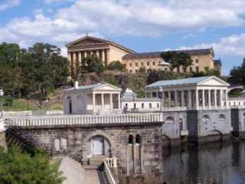
|
| Water Works Today |
However, strenuous exertions for half a century have made Philadelphia water safer, tastier, and far cheaper than bottled water. The recent trend of young people to walk about sucking a three dollar bottle of water drives the Philadelphia Water Department up to a wall. For example, 25% of bottled water comes straight from the tap. The inspection standards for public water are much stricter than for commercially bottled water, whose safety is in large part secondary to the safety of the tap water from which it is derived. True, public water is chlorinated, but then it is also fluoridated, putting legions of dentists out of business. In Philadelphia, that's the main difference justifying the rather appalling price difference, and the accumulation of plastic bottles in various trash heaps.
The recent advances in Philadelphia's water can in part be traced to Ruth Patrick, now over a hundred years old but the world's foremost expert on streams and water, and to the persistent professionalism of the Philadelphia Water Department. Perhaps, though, it may take a century of slander about water to persuade the politicians to keep their hands off the Water Department. It does take a lot of tax money to implement the third step in the process of cleaning up the water supply, which is the purification of wastewater. For centuries, the guiding principle was to obtain and maintain pure water at the source; wastewater was flushed down the sewer to go back out to the ocean. However, seven times as much water is removed from Delaware, as it flows past the city. That is, the water now recirculates through the sewage system seven times before it is turned over to residents of lower Delaware Bay. The expensive and elaborate -- but scarcely visible -- system of treating sewage in various sewage treatment centers has now resulted in returning water to Delaware in better condition of purity than it had when it came down past Bucks County.
But it costs lots of bucks, and nobody seems to notice the water. People only notice the bucks.
Heron Rookery on the Delaware
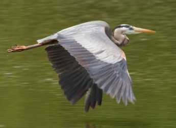 |
| Great Blue Heron |
When the white man came to what is now Philadelphia, he found a swampy river region teeming with wildlife. That's very favorable for new settlers, of course, because hunting and fishing keep the settlers alive while they chop down trees, dig up stumps, and ultimately plow the land for crops. As everyone can plainly see, however, the development of cities eventually covers over the land with paving materials; it becomes difficult to imagine the place with wildlife. But the rivers and topography are still there. If you trouble to look around, there remain patches of the original wilderness, with quite a bit of wildlife ignoring the human invasion.
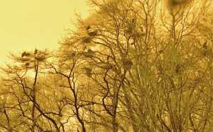 |
| Heron Nests |
Such a spot is just north of the Betsy Ross Bridge, where some ancient convulsion split the land on both sides of the Delaware River; the mouth of the Pennypack Creek on the Pennsylvania side faces the mouth of the Rancocas Cree on Jersey side. In New Jersey, that sort of stream is pronounced "crick" by old-timers, who are fast becoming submerged in a sea of newcomers who don't know how to pronounce things. The Rancocas was the natural transportation route for early settlers, but it now seems a little astounding that the far inland town of Mt. Holly was once a major ship-building center. The wide creek soon splits into a North Branch and a South Branch, both draining very large areas of flat southern New Jersey and making possible an extensive network of Quaker towns in the wilderness, most of whose residents could sail from their backyards and eventually get to Europe if they wanted to. In time, the banks of the Rancocas became extensive farmland, with large flocks of farm animals grazing and providing fertilizer for the fields. Today, the bacterial count of Delaware is largely governed by the runoff from fertilized farms into the Rancocas, rising even higher as warm weather approaches, and attracting large schools of fish. My barber tends to take a few weeks off every spring, bringing back tales of big fish around the place where the Pennypack and Rancocas Creeks join Delaware, but above the refineries at the mouth of the Schuylkill The spinning blades of the Salem Power Plant further downstream further thin them out appreciably.
Well, birds like to eat fish, too. For reasons having to do with insects, fish like to feed at dawn and dusk, so the bottom line is you have to get up early to be a bird-watcher. Marina operators have chosen the mouth of the Rancocas as a favorite place to moor boats, so lots and lots of recreational boaters park their cars at these marinas and go boating, pretty blissfully unaware of the Herons. Some of these boaters go fishing, but most of them just seem to sail around in circles.
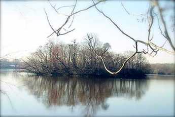 |
| As Seen From Amico Island |
Blue herons are big, with seven-foot wingspreads as adults. Because they want to get their nests away from raccoons and other rodents, and more recently from teen-aged boys with 22-caliber guns, herons have learned to nest on the top of tall trees, but close to water full of fish. And so it comes about that there is a group of small islands in the estuary of the Rancocas, where the mixture of three streams causes the creek mud to be deposited in mud flats and mud islands. There is one little island, perhaps two or three acres in size, sheltered between the river bank and some larger mud islands, where several dozen families of Blue Herons have built their nests. One of the larger islands is called Amico, connected to the land by a causeway. If you look closely, you notice one group of adult herons constantly ferries nest building materials from one direction, while another group ferry food for the youngsters from some different source in another direction. At times, diving ducks (not all species of ducks dive for fish) go after the fish in the channel between islands, with the effect of driving the fish into shallow water. The long-legged herons stand in the shallow water and get 'em; visitors all ask the same futile question -- what's in this for the ducks? The heron island is far enough away from places to observe it, that in mid-March its bare trees look to be covered with black blobs. Some of those blobs turn out to be heroes, and some are heron nests, but you need binoculars to tell. When the silhouetted birds move around, you can see the nests are really only big enough to hold the eggs; most of the big blobs are the birds, themselves. There are four or five benches scattered on neighboring dry land in the best places to watch the birds, but you can expect to get ankle-deep in the water a few times, and need to scramble up some sharp hills covered with brambles, in order to get to the benches. In fact, you can wander around the woods for an hour or more if you don't know where to look for the heron rookery. Look for the benches, or better still, go to the posted map near the park entrance south of the end of Norman Avenue. There are a couple of kiosks at that point, otherwise known as portable privies. Strangers who meet on the benches share the information supplied by the naturalists that herons have a social hierarchy, with the most important herons taking the highest perches in the trees. That led to visitors naming the topmost herons "Obama birds", and the die-hard Republicans on the benches responding that the term must refer to dropping droppings on everybody else. That's irreverent Americans for you.
There is quite a good bakery and coffee shop just north on St. Mihiel Street (River Road), and the new diesel River Line railroad tootles past pretty frequently. That's the modern version of the old Amboy and Camden RR, the oldest railroad in the country. It now serves a large group of Philadelphia to New York commuters, zipping past an interesting sight they probably never realized is there because they are too busy playing Hearts (Contract Bridge requires four players, Hearts are more flexible). However, there's one big secret.
The birds are really only visible in the Spring until the trees leaf out and conceal them. Since spring floods make the mud islands impassible until about the time daylight savings time appears, there remains only about a two-week window of time to see the rookery, each year. But it is really, really worth the trouble, which includes getting up when it is still dark and lugging heavy cameras and optics. Dr. Samuel Johnson once remarked that while many things are worth seeing, very few are worth going to see. This is worth going to see.
And by the way, the promontory on the other side of the Rancocas is called Hawk Island. After a little research, that's very likely worth going to see, too.
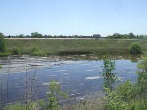
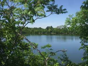
Reservoir on Reservoir Drive
William Penn planned to put his mansion on top of Faire Mount, where the Art Museum now stands. By 1880, long after Penn decided to build Pennsbury Mansion elsewhere, city growth outran the capacity of the new reservoir system which had then been placed on Fairmount. An additional set of storage reservoirs were placed on another hill across East River (Kelly) Drive, behind Robert Morris' showplace mansion now called Lemon Hill (Morris merely called it The Hill); the area was eventually named the East Park Reservoir. In time, trees grew up along the ridge and houses got built; the existence of these reservoirs right in the city was easily forgotten, even though the towers of center city are now plainly visible from them. These particular reservoirs were never used for water purification; that's done in four other locations around town, and the purified water is piped underground to Lemon Hill, for last-minute storage; gravity pushes it through the city pipes as needed.
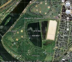
Now, here's the first surprise. Water use in Philadelphia has markedly declined in the past century. That's because the major water use was by heavy industry, not individual residences, so one outward sign of the switch from a 19th Century industrial economy to a service economy is -- empty old reservoirs. Only one-quarter of the reservoir capacity is in active use, protected by a rubber covering and fed by underground pipes. The rest of the sections of the reservoir are filled by rain and snow, but gradually silting up from the bottom, marshy at the edges. Unplanted trees have grown up in a jungle of second-growth, attracting vast numbers of migratory birds traveling down the Atlantic flyway. Although there are only a hundred acres of water surface here, the dense vegetation closes in around the visitor, giving the impression of limitless wilderness, except for the center city towers peeping through gaps in the forest. It's fenced in and quiet except for the birds. For a few lucky visitors, it's easy to get a feeling for how it must have looked to William Penn, three hundred or more years ago, and Robert Morris, two hundred years ago. In another sense, it demarcates the peak of Philadelphia's industrial age, from 1880 to 1940, because that kind of industrialization uses a lot of water.
The place, in May, is alive with Baltimore Orioles. Or at least their songs fill the air and experienced bird watchers know they are there. Even a beginner can recognize the red-winged blackbirds, flickers, robins, and wrens (they like to nest in lamp posts). The hawks nesting on the windowsills of Logan Circle suddenly makes a lot more sense, because that isn't very far away. In January, flocks of ducks and geese swoop in on the water surface, which by spillways is kept eight feet deep for their favorite food. Just how the fish got there is unclear, perhaps birds of some sort carried them in. The neighborhoods nearby are teeming with little boys who would love to catch those fish, but it's fenced and guarded much more vigorously since 9-11. In fact, you have to sign a formal document in order to be admitted; it says "Witnesseth" in big letters. Lawyers are well known for being timid souls, imagining hobgoblins behind every tree. However, there are some little reminders that evil isn't too far away. Just about once a week, someone shoots a gun into the air in the nearby city. It goes up and then comes down at random, with approximately the same downward velocity when it lands as when it left the muzzle upward. That is, it puts a hole in the rubber canopy over the active reservoir, which then has to be repaired. No doubt, if it hit your head it would leave the same hole. So, sign the document, and bring an umbrella if the odds worry you.
A treasure like this just isn't going to remain as it is, where it is. It's hard to know whether to be most fearful of bootleggers, apartment builders or city councilmen, but somebody is going to do something destructive to our unique treasure, possibly discovering oil shale beneath it for example, unless imaginative civil society takes charge. At present, the great white hope rests with a consortium of Outward Bound and Audubon Pennsylvania, who have an ingenious plan to put up education and administrative center right at the fence, where the city meets the wilderness. That should restrict public entrance to the nature preserve, but allow full views of its interior. Who knows, perhaps urban migration will bring about a rehabilitation of what was once a very elegant residential neighborhood. And push away some of those reckless shooters who now delight in potting at the overhead birds.
This whole topic of waterworks and reservoirs brings up what seems like a Wall Street mystery. Few people seem to grasp the idea, but Philadelphia is the very center of a very large industry of waterworks companies. The tale is told that the yellow fever epidemics around 1800 were the instigation for the first and finest municipal waterworks in the world. There's a very fine exhibit of this remarkable history in the old waterworks beside the Art Museum. But that's a municipal water service; why do we have private equity firms, water conglomerates, hedge funds for water industries, and other concentrations of distinctly private enterprise in the water? One hypothesis offered by a private equity partner was that the success of the municipal water works of Philadelphia stimulated many surrounding suburbs to do the same thing; it was surely better than digging your own well. This concentration of small and fairly inefficient waterworks around the suburban ring of this city might well have created an opportunity for conglomerates to amalgamate them at lower consumer cost. Anyway, it seems to be true that if you want to visit the headquarters of the largest waterworks company in the world, you go about seven miles from city hall and look around a nearby shopping center. If you are looking for the world's acknowledged expert in rivers, you go to the Academy of Natural Sciences of Philadelphia on Logan Square and look around for a lady who is 104 years old. And if you have a light you are trying to hide under a barrel, come to Philadelphia.
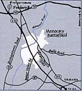
Monocacy Creek and Monocacy River
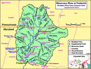
|
| Monocacy River |
Monocacy sounds like a Greek word for some form of government, but is in fact a Shawnee Indian term, meaning "crooked river". It might well be spelled as the Indians pronounced it, Monnockkesey. Confusion for history lovers is made worse by the existence of a Monocacy Creek about twenty miles long, flowing into the Lehigh River at Bethlehem. But there is a second stream, the Monocacy River, flowing about sixty miles south from Gettysburg, through the town of Frederick, Maryland, eventually merging with the Potomac River a few miles south of Harper's Ferry. Both forms of Monocacy do flow-- but do not connect-- along the base of the first mountain range of the Alleghenies, on its Eastern side. Pennsylvanians refer to this ridge as the Blue Mountain because looking westward it can be hazily seen across the plain from a great distance. In Maryland, it is called the South Mountain. In the early part of the Civil War, General Lee attempted to attack Washington DC from the rear by striking through several gaps (particularly "Fox's Gap") in that mountain. The Philadelphian General George McClellan uncharacteristically surprised him by getting masses of Federal troops through the mountain gaps before Lee could reach and fortify them from West Virginia. Although McClellan did intercept some of Lee's orders, it is now questioned whether this affected the outcome. The culminating result was what the Union side continues to call the Battle of Antietam Creek, but the former Confederates persist in naming the Battle of Sharpsburg. Antietam Creek is one of those many creeks which flow along either side of the long mountain range, fed by runoff rainwater from the ridge, and therefore has steep embankments. Regardless of the nomenclature quarrel, the main point is that both of these placenames refer to the west side of the mountain gap, putting Lee at a disadvantage for an attacker. He got there first, but he did not get there first with enough force to dominate the passes.
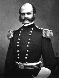
|
| General Ambrose Everett Burnside |
A horrendous slaughter of Federal troops took place when General Burnside was ordered by McClellan to get his troops across Antietam Creek immediately, and Burnside chose frontal attacks over a narrow stone bridge crossing the Antietam as the way to get there. Because of the creek's flow along the base of the mountain, once the bridge was crossed under constant sniper fire, the troops faced a sheer embankment which had to be climbed into the face of 500 Confederate sharpshooters shooting down from the top. Burnside and the Federal troops finally did accomplish this suicide mission after four hours of trying, mostly because the Confederate sharpshooters ran out of ammunition. At the end of that day, 23,000 troops on both sides were casualties. Toward the end of the war, similar casualties would be sustained fifty miles north at Gettysburg PA, along a branch of the Monocacy on the east side of the ridge. The two Monocacy streams, Creek and River, are entirely distinct but a natural source of confusion.
|
| Monocacy River Map |
It would seem a pity, however, to succumb to a fit of tidiness and change the name of either stream. The Shawnees were once the most important Indian tribe in this region, and at various times have achieved dominance over regions from the Delaware River to Oklahoma. As a major component of the Algonquin federation of tribes, they fought a losing battle with the Iroquois over a period now named the Sixty Years War, eventually retreating from the Eastern Alleghenies to Ohio. Meanwhile, the Iroquois were destroyed by the consequences of the Revolutionary War, while eventually, the Shawnees retreated to reservation areas in Oklahoma. The Monocacy streams, both of them, represent a high-water mark of Shawnee influence. It would be sad to see the last few vestiges of their pre-eminence, even if only names on a map, destroyed by inadvertence or indifference.
Central Pennsylvania Settlers Before 1700

|
| German Rhineland |
Dates are unclear, but twenty-five families from the German Rhineland bought Pennsylvania land from William Penn prior to 1700, which is the earliest recognizable date on a gravestone in the Hummelstown Cemetery. Future research may narrow that time interval down, but it can confidently be said they got on a sailing ship bound for Philadelphia between 1682 and 1699. For reasons also unknown, tradition relates the Captain refused to stop in Philadelphia, putting them off in New York. They discovered they were unwelcome among the Dutch settlers in New York, who quite likely reflected the ancient hostility between the Dutch at the mouth of the Rhine River, and the Germans living upstream from there. Augmented by wars and invasions, the feeling persists to some degree even today. The twenty-five families sailed from New York, up to the Hudson River to Kingston the state capital, where they discovered they were even more unwelcome. The British under the command of the Duke of York took over New Amsterdam in 1664, but Dutch cultural control persisted long after the change of political control.
|
| Governor Keith of Pennsylvania |
Tradition continues that Governor Keith of Pennsylvania happened to be in Kingston at the time of the stranding of the migrants. He suggested they travel eighty miles overland to the Susquehanna River and then float down to land where topsoil was reputed to be several feet thick. Since Dutchmen everywhere concentrated on fur trading more than farming, it seems safe to guess reliable guides were easily found in Kingston. From there to what later became famous as Three-Mile Island below Harrisburg, the three-hundred-mile route of these pilgrims can be guessed by following valleys between towering ridges. Unfortunately for this surmise, there are two main canyons leading to Kingston from the Susquehanna, which improved Kingston as a choice for fur trading. The more northerly canyon is somewhat longer, but it might have been safer; perhaps the German pilgrims just flipped a coin. Taking either choice it's a hard trip however, even assuming the Indians were friendly and food sources abundant. It must have required at least a month to go the full distance to what is now Harrisburg, passing by a number of places which now support prosperous farms. That potential likely provoked demands of some travelers that they had gone far enough, as kids do today in the back of the station wagon. By luck or stubbornness, however, they kept right on into the wilderness, eventually making permanent settlements along the Swatara Creek in Dauphin County, which proves to have the richest farmland in America. Middletown and Hummelstown are thus the two oldest settlements in Central Pennsylvania. By the time the other German sects made their way up Germantown Avenue, out Germantown Pike, and then onward to the Great Valley beside Blue Mountain, the original settlers had ample time to discover the best land, the surest wells, and the best access to the creeks. Furthermore, they had several generations to notice which families produced the strongest lads, and which families were the best natural farmers. Since later incoming families were mostly penniless, they had to settle for less advantageous farmland and less endowed marriage partners. Dominance by the original farming families continued until the early Twentieth century when it became prestigious to enter one of the professions. Or even to move away from the Dutch Country and go to the city.
|
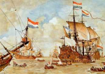
| Dutch Ships |
Getting back to their days in Kingston, it is not easy to tell what route they took, judging only from a highway map. We look for the largest towns and then the shortest highway route, but it seems likely Kingston was chosen as a trading center because it was the place where the fur traders brought their pelts to the Dutch ships on the Hudson. The roads chose the towns, not the other way. When you observe the valley beginning at Kingston, there remains little doubt the route to Harrisburg must have led that way. The local folks at the museums and stores of Kingston can't help; they never heard of any such migration, and most of them never had reason to travel in that direction. Kingston was burned to the ground (by the British) in 1777, the state capital moved to Albany, and the economic center went south to New York City. Kingston is just a nice little town on the Hudson, across the river from where rich folks put their mansions, and liberal-minded folks send their children to Bard College, a place where no two buildings follow the same architectural style.
So when you go West from that nice little town, it is only a mile or two before you are out in the woods, with farms here and there, and scattered cabins which look like fishing and hunting "lodges". There's a creek in the bottom of the valley, and if you look up, you see the road merely winds its way between parallel mountain ridges. Perhaps a glacier carved out this trail, perhaps a mighty river once ran there, perhaps volcanic action tented up and cracked. Anyway, you are not going to get lost if you follow the creek, going steadily uphill from Kingston for twenty or thirty miles. If this were a single mountain ridge, you would be approaching either a water gap or a wind gap. A wind gap is a water gap that has lost its river at the top.
|
| The Rhine River |
What's at the summit is not a notch, however, it's a bowl. Out of this bowl flow the three main rivers of the eastern seaboard, the Hudson, Delaware, and the Susquehanna. The effect resembles what is said of Switzerland: The Rhine, the Rhone, Danube, and Po; They rise in the Alps, and away they go. The highway from Kingston runs along a creek which flows into the Hudson. At the top of the bowl are some nice dairy farms scattered along ten miles which drain into Delaware. The East Branch and the West Branch of the Delaware River are scarcely more than creeks at this point. At Delhi and Andes there is a further rise in the mountains, and then along twisting decline as you follow a branch of the Susquehanna down to its junction at Oneonta. As you cross the top of the ten-mile mesa you have perceived the answer to a natural question: how did those German families get across the big wide Delaware River that runs between Kingston on the Hudson -- and Cooperstown, where the Susquehanna begins? The answer is pretty evident. Delaware, while a mile wide at Philadelphia, narrows down to two little creeks on this mountain plateau. The Susquehanna system on one side and Hudson on the other have swallowed up the Delaware watershed between them. This might well have seemed a nice place for the German settlers to set up a few dairy farms, but it probably was an even more ideal place for the Iroquois to set up headquarters. Their favorite style of warfare was to occupy the high ground and make lightning raids (or quick escapes) on canoes down the various rivers starting from their origins. If it's of any interest, Charles Evans Hughes began his law practice in Delhi, and a lot of the town boys were killed at the battle of Antietam, thus illustrating the unwisdom of recruiting whole towns into regiments.
Down the mountain we go, into the broad Susquehanna valley. It was probably troublesome to manage wagons down a mountainside. But from here on the German families could stop walking, and float.
Dingman's Ferry, Below Port Jervis
|
| Dingman Ferry Bridge |
Because the area was once covered with a glacier, the northeast corner of Pennsylvania is fairly deserted. That's always been good for hunting and fishing, and more recently is good for skiing. Although the topsoil is poor, it's a beautiful area, practically guaranteed to provoke confrontation between the environmentalist movement and the Marcellus shale-gas extraction industry. The history of anthracite coal demonstrates locally that the mineral extraction industry always wins these arguments in the short run, but ultimately the land seems to heal itself without much help from people living in city apartments. The followers of Gifford Pinchot and Teddy Roosevelt are slowly learning to concentrate on minimizing the damage and forcing the extraction industries to pay for clean-up afterward. Right now, this semi-wilderness area is a remarkably beautiful but deserted forest within two hours drive of Philadelphia and New York City. It contains the headwaters of the three main rivers of Northeastern United States.
Crossing those three rivers was the main geographical problem for the Connecticut invaders of Pennsylvania. Today, the landscape is not a great deal different except for the absence of Indians, and crossing the three rivers is the main event. There's a Hudson River bridge at Newburgh, and crossing the Susquehanna at Wilkes-Barre is a placid bridge within a town park. From the point of view of the Interstate highway, crossing Delaware occurs very near the highest point in New Jersey, over a deep rocky gorge with boaters deep below. Since the traveler is at a peak point within a long wide mountain valley, the view is spectacular in several directions.
However, for centuries the builders of roads had to operate on a modest budget, and the only reasonable place to cross Delaware in that region is a few miles south of Port Jervis, at Dingman's Ferry. The Dingman family prospered at their trade for many generations before they modernized and constructed a toll bridge, which is now one of the few remaining toll bridges in private hands, and possibly the oldest one. You don't have to ask the two jolly old toll collectors whether they are part of the Dingman family because they certainly act like it, adding to the wad of dollar bills in their left hand as they greet the fellas, josh the girls, and wave directions with a free hand. A quarter-mile to the south of the bridge on the Pennsylvania side is the entrance to a trail leading to a National Park Service station. The Park Guards are a friendly sort, most of them freely admitting they are members of the Dingman clan, available to help tourists interested in a trail walk, including a visit to the local waterfall. In spite of all this family connection, and Park Service training, nobody at the station had ever heard of the march of the Connecticut invaders. Or of the Proprietorships of West and East Jersey, or of the line between them which allegedly ends at Dingman's Ferry. The best they could do was the point to the local cemetery, which has a big rock at the entrance that somehow has some particular significance, or other.
As it turns out, the cemetery is quite large, with surely a thousand or more gravestones, a great many of which fly American Legion flags for veterans of one war or another, and many more are decorated with fresh flowers. Only a corner of this graveyard touches the curving road to The Bridge, and just inside the entrance is a very large, unmarked stone. Trees have been planted nearby, and their roots have half-covered the rock. But the roads and the cemetery, in general, seem designed around it. There's no marker to explain it, any more than there is a plaque at Stonehenge. As the Park Ranger said, it has clear significance, but no one now seems to know what it is significant of.
Well, if no one is likely to contradict, let's make the timid suggestion that this may be the terminus of the line dividing East from West Jersey. Yes, it's in Pennsylvania. But there is nothing more likely on the New Jersey side of the crossing, and the current Surveyor-General of West Jersey, William Taylor, is firm in the belief the line terminated at Dingman's Ferry. William Penn had hoped to control land on both sides of the river, and when he acquired Pennsylvania in addition to New Jersey, the issue became moot. The style of the survey had been to start at Beach Haven ("Ye inlet of ye beach of Egg Harbor") and follow the compass until it hit something large and heavy. That rock was marked, and another survey went the next step. About fifty of these markers have been discovered by later explorers, and officially represent the underlying fixed line which serves as a survey basis for every property in the state of New Jersey. Since I own some property in New Jersey myself, it seems important to be sure I know where it is, or else some trial lawyer may try to take it away.
South Philadelphia: Ideal Intermodality Transportation Site
The Right Angle Club was recently visited by Troy Adams, representing the Greater Philadelphia affiliate of the regional Chamber of Commerce. Sustained by contributions from sixty local corporations, the Greater Philadelphia organization is a major storehouse of data useful for businesses, supported by a staff of analysts and computer experts. The purpose of this institution is to help businesses who are trying to decide whether or how to locate in the Philadelphia region. With such an organization behind him, Mr. Adams was able to show a number of slides displaying the demography, geography, and statistics about our region, and his appearance is greatly appreciated. This is definitely the place to go if you have questions of that sort. It would probably also be a good place to go for opinions and gossip about the politics and inside baseball of the town, but the Chamber has a strict rule about avoiding any involvement in business moving from one district to another within the region or hearsay that might lead to such internal friction.
One really important insight into the potential of our region concerns South Philadelphia. Historically, this was the place where the Schuylkill and Delaware Rivers met, and was once a very big swamp (wetland, nature sanctuary or whatever). Over time, the swamp became a trash and garbage landfill, and over still more time it became a big flat uninhabited area right next to a big city. But then an Interstate Highway (I95) was built on its circumference, and several rail lines, and an international airport, not to mention extensive port and shipping terminals for ocean transport. While it is true that a certain number of houses would have to be purchased and demolished to accomplish it, the potential exists for the construction of an intermodal interconnection which would be almost unique in the world.
|
| South Philadelphia Ports |
There would be plenty of lands left over for industries related to freight forwarding and the like (the food distribution center is a good example of the general concept), and all of this would be within twenty minutes of the center of a major city. SEPTA already sends a passenger rail spur from the very heart of the city to the very center of the airport, and there is no reason it could not be extended to include ocean, bus, and distribution terminals. Whether this exactly fits with the extensive sports stadium complex in the area is unclear, but these entertainment features are doing no harm to the intermodal interchange idea in the meantime. Judging by the city government's willingness to tear these structures down every five or ten years, there should be no great resistance to moving them elsewhere if the need should arise.
Reviving Schuylkill: Eight Miles From the Dam to Ft. Mifflin

|
| Joshua Nims |
Joshua Nims of the Schuylkill River Development Corporation recently addressed the Right Angle Club about current activities of that organization. It's a non-profit corporation, but in a sense is a quasi-City agency, spending State and Federal funds, plus remediation funds. Just what remediation funds are was not clearly explained, but seem to be fines or assessments on companies who are thought to have fouled up the environment. Whether those assessments are fair or unfair, too small or too large, are political issues largely avoided in Mr. Nims' presentation, and hence are avoided here.
|
| Gray's Ferry Bridge |
The Gray's Ferry area is certainly an urban tragedy of epic proportion, but since its deterioration began in 1856, the events of the Civil War probably had a lot to do with it. Up until the Civil War, the western banks of the Schuylkill, especially around Gray's Ferry, were famously upscale and beautiful. The South Street Bridge, for example, was originally envisioned as leading into a boulevard of the Arts, with the University Museum, Irvine Auditorium, the University Hospital and the mansions on the top of the hill setting off what promised to become a striking cultural statement. Anthony Drexel himself lived up there, walking it to work at Third and Chestnut. And that's just one famous example. It's hard to know what started the blight, but Harrison Brothers White Lead, Color and Chemical Works might be a good candidate and the fact that the area soon developed the tracks often (10) smoke-belching railroads was certainly another major issue. The western bank of the Schuylkill rose to a high rocky promontory at Gray's Ferry, crowding wartime industrialization into a narrow place. Before that, Gray's Ferry Bridge had been the main artery to the South, traveled by George Washington many times, often stopping at Woodlands, that palatial home of Andrew Hamilton the original Philadelphia lawyer. A century before that, the Dutch fur traders had found it to be the first firm land after they sailed inland through the swamp, while the Indians knew it was the last forest area before you reached the (South Philadelphia) area of malaria, yellow fever and other mysterious vapors that must be avoided. In the sense of land travel, Gray's Ferry was, therefore, the most prominent part of the Philadelphia landscape for two centuries. The ferry itself was a floating bridge, pulled back and forth by ropes on each shore of the river. Given a choice of pretty much all of the North American continent, John Bartram placed his farm just south of this promontory. Where it still stands today but surrounded by slums and urban decay.
It's a little hard to judge whether the Civil War pushed railroad construction into the only rocky crevice suitable, and then industrial pollution followed with vile and noxious effluents, or whether the Harrison Lead, Color, and Chemical factory simply started it across the river in the river bend. That's where the DuPont paint factory relocated in 1916, and in fact, the Duponts get local blame as polluters when in fact they made considerable effort to clean things up after they acquired it. The area had a major slaughterhouse abattoir, and an asphalt plant and several other major inducements to the populace to abandon their elegant mansions and run for their lives. The place now has old rusting bridges, tumble-down concrete pilings, lots of weeds, and not a single living fish for a century in that water. To diffuse the blame somewhat, it should be remembered that after the War of 1812, the Schuylkill was the main transportation artery for coal coming down from Pottsville and the rest of Schuylkill County. The river didn't have a sandy bottom, it was pulverized anthracite which releases acids and toxins when washed.
So that's the river region the Schuylkill Development Corporation plans to line with grassy running paths and benches to admire the view. Maybe the Wilson Steamship Line or something like it can again be persuaded to bring tourists here, or maybe the riverbanks can be lined with hotels to house people who take rides on river flatboats, as they do in San Antonio. Or dare we mention it, maybe Paris. Maybe Philadelphia can once again be a tax collector's idea of heaven, together with five-day weekends.
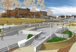
|
| Schuylkill River Development Corporation |
At the moment, this little non-profit city agency is run on a $500,000 operating budget, and has about $20 million worth of projects in progress. Some of that is reparation money pried from the grandchildren of the owners of those factories who did the damage over a century ago, and some large part of it is Philadelphia's share of the boodle from the Stimulus package. There's no doubt the area will look immensely improved in the next year or two, and a lot of hope that private investment will be attracted to an area previously shunned vigorously. The area which has already been cleaned up, from the Wissahickon to the Dam, really must be called a great success; there's lots of foot traffic and joyousness. And the area can also be praised in what unfortunately is the measurement of modern urban development: it has only had two lawsuits for sprained ankles, and only two muggings, quite a commendable record. But now development is going past South Street, into much murkier areas, with more low-income residential spaces. Surveillance cameras are planned, and bright lighting, but it's far from certain that a little strip of gentrification can defeat miles of surrounding decay.
Only if they pull it off will private investment creep into the area, and the parents of University students permit their children to run there. If private investment arrives, this organization can do no wrong, because only then can it fairly be described as "Infrastructure". My own definition of infrastructure as an economic stimulus is of early public spending on projects which would have eventually consumed the money anyway, except later. By that standard, infrastructure spending's only true cost would be the interest on borrowed money to do it sooner. Let's make a note to revisit this experiment in a couple of years, cautiously wishing everyone the best, in the meantime.
Fort Washington, PA
|
| British Campaigns |
The Revolutionary War lasted eight years, so there are a half dozen Fort Washingtons, in several states. Pennsylvania's Fort Washington gets free advertising from being a stop on the Pennsylvania Turnpike at the intersection of the East-West branch and the North-South branch, near some very large shopping malls. Nevertheless, the suburbs haven't reached it yet, and it is on a series of wooded mountain ridges discouraging housing development. Another way of describing its location is that it is several miles north of Chestnut Hill along the Bethlehem Pike, a road which begins in the center of Chestnut Hill at Germantown Avenue. The Pike is quite old, with many surviving colonial-era houses and inns to liven up the trip.
A third way to describe Fort Washington is that the headquarters were at the point where Bethlehem Pike crosses the Wissahickon Creek. How's that again? How does the western Wissahickon Creek then flow uphill to Chestnut Hill? Of course, it doesn't, but the appearance takes some explaining. The northwestern end of Philadelphia is reached by two ancient roads running on ridges quite close together like the split tail of a fish. Germantown Avenue runs up one ridge, and Ridge Avenue runs up the second ridge closer to the Schuylkill. The Wissahickon runs in the gully between these two ridges and tumbles down the hill at Wissahickon Avenue, or Rittenhousetown if that is more understandable. The ridge of Ridge Avenue is essentially cut off by the creek, but engineers have put Ridge Avenue on a high arching bridge as it crosses the creek far below, and by this magic Ridge Avenue and Germantown Avenue are at about the same height most of the way. The Wissahickon Creek is really running downhill the whole way, but sort of disappears from sight and reappears as it twists through the gorges, misleading the casual visitor (or commuter). As happened so often during the Revolutionary War, Washington showed his understanding here of geography in the service of guerrilla warfare.
Since the British were headquartered in Germantown, and the Americans have camped a few miles away on the same creek, it was inevitable there would be some sort of battle in the region. Washington launched a three-pronged attack on the British soon after arriving at Fort Washington, but his troops fired at each other in the fog, and apparently, two prongs more or less got lost in the gorges. The Americans retreated, and the British consolidated their conquest of Philadelphia. They did launch one surprise attack on the American encampment (the Battle of Whitemarsh), but that was mainly a reconnoiter, given up after a few days when it became clear Washington's troops held the high ground. It really is high ground (hawk-watching platforms and all) for reasons already stated. Chestnut Hill is a pinnacle sticking up on the west side of the Creek, with the Wissahickon snaking around its base.
This really was a perfect place for Washington to aim for after the Brandywine Battle, close enough to threaten the British, located in a bowl-like valley for camping, but terminating at the top of a mountain ridge in case the British counter-attacked. And with plenty of running water from the Wissahickon. However, it was a little too close for comfort, and he withdrew across the Schuylkill into Valley Forge as a more substantial natural fortress. Valley Forge is also on a hilltop, but one sitting in the middle of the Great Valley (Route 202 to Wilmington), as the center of an angel food cake tin. No doubt, the advantages of this new location became evident to him at the earlier skirmishes of the Battle of the Clouds, and the Paoli Massacre, which occurred nearby.
In retrospect, these maneuvers and skirmishes were of little military significance, except for the major Battle of Brandywine. The lost opportunity was the chance to catch the British Army without supplies or access to the Navy, aborted by what was probably a hurricane, the so-called Battle of the Clouds. Philadelphia was lost, and the opportunity to win the war early by smashing a third British army was gone for good. The defeat of the Hessians at Trenton, the loss of Burgoyne's army at Saratoga, and a victory on the outskirts of Philadelphia might together just have finished the War. But things didn't work out, the British similarly missed some opportunities, and the war was to last another five years. Once the French allied themselves, their wealth and naval strength tended to make French priorities dominate strategy.
Nevertheless, a perfectly splendid tourist trip awaits the history buff who travels from Elkton, Maryland, where the British landed, to the Battle of Brandywine battlefield, up the Great Valley to Immaculata University where the Battle of the Clouds took place, over to the Battlefield of the Paoli Massacre, crossing the Schuylkill and going to Whitemarsh, then to Fort Washington, and back up Bethlehem Pike to Germantown Avenue, and down to the Chew Mansion. The campaign for the conquest of Philadelphia ended with the fall of Ft. Mifflin when the British fleet was finally able to re-supply Howe's army. This direct auto tour is a little out of chronological sequence, but it can be done in one day if you don't dawdle. If you slow down and spend an extra day, you can include the Moland House where Washington waited to see where General Howe was going. At the right season, there's hawk watching on the ridge at Fort Washington Park, and maybe on to Trenton, or even up the New Jersey waist to Perth Amboy on lower New York Bay, where the Howe brothers began and ended their Philadelphia adventure. That would take you past Princeton and New Brunswick, or even include a trip to the Monmouth Battleground. With this extension, you have traveled much of the extent of the Revolutionary War in the Mid-Atlantic states.
Heavenly House
|
| Father Divine House |
While prosperous people, on deciding to enter a retirement community, are often heard to say they are tired of managing a big house, it can also be noticed that people who get the foreign travel bug usually drift around to see the palaces, castles, and estates of kings and emperors. The king's bathroom plumbing is a stop on most tours. Places like Buckingham Palace, the Vatican, the Temples of Karnak, Fortresses of Mogul Conquerors of India, or similar places in Cambodia, are all vast looming piles of stone dedicated to the memory of departed leaders who Had it All. That's probably all you need know, to understand that Americans who have it all tend to build huge show places, too. A great many do discover the castles to become just too much bother. Safe protection and privacy are somewhat separate issues, reasons given for putting up with a big place past the time the thrill has worn off. Perhaps such jaded feelings appear at the end of the wealth cycle. Nevertheless with enough affluence, if you had unlimited money and inclination, where around Philadelphia would you put a dream palace, one built for a modern Maharajah? Answer: close to Conshohocken.
|
| The Philadelphia Country Club |
The Schuylkill takes a sharp bend at Conshohocken because it flows around a big cliff on the west side of the river. It was there the White Steel Company built the first wire suspension bridge in the world, as distinguished from cable (twisted wire) suspension bridges invented by Roebling at Trenton. The bridge was swept away by a flood, the steel mill replaced by the Alan J. Wood Steel Company. Alan Wood prospered mightily, and built his mansion ("Woodmont") on 75 acres on the top of the big rock on the west side of the Schuylkill, in such a way he could watch the smoke rising from his factory down below at the foot of the cliff. The Philadelphia Country Club is across the road from Alan Wood's mansion, with fairways clinging to the cliffs, a Gun Club for trap shooters who want to aim away from houses and toward mountainsides, and a cliff-top road leading straight for Gladwyne between dozens of mansions with five-acre lots. Down the hill, however, rocky projections force the road to funnel into a winding crooked road which ends up near the filling stations of Conshohocken, passing ancient farm structures on the way. Railroads and expressways tend to fill the valley, the old White bridge is gone, and two distinct cultures are within a few hundred oblivious yards of each other. To the west stretches the Main Line, now filled with houses almost as large as the mansion, but air-conditioned and filled with other modern amenities. Seventy acres of a lawn is nice, but it's a lot of grass to cut.
The Alan Wood Steel Company had a hard time in 1929, recovered somewhat after World War II, and then declined to the point where Lukens and Phoenix Steel took over. And then Indians from India took over the lot, forming part of the largest steel complex in the world, now headquartered abroad. In 1952, one of Father Divine's religious followers named John Devoute gave Father the Wood mansion; which then became the new headquarters of his religious sect. He died in 1965 but Mother Divine still lives there in stately and tasteful semi-seclusion. The grounds of the estate are beautifully tended by various of the twenty-five attendants of Mother. Father's mausoleum is near the house.
|
| Father and Mother Divine |
The house itself is patterned after Biltmore in Asheville, NC, although perhaps only a quarter as large. Just inside its portecachier, the oak-paneled living room has a ceiling 45 feet high, and many oriental rugs. There is a music room, off to the side of which is Father's former office, bearing a strong resemblance to the Oval Office in the White House in Washington. As planned, the living room window looks down the valley to the site of the old steel mills, although when the trees are leafed out it may be difficult to see. The dining table probably seats forty people, although the paneled dining room was fitted with electronics and used to broadcast sermons to religious adherents across the country. In the living room are testimonies to the many who seemed to rise from the dead, or who had their blinded sight restored, or who were crippled but enabled to walk. The attendants take visitors on tours, but Mother Divine likes to meet them, coming down the sweeping staircase without noticeably showing her age. The greeting of "Peace" replaces the usual "hello" and "goodbye".
At one time, the Religion housed a large number of single women in several hotels, and the invested proceeds of their work as domestics still supports the Religion. The religion frowned on gambling, drinking, smoking, and sex. However, celibacy inevitably leads to a decline of numbers, particularly evident since the death of the founder.
Not a Single Red Knot
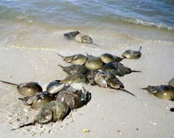
|
| Horseshoe Crabs |
A full moon brings high tide, which for centuries has brought vast numbers of horseshoe crabs to the banks of the Delaware River, toward the end of May. Marine biologists tell us these ugly-looking beasts have evolved very little for thousands of years.
Horseshoe crabs transport oxygen through their blood as a blue copper compound instead of that iron-containing hemoglobin the rest of us use. That's red, of course. Somewhere in the evolutionary path, these ancient animals also neglected to develop an immune system, but defend themselves against bacteria by precipitating sediment when they encounter endotoxin. By luck, this reaction takes place even though the bacteria are dead, so it is routinely employed as a way of detecting and eliminating endotoxin in intravenous fluids, which would otherwise go undetected by failing to grow the original bacteria in conventional culture media. Unfortunately, those of us who have never experienced a temperature spike to 106 degrees from an intravenous infusion of "sterile" water is more or less indifferent to the contribution of the Delaware crabs to our well-being. As well as being sadly indifferent to the unique nature of their nerve cells, in long single neurons, which make a number of important experiments possible.
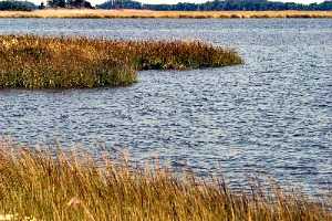
|
| Bombay Hook |
The horseshoe crab offers still other attractions. When they come ashore to lay eggs (at a full moon, or high tide, in May), they lay incredibly large quantities of them, attracting astonishing swarms of birds, which can be seen gliding a few feet above the water surface in groups of hundreds or even thousands. The Red Knot sandpiper is certainly not the only egg-eater at Bombay Hook, but there are some unique features of that bird to be mentioned in a minute. A lot of people object to being attacked by monster swarms of mosquitoes in the summer, but screens and air-conditioning have encouraged a large number of rather prosperous houses to be built along the shore, particularly where there are sandy beaches. In fact, it is so crowded the Fish and Wild Life Service has placed street lights at such public places, with a narrow driveway to lead you to the beach. If you don't know how to recognize such amenities, well, too bad for outsiders.
Although there are plenty of naturalists and bird-watchers who come in the early spring, most of the houses along "Slaughter Beach" seem to belong to fishermen and duck hunters, the two outdoor sports with most popularity. Different migrations of different food-producers bring different prey for the sportsmen, but somehow the most up-scale members of this fraternity tend to go there in May, looking for Red Knots. A Red Knot is a form of sandpiper, with a red head and breast. The birds are born in the Arctic tundra, eating vast amounts of mosquito eggs and larvae, migrating south in the fall. They winter over in Tierra del Fuego at the opposite end of the earth and then migrate north to Bombay Hook on Delaware. For these long migrations, they must eat voraciously when they do eat and somehow have learned to look for the horseshoe crab eggs at just the right time, presumably following cycles of the moon for timing. Residents of the area for centuries have remarked on the timing of the birds and the tides and the crabs. Unfortunately, the two-continent migration was only recognized fairly recently, and when the supply seemed endless, the crabs were scooped up and used for fertilizer until their supply began to dwindle; both Delaware and New Jersey now have protective legislation, and Virginia is being verbally excoriated by bird watchers, to do the same. The crabs have started to come back, but the Red Knots are slower to respond, and now the threat is Sushi. Another ecological damage has reduced the supply of crabs in the Pacific, so the crab fishermen have migrated to the Atlantic to catch the crabs as bait for conch and other ingredients of Sushi. Once again, the abundance of crabs has declined, although to a much smaller degree than the Red Knots. This year, on the very best day of the year for this sort of thing, with dozens of out-of-state license plates wandering aimlessly up and down thirty miles of shoreline, the shouted greetings among serious bird watchers returned the sad news, "No Red Knots today. Try the beach." It was generally agreed there was a bit too much wind for good Red Knot sighting, and that oil spills in the Gulf of Mexico were to be suspected, and that perhaps tomorrow would be a better day. But judging by the very expensive optical equipment these people were carrying around, these were serious birders, indeed. If they couldn't find Red Knots, the rest of us might as well give up.
The most plausible theory for the latest decline centers around the old-timer birds. When the first-timers start their northward migrations, they are guided by the old-timers who have made the trip at least once before. If something injures the flock, it may be a few years before the supply of old-timers revives enough to supply the first-timers with guides. That's just a theory, of course, but currently the most popular one. Just what it would take to eliminate the Red Knot migration completely, may now be close to being tested. Just on principle alone, it does seem a pity to eliminate a phenomenon which took thousands of years to develop.
|
| Benjamin Chew's Whitehall |
When you finally give up on Red Knots, you might as well wander around this enormous wildlife sanctuary. A few miles up the road is the former location of Whitehall, the plantation house of Benjamin Chew, lawyer for the family of William Penn, and owner of the stone fortress on Germantown Avenue in Philadelphia that thwarted George Washington's attempt to stall and starve the British before they could join up with their ships in the harbor below Fort Mifflin. The original buildings on the plantation have disappeared, but the spongy plantation trails have been replaced by elevated gravel roads. So it is possible to roll up the windows of your car in mosquito season, turn on the air conditioning, and cruise around the spectacularly beautiful ponds and inlets. Further south is the plantation of Caesar Rodney, who rode to Philadelphia in the rain to cast the deciding vote for the Declaration of Independence. And further south of that is the plantation of John Dickinson, who made Rodney's ride necessary by refusing to sign the Declaration, on the grounds that the colonies showed insufficient unity, in his eyes, to be able to win a war with England. And anyway, the argument was largely economic, hence more likely to be won by economic means than military ones.
To the west of these historic plantations are some pretty impressive farms, new style. The houses give them away since no farmer will spend a cent on his house if he can profitably expand his farm; these houses belong in glossy magazines. The silos are grouped in clusters of ten or twelve, the irrigation sprinklers are a quarter-mile long, attachable to what resembles a fire hydrant in the center of the field. There are over a hundred sheds on some farms, filled with chickens fattening up. And do you know what? You can drive for miles without seeing a single chicken.
Eventually, the road leads to the Dover Air Force Base, very large indeed. No planes are in evidence, as is true on most days. But one day in 1962 Mr. Kennedy was talking to Mr. Castro, and overhead at Dover you could see dozens, maybe hundreds, of eight-engine bombers. Just circling, circling, waiting for orders to go lay an egg on the Kremlin. It wasn't clear to onlookers at the time, just what this was all about. But the idea can now be entertained that perhaps Red Knots weren't the only species flirting with extinction.
State in Schuylkill Fishing Club

|
| Richard Romm |
Richard Romm, a rising historical scholar with a special interest in early Philadelphia, recently educated the Right Angle Club in the history of the Schuylkill Fishing Club in the State in Schuylkill, and was immediately accepted into membership. Of the Right Angle, that is, which is an old club by some standards, but scarcely a hundred years old in the eyes of the really old, old clubs.
The State in Schuylkill is an eating club, originally a fishing and eating club, apparently organized around the annual shad run up the river. The clubhouse, or Castle, was moved several times, in response to damming of the river, and is now located on the grounds of, or adjoining the edge of, Nicholas Biddle's estate on the Delaware River called Andalusia. One by one, the Atlantic Ocean rivers of America have been dammed and their annual shad migrations brought to an end, except through the city of Richmond, Va, so there was little point in moving The Castle to follow the fish. It remains, overlooking Delaware in spite of its name.
There seems to have been several name changes, the most important of which was to change the Colony of Schuylkill to the State of Schuylkill for obvious reasons. Originally, the Castle was roughly opposite the falls of Fairmount on the West Bank of the Schuylkill at about Girard Avenue; thus, from 1732 to 1822 located on Baron Warner's property called Eaglesfield. In 1822 it moved to Rambo's Rock (the Rambo family is said to be the oldest European settler family in Pennsylvania) opposite Bartram's Gardens, then finally in 1887 to Andalusia, Nicholas Biddle's country estate. The club was founded in 1732, and dates of movings are possibly hazy, possibly somewhat because of the reluctance of club officers to return the calls of inquiring historians. The State in Schuylkill claims to be the oldest organized men's club in the world, an honor contested by White's in London. The roots of this argument are found tangled in the vital issue of whether their age should be based on the formal organization of the clubs, or on the establishment of the coffee houses which housed the original clubs. Four books are said to have been written about club history, but we depend here on Mr. Romm.
|
| Chief Tammenend |
There is also an unclear relationship with Chief Tammenend, possibly traceable to the shad run, but in any event to the Indian chief depicted with William Penn in the paintings by Benjamin West and Edward Hicks. May 1 is St. Tammany's day, growing into the fancy that he was the "Patron Saint of America", before a branch of the nation-wide Tammany association opened in New York and sort of tarnished up the name. Other traditions of the Fishing club have to do with wearing Mandarin hats, possibly having to do with the export of ginseng which was once abundant in our colonial suburbs, with a return cargo of Chinese dishware. All of the cooking is done by official citizens of the club. The quantities of food are remarkable; one 19th Century menu listed eleven pounds of meat per member. The club drink is a punch, the famous Fishhouse Punch, widely recognized to be rather strong. Its inventor is reputed to be Edward Shippen Willing, on the occasion of the first visit to the clubhouse by women guests. The quantity of alcoholic beverage at these events is especially remarkable in view of the Quaker origins of many original members of the club, but not necessarily of the guests. Among the various guests were Generals Grant, Meade, and McClellan. Dinner begins with two traditional toasts: to George Washington, and to Captain Sam Morris. Washington was appropriate enough, having a history of drinking a bottle of Madeira every day at lunch. But Sam? Captain Sam the Quaker?
|
| Free Quaker Meetinghouse, Fifth and Arch Streets |
Somewhere in this tradition are allusions to the Free Quakers, Quakers who abandoned the peace testimony to fight the British. There is also the tradition of hostility to British rule which antedates the Revolution and may have some connection to the fanciful contention that their little state was not really part of Penn's colony. Captain (of the City Troop) Sam was a stalwart, possibly the sole founder, of the Gloucester (N.J.) Fox-hunting club. The history is passed down that 22 of the original 26 members of the First City Troop were members of the fox-hunting club, and many if not most were Quakers. The first "Governor" of the State in Schuylkill was Thomas Stretch, but the second Governor, from 1766 until his death, was Captain Sam. He was repeatedly referred to as the life of the club and held in the highest esteem by all. He was "read out" of the main Quaker Meeting, not so much for his drinking as for his flouting of Quaker belief in pacifism. He reputedly led a saber charge at the Battle of Trenton and was a leader of the City Troop in that revolution within a revolution at James Wilson's house, which rescued at least four future signers of the Constitution from a mob of militia which momentarily turned Jacobin.
Naturally, descendants of Quakers on both side of this uproar have been reluctant to say much about it. But somewhere within the history of Samuel Morris must be some important clues about the 18th Century splits within the Quaker Church, to say nothing of the revolt of the three Quaker colonies against British rule.
Weather Man

|
| Paul Walsh |
PAUL Walsh, our local weatherman, recently addressed the GIC (Global Interdependence Center) at the Federal Reserve, and presumably because everyone talks about the weather, the meeting was well attended. While he is too experienced to get drawn into a global warming controversy, we get the general outline of his views. What we call the weather is largely a result of various clouds and wind currents blowing around the planet in response to the rotation of the planetary mixture of oceans and land masses. The familiar landscape visible to astronauts makes it easy to accept this view of things.
The global warming issue, however you explain it and where ever it may be going, is a weather cycle to be measured in centuries. Shorter cycles of about eight years in duration tend to result in American weather patterns sometimes blowing Canadian cold air toward the East Coast, and sometimes blowing California winter weather Eastward. In 2011-12 we seem to be experiencing a California winter, while the preceding two winters were unusually cold, reflecting Canadian conditions. What may or may not be happening with the hundred-year global warming cycle is not easily slipped into our daily conversations. It is probably quite irrelevant to global trends whether or not last year was a cold one, or whether our sidewalks are unusually slippery this morning.
Inquiries about the weather are the number one topic to be clicked on the Internet, reaching 17% of queries. That's nearly double the second largest category and four times the number of inquiries about the stock market. Ordinary variations of the weather have been calculated to have an economic value of $384 billion, or 3.4% of the Gross Domestic Product (GDP). Insurance claims for more severe weather abnormalities run between ten and fifty billion dollars a year. The number of hurricanes and similar disasters is highly variable, sometimes running as high as fifty in a bad year.
Predictions are improving, but ridicule of weatherman errors is still highly embarrassing to the professionals in the business. A generation ago, it was almost impossible to get a one-minute warning of an approaching tornado, but nowadays we average fourteen minutes warning for them. That's almost long enough to be useful. Hurricanes seem to be increasing in frequency, but decreasing in average intensity. But insurance claims are getting steadily higher, largely because more people are building more structures in harm's way.
Small wonder that weathermen are a cautious lot about predictions. The present party line, in case you wanted to ask, is that predictions more than ten years in advance -- are just about impossible.
American Chestnut Trees
|
| American Chestnut tree |
RECENTLY, John Wenderoth of the Tyler Arboretum visited the Right Angle Club of Philadelphia, bringing an astounding account of the triumph, near-extinction, and revival of the American Chestnut tree. The Tyler Arboretum, and this man, in particular, is at the center of the movement to rescue the tree, although the modern Johnny Appleseeds of the movement seem to be a Central Pennsylvanian named Bob Leffel, and a geneticist named Charles Burnham. Together, they had the vision and drive to enlist a thousand volunteers to plant seedlings in Pennsylvania; and there are many other volunteer groups in other states within Appalachia. About 45,000 Chestnut hybrids have been planted, surrounded by wire fencing to protect the new trees until they grow too tall for deer to reach the leaves. Here's the story.
In 1904 it was estimated that a fourth of all trees in the Eastern United States were American Chestnuts. The tree typically grew to eighty feet before permanent branches took over, so the shading and tall pillars of tree trunks gave the forest a particular cathedral-like distinctiveness, much celebrated by such authors as James Fennimore Cooper. The wood of the American Chestnut tree is rot-resistant, so it was favored by carpenters, log-cabin builders, and furniture makers. It once was a major source of tannin, for leather tanning. The nuts were edible, but it has been a long time since they were available for much eating. The chestnuts you see roasted by sidewalk vendors are primarily Chinese Chestnuts, which actually come to us from South Korea. The Buckeye, or horse chestnut, produces a pretty and abundant nut but is too bitter for most tastes. For whatever reason, a fungus was first discovered to infect the chestnuts of the Bronx Zoo in 1905, attracting the attention of Teddy Roosevelt and his Progressive naturalist friends, but to little avail. The fungus (Cryptomeria parasitic) enters the tree through cracks in the bark, flourishes in the part of the tree which is above ground, leaving the roots undisturbed. Ordinarily, when this sort of thing happens, the roots send up shoots which keep the tree alive and flourishing. Unfortunately, the abundant deer of this area quickly nipped off the shoots as they appeared, and finally, the trees died. It took only a decade or so for this combination of natural enemies to wipe out the species, and today it is unusual to see lumber from this source. The forests of Chestnuts have been replaced by other trees, mostly oaks. The Chinese chestnut, however, proved to be resistant to the fungus, even though it does not grow to the same height.

|
| Chinese Chestnuts |
After many futile but well-meaning efforts to save the trees by foresters, friends of the American Chestnut tree turned to geneticists. The goal was to transfer the fungus resistance gene from the Chinese Chestnut to a few surviving American Chestnuts. It took six or seven generations of cross-breeding to do it (four generations of seedlings, then crossing the crosses, then weeding out the undesirable offspring), but eventually, the Tyler Arboretum was supplying truckloads of seedlings to the volunteers to plant in likely places. It's going to take many years for the seedlings to grow in sufficient numbers to make an impact on our forests, and eventually on our carpenters, but that effort is underway with gusto. If anyone wants to volunteer to join this effort, there appears to be room for plenty more people to help.
U.S. Army Corps of Engineers in the Delaware Valley

|
It seems unlikely a peanut farmer from Georgia would have much interest in Philadelphia, let alone the activities of its local Army Corps of Engineers. But it seems there is some sort of story, there. An acquaintance chairing a local meeting of Americans for Democratic Action at the time remembers an episode dating from the 1976 presidential nominating campaign. Morris Udall was the main opponent of Jimmy Carter for the Democrat nomination. You might suppose an out of town politician would have instincts tell him to be nice to the local mayor of his own party, but Jimmy Carter went out of his way to attack Frank Rizzo. Udall took the path of conventional wisdom and refrained from joining Carter in the attack. Since Pennsylvania votes were considered pivotal in that particular race, it was watched with considerable interest. But to the surprise of the insiders, Carter won the Pennsylvania votes, suggesting that hidden animosity to Rizzo was extensive. Furthermore, from that event, it would be possible to suppose either of two conclusions. Either Carter would be grateful to Pennsylvania for putting his nomination over the top, or else he had some sort of grievance against Rizzo.
Subsequent events suggest he had a grievance, but it would be very hard to imagine where the two would even have met each other in the past. More likely, he made some slighting remark to an aide, who took it on himself to curry favor when in fact Carter had forgotten all about it.
|
| U.S. Army Corps of Engineers |
In any event, the local division of the Army Corps of Engineers went into some sort of decline, dating from about that time, which might well have been over-reacting to the so-called Love Canal episode. The chief of the division was to have no higher rank than Lt. Colonel. The activities of the division had been centered on building dams and flood control projects but began to be mostly environmental protection, particularly repair of hurricane-damaged ocean beaches. The headquarters was moved from the Custom House to the Wanamaker Building because the personnel and budget had declined. There was the talk of merging the district with another district. The Delaware Division is the smallest district in the country, almost difficult to find on a map whereas some other districts enclose eight states. When you get more states you get more Senators, so you get more budget, and so on. It was sad that the Navy and Marines were founded here, the Revolution and the War of 1812 caused many fortifications to be centered here, the capital of the country. From that point to the present, there has been a long decline. It was particularly painful that West Point is primarily an engineering college, with a tradition that the top five percent of every class is offered a place in the Corps of Engineers. In Army politics, it is clear that a heavy proportion of the generals were West Point graduates, just as it is almost exclusively true that all admirals have Annapolis in their background. Jimmy Carter went to Annapolis, but so what?
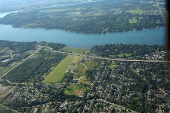
|
| Love Canal |
Rather than follow a line of thought which leaves many uncomfortable, perhaps it is more relevant to notice that all of our rivers seem to be drying up. Colorado and the Rio Grande are mere trickles, the Mississippi now has wide banks of mud. Delaware has long been recognized as having a wide mouth and a short length, reflecting its origin as a small river emptying (at Trenton) into a wide bay which is really the back bay of the huge barrier peninsula of Southern New Jersey. What might have been its extensive watershed runs instead into the Susquehanna, about a hundred miles north of Philadelphia, probably because of volcanic shifts? But what was once a thriving port has dwindled as a result of labor troubles and some unfortunate legislation. That's where the number of Senators in your district makes a difference.
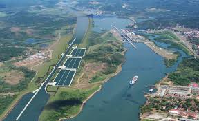
|
| Panama Canal |
Wilmington, Delaware has the largest port for bananas in the nation; Delaware points southward, toward all of Latin America. The Chinese are financing, and probably engineering, a widening of the Panama Canal to accommodate giant container ships that now can't get through. The first port on the Atlantic seaboard to deepen its harbor accordingly, will probably get first-mover advantage and hold it because it is expensive to play catch up. Philadelphia is about half-finished in the deepening of the channel to forty-five feet. But New York's deepening of the Hudson is almost complete. New Jersey politics involves both channels on its north and south borders, but New Jersey has long since thrown in its lot with New York. Now that it probably won't matter, the Pennsylvania dredging will probably be permitted to finish. If that happens, the only hope for Philadelphia in the race to be a big container port will depend on a recession in China slowing down their import traffic until we catch up. After all, Philadelphia is blessed with an almost world-unique combination of rail, highway, airport, and ocean shipping interchanges at a single point, on relatively undeveloped land close to a major city. Without wishing any evil on China, we do have to wish they would encounter some reason to slow down for us. Slow down, that is until our natural advantages can overcome the foibles of our politicians.
The Wissahickon
Recently, Sarah West came to the Right Angle Club and told us about the history of the Wissahickon Creek. Sarah taught at Germantown Friends School for twenty-five years, and in the course of it became the acknowledged expert on the Wissahickon. The mouth of the creek empties into the Schuylkill in Fairmount Park, but the mouth of it is so covered over with a tangle of clover-leaf overpasses, most people zip past without noticing. After that, the drivers of cars up to Chestnut Hill are so busy negotiating the sharp curves, they don't see much of the rest of the creek, either. There's a stop light opposite Rittenhousetown, so perhaps the little village is noticed on the other side of the rivulet, but the entrance is off to the left on Wissahickon Avenue, approachable only from the other direction, so even this cute little village is seldom visited. Pity.
First, notice that the mouth of the creek is just opposite City Line Avenue, so it is an important geographical landmark. The creek is 23 miles long, going right past Roxborough and ending up well beyond Philadelphia's city limits. To a passing motorist, the creek seems to disappear at Rittenhousetown, and the commuter goes on his way through miles of the city before reaching Chestnut Hill. In fact, the creek curves abruptly north at Rittenhousetown and travel twenty miles through woods and wilderness, accompanied by fifty miles of hiking trails. This Wissahickon Park contains about 1200 acres of the 9600-acre Fairmount Park; at one time it was lined with mills seeking water power for one industrial activity or another. From Rittenhousetown to Chestnut Hill College the creek is accompanied by Forbidden Drive, forbidden (in 1922) to automobiles, that is. It crosses Germantown Avenue at that point and circles around Chestnut Hill College, only a branch disappears back into the woods surrounding the edges of the College and Morris Arboretum. On its right that branch of it, starting at Chestnut Hill College, passes (and supplied water for) Washington's encampment at Fort Washington. As a sidelight, Forbidden Drive parts company with the creek at Chestnut Hill College and the main branch of the creek goes on for miles past the Whitemarsh Country Club, then the Germantown Cricket Club, and the Wissahickon Valley Park, eventually reaching its origin in the water runoff from a parking lot off in the country near Ambler, well past Fort Washington, out in Montgomery County.
Only a short part of the Wissahickon is visible from the paved road, which veers to its right near the top of the steepest dropdown of the cliff on the west side of Germantown. That's one of two ridges. Roxborough is on one side of the valley, Germantown and Chestnut Hill on the east. The longest part of the creek veers to the left up to the wooded valley, along miles of Forbidden Drive before it re-emerges to the sight of motorists as it crosses Bethlehem Pike. This was one of several routes followed by sections of Washington's army in their attack on the Chew Mansion in the Revolutionary War. Washington lost, partly because of the stout stone walls of the Chew House, and partly because two sections of his troops got lost in the fog along the creek and started shooting at each other. Even today, the geography around here is so confusing it is really pretty hard to criticize Washington for getting mixed up.
The edge of the Wissahickon Creek was first settled by an early group of Germans led by Johannus Kelpius in the Seventeenth Century; the Kelpius Society feels that colony was located around the Henry Avenue Bridge footings standing athwart the gorge, comparatively near the mouth of the creek into the Schuylkill. Swift waters running downward provided water power for mills, originally paper mills. Paper plus education leads to printing, and at this point was located the heart of German culture, running north and south through all the thirteen colonies; eventually, this settlement of Baptists, Dunkards, and Church of the Brethren moved westward toward Ephrata and other more scattered locations. Sarah tells us that a good workman could produce about three hundred sheets of paper in a day, so it had to be of good quality. Many of the historical documents of the Revolutionary period were written or printed on this paper. Bear in mind, however, that nothing smells so bad as a paper mill.
It takes wood to make paper, so paper mills tend to denude the surrounding hills and start a process of washing away the topsoil. The creeks started to flood in the spring, and dry up in the summer. The final blow of this type was caused by Hurricane Floyd in 1985, which washed away many of the landmark buildings, leaving miles of the woods to the pleasure of hikers and joggers and environmentalists. Sarah West reports that you don't have to walk very far into the woods to find the remnants of mills and mansions, many of which had fruit cellars dug into the side of the basements. Some of these fruit cellars were then extended into tunnels, allowing the Underground Railroad to flourish here before the Civil War. And possibly earlier than that, because this area close to Philadelphia was a favorite place for spies to hide, attracting British raiding parties during the Revolution.
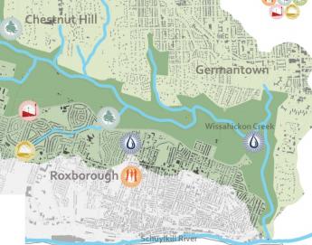
|
| Wissahickon Valley |
But water power was water power in Colonial days, and mills of all kinds flourished up and down the length of the creek until steam power ultimately posed too much competition. For a while, the dwindling water-powered mills supplemented their power with the steam generation, and tall smokestacks, but eventually, water power was driven away by steam power. Whether it was a flour mill or a nuts and bolts factory, grist mills or blanket factories, the product was usually shipped in white oak barrels, which hastened the destruction of the woods and made the flooding worse. Around each mill was usually found a cluster of houses for the workers, so the whole Wissahickon Valley eventually filled with settlements, usually with the owner's mansion dominating the scene, surrounded by little workers' houses. Eventually, the stream became polluted, and the pollution was unfairly blamed for Yellow Fever epidemics. The Schuylkill Water Works and the migration of the factories elsewhere did a whole lot of good for typhoid fever, which definitely is caused by water pollution. So pollution control is sometimes useful even if there is no pollution of the kind you had in mind. The area became Fairmount park, dotted with mansions which used to belong to rich Quaker families with names like Evans and Livezy. There were once five covered bridges scattered along the creek, but mostly they were replaced by bridges, or just got washed away.
So, over the course of two centuries, the pioneers settled the woods, the civilization created a factory town in the middle of a peaceful city, and then the environment took it all back. Now we have a forest in the middle of a city, and rather more unemployment than we want. It isn't fair to say the environmentalists won, it just seems to be cyclic. So enjoy it while you can.
Glen Foerd, Torresdale, and the Feudal Industrial Style
|
| Meg Sharp Walton |
Recently, the director of Glen Foerd on the Delaware, Meg Sharp Walton, told the Right Angle Club all about the mansion, the industrial titans who owned it, and the surrounding community which keeps it going. Glen Foerd Mansion sits on the small bluff where the Poquessing Creek enters Delaware. It's on the south bank of the creek, so it is just inside the Philadelphia boundary. Charles Macalester, who built the original mansion was a financier who sat on the board of the Second National Bank. So it is not surprising that he built a summer place just downriver from Nicholas Biddle's "Andalusia", which is on the north side of the creek. The Philadelphia consolidation of city and county government left one mansion in Philadelphia, and the other one in Bucks County. The region is perhaps better known for the little company town of Torresdale, and even better known for the Torresdale water inlet, where much of Philadelphia's water comes from Delaware. The Torresdale stop on SEPTA makes it an easy commute from Philadelphia, as does I-95, some of the time. The creek's inlet into Delaware is swampy, as most such confluences are, and is a favorite place for bird watchers and nature lovers. The tidal nature of Delaware at that point is quite apparent; at some times of the day, much of the bank of the inlet is bare ground.
|
Charles Macalester may well have been the right sort, but he sold the property and left his estate to Macalester College in Minnesota, so Philadelphia doesn't find much to remember him by. After all, the early Quakers wouldn't even consent to put their names on tombstones, let alone name colleges after themselves. Robert Foerderer bought the property around 1850 and embarked on an elaborate renovation project. He had made his pile of money by purchasing the French patent for making kid leather and eventually had 5000 employees in Frankford making the material for kid gloves. The mansion on the river could be said to be the apex of an industrial empire, quite typical of how Philadelphia, particularly Northeast Philadelphia, did things. He was said to have been quite a benevolent emperor of this kid glove empire, including the little company town of Torresdale, until there was an industrial uproar of the 19th Century variety. Whereupon, he abruptly shut the whole business down, just as John Roebling did when his company town across the river wanted to run its own town. There's a sort of European flavor to this sort of story, sort of an opera about a principality on the Rhine River. This area of northeast Philadelphia and Bucks County has a number of principalities with this sort of town cohesiveness, where families who work there are clustered around their factory center, and children, and grandchildren, and great-grandchildren tend to stay in one place to live a life which ignores the rest of the world. Someone has to be the boss of such communities, tends to regard the position as hereditary, and definitely resents the idea that anyone else has much to say. Central to the concept is the Horatio Alger story of the hard-working youngster who gets to the top by merit, leading to the conviction that if someone else wants to be at the top of a heap, let him first build his own heap. Somehow, the Foerderer story seems to add realistic color to what was true about this social system.
|
| Robert H. Foerderer |
Robert Foerderer died fairly young, having married Caroline Fischer, and producing a daughter, Florence Foerderer Tonner who married a New York hosiery tycoon named Tonner. The ornate decorations of Glen Foerd, the idiosyncratic taste in art, the parties and the ostentatious social circle, all add up to the sniffy description of "new" money, the so-called nouveau riche. The hundred older families of the Philadelphia establishment were very cautious about mixing socially with such newcomers and their often unexpected behavior, although there were notable exceptions. In all this uproar you can see the origins of the two present political parties, with the "old money" rich people displaying a quite surprising preference for redistributionist economics and environmental protectionism. It's easy to exaggerate, but a good part of this enduring split is due to social resistance of the older settler families to new ways of doing things, particularly when new ways have not demonstrated unequivocal value.
|
| Glen Foerd Mansion |
But returning to Glen Foerd, the name is a composite of the original Glengarry and the newer Foerderer. Florence Tonner got one of the first television sets to be produced and put it in the middle of her gallery of fine art. She sat there watching her favorite TV shows, why not. In her will, she left the estate to the Lutheran Church, but during the Depression, the church had trouble keeping it up. Someone discovered a clause in her will which provided, that in the event the Church could not support the estate, it was to be given to the residents of Torresdale. Since Torresdale only consisted of two streets, not including East Torresdale, West Torresdale, and any other splinter communities, the ownership of the estate was pretty closely held. This small group of true believers took up the burden and tried to make the estate survive. The house was opened to visitors, and available for weddings and events. Adult education courses, small-scale Chautauquas, bird-watching and nature walks were established. Slowly, the residents have been succeeding in making a go of it, but the original residents are getting older and dying off. It's going to be a hard struggle to make the place self-sustaining on every necessary level. But we wish them well, and certainly, admire their spirit.
Taming the Creeks of Olde Philadelphia
For the past ten years, the Morris Arboretum has sponsored a mini-bus tour of the sewers of Philadelphia conducted by Adam Levine. In spite of its name, it attracts a pretty high-brow audience, who have a perfectly wonderful experience. Adam has been a consultant to the Water Department for decades, and he gives a pretty polished tour, which anyone interested in the City really ought to join some year. He's planning to write a book about it, someday, and instead of giving away all the best stories, I bet it will swell attendance at the tours considerably. Some of us know that writing books can be pretty hard work, however, while giving tours seems like a lot of fun.
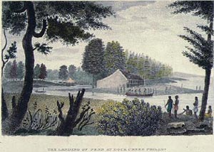
When William Penn picked out this area for his new city, there were herds of swans swimming in the Delaware River around the mouth of the Schuylkill, and there were wide mud flats thrown up around what we call the airport, by the slowed waters making a big turn there. Although Mr. Penn originally planned to settle at what we now call Chester, apparently he thought the protected river above the mud flats would be a safer harbor. In the area of Philadelphia County in Penn's time, there were about three hundred miles of creeks, now reduced to about one hundred by the Water Department and the Department of Streets. Dock Creek was the main seaport at first, and it eventually became Dock Street by putting the creek into a culvert. In a sense, that is what has been happening for three hundred years, all over town. At first, the creeks supplied drinking water, and then they became sewers, and then they became streets on top of sewers.
As a matter of fact, there were further steps in the process. The railroads were laid on the banks of creeks, to reduce the amount of excavation and fill-in required. And as factories were built along the creeks to take advantage of the transportation and water power, the run-off of sewage was mixed with ground-water runoff, in what is delicately spoken of as a "combined sewer". The water department spends most of its time and money nowadays, separating rainwater sewage from the real thing, and diverting the rainwater into ponds and other catchment hollows, where the relatively clean water percolates through the soil and cleans itself up. The real sewage is diverted into massive pipe systems leading to the sewage disposal plants. Where, would you believe it, it gets cleaned and chlorinated and returns as drinking water -- purer than the river water that flows past, by a good bit.
But that gets ahead of the story somewhat. As the factory areas become liveable, the sewers encased in the pipe are at the bottom, the rail lines are somewhat higher. Where there were no railways, the electrical and water pipes are high above it all and often get encased in concrete. However, we can expect combined sewers to last a long time, since it is estimated that the project of uncombining two-thirds of the sewer system will cost several billion dollars, and require twenty-five years to complete. The infrastructure money from the "Stimulus package" will be a forgotten episode of the past when this project is finished. Philadelphia likes straight streets aligned in grids, so you can almost be certain you are over a creek bed when the road gets crooked in Philadelphia.
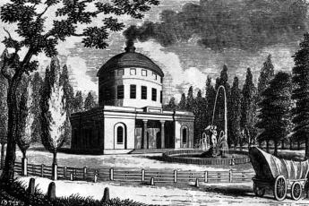
Now, look at the grid of streets from the point of view of a Water Department engineer. Somebody gave the process the name of a waffle, and it is very apt. As the straight streets go as straight as they can, they cut through hills and fill up the gullies. The fill from the hills is used for the valleys, so the straight grid streets are generally somewhat higher than the residential areas, giving the waffle effect, but leaving half of the houses with a sharp embankment in their lawns going down to street level, and the other half of the houses with water in their basements. It's up to the house builder to fill up the depression between the streets, with the streets nevertheless somewhat higher than the depressions. Sometimes the streams cut through, and are encased in pipes as they go under the streets. Sometimes it's just too much to handle, and we get green parks scattered around the city, breaking up the monotony of row houses, for a generally pleasing effect not seen in flat areas, like New Jersey.
The city has two watersheds, one draining into the Delaware River, and the other draining into the Schuylkill. And the trail between the two watersheds, the continental divide if you please, is Germantown Avenue.
Bring Your Own Hammer
Stonehenge in England is a ring of big stones standing on the edge, but only recently has it been discovered that they chime when you hit them with a hammer. The British didn't discover the phenomenon, however. Long ago the Quakers of Pennsylvania knew they had ringing rocks in a moraine dumped at the edge of a receded glacier in Bucks County. The County has made it a recreation park which is mostly deserted, except when a drove of cars appears, bearing dozens of Cub Scouts or other excursionists.
|
| Ho Chi Minh Trail |
Just what makes these boulders chime when you hit them with a hammer, isn't entirely clear. It's certainly a good topic for a geologist to use for a thesis, but right now none of the visitors to the park cares very much. It can easily be seen that the moraine marks the edge of the fertile plain surrounding Philadelphia, to the north of which the ground breaks up and has mining as its main industry. The farms suddenly become smaller and less prosperous on the moraine plateau, and fancy exurban restaurants yield place to auto dumps and parks of pickup trucks. In certain seasons, it is possible to imagine the gun racks above the front seats. Some of the areas suit itself for summer cottages in the hot weather, usually close to a stream or lake. This is the area where the Shenandoah Valley extended, narrowing down to the Delaware Water Gap. George Washington didn't just cross Delaware once near here, it was a sort of a Ho Chi Minh Trail out of reach of the British Fleet during the Revolutionary War. The main arsenal of the Revolution was in Reading. The valley meets what used to be an industrial area along Delaware, coming up from Philadelphia. Before that, the Seneca Indians had made it their headquarters, and after that, people like Stephen Girard discovered and exploited the minerals once exposed by the glaciers to the north. There's a "wind gap" (cleft in the mountain without water at the relatively high base), and the water gap. William Penn terminated his line separating East from West Jersey at Dingman's Ferry within this region, and later his sons' agents cheated the Indians with the Walking Purchase nearby. The politics of Bucks County are easily imagined by looking at prosperous Doylestown and comparing it with nearby rundown Easton. This is really just the center of Bucks County, half of which extends to the North, and all of which must have an interesting political history.
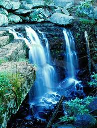
|
| Ringing Rocks County Park |
Abruptly, turning a corner amidst the summer cottages, is a neat little park, the Ringing Rocks County Park. At times it is deserted, at other times you can hardly find a place to park your car. Fields of boulders, three to ten feet in diameter, extend down the hill to the river. It's easy to go down, not so easy to get back up to your car. People pile out of their cars, carrying brand-new hammers, and you can see dozens of (probably disappointed) pockmarks on the rocks near the parking area. If you thought it was going to be easy, you are quickly disappointed.
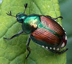
|
| Japanese Beetle |
But the legions of cub scouts, happily swinging their hammers, swarm down on the rock piles, hitting every rock as they go. If there are enough of them, you hear plenty of clunks, but also an occasional ringing chime is heard, and the other cubs soon swarm around. At a rather daunting distance from the edge of the rock field, one cub scout after another discovers a rock that chimes like a cowbell. He attracts his friends, who have a whack at it. The chimes never quite outnumber the clunks, but the music rises as the scouts swarm over the property on agile little feet that soon defeat their elders' lumbering climb. A sudden thundershower made the rocks too slippery even for kids, and the place quickly emptied out. When we got back to the top of the hill, soaking wet, there were only a few cars still there.
Pennsylvania's First Industrial Revolution
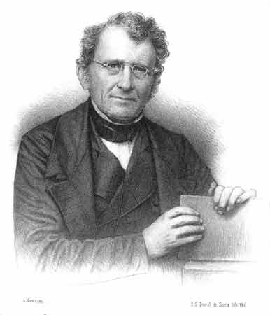
|
| David Thomas |
We tend to think of 1776 as the beginning of American history, but in fact, the region around Easton was settled a hundred-forty years before 1776, and the forests were pretty well lumbered out. The backwoods lumbermen around the junction of the Lehigh and Delaware Rivers were about to move further west when Washington crossed Delaware and fought the battle of Trenton. This region nevertheless had three essential ingredients for becoming the "Arsenal of the Revolution": It was close to the war zone but protected by mountains, it had a network of rivers, and it had coal. The hard coal of Anthracite had the problem it was slow to catch fire, and iron making in the region didn't really get started big-time until a Welsh iron maker named David Thomas discovered that anthracite for iron making would work if the air blast was pre-heated before introducing it into a "blast" furnace. A local iron maker traveled to England to license the patent from Thomas, whereupon Thomas' wife persuaded her husband to move to Pennsylvania. Blast furnaces only got started into production by 1840, but by 1870 there were 55 furnaces along the Lehigh Canal. For thirty years this was America's greatest iron-producing region. In fact, Bethlehem Steel only closed its last plant in 1995.
|
| Canal Boat |
When iron-making got started, the local industrial revolution really took off, but the more fundamental step was to dig canals to transport the coal to other regions. Canals were the dominant form of transportation for only thirty years until railroads took over, and the entire Northeast of the nation was laced with canals. Curiously, the South had relatively few canals, so their industrialization was too late for canals, and too early for railroads, to help much in the Civil War. The Erie Canal was the big winner, but Pennsylvania had many networks of canals in competition, leading to the Ohio and Mississippi Rivers, whereas the Erie Canal was more headed toward the Great Lakes and Chicago. Eventually, J.P. Morgan put an end to this race by financing the Pennsylvania Railroad and moving the steel industry to Pittsburgh, where bituminous coal was the fuel of choice. This industrial rivalry was at the heart of the enduring rivalry of Philadelphia and Pittsburgh, as well as the commercial rivalry between New York and Philadelphia. It was more or less the end of the flourishing economy of the "Reach" including Easton, Bethlehem, and Allentown. A reach is a geographic unit sort of bigger than a county, in local parlance. But you might as well include the city of Reading, which concentrated more on railroads and commerce with the Dutch Country. Out of danger from the British Fleet on the ocean, but close enough for war, the "reach" was more or less the forerunner of the Ho Chi Minh Trail in Vietnam in several later wars. The Lehigh Canal stretched from Easton to Mauch Chunk (now Jim Thorpe), the so-called Switzerland of Pennsylvania, only a mile or two West of the Northeast Extension of the Pennsylvania Turnpike.
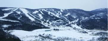
|
| Blue Mountain |
The Allegheny Mountains stretch across the State of Pennsylvania, and the most easterly of these mountains is locally called "Blue" mountain because of its hazy appearance from the East when seen across a lush and prosperous coastal plain. It represents the farthest extent of the several glaciers in the region, and the two sides of it present quite a sociological contrast. The Pennsylvania Dutch found themselves on the richest farming land in the world, whereas the inhabitants of the other side of the mountain had to subsist on pebbles. The mountain levels down at the Delaware River, so the Dutch farmers and the late immigrants from Central Europe mixed, in the time and region of industrial prosperity. Gradually, the miners and the steelworkers began to drift away, but the Pennsylvania Germans tended to remain where they had been before all the fuss. So the Kutztown Fair is full of Seven Sweets and Seven Sours, the farmhouses are large and ample, and mostly remain the way they were, too. You have little trouble finding a twang of Pennsylvania Dutch accents. But Bucks County in Pennsylvania was cut in half by the glacier, and north of the borderline, you can see lots of pickup trucks with gun racks behind the driver. Everything is amicable, you understand, but for some reason, the tax revenues of the two halves of the County are forbidden to be transferred, even within the same county. Better that way.
|
| Lehigh Marker |
The Lehigh River runs along the North side of Blue Mountain, and trickles down to join the Delaware at the town of Easton. There were only 11 houses in the town in 1776, and now you can see several miles of formerly elegant early Nineteenth century townhouses. At the point where the two rivers join, a lovely little park has been built to celebrate the high point of Colonial canal-making. Hugh Moore, the founder of the Dixie Cup Company is responsible for this historic memory, well worth a trip to see. If you have called ahead for reservations, you can have a genuine canal boat ride, pulled by two genuine mules. When you hear that the boat captain and his family used to live on the boat (Poppa steered, Momma, cooked, and the children tended the mules), it seems small and cramped. But when you climb aboard, you find it holds a hundred people for dinner with plates in their laps. The food is partly Polish, partly Hungarian and partly other things Central European. And the captain plays guitar and fiddle, singing old songs he mostly composed himself. Surprisingly, no Stephen Foster, who held forth about four hundred miles to the West, until he drank himself to death at Bellevue Hospital in New York. Foster was a member of a rival tribe of canal boaters, the ones who traveled down to Pittsburgh via the Erie Canal. Along the Reach, you hear about three canals, the Lehigh, Delaware, and Morris. The first two are obvious enough since they and the railroads which subsequently followed ran along the banks of two rivers joined. The Morris was Robert Morris, at one time the richest man in America, who bought Morrisville across from Trenton on the speculation he could persuade his friends to put the Nation's Capital there. It didn't work out, so he bought and went broke with the District of Columbia. Anyway, the Morris canal went on to New York harbor, where it prospered mightily shipping iron to New York, and iron for the rolling mills of Boston. The Morris Canal went over the Delaware River on a bridge that carried an aqueduct, over to Philipsburg; and then across the wasp waist of New Jersey.
| Posted by: Patrick Connors | Jan 8, 2013 9:58 PM |
29 Blogs
Gunk, 27 Million Tons of It
Philadelphia wants to dredge Delaware to help our port, but New Jersey resists because of political pressure from New York harbor, which dominates the New Jersey Legislature.
The Swamps of Philadelphia
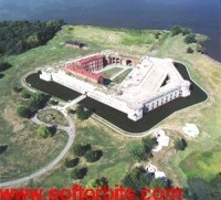 It's now a little hard to remember that the swamps began at what is now the Airport, and extended to what we now call Gray's Ferry. A lot of garbage got dumped there.
Draining Suburbia
Clueless storm sewer design is destroying our brooks and streams.
Tony Junker: Tunnell's Boys
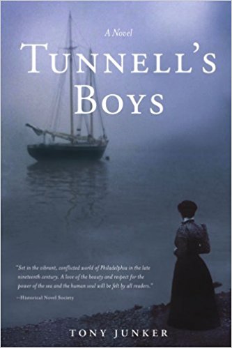 Pilots once had to race from the mouth of Delaware Bay to meet incoming ships. First one there got the job.
Pennsbury Manor
The Delaware River takes an abrupt right turn at Trenton, creating extensive wetlands for miles around. Whatever its environmental drawbacks, the river delta is moving toward landfill and "development". Come back in fifteen years and be amazed.
Port of Philadelphia
The Port of Philadelphia has access to six U.S. Senators from its surrounding states, but the price to be paid is endless political wrangling.
New Jersey Ponders a Rising Sea Level
When discussion turns to global warming, here are a few sound bites for the conversation.
Hidden River
In season, and for benefits, cruises of the Schuylkill are starting to be available at the Walnut Street dock. Go down the stairs at 24th Street.
Wildlife in Haddonfield
 Haddonfield looks like a carefully manicured suburb but there is a surprising amount of wildlife if you know how to look for it.
Water Works, Emblem of the Past
Water pollution doesn't cause Yellow Fever, but in 1799 Philadelphians thought it might, and united to make a work of art out of a new water utility. Eventually, it did eliminate Typhoid deaths.
Heron Rookery on the Delaware
Two or three miles from Philadelphia City Hall, a large flock of Blue Herons with seven-foot wingspreads are nesting in the trees, largely unnoticed.
Reservoir on Reservoir Drive
Philadelphia has a wildlife treasure within a mile of City Hall. The birds know all about it, but citizens need to search a little.
Monocacy Creek and Monocacy River
 An ancient Shawnee Indian word causes confusion along the Blue Mountain.
Central Pennsylvania Settlers Before 1700
When German-speaking religious sects migrated into the "Pennsylvania Dutch" area around 1730, they found German Lutherans had been living there for nearly fifty years.
Dingman's Ferry, Below Port Jervis
The northeastern corner of Pennsylvania has a deep gorge for the Delaware River. Just south of it, the river narrows to a crossing at Dingman's Ferry, now occupied by Dingman's Bridge.
South Philadelphia: Ideal Intermodality Transportation Site
Very few places on earth have rail, airport, ocean port, and Interstate Highway exits all crowded in a small place. An ideal location for intermodality connections, twenty minutes travel from the center of a major city.
Reviving Schuylkill: Eight Miles From the Dam to Ft. Mifflin
Cleaning up eight miles of banks of the Schuylkill from Fairmount Dam to Fort Mifflin, is Philadelphia's share of the Obama Stimulus Package. It will take a decade to know whether it was worth it, but as the program begins, it stirs a lot of excitement.
Fort Washington, PA
Fort Washington PA was never much of a fort, and nothing of it remains to be seen. Rather, it was mostly a large campground north of Philadelphia between the Battle of Brandywine and the Battle of Germantown. An interesting visit, nonetheless. A side-visit to Hope Mansion would add some local color.
Heavenly House
In or around Philadelphia, money no object, what's the best place to build a super-mansion?
Not a Single Red Knot
Between the Dover Air Force Base and the west bank of the Delaware River is a large area of wetland and fertile soil centered on what is called the Bombay Hook. Benjamin Chew, Caesar Rodney, and John Dickinson all had extensive plantations there. In some ways, remarkable wealth is all centered on the fertility deposited over the centuries by the eggs of horseshoe crabs along the bank
s of the river.
State in Schuylkill Fishing Club
 Unless you listen to some quibbles from White's in London, the Schuylkill Fishing Club of the State in Schuylkill is the oldest organized men's club in the world. And even if that exception is admitted, it's the oldest men's club in America. It's no secret, but it's very private.
Weather Man
The weather is a big business.
American Chestnut Trees
Scarcely a century ago, American Chestnut trees were a quarter of all trees in America. Now, they are almost all gone, but a thousand volunteers are trying to rescue them.
U.S. Army Corps of Engineers in the Delaware Valley
The Delaware division of the Corps of Engineers is dwindling away. The engineers don't know nuttin', but they say on the street, Jimmy Carter did it.
The Wissahickon
If you want to understand Philadelphia history, begin with the Wissahickon Creek.
Glen Foerd, Torresdale, and the Feudal Industrial Style
The owner of the many mansions of Glen Foerd was unabashedly nouveau riche, and like John Roebling, tolerated no threat to the Imperial style of industrial organization.
Taming the Creeks of Olde Philadelphia
Located between two rivers, with a small mountain separating them, Philadelphia has found its abundant water supply to be a blessing, and a burden.
Bring Your Own Hammer
 Pennsylvania has 120 State Parks, but this is a Bucks County Park. The exposed bedrock is in an eight-acre park of great big boulders, a few of which chime when you strike them. The rest just give out a clunking noise.
Pennsylvania's First Industrial Revolution
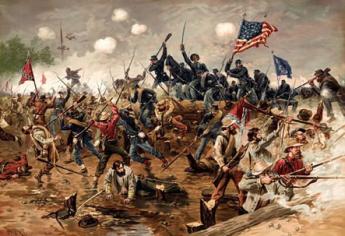 By 1776, a hundred forty years of lumbering had just about exhausted the forests on upper Delaware and Lehigh Rivers. The Revolutionary War then created a use for munitions and iron products in a region which discovered it was on top of Anthracite and connected to the fighting by a network of rivers.