Related Topics
Philadelphia's River Region
A concentration of articles around the rivers and wetland in and around Philadelphia, Pennsylvania.
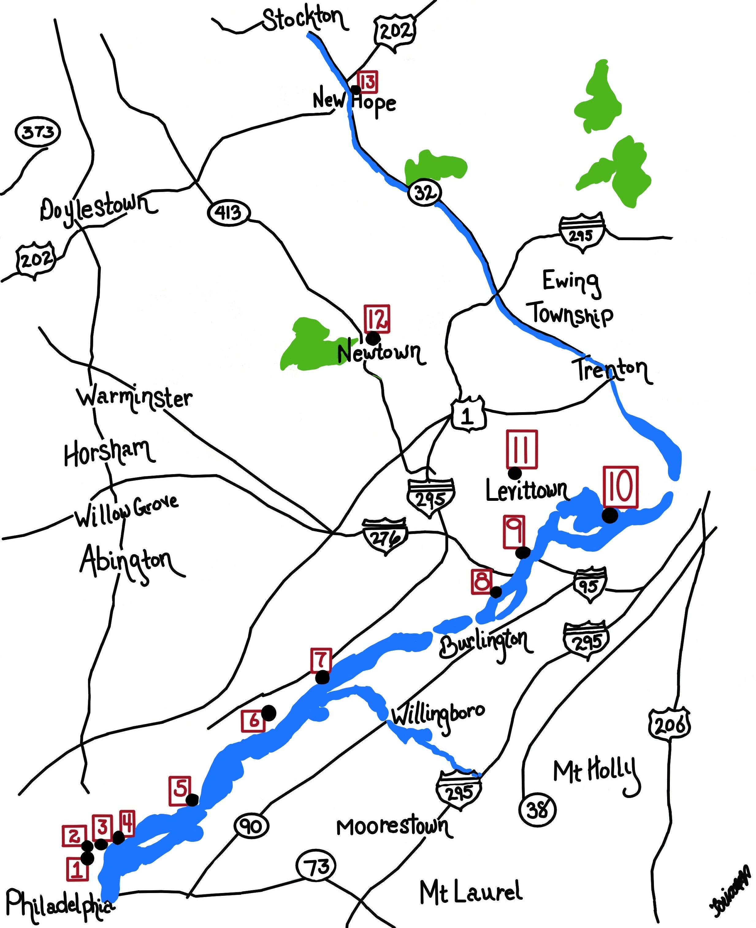
City of Rivers and Rivulets
Philadelphia has always been defined by the waters that surround it.
Sights to See: The Outer Ring
There are many interesting places to visit in the exurban ring beyond Philadelphia, linked to the city by history rather than commerce.
Tourist Trips Around Philadelphia and the Quaker Colonies
The states of Pennsylvania, Delaware, and southern New Jersey all belonged to William Penn the Quaker. He was the largest private landholder in American history. Using explicit directions, comprehensive touring of the Quaker Colonies takes seven full days. Local residents would need a couple dozen one-day trips to get up to speed.
Central Pennsylvania
"Alabama in-between," snickered James Carville, "Philadelphia, Pittsburgh, and Alabama in-between."
Central Pennsylvania Settlers Before 1700
|
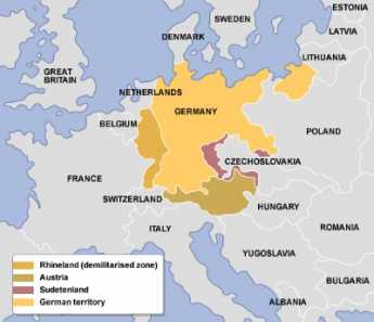
| German Rhineland |
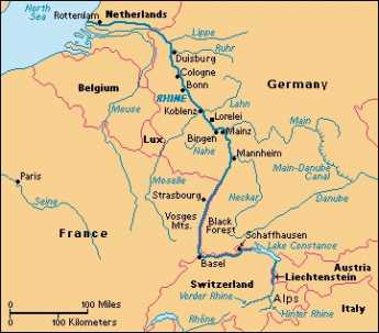
Dates are unclear, but twenty-five families from the German Rhineland bought Pennsylvania land from William Penn prior to 1700, which is the earliest recognizable date on a gravestone in the Hummelstown Cemetery. Future research may narrow that time interval down, but it can confidently be said they got on a sailing ship bound for Philadelphia between 1682 and 1699. For reasons also unknown, tradition relates the Captain refused to stop in Philadelphia, putting them off in New York. They discovered they were unwelcome among the Dutch settlers in New York, who quite likely reflected the ancient hostility between the Dutch at the mouth of the Rhine River, and the Germans living upstream from there. Augmented by wars and invasions, the feeling persists to some degree even today. The twenty-five families sailed from New York, up to the Hudson River to Kingston the state capital, where they discovered they were even more unwelcome. The British under the command of the Duke of York took over New Amsterdam in 1664, but Dutch cultural control persisted long after the change of political control.
|
| Governor Keith of Pennsylvania |
Tradition continues that Governor Keith of Pennsylvania happened to be in Kingston at the time of the stranding of the migrants. He suggested they travel eighty miles overland to the Susquehanna River and then float down to land where topsoil was reputed to be several feet thick. Since Dutchmen everywhere concentrated on fur trading more than farming, it seems safe to guess reliable guides were easily found in Kingston. From there to what later became famous as Three-Mile Island below Harrisburg, the three-hundred-mile route of these pilgrims can be guessed by following valleys between towering ridges. Unfortunately for this surmise, there are two main canyons leading to Kingston from the Susquehanna, which improved Kingston as a choice for fur trading. The more northerly canyon is somewhat longer, but it might have been safer; perhaps the German pilgrims just flipped a coin. Taking either choice it's a hard trip however, even assuming the Indians were friendly and food sources abundant. It must have required at least a month to go the full distance to what is now Harrisburg, passing by a number of places which now support prosperous farms. That potential likely provoked demands of some travelers that they had gone far enough, as kids do today in the back of the station wagon. By luck or stubbornness, however, they kept right on into the wilderness, eventually making permanent settlements along the Swatara Creek in Dauphin County, which proves to have the richest farmland in America. Middletown and Hummelstown are thus the two oldest settlements in Central Pennsylvania. By the time the other German sects made their way up Germantown Avenue, out Germantown Pike, and then onward to the Great Valley beside Blue Mountain, the original settlers had ample time to discover the best land, the surest wells, and the best access to the creeks. Furthermore, they had several generations to notice which families produced the strongest lads, and which families were the best natural farmers. Since later incoming families were mostly penniless, they had to settle for less advantageous farmland and less endowed marriage partners. Dominance by the original farming families continued until the early Twentieth century when it became prestigious to enter one of the professions. Or even to move away from the Dutch Country and go to the city.
|
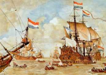
| Dutch Ships |
Getting back to their days in Kingston, it is not easy to tell what route they took, judging only from a highway map. We look for the largest towns and then the shortest highway route, but it seems likely Kingston was chosen as a trading center because it was the place where the fur traders brought their pelts to the Dutch ships on the Hudson. The roads chose the towns, not the other way. When you observe the valley beginning at Kingston, there remains little doubt the route to Harrisburg must have led that way. The local folks at the museums and stores of Kingston can't help; they never heard of any such migration, and most of them never had reason to travel in that direction. Kingston was burned to the ground (by the British) in 1777, the state capital moved to Albany, and the economic center went south to New York City. Kingston is just a nice little town on the Hudson, across the river from where rich folks put their mansions, and liberal-minded folks send their children to Bard College, a place where no two buildings follow the same architectural style.
So when you go West from that nice little town, it is only a mile or two before you are out in the woods, with farms here and there, and scattered cabins which look like fishing and hunting "lodges". There's a creek in the bottom of the valley, and if you look up, you see the road merely winds its way between parallel mountain ridges. Perhaps a glacier carved out this trail, perhaps a mighty river once ran there, perhaps volcanic action tented up and cracked. Anyway, you are not going to get lost if you follow the creek, going steadily uphill from Kingston for twenty or thirty miles. If this were a single mountain ridge, you would be approaching either a water gap or a wind gap. A wind gap is a water gap that has lost its river at the top.
|
| The Rhine River |
What's at the summit is not a notch, however, it's a bowl. Out of this bowl flow the three main rivers of the eastern seaboard, the Hudson, Delaware, and the Susquehanna. The effect resembles what is said of Switzerland: The Rhine, the Rhone, Danube, and Po; They rise in the Alps, and away they go. The highway from Kingston runs along a creek which flows into the Hudson. At the top of the bowl are some nice dairy farms scattered along ten miles which drain into Delaware. The East Branch and the West Branch of the Delaware River are scarcely more than creeks at this point. At Delhi and Andes there is a further rise in the mountains, and then along twisting decline as you follow a branch of the Susquehanna down to its junction at Oneonta. As you cross the top of the ten-mile mesa you have perceived the answer to a natural question: how did those German families get across the big wide Delaware River that runs between Kingston on the Hudson -- and Cooperstown, where the Susquehanna begins? The answer is pretty evident. Delaware, while a mile wide at Philadelphia, narrows down to two little creeks on this mountain plateau. The Susquehanna system on one side and Hudson on the other have swallowed up the Delaware watershed between them. This might well have seemed a nice place for the German settlers to set up a few dairy farms, but it probably was an even more ideal place for the Iroquois to set up headquarters. Their favorite style of warfare was to occupy the high ground and make lightning raids (or quick escapes) on canoes down the various rivers starting from their origins. If it's of any interest, Charles Evans Hughes began his law practice in Delhi, and a lot of the town boys were killed at the battle of Antietam, thus illustrating the unwisdom of recruiting whole towns into regiments.
Down the mountain we go, into the broad Susquehanna valley. It was probably troublesome to manage wagons down a mountainside. But from here on the German families could stop walking, and float.
Originally published: Tuesday, August 31, 2010; most-recently modified: Wednesday, May 15, 2019