1 Volumes
Nineteenth Century Philadelphia 1801-1928 (III)
At the beginning of our country Philadelphia was the central city in America.
Central Pennsylvania
"Alabama in-between," snickered James Carville, "Philadelphia, Pittsburgh, and Alabama in-between."
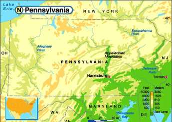
Appalachian Geography
Let's sketch the geographical skeleton of eastern North America as a strip of land from the Arctic Ocean, down through Central Pennsylvania, to the Chesapeake Bay. The Bay is essentially a southern continuation of the Susquehanna River so this area might be described as the Susquehanna watershed, extended.
|
| Keystone State Water Ways |
Cold air blows down from the Arctic to the Great Lakes where it picks up a lot of water, which then gets dumped on the snow belt of Upstate New York, as well as on the formerly glaciated mountain basins of the Appalachian mountains of Pennsylvania. Geologically, this once created a large inland sea, until the water broke through the mountains through four main water gaps. The most obvious ones are at Pittsburgh, West Point NY, and the Delaware Water Gap. The Susquehanna is so large it has several water gaps, notably above Harrisburg, at Northumberland, and Sayre. This huge drainage area percolates streams down the North-South mountain ranges, flowing into progressively larger river branches which finally drain into the Northern tip of Chesapeake Bay, and thence out to sea at Norfolk VA. The mountainous areas are several hundred miles wide, so the western collection area flows into the Allegheny River and down to the Mississippi, while the Eastern mountain area collects water that flows into the Delaware River and out the Delaware Bay. Since the mountain ranges bend to the East above Pennsylvania, there is even a Northern runoff draining into the Mohawk and Hudson River basins. This huge water-collecting system thus fills four major rivers along the Atlantic coast, and along with astonishingly deep winter snowfalls pumps major amounts of fresh water out to sea. The central river system in this whole area is the Susquehanna. As far as bird migration is concerned, it extends up to the Arctic Ocean, and a few bird species go on South to Patagonia. The birds are up where you don't see them much, but the quantity of bird life is huge. At one time, the fish migration was equally immense.
At the moment, there is a strip more than a hundred miles wide, covered with a forest of mixed hardwood and conifers; there are little towns and a few fairly big ones, but large stretches where ten persons per square mile would seem populous. Because of the recent boom of shale gas prosperity, most of the houses which were sort of tumble-down and in need of paint five years ago, now look brand new. Some of these houses are prefabricated, many were probably only reshingled with new siding in the past couple of years, but they look new to a passing tourist. The roads are mostly quite good, looking recently repaved and graded. There are hundreds, possibly thousands, of trucks hauling pipe and wastewater for the comparatively simple process of pumping in water, to drive out the pockets of gas, and then collecting the gas in pipelines.
Naturally the sudden gold rush, or shale gas rush, excites two varieties of comment: about the great good luck for the locals, and about the drastic threat to the environment. This is the forest primeval, but it won't be primeval for much longer, goes the lament. But there is a third sort of reaction, which only emerges slowly, after learning that vast areas of this pristine forest were burned to the ground in 1910, just one century ago. During most of the Nineteenth century, the main industry had been logging. Paul Bunyan lumberjack stories abounded at the time of the First World War, as the trees were cut, collected, and floated down various rivers in the spring log rafts. Railroad ties were a large destination for such wood and houses and barns for new settlers. The really tall and straight logs were floated down and around to Camden, where they became the masts of ships. It is said a major battleship of the Revolutionary period might consume 800 trees. But those big trees had been shading and protecting the smaller ones; once the big ones were gone, the region became vulnerable to forest fires. Major forest fires even destroyed the topsoil by erosion, after first burning off the protective understory. The long and the short of it is that this place was a virtual desert in 1910. It may have been a primeval forest before the lumberjacks arrived, but it was only a burned out desert within the memory of our grandparents. So even if the shale gas industry ruins the landscape a second time, turning scattered settlers into near-millionaires and all of those other exaggerated reactions, pro, and con, it may not be so bad. The forest spontaneously recovered from worse devastation than that, only fifty years ago. As a matter of fact, it has gone through three ice ages in the comparatively brief interval of 20,000 years, grinding those craggy ridges down to graceful bowls. That's no reason to be careless and profligate. But it's doubtful that environmental conditions will ever be as bad again as they were, only a century ago.
Headwaters of the Middle Atlantic Rivers
When Governor Keith suggested to some German wanderers that they might reach the Susquehanna River by walking eighty miles west from Kingston NY, he had probably never tried that route himself. Two mountain valleys converge toward Kingston on the west bank of the Hudson and were ideal routes for Indians to bring their furs to the Dutch trading post, later to become a whaling port. Taking the northern valley to arrive at what is now Cooperstown NY, the traveler discovers a beautiful mountain lake creates the Susquehanna River, much as Lake Geneva in Switzerland creates the Rhone, giving credence to the claim that Geneva is the most beautiful city in the world. Alternatively, taking the more southerly valley west from Kingston brings a traveler first to a mountain bowl from which several creeks run in different directions, before descending to what is now Oneonta on the Susquehanna. Just which valley the twenty-five German families actually followed in 1687 or so, is presently uncertain but either route would get you to the river after hiking about eighty miles. From either place, it is possible to float about four hundred miles downriver on a flatboat, to the famously rich topsoil of what we now call the Pennsylvania Dutch country. If you took it today it would be a terrifying ride, and in the 17th Century, it must have been much more so. First, you go south, then north, then west, then southeast, then southwest, then southeast again, as the North Branch of the Susquehanna finds openings in the mountain ranges, eventually emptying into the Chesapeake Bay four hundred miles to the south.
The reader may choose to follow that route (by automobile on roads closely paralleling the river), for which, clicking on the Philadelphia Reflections Topic called German Immigrants via New York are comments on the three hundred years of history that subsequently affected this first, founding, westward frontier. But it's still a mountainous wilderness for the most part, quite effectively dramatized in the movie How the West Was Won. The history of America was once regarded as the history of a moving frontier; the one which began here and ended up around 1900, in Arizona.
|
| Delaware River |
So focus first on the Mid-Atlantic tri-river watershed, the eighty-mile area west from Kingston NY. Some collision of ancient plate tectonics caused the North-South Appalachian mountain ridges to bend sharply at about the level of New York City, resembling a jumble of little mountains which subsequent glaciers ground down and smoothed out. The series of vertical ridges we call Appalachia more or less all bend sharply eastward at this level and the rivers consequently run in various directions, away from that center. The watershed of the Hudson runs along its banks for a few miles, the Susquehanna finds its way among the mountains eighty miles to the west, and Delaware gets snuffed out between them. When things sorted themselves, the streams had found their way into three main pathways, roughly parallel as they flowed south on their way to the sea. There's another way to look at the result. When the prevailing winds blow cold air from Canada across the Great Lakes, they pick up vast amounts of moisture which is dumped on upstate New York in huge winter snowbanks, or simply rain and fog the rest of the year. This massive rainfall system generates the water for three large river drainage systems. There's one more point of amateur geology: the advancing glaciers scraped the topsoil from the top of the land down to and over the mountain ranges and then dumped topsoil on the southern Pennsylvania counties as they receded. The German settlers of our story were seeking to get around the rocks and pebbles in order to live in eternal happiness in Lancaster County, PA. Governor Keith had somehow been told of this geography from Indian tales, and the scattered reports of white explorers confirmed it. You have to be pretty desperate to stake your family's survival on such reporting.
In any event, the settlers did give it a try, taking either the northerly or the southerly passage out of Kingston. Present hindsight suggests the southern route was shorter, but the northern route was more scenic. So scenic in fact that two prosperous residents of 18th Century Philadelphia bought up large tracts of land. Judge William Cooper of Camden (father of James Fennimore Cooper) bought 10,000 acres around Cooperstown, and William Bingham bought up a region he never visited, now called Binghamton, NY. The area is also noted for the much later construction of the main IBM calculator factory, and for the fact that I was married there, immediately spiriting the local girl back to Philadelphia where I belong.
Wellsboro: Grand Canyon
|
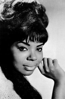
| Mary Wells |
Robert Morris bought a million acres of land in upstate New York and north-central Pennsylvania at the end of the Revolutionary War, and sold it at a considerable profit. Unfortunately, it gave him the wrong idea about real estate investment, which led him on to his bankruptcy and spell in debtor's prison. Benjamin Wister Morris managed the section around what is now called Wellsboro, named after his wife, Mary Wells. Because of the path of westward migration and the flourishing of the lumber industry, the area prospered, so the town grew to a population of 54,000 in 1890, although it looks to be about half that at the moment. However, it is the local cultural center, attracting hunters and fishermen to its nice hotel and numerous restaurants. Wellsboro has schools and stores, a movie house and annual festivals promoted by the Chamber of Commerce. There's an annual auto race, for example, and periodic art displays. With the coming of the Marcellus shale gas industry, Wellsboro is likely to become the local center of activity, but at the moment, the locals are too busy renting out their rooms to truckers to have expanded their cultural dreams much further. In another five years, this town might well blossom.
|
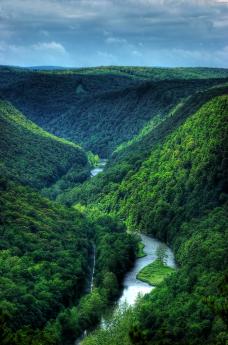
| Pine Creek Gorge |
A few miles away is the Grand Canyon of Pennsylvania, more officially known as Pine Creek Gorge. There are now several lookouts on the rim, with quite an exciting view from above of eagles, buzzards, ospreys and similar birds of prey, soaring over a thousand-foot canyon down below. Naturalists and environmentalists since Gifford Pinchot, Teddy Roosevelt and other more recent ones have been attracted to this mountain scene. It has its own local author of note, George Washington Sears. Pine Creek runs for sixty miles through this gorge, particularly attracting trout fishermen; easy access to the creek is found at Colton Point Park. Access to the outlooks on the rim, as well as the creek at the bottom, is fairly easy but is not particularly well marked. Right now, it's best to drop in on the Wellsboro Chamber of Commerce, or at least to the AAA, before you go there.
|
| Boal Mansion in Boalsburg |
There's an interesting short movie provided in the lookouts, telling the history of the place, and the abundant wildlife; well worth seeing. Like the Copper Canyon in Texas, this canyon tends to disappoint visitors expecting something like the Grand Canyon of Colorado, because it is covered with trees from top to bottom. In addition to the fish, game and birds the attraction of this canyon is to see the creek winding seventy crooked miles through the mountains. Unless you get up high enough to see over the tops of trees, the vista may be hard to make out, so do what you're told and go visit the places the park rangers have provided. Other places to visit "nearby" are the Cherry Valley Astronomy Center near Coudersport, the Asylum for Marie Antoinette near Towanda, and the Boal Mansion in Boalsburg near State College. It's a two-day trip, and whether you think it is worth it will depend on how interested you are in some grand views, your interest in seeing for yourself what the Shale Gas uproar is all about. And in the case of Boalsburg, some perfectly astounding history. Where else can you find history about Robert Morris, Marie Antoinette, Christopher Columbus, and the origin of Memorial Day? Have you seen the place where Joseph Smith wrote the Mormon Bible? Do you know what a Scotch-Irish diamond is? Stay at home and watch football on TV if you must, but a two-day trip around Central Pennsylvania is something you wouldn't soon forget.
Cornell, For the Birds
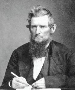
|
| Senator Ezra Cornell |
Cornell is in Ithaca, at the foot of Lake Cayuga. It's New York's land grant college, which at first seems a funny way of expressing it, until you learn that during the Civil War, Congress declared that at least one college in each state would receive a grant of federal land (which they could sell) for advancing the working class through agricultural and mechanical education. Cornell is thus New York's "A and M". The whole idea is central to the Whig philosophy that social classes were not a permanent status, but rather only stages in the evolution of penniless immigrants into managers, and thence into entrepreneurs and owners.
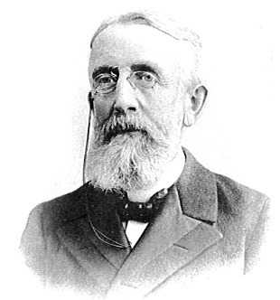
|
| Sen. Andrew White, President |
The Whigs didn't hate poor people, they just wanted to get rid of that class by showing them how to get rich. Although the Republican Party was largely the successor to the Whig party, Lincoln remained philosophically an ardent Whig; the emancipation of slaves was a bold and imaginative extension of the Whig ideal. The striking thing about the founding of Cornell University is that both of New York's U.S. senators were enthralled by the land grant college idea. Ezra Cornell drove the legislation through Congress, and Andrew White became Cornell's first president; both of them devoted their later lives to it. Cornell donated most of his substantial fortune to its establishment and applied his unusual financial talents to investing the proceeds of the land grant.
|
Devotion to self-improvement of the working classes helps explain why many of Cornell's departments sound a little out of place in the Ivy League, hotel management being the first to come to mind. However, it must have been the two senators who instilled in this project the idea of striving for excellence. If you manage a hotel, be the very best hotel manager in the world if you have it in you. Very likely that's the bug that bit the Johnson family, whose name is on the Johnson School of Management, the Johnson Museum. And the Imogene Powers Johnson Laboratory for Ornithology, which is our present topic.
|
| Cornell Laboratory for Ornithology |
They say it took the architects six years just to design the 80,000 square foot building overlooking the wetlands on 220 acres of the bird sanctuary, otherwise known as the Sapsucker Woods. The public doesn't often see most of the interior of the building, which is devoted to working scientists, and their extensive effort of computerizing the voluminous efforts of volunteer bird watchers up and down the Appalachian Flyway. The result has been a set of coherent conclusions about what is happening to ecology, as illustrated by ornithology. That's only one of many scientific projects underway. What the public does see are two things: the most elaborate bird-watching museum anywhere, and one of the most imaginative bird-hobbyist stores. Between them, these two features are designed to make a bird lover out of the meanest curmudgeon, show him how to arrange an indoor watching area, buy books and magazines about how to do it, and offer for sale the most advanced and clever devices and supply. If you hate birds, or even if you are merely indifferent to them -- this is the place to come to Jesus.
La Cosa Nostra Has an Apalachin Outing
|
| Joseph Barbara |
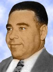
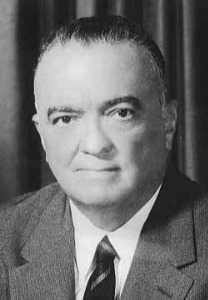
It's hard to convince people of something they don't want to believe; others are simply determined to deny they already know it. In any event, prior to 1957, it was vigorously denied by many Americans of Italian descent that there was any such thing as organized crime, The Mob, The Mafia, or La Cosa Nostra. One of the pieces of evidence for regarding organized crime as just an anti-Italian slander was the consistent denial by the head of the F.B.I. J. Edgar Hoover that a national crime syndicate existed. Just why Hoover took this strange position will have to be left to future historians. But even J. Edgar Hoover couldn't deny it after November 14, 1957, when New York State Police surrounded a hundred mob bigwigs, lieutenants, and bodyguards at Apalachin, NY.
|
| Sgt Edgar Croswell |
New York State troopers always kept a watchful eye on a fifty-acre estate belonging to Joseph Barbara the reputed boss of Central Pennsylvania crime, located just within New York state borders; it is not necessary to invent a feud with one trooper, or insist that some disgruntled criminal tipped him off. When all local motels were suddenly booked up, and dozens of expensive automobiles with out-of-state licenses could be seen parked in the estate, it was only prudent to check the license numbers. When the report came back that most of the cars belonged to persons suspected of leadership in organized crime, it was reasonable to establish roadblocks around the estate, just in case. And then, after a car sped in past the roadblocks, soon followed in reverse by dozens of adult males fleeing in suits into the surrounding woods, it was natural enough to pick them up for questioning. It's estimated that fifty of them got away, but 58 mob bosses, henchmen, and bodyguards were caught and indicted. Everybody, it seems, had heard that Joseph Barbara was feeling unwell, and they had come to inquire after his health. Local lore has it that for years, wallets filled with hundred dollar bills were to be found tossed into the nearby underbrush.
|
| J. Edgar Hoover |
A great deal has been said and written about what was really going on, although a lot of it is probably deliberate misinformation, and some of the rest is couched in "weasel words" intended as some sort of code. The present general opinion is that the old-style Sicilian Mafia had engaged in a war for several years with upstart "Liberals" and that this meeting was intended as a peace treaty of the "Crime Commission", for which some crime bigwigs from Italy had been imported as referees. Grander visions, including the extension of crime syndicates into Cuba, Las Vegas, and California were on the agenda but were not the primary agenda. It was rumored that Angelo Bruno of Philadelphia had been newly appointed to the Commission, and was leaning toward favoring the "Liberal" faction. Such a disruption of leadership as the Apalachin round-up naturally resulted in a large number of assassinations, imprisonments, novels, and movies. This was the final, undeniable, outing of organized crime. The mob was finally turning away from the giddy days of prohibition rum-running, toward more modern entertainments like recreational drugs, gambling, and loan sharking. The Sicilians were losing control to Italians and Jews. The public was going to movies and reading books; it was becoming inevitable that the "goddam innocent bystanders" and other do-gooders were going to demand that this sort of invisible empire simply had to be curbed
|
| Joseph Barbara's Place |
Just why Apalachin was selected is debatable. It's visible from the Interstate Highway, and state roads run by the estate. It's quite close to the Susquehanna River, for whatever value that might have to organized crime. It's, therefore, both private and remote, as well as within a couple of hours easy drive to most East coast cities. And its back road runs straight to Hazelton, which might seem a more natural place for the boss to live, except that Apalachin was just over the state line for legal purposes. The verbal history circulated within knowledgable circles is that the Mafia started in Sicily in response to resistance to Italian authorities, especially Garibaldi. When it got to be time to move, they first went to New Orleans. Unable to cope with the Ku Klux Klan, however, the pilgrims split into two main movements. One went to South Philadelphia, and the other went to Hazelton. After that, the links to New York, Chicago, and Las Vegas are obscure.
So, Apalchin is worth a drive-by. Those who are timid can get a fairly good idea from Google Earth.
Marcellus, Where Shale Gas Comes From
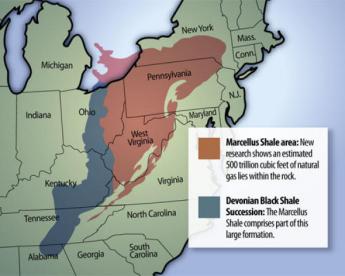
|
| Map of Marcellus |
The region of upstate New York called Marcellus stretches from the tourist jewel of Skaneateles to the Onondaga Indian Reservation, where you can buy untaxed cigarettes if you wish, and get on Interstate 81 to the Canadian border. Tucked within that region is the little town of Marcellus, which is neat and cute, but almost too small for tourists to notice. It's one of those remarkable things about scientists that someone in 1840 noticed a black shale outcropping in Marcellus, and recognized it as a distinct layer of sedimentary rock. Little did they know this tiny outcropping in Marcellus was part of a layer thousands of square miles in area, containing more dissolved natural gas than the peninsula of Arabia. Even if they had realized the extent of it in 1840, the technology for extraction had yet to be invented, and the price of gas had yet to rise to a level making extraction worth the effort. And also, worth enduring what has proved to be a hornet's nest of criticism by environmentalists. Patty Weisse, the most eminent local geologist, simply shrugs her shoulders and says, "It's going to happen." Since a number of prominent scientists are firm of an opinion that alternative forms of non-fossil energy will take at least fifteen years to become practical energy sources, public pressure to develop the "Marcellus" shale gas seems indeed pretty undeniable.
|
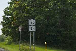
| Route 175/ Route 174 |
First, the tourist attraction. The original shale discovery has long since vanished, but there's a big hill outside the town, meaningfully identified as Shale Hill. Two state roads intersect at that point, Routes 174 and 175, so the highway engineers created some cuts in the shale hill. That's not exactly an outcropping, and something ten feet high is not exactly a cliff, but you can certainly find shovels-full of honest to goodness Marcellus shale within a few feet of the highway. No one objects if you take a piece of the stuff home with you, but in trying to do so, you will discover something important about Marcellus Shale. It easily breaks off in your hand, and if you drop it on the floor of the car, it will crumble into dust. You have now just observed why it is possible to extract gas from it with relative ease and expense. This formation is called Devonian because there is something like it in Devon, England.
|
| Marcellus Shale |
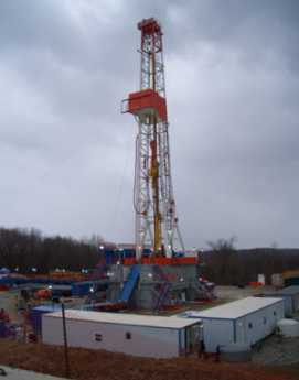
Mostly by volcanoes and glaciers, rocks get split into gravel, gravel gets ground into sand, and sand is ground into powder. Add heat and water to the powder and you get clay. Marcellus shale is a form of clay, with a difference that it was formed at the bottom of a huge lake by fine-grained rock particles slowly drifting down to the bottom, getting later squashed by vegetation, sand, gravel, and rocks. The vegetation ferments and permeates the clay, at the rate of twenty-five cubic feet of gas to a cubic foot of shale, and a cost to extract it off about a dollar a cubic foot. The economics of extracting it is quite attractive. The mechanism for extracting it is to inject lots of water through a drill-pipe, drain out the water, and let the gas flow. Getting rid of the dirty water is a problem we will return to in a moment. One surface well can be used to drain off the gas from many different underground directions, which reduces the surface spoilage considerably. If you have fiber-optic television cable, it was most likely installed underground by such "re-directional drilling", much like the operation of a colonoscopy to extract your colon cancers and polyps. Since gas has the smallest carbon emission of any energy source except those which have no carbon emissions at all, this seems like a godsend at a time of world-wide energy uncertainty. It can be stated without much challenge that no non-carbon energy source is or will be practical for another fifteen years, except nuclear energy. There is easily enough gas in the Marcellus shale to supply America's energy needs for fifteen years. If you don't like that, your choice must be nuclear, but the U.S. Government refuses to license any nuclear plants because of the dispute about radioactive waste disposal. And furthermore, while France uses a disposal method which is safe from that sort of contamination, their approach is easily transformed into nuclear weapons. It would thus emerge that our choice is between the French nuclear approach and allowing oil and coal to dominate. Atom bombs for everyone, or pollution for everyone. On the other hand, going ahead with Marcellus shale would give us relatively low carbon emission for fifteen years, on the prayer that wind and solar power can be made practical in the meantime. So, what's the matter with shale gas?
Three things. First, the heavy equipment used in drilling seriously tears up the landscape. The construction roads open up the wilderness to raccoons, snakes, and rodents of all sorts, which badly affect bird migrations. These aren't highways they are building; the soil erosion is fairly major. Secondly, "fracking" or injecting water into the shale formation uses up tremendous amounts of water, and could easily drain dry some lakes and streams, not to mention human water supplies. Since the aquifers are formed by flowing water boring holes along with the upside of an impermeable layer, the aquifers are right above the layer of Marcellus shale. If water runs dry, the chances are high that some driller will reach up into the aquifer for water, and claim it was accidental. Third and finally, the water which is washing around underground will inevitably encounter salt, minerals and radioactive materials. When the resulting brine reaches the surface, it won't be useful for inhabitants without extensive purification.
Patty Weisse, a geologist member of a whole geologist family and who runs the Baltimore Nature Center in Marcellus, tells us it is unnecessary to inject water into the upper half of the Marcellus formation in order to get the gas out, at least in the neighborhood of Marcellus itself. That leaves only landscape damage to contend with, and surely the damage from that can be minimized by thoughtful zoning. After that, it gets harder because, in the southern half of the formation, water must be injected. That means that anxiety is less around Marcellus itself than in Pennsylvania. But there is going to be some kind of environmental price to be paid, anywhere shale gas is extracted. If you can't stand any pollution at all, even nuclear, apparently your only practical alternative leads to just letting Iran and North Korea get their bombs. Or letting OPEC drain our economy.
Marcellus Shale Gas: Good Thing or Bad?

|
| Marcellus Shale |
Soon after discovering widespread hard and soft coal, Pennsylvania found in Bradford County it also had oil. Local oil was particularly "sweet", with a low sulfur content. Long after much cheaper oil (cheaper to extract, that is) was found in Texas and Arabia, Pennsylvania oil was prized for the special purpose of lubricating engines, which commanded a higher price. This discovery of oil in the western part of the state also provided a vital competitive advantage for local railroads. Other east-west railroads like the New York Central and the Baltimore and Ohio lacked a dependable return cargo like this, so the Pennsylvania Railroad lowered prices and became the main line to the west for a century. Refineries were built in Philadelphia, and continue to dominate Atlantic coast gasoline production, even though the source of crude oil is mostly from Africa. When oil and coal declined in use, Pennsylvania's industrial mightiness declined, too. Philadelphia and Pittsburgh lost much of their competitive advantage, while the center of the state just about went to sleep. When even Texas oil later ran low, America's industry turned to computer-improved productivity to keep its prices competitive, helping California at the expense of Pennsylvania. The bleakness for Pennsylvania may not last, however. Suddenly, we discover we have another enormous source of cheap energy, shale gas.
It's rather deep, however, even deeper than our supply of fresh water. The next layer below surface minerals is porous rock filled with fresh water, the so-called aquifer. Gas bearing shale is layered just under the aquifer. We'll return to the aquifer later.
There is and will be abundant oil in the world, well into the future; but cheap oil has been selectively depleted. When military and economically weak nations like the Persian Gulf had cheap oil, only transportation costs were irksome. But now Russia is emerging as an oil-rich state, previously impoverished states like Iran are asserting themselves, the existence of an international oil cartel becomes more threatening because it reinforces oil price with military threats. Raw material discoveries -- gold rushes -- are always destabilizing because they are tempting to the dictator mindset. That's known in the political literature as the source of the "Dutch Disease", not because Netherlanders are aggressive, but because North Sea oil discoveries destabilized the politics of even that little peaceful nation. America has now made a universal decision to establish energy independence. It once was credible to make predictions that in a decade or two, we would run out of competitively priced energy. To be both rich and weak invites aggression and we knew it.
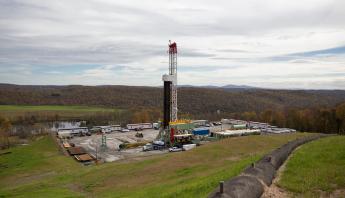
|
| Gas Drilling |
There's little question America is profligate with its energy, so the need for energy conservation is undisputed. Actually, we are already five times more efficient with energy use than China is; furthermore, we have improved energy efficiency by 20% while China has defiantly worsened. We'll do better, but unfortunately, our immense investments in inefficient home heating and transportation are too costly to discard abruptly in both cases. There is also little question that American research and development of alternative energy sources has been neglected, while China is subsidizing R & D appreciably. In our frenzy, converting food into gasoline by subsidy is a bad joke, electric cars are subsidized and widely described as "Welfare buggies", wind power is twice as costly as carbon-sourced energy and needs better battery development to be able to store it, atomic energy has been encouraged by the French government, but totally held back by ours, in response to public anxieties. The long and the short of it is this: we face a fifteen-year period of doubtful energy sources, a vulnerability our international competitors and enemies might easily use against us.
And then along came shale gas, like a gleaming savior on a white horse. For seventy-five years, the world has known unlimited amounts of petrol carbons are locked into vast stores of shale. Unfortunately, it is buried deep, and located where it is expensive to transport to market. The techniques for extracting such carbons were unacceptably expensive in a world that shrugged off abundant oil. Politics and geology turned against us; we now need fifteen years of catch-up to make alternative energy sources more affordable. Cheap oil ran out before non-carbon sources became practical. But miraculously shale gas is now upon us, right here in Pennsylvania. It takes a long time to map out the existence of shale from Canada to Texas, when it is 8000 feet deep; it was first recognized in 1839 from a cliff outcrop around the little town of Marcellus, New York and vigorously explored in the disappointed hope it would lead to discoveries of bituminous coal, iron ore or other minerals. Land speculators have been roaming Pennsylvania for two centuries. Now, they are offering $5000 an acre plus royalties, just for the right to drill. In 2010, probably 5000 leases will be issued. Needless to say, the discovery is popular with local farmers, and "gas fever" has enormous political momentum. With techniques discovered around Fort Worth, Texas, about 10% of the existing gas can be extracted easily, serving America's energy needs for much of the 15 years required to make renewable, non-fossil, energy cheap and practical. This long history paradoxically accounts for the apparent suddenness of the current popularity; it's not a new mineral discovery, it is the development of practical extraction methodology at a critical political and marketing moment.

|
| Tree Hugger |
And equally needless to say, the environmental movement is being called to its barricades. Whatever is their objection to drilling for gas, 8000 feet below the surface of a wilderness? In the first place, just cutting roads through the forests is destructive to migrating and local bird populations. In a well-known process of "fragmentation", the cutting of roads allows an invasion of raccoons and similar bird predators. Forest fragmentation simply cannot be avoided if drilling rigs are to enter and leave the forests; some vulnerable bird species are bound to go extinct. This particular region is particularly prone to emissions of radon, which is a radioactive gas traveling along the stone layer and occasionally entering the basement of houses; will drilling through to the shale layer make radon seepage better or worse? Furthermore, since this sedimentary shale layer lies underneath the aquifer, drilling must go through the freshwater-bearing caverns before it gets to the shale; expensive sealing methods may be needed to keep the contaminants below from seeping up through and around the drill holes. The practice of fracturing the shale by high-pressure mixtures raises issues with water, sand, and chemicals. Water consumption is millions of gallons per year per well, seemingly enough to drain the rivers and creeks. Some operators will be tempted to use the aquifer as a surreptitious source of water, leading to consequences hard to anticipate. The sand is meant to support the walls of the rock fractures but may clog up other channels unintentionally. And the composition of the chemical drilling components is a trade secret which the extraction companies naturally wish to keep private; it's pretty hard to get public approval of a secret. So to sum it all up, there is a legitimate need to hurry the drilling, and there are legitimate environmental safety issues to be addressed, slowing it all down. New York State has passed laws prohibiting further drilling. Is that an opportunity for Pennsylvania, or a warning we should heed?
|
| Where's My Aquifer? |
This is a time for serious negotiation, and the spending of serious amounts of money on study and monitoring, not for shouting. Politicians sense you can't make omelets without breaking eggs. For them, it's a question whether to choose to be blamed for the inevitable problems of exploring new science, or whether to be blamed for lack of patriotism in a national emergency. The amount of heedless rhetoric is predictably extreme, and the money available to spin it is daunting. If there is anything resembling a middle road in this uproar, let's explore it. In the first place, some sensible discussion between scientists of both sides can be held immediately. Geologists are probably unaware of issues like forest fragmentation, while naturalists are probably unfamiliar with radon hazards and available drilling precautions. Some concerns are exaggerated, some are unsuspected; let's get the experts together quickly and establish most of the knowns and unknowns before popular media runs away with the issue. Let's get the responsible leaders of the gas extraction industry into continuous dialogue with the responsible leaders of environmental protection organizations, so wars they get dragged into are real and not hysterical. Let Congress consider the issue and appropriate funds immediately to study the issues everybody agrees need to be addressed. It seems very likely the huge corporations involved in this issue will rather easily agree among themselves on responsible positions unless they get rattled by overly vocal denunciations. Since this is a gold rush, however, it is also likely that underfunded small operators will start to employ short-cuts and rush heedlessly into dangerous territory; large operators will wish to have laws passed to restrain everybody, small operators will plead fairness. The more transparency this field has, the better. And the most immediately obvious area of resistance to transparency is the natural wish to protect trade secrets in the composition of drilling fluids. In time, the other continents of the world will develop satisfactory drilling fluids; the secret won't last long. The situation cries out for the large operators to negotiate among themselves so those who have an incentive to protect secrecy can tell us how to do it responsibly, while those with a political incentive to expose secrets can be offered time limits related to the how fast the rest of the world catches up. Politicians particularly need to be offered some mechanism for assuring the public about those secret injection ingredients.
Anyway, let's negotiate a way to take chances we have to take, but avoid the costly blunders of studying the issue to death. Hurry up, folks, it's a matter of time before problems have to be faced.
Great Bend: Joseph Smith Translates the Golden Plates
|
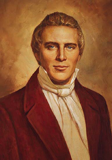
| Joseph Smith |
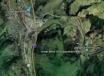
As the traveler up the Pennsylvania Turnpike Northeast Extension approaches the New York border, there's a chance for a fleeting glance at an exit sign pointing to Great Bend, without additional comment. The comment is definitely needed because a ten-mile detour at this point is rewarded by two interesting attractions. In the first place, the Susquehanna does indeed make a great bend there. Starting in Cooperstown, New York at a beautiful mountain lake which resembles Lake Geneva in Switzerland, the Susquehanna heads south for ninety-six miles and then turns around at Great Bend and goes back fifteen miles north to Binghamton. After that, it goes west for forty miles to Sayre and then goes south again as it picks up other branches. Greatly enlarged, it reappears to Turnpike travelers at Wilkes Barre. Thousands of travelers have sped up the wide valley without noticing that the same river which flows south from Wilkes Barre apparently starts flowing north at Great Bend. The traveler's eye is deceived by the apparently continuous long valley which the highway follows. At Binghamton, the Susquehanna starts flowing west, but that too is overlooked in whizzing past the cloverleaves and traffic directions. The Great Bend itself is a lovely water gap with a couple of small towns on its shores, but is otherwise pretty deserted.
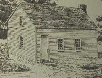
For two and a half years, Joseph Smith the founder of the Mormon religion spent full time five miles away from the Turnpike exit, at the real bend in the river (not the town of Great Bend) writing the 275,000 words of the Book of Mormon. Although Smith was a native of Palmyra, New York, and Mormonism is most easily viewed as an outgrowth of wide-spread religious uproar in upper New York State during the 1820s, it undoubtedly provoked malicious gossip from those who resist all claims of miracles, as well as staunch defense from those who believe. It's comparatively safe to say the prophet was living at the Great Bend in his wife's tiny home while she wrote down his dictated translation. The source of his vision was said to be John the Baptist, which others have since taken literally to varying degrees. Those who believe in the pregnancy of virgins and reappearances after a death must be tolerant of the sometimes overstated beliefs of others. Smith never let anyone see the golden plates from which the writings were derived, however, and ultimately it must rest that he was relating what he believed he had seen. His father-in-law described him as a charlatan, an attitude not completely rare among other fathers in law. His wife, caught between conflicting family loyalties, declined for years to join the religion that flowed from her own pen.
|
| The Church of Jesus Christ of Latter-day Saints |
However, with the publication of the Book of Mormon, Smith rapidly gained adherents numbering in the thousands. He moved the center of the religion westward in several steps and was shot to death by a mob, variously styled as militia and vigilantes, in Illinois at the age of 38. Just who killed him and what the motives were are matters we normally leave to courts rather than newspaper accounts. There is little doubt that many other religions of the time were outraged by the tolerance of polygamy, and so the account that he was assassinated by offended husbands of those to whom he proposed marriage, must be somewhat discounted. All religious disputes have a tendency to get out of hand, and the frontier religions of that time were particularly feverish, flaring up in an environment of the rule of the six-gun.
|
| Joseph Smith House |
The attraction of this religion seems to an outsider to have been based on its forgiveness for sinners, offering them tolerant heaven rather than the vindictive hellfire and brimstone which more puritanical protestant sects at that time envisioned for even well-behaved converts. There is a certain echo in Smith's Mormonism of the tolerant Quaker view that "There is that of God, in everyone." Similarly, although it is difficult to accept his idea that the American Indian tribes might be descendants of a lost tribe of Israel from the 7th Century B.C., the Mormon, and Quaker, teaching of tolerance to the Indians was in keeping with changing racial views in the early 19th Century, and softens somewhat the former Mormon distrust of the black race; although that, too, must be seen in the context of the then-approaching Civil War.
The best-known feature of this religion used to be polygamy, however, which is difficult to defend with theological, demographic or even romantic reasonings. With a few exceptions among Mormon extremists, the religion has moved away from any defense of polygamy. As the center of Mormonism moved to Utah, Congress outlawed polygamy, and the church officially condemned the practice and gave it up. Since it is still not rare to encounter a kindly decent gentleman on the streets of Salt Lake City whose grandmother or great-grandmother had been a polygamous wife, the whole subject has come to be treated there as an ancient embarrassment, best left unmentioned, but never quite forgotten. As a matter of fact, all religions have so much to account for in their past that they are most fairly judged by the sort of behavior they seem to inspire in their followers. By that standard, the earnest, decent, hard-working Mormons of today have earned their right not to be sneered at.
|
| Great Bend PA |
As for the simple little memorial along the river, it may seem a disappointment to some. It has not been made into a tourist attraction or a place of pilgrimage. It may even be a little unprotected from vandalism. But is surely worth the small trouble to visit, adding only half an hour to anyone's trip. One does not have to accept either the history or the theology in order to wish to see the place, which is a sweet little neglected clearing with a railroad running between it and the river. As a backdrop, the great bend in the Susquehanna is a remarkable sight in itself, because the river seems to be running in the wrong direction while no one notices. But one final double-take about polygamy simply cannot be resisted. One of the members of the Right Angle Club spent many years in the Middle East as a diplomat, where every Muslim man is permitted to have four wives. He reports that the younger Muslim men will often have nothing whatever to do with polygamy. Having watched the scheming, conniving jealousies of that custom from a front-row seat, the sort of Arab who always wears western clothes has firmly decided from personal observation that one woman, or at least one woman at a time, is quite enough.
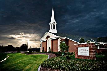
The newspapers tell us a Mormon tabernacle or church may soon be constructed near the new Barnes Museum on the Parkway in Philadelphia. It could even resemble the one in Washington DC, with a statue of the Angel Moroni, blowing a gleaming gold trumpet. The Mormons seem to want Philadelphia to notice them and form an opinion, which indeed we probably will.
Harvard Men Suggest a Cold Place for Yale
THE Colonial disputes with Great Britain were settled in 1783, creating great opportunities for the Colonies to resume their disputes with each other. Because of the unfortunate earlier action of the Penn Proprietors in selling land already occupied by Connecticut settlers, the legislatures of Connecticut and Pennsylvania behaved in ways that do them no credit. The situation could easily have led to more armed conflict, and it could even have gone from local war to fragmentation of the nation. So, although New York was close enough to know better, they joined with Massachusetts in offering to consider carving a new state out of Pennsylvania's northeast corner. The proposal was rejected, but the geological idea remains.
The northeast corner was once covered by glacier, and the region remains separated from the rest of Pennsylvania by a "terminal moraine", which is the huge pile of rocks and stones left behind after a glacier recedes. There are thirteen counties of rather desolate woods in this corner, with five or six more counties of moraine. Even today, some upper counties have only five or six thousand residents scattered in little settlements. The whole idea of creating a new state died when people got a chance to walk around and actually look at the region. Although one county is named Wyoming, this was not Wyoming, Fair Wyoming, at all; this was a pile of rocks. Moraines were what the Connecticut settlers were trying to escape.
However, their grandchildren might be unsure. Tremendous deposits of anthracite were soon discovered in the region, and then oil in Bradford County. Present residents of New York City will apparently commute endlessly to escape taxes, so an interstate highway or two would probably quickly make the area into Little Brooklyn.
The central point in all this was beginning to emerge. Since the Constitution was ratified, it simply no longer matters what state you were living in, as long as you can trust the legislature and the courts to be reasonably fair. These two combative legislatures and affiliated courts were once quite obviously behaving in a manner too obscenely partisan to be tolerated. Everybody involved in this mess could see the advantage offered by the ability to appeal to a superior power dominated by the other eleven (now, forty-nine) states. Carving out a separate state was not a compromise, at all. It was a threat, just as unsatisfactory to one combatant as the other.
Although it was clearly time to put aside the grievances and vengeances of a land dispute which had got out of hand, currents of other wild and headstrong ideas continued to swirl into the northeastern corner of Pennsylvania. In April 1786 Ethan Allen himself showed up in this region, wearing full Regimental uniform. He declared he had formed one new state and that with one hundred of his Green Mountain Boys and two hundred riflemen, he could establish another one. There is some reason to suppose Allen was responding to an action of the Susquehanna Company of Connecticut, which had held a meeting the previous September where Oliver Wolcott drafted a constitution for a new state named Westmoreland. William Judd was to be governor, John Franklin lieutenant governor and Ethan Allen was to be in command of the militia. The Assemblies of both Connecticut and Pennsylvania immediately reacted with outrage to renounce the whole State of Westmoreland idea; when John Franklin persisted, he was dragged to Philadelphia and thrown into jail to calm his rebellious spirit. Nevertheless, the point was dramatized that -- even five years after the Decision of Trenton had supposedly settled the matter, and after all sensible neighbors urgently wanted this dispute terminated -- something else needed to be done to strengthen the Articles of Confederation, or preferably replace them entirely.
Sayre / Athens
|
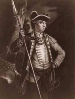
| General John Sullivan |
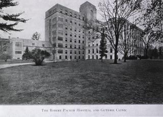
Running west from Oneonta and Binghamton, NY, the North branch of the Susquehanna runs due west for about fifty miles until it turns abruptly south at Sayre, PA. In the course of this westward run along the northernmost ridge of the Endless Mountains, it passes Apalachin NY, where the mobster chieftains got caught by the state police while holding a convention. At Sayre, named after an eastern railroad financier of the 19th Century, it joins the Chemung River at a large bowl-shaped refuge in the mountains which shelters it somewhat from the ferocious snows for which this part of Upper New York State is famous. Sayre usually gets a heavy snowfall or two in January, which lies on the ground until the Spring thaw in April. But that's pretty mild for this region, and the Iroquois made it a sort of headquarters, where Queen Esther of head-smashing fame made her home just before the Wyoming massacre in which she figured so prominently. Consequently, General Sullivan made his famous march to destroy the Iroquois by going northwestward up the Susquehanna to Athens, rather than following the Northeast Extension of the Pennsylvania Turnpike, as somehow seems more probable. Actually, Sayre was more of a 19th Century town, with the original settlement concentrated a few miles south at the region of Athens. Sayre is more modern, once was the location of a huge locomotive repair center, and has the Guthrie Medical Clinic at Robert Packer Hospital. Athens is older, quieter and has more stately charm, and is actually on the Chemung River with a two hundred yard portage to the Susquehanna.
|
| Lehigh Valley RR Fame |
Robert Packer was considered to be the ne'er do well son of Asa Packer, that go-getting industrialist of Mauch Chunk/Jim Thorpe, and Lehigh Valley RR fame. The father is said to have sent his son up to Sayre to get him out of the way, but once freed of the old tyrant's grip, Robert built things up into the second-largest locomotive repair center in the world. Robert Packer never had children and eventually set about building up the Robert Packer Hospital. Much taken with the Mayo Clinic model, he called Charlie Mayo and asked if had someone to suggest for running the local institution. Indeed, Mayo had just the fellow, Guthrie, who like the Mayos was a surgeon with a specialty in removing enlarged thyroid glands. As long as the railroads flourished, the Guthrie Clinic was headed toward the status of a major medical center with private rail cars for the surgeons and the like. However, the advent of diesel locomotives put an end to the main source of local prosperity, and the Guthrie Clinic settled down to a more modest status of a regional medical center, mainly in competition with the Geisinger Clinic further south on another bend in the Susquehanna. At present, the Obama Administration seems much taken with the model of the Midwestern group practice, of which both Guthrie and Geisinger are models. Perhaps the politicians do not realize that all of these clinics were based economically on the principle that surgeons can make enormous incomes if they are fed enough cases. Consequently, they are willing to reduce their own income in order to make group practice more attractive to the "feeders"; the department of surgery subsidizes the department of general medicine. Their competitors have long grumbled that this arrangement was an elaborate evasion of the medical ethical prohibition of fee-splitting. Most of that feeling has subsided, but a more serious present criticism is that the Obama Administration mainly seems determined to reduce surgical fees, so the whole arrangement may collapse when they do.
|
| Robert Packer Hospital |
Curiously, prosperity looks as though it may be ready to return to the Endless Mountains, in the form of the fracking method of gas extraction from the Marcellus Shale which underlies this region. Coming as it does at a time when domestic oil production is growing inadequate, but alternative energy sources are not yet competitive, rail freight is returning to the region, and truckers by the thousand are migrating from economically depressed regions like Detroit. For reasons not immediately clear, the huge trucks which import water and chemicals for fracking are driven by non-residents. The smaller trucks which carry away (to Northern New York, they say) the brine effluent from the wells, are driven by locally recruited truck drivers. A certain number of bar room fights have been rumored to have grown out of this situation. Camp followers of the fair sex have occasionally drifted into town, but so far not in large numbers.
As the region has evolved, the third town of Waverly NY has joined the other two in what amounts to a seamless conurbation of about 30,000 people, nestled in the cozy valley.
Star-Gazing in Cherry Valley
Somebody with a lot of imagination has taken the darkest, highest, a most remote place on the East coast -- and made it into a pleasant entertainment for the whole family. That unknown somebody apparently realized that streetlights and other signs of civilization make it almost impossible for most people to see the starlit heavens above them. The process has been named light pollution, which sort of crept up on most of us in the past fifty years. I can easily remember the days when you could walk out of your front door almost any night and see the Big Dipper and on clear nights the Milky Way. If you were a Boy Scout, you could earn merit badges for the number of constellations you could recognize. For thousands of years, everybody could share the night with the nomads of the Far East, but slowly light pollution made it go away. Maybe you can see the North star once in a while, but hardly ever see the same sky which mariners and camel drivers see. There's not much to do when you are a shepherd tending your flocks by night, so the nomads named stars for ancient myths, observed the difference between stars and "wandering stars", or planets. Nowadays that's a real experience for most city dwellers, impacting children with the novelty, and the old folks with a sudden recollection of How It Used To Be. You can go to a planetarium of course, but you have to go to Cherry Valley, Pennsylvania, for the real thing.
The site is an old abandoned country airport, situated on top of one of the highest local hills, located as far away from a town as possible. In this case, Coudersport. The perimeter is planted with trees, to add to the darkness of the horizon. The area is actually divided into two astronomy centers, one for the general drive-in public and the other restricted to overnight campers who pitch their tents and gather in the log-cabin sanctuary. A number of the tents of these pros and semi-pros are designed to be small planetariums or observatories; it's quite an unusual thing to see. Astronomers seem to know other astronomers, and guitars are soon produced to sing country music around the fireplaces. The fact is, of course, that if you aren't one of the repeaters you will be more welcome across the road in the public drive-in observation area.
The rangers and local volunteers start their programs at 7 PM, with more serious programs after 9:30 PM, when it gets seriously dark. Perhaps the idea was to have an early program for small children, but where a crowd gathers, there will be speakers, and the earlier program mostly features the use of telescopes of professional size, where you stand in line to see what is being talked about. When the sun goes down, however, everything stops for the enjoyment of the sky turning black, and the astonishing stars coming out of every corner, right down to the tops of the trees. Most spectacular and a little later than the brighter stars is our own galaxy, the Milky Way is seen on edge and stretching over the arch of the sky. It must be admitted that, at almost all times, at least two man-made stars are rapidly crossing the sky; they are either airplanes or satellites. That's something we didn't have in my childhood, but it adds to the interest. There are about a hundred wooden benches placed advantageously to form an outdoor amphitheater. There was a sudden spurt of crowd interest following an article in the Philadelphia Inquirer. If the crowds continue to grow, they will have to find more benches. A number of people brought their own lawn chairs, but at least so far that isn't needed.
As soon as the ranger starts talking, it becomes clear that another modern invention makes this outdoor planetarium possible. A speaker can hold a small flashlight and point a beam of laser light for several hundred feet. It doesn't reach to the stars of course, but it seems to and quite effectively allows the lecturer to point out individual stars and constellations as if it the pointer were touching them. The audience gets the idea immediately, and the effect is considerably more realistic than the artificial pointers of indoor planetaria. Now you can really get the idea of those constellations with Greek and Roman names. It turns out the American Indians had large star mythology, too, full of stories about bears chasing hunters and the like.
There are a couple of irreconcilable conflicts, here. It won't stay dark if a lot of light-polluting houses are built in the neighborhood, so the nearest gas station and the modern motel is about fifteen miles away. That's kind of tough on little kids who are well past bedtimes and even sort of a challenge for drivers doing night driving on winding country roads. The alternative is to camp out, preferably in the area designated for reg'lars. And don't forget the moon and weather. A new moon is best, full moon worst; rainstorms worst of all. There are a growing number of contests and gatherings of non-astronomical interest. In particular, there are annual lumberjack contests, cutting down big trees with hand axes, and the like. This was once a great lumbering region, and its traditions persist.
Stephen Foster, Susquehanna Schoolboy
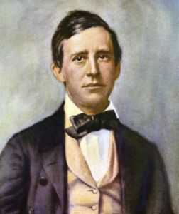
|
| Stephen Foster |
Stephen Foster was born in Pittsburgh, spent much of his life there, and the University of Pittsburgh honors him with the most important collection of his letters and life history. It is, therefore, a surprise to encounter The Camptown racetrack near the upper Susquehanna River and to find that he was sent to boarding schools in Towanda and Athens by his Pittsburgh parents. This partly reflects the nature of pre-steel mill Pittsburgh, a transportation gateway for westward migrants in the early part of the 19th Century, for whom Athens and Towanda were cultural centers "back East". Whether this signifies some subsequent decline of the Central portion of Pennsylvania, or merely the relative growth of Pittsburgh, is a little less certain.
The Camptown Racetrack, five miles long, Do-Dah, Do-Dah is surely the place referred to in the song; its present obscurity is a surprise compared with its enduring fame in song. At the time Foster wrote it, Camptown probably was a bustling center on the frontier, seemingly more glamorous because of gambling and adventure of other sorts. Its fame endures because reality has by-passed it. By contrast, the Bowery where Foster died has declined to a noxious slum and the name summons up a different image.
Stephen Foster was an alcoholic, suffering in poverty all his later life and dragging his wife and child down with him. He struck his head and bled to death over a period of three weeks, in the Bowery. Since then, the simple little tunes he wrote have become a central part of the American myth, leading to the title of "America's first composer", or the "Father of American Music." The songs were in fact the product of considerable study and skill, with numerous revisions to achieve their apparent simplicity.
Since Pittsburgh continues to think of itself as a Union town, part of the emphasis in that environment is on the way he made a pitiful income from works which enriched sheet music publishers and performers, largely because of a lack of enforceable copyright protections, or even an organized methodology for monetizing a work of art. In a subsequent article, a happenstance encounter with the present leader of music monetization points a contrast between then and now.
(Notes: 1. His brother, Morrison Foster, is largely responsible for compiling his works and writing a short but pertinent biography of Stephen. His sister, Ann Eliza Foster Buchanan, married a brother of President James Buchanan. 2. Alexander Cassatt was born on December 8, 1839, in Pittsburgh, Pennsylvania.[3] His sister was the painter Mary Cassatt. He married Lois Buchanan, daughter of the Rev. Edward Y. Buchanan and Ann Eliza Foster. Lois Buchanan was a niece of James Buchanan, 15th President of the United States, and through her mother, a niece of songwriter Stephen Foster.[4] The couple had two sons and two daughters.)Wilkes-Barre, Site of the Wyoming Massacre
|
| Wyoming Massacre |
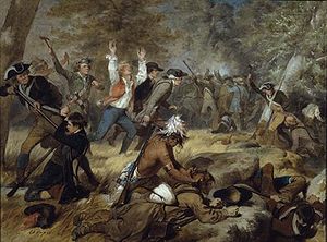
For eons of time, the site of Wilkes-Barre, PA was once a sort of finger-lake between two mountain ridges. As dammed-up rivers tend to do, this one gradually filled up with sludge until the water spilled over at Nanticoke, a few miles to the south. After the lake drained out leaving the original river in place, there was also left a flat and fertile valley on either side of it. Furthermore, the towering mountain ranges on either side protected the valley from the weather, so the Wyoming Valley became a verdant paradise in the middle of the mountains. Somehow, the Congregationalist settlers of Connecticut found out about it, dug up some old deeds from King Charles to the effect it belonged to Connecticut, and eventually set forth to resettle in this mountain valley. Pennsylvania took offense at this, and the result was three little wars which few people have heard of, called the Pennamite Wars. The local Indians were most offended of all and did the most massacring in a very thorough way. During the Third Pennamite War, George Washington was at Valley Forge with more urgent matters on his mind, and dispatched General Sullivan to "take care" of the Indian problem; Sullivan did so in a very thorough way, essentially destroying the Iroquois nation. The other eleven colonies were distraught to see Pennsylvania and Connecticut putting on a side-show, and part of the judicial settlement was to give Connecticut the "Western Reserve" in Ohio as compensation for restoring the peace. The American Constitution of 1787 essentially made state possession of land a moot point, and the Western Reserve is just a quaint term you hear in Cleveland. Wyoming is a term that most people associate with a Western State, although it is named for this valley, and Dallas is another term that has been largely transplanted from a small town near Wilkes-Barre to a big town in Texas. So, if you want to get the confusion of terms straight, about Wyoming, Dallas, Western Reserve, and Westmoreland, you will take a little time to learn about Wilkes-Barre. Westmoreland is the name of gentleman's club in Wilkes-Barre, but it is also the name of a county near Pittsburgh where Connecticut folks thought it would be useful to flee.
That's a lot of history for a little town, but there's more. Somehow, the joys and pleasures of living in the Wyoming Valley were carried back to people like Rousseau, who were looking for examples of the "noble savage", noble because he had not learned all of the evil things that French aristocrats invented, and therefore warranted effusive praise during the so-called Romantic Period, when France was being purified by the guillotine. The main drum-beater for this mania was a poet named Thomas Campbell, who composed a long poem in Spencerian rhyme called "Gertrude of Pennsylvania". Even those who find merit in Spencer will nowadays find it difficult to accept the notion of flamingos on Pennsylvania streams, or lying on the ocean beaches of Pennsylvania, reading Shakespeare. Even those who have less taste for Herbert Spenser will still find a reason to distrust the judgment of those who praise the beheading of, say, Lavoisier. The noble savages in this particular case were Iroquois, who exterminated 600 settlers by essentially torturing them to death.
|
| General John Sullivan |
There's a memorial in nearby Wyoming commemorating this massacre, which indeed is probably better left forgotten. There are plaques with the names of the fallen, and the names of the survivors. The idea of the Wyoming Valley as a paradise on earth was destroyed by another event. The ancient lake which once filled the Wyoming Valley was deeper and more ancient than anyone guessed. Underneath the rich topsoil was a vein of anthracite, and Wilkes-Barre became a boom town with strip mining, a fate no paradise can long withstand. There is nearby said to be a coal mine which caught fire underground and has been burning uncontrolled for several decades. Talk about pollution disasters; this one is a monster.
Reliable records of how the Connecticut Yankees got to the Wyoming Valley are hard to find. Offhand, it is puzzling to wonder how they got past New York or crossed the Hudson River. The best way to get between the two places today is probably pretty close to the route the colonists took, however, because travel in those days was much more constrained by geography. We know they started from Litchfield, CN, and in fact, for a while, Wilkes-Barre was part of the County of Litchfield. From Litchfield, they likely crossed the Hudson near Newburgh, went to the mountain gap at Port Jervis, and either came into the Wyoming Valley over the ridges or went a little north to the Susquehanna and came down from there. On a map at least, that's a relatively straight shot.
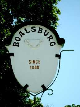
Boalsburg
|
| Boalsburg |
FIVE miles East of State College is Boalsburg, which is by far the most interesting place in Central Pennsylvania. First of all, the town itself is laid out around the most perfect surviving example of a Scotch-Irish diamond. The Scots in Northern Ireland were much resented by their Roman Catholic neighbors to the south of them, and gladly accepted James Logan's offer to come to William Penn's haven of religious freedom, in return for their settling near the Indians. This was Logan's solution to the problem of keeping the peace between the pacifist Quakers in Philadelphia, and the sensitivities of the Indians about settlers on their ancient lands. The Quakers wanted to avoid conflict with the Indians, wouldn't sell them either liquor or gunpowder, while Logan was under orders from Penn's descendants to sell the land. So, being Scotch-Irish himself, he felt confident his relatives would find ways of coping with the problem. Much of the turmoil of Pontiac's War and the French and Indian Wars, the marauding Paxtang Boys and King George's War, grew out of the resulting conflicts between the two notoriously combative groups. In any event, this decision explains why Scotch-Irish settled the frontier early, and surprisingly far west of the centers of Pennsylvania Dutch settlement. The Scotch Irish had a tradition of favoring the crossroads of two main highways. Their habit was to cut off the four corners of an intersection, leaving a diamond-shaped park in the middle. Traditionally, the enlarged intersection would have a flagpole in the middle.
|
| Boalsburg Diamond |
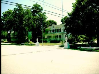
Naturally, the diamond was a good place to put a post office, a general store, or a tavern. A man named Boal put up an early tavern, and this diamond became Boalsburg. Boal is the name of a type of Madeira wine, which may have some relevance here, having to do with old stories of some Portuguese debts which were paid off in the land of Center County. In any event, there is a log cabin near the diamond, with a dozen Boal tombstones in front of it. Quite a large and elegant restaurant is now more directly on the square. This town is a photographer's dream and well worth anyone's drive around the main streets.
At some time, the Boal family moved out of the center of town to a mansion about half a mile away. From the looks of it, five or six additions were made to house family and servants, and it almost looks like five houses joined together. The carriage house has a couple of ancient carriages, one with and one without, leaf springs. The walls are hung with dozens of sabers and swords from many different wars, each with its story. There are muskets and rifles, dating back to the Revolutionary War.
The main house is modest for a mansion but immoderate for a farmhouse. It has definitely been lived in, and it's built for comfort. The walls are covered with trophies and mementos, with five signatures of US Presidents identifiable. Lots of Boals seem to have married lots of European nobility, perhaps in one of these rooms. One old rake is quoted as saying he inherited three fortunes -- and spent 'em all. Over and over again the theme emerges: the Boals was a military family, often raising their own regiments. Across the road in what seems sure to have once been Boal property, is the Military Museum, with real battleship cannons at the gate. Memorial Day was started here after the Civil War, and it is the headquarters of the local National Guard Division; it's by far the most popular tourist attraction in town.
|
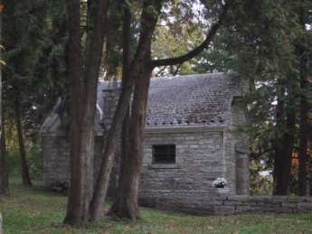
| The Columbus Family Chapel |
But off in one corner of the side yard of the mansion is a little stone house, perhaps two stories high. It is a replica of the Columbus family chapel in Spain, copied stone for stone. The stories vary somewhat between guides, but apparently, two or more relatives were descended from Christopher Columbus, and while one Boal was Ambassador to Bolivia, he married a lady in waiting to the Queen who was also descended. Possibly the Spanish Civil War had something to do with it, but in any event, the personal belongings of the Columbus family were judged to be the property of the Boals, so they were moved here to the chapel replica. A decade or so ago, the chapel was broken into by thieves, and since that time security is considerably enhanced. Two pieces of wood are still shown as pieces of the True Cross of Jesus, with authentication going back to the 5th Century, and numerous handwritten journals are there. The Goya paintings and tapestries, and a solid gold crucifix are among the pieces which are now somewhere else. The matter is one of considerable embarrassment. Most of the many pieces which remain, are seeming of the nature of things which would be enormously valuable if you knew what they were, but just about worthless if you don't. In a sense, the best protection is the ignorance which surrounds them. The guide last month remembers one day when 27 visitors came to the Mansion and many days when no one came. As he spoke, you could see at least five hundred cars parked in the Military Museum across the road. There may have been five cars parked in the diamond in the center of Boalsburg. It's sort of a shame that this would be true, just as it makes you grit your teeth to imagine the indifference the whole place would receive if you moved it to Times Square. But, let's face it, the main protection for these invaluable pieces of history lies in that general lack of interest in them.
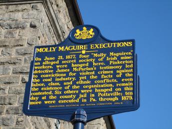
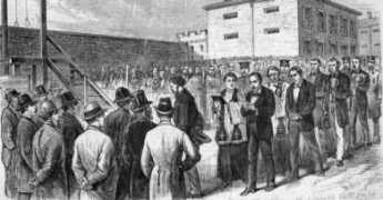
Molly Maguires of Pennsylvania (1)

|
|
| Pottsville Hanging |
|
| Historical Marker |
However, resistance to conscription during the Civil War gave newcomer clannishness more serious consequences. This was particularly true when it inserted a surprising pro-slavery (or at least anti-emancipation) protest into the very center of the Northern Union, around Pottsville, Pennsylvania. Whatever the South was fighting for, the North was primarily fighting to preserve the economic benefits of greater trade in larger markets -- a concept loosely described as "preserving the union". A second twist to anti-Mollie repression was later added after the war was over, when the 19th Century Industrial Revolution created another untamable tribe, the Robber Barons, for whom uncooperative behavior was a tendency not to be trifled with.
Basic behavior of the Molly Maguires in action followed a simple pattern. Males dressed as females in blackface made extortion threats against members of the dominant society, protesting that their own subsequent violence was merely justice for heartlessness toward widows and orphans. Since the Mollies out of costume mingled cheerfully with those they secretly called oppressors, for actual assassinations they either called in the help of distant outsiders or drew lots to choose the assassin locally. The community would then unite to provide a vocal alibi and profess to be offended by the accusation. To increase intimidation, death threats were pinned to the door.
Molly Maguires of Pennsylvania (2)
|
| the Mollie threat in the coal regions |
IT was in their interest for both the Molly Maguires and their chief enemies to exaggerate the Mollie threat in the coal regions. Mollies hoped to achieve more pay for less work by intimidating employers, the more intimidation the better. The management of the mines and railroads more shrewdly hoped to mobilize public sympathy to their side, in the newspapers, courts, and legislature, by exaggerating the undoubtedly real menace of lawless, unpatriotic behavior. There have since been great strides in the art of slanted propaganda, and it takes more finesse to mobilize modern opinion. Having watched Hitler and Stalin in action, and noticing our political parties going in the same direction, we would now regard the behavior of 1870 to be crude, and therefore less effective. But there was one very public rebuttal to what the Mollies were claiming. Although they portrayed themselves as oppressed Irish in an English dominated world, their main enemy was himself a well known Irishman.
|
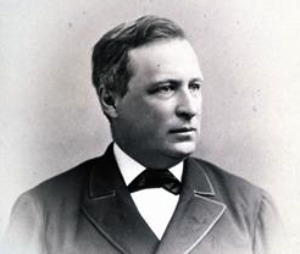
| Franklin Benjamin Gowen |
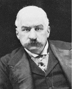
Franklin Benjamin Gowen, President of the Reading Railroad from 1870-1886, was both Irish and definitely larger than life. As one illustration of his extraordinary energy, he died at the age of 53 but had risen from moderate circumstances to control what would become the largest railroad in America by age 34, ultimately being forced from office by J.P. Morgan while still only 50. By some measures, in those sixteen years, he had made the Reading into the largest corporation in the world, even though he had comparatively little interest in and no training in railroading. Although born in Mt. Airy, he apprenticed himself to a lawyer in Pottsville, and at age 26 became District Attorney in the coal region during the first outbursts of Molly Maguire violence. Although he had never gone to law school, he seemed to love the courtroom and continued to work as an independent trial lawyer all during the time he was president of the railroad. One commentator remarked that to read his speeches in cold type was still enough to jeopardize one's judgment. During his later battles for corporate dominance, he twice filled the Academy of Music with stockholders, holding them spellbound for three-hour speeches. On this evidence alone, one. supposes he had a lifelong tendency to stretch facts.
|
| J.P. Morgan |
Following the Civil War, labor relations in this rough coal region became temporarily peaceful. The prosperity of a post-war boom was probably mainly responsible, but it was also true that the labor movement was pretty well smashed by the response to patriotic feelings, slavery was no longer an issue, and huge casualties in the war had created labor shortages. However, these same factors made dominance of the coal and railroad industries more attractive. Franklin Gowen set about merging the small railroads in the coal region into an empire, and used his control of freight costs to force the coal distributors and the coal producers into subservience or forced sales. The charter of the Reading Railroad inconveniently prohibited the railroad from owing mines, but other competitors were legally permitted to do so. Using the fairness argument and probably both bribery and threats, he "persuaded" the legislature to permit a new corporation to own mines, and permitted railroads to own the new corporation. The Reading then promptly owned the mines in a two-step arrangement, couched in bewildering legal language. Gowen had no compunction about doubling freight rates and then doubling them again until he got what he wanted. Anthracite coal was the driving engine of America's Industrial Revolution, and Gowen controlled it. He was a wild and reckless spender, he thought big, and was ready to smash any opposition. His ambition set him to building a transcontinental trunk line which would compete with the Pennsylvania and New York Central lines, both under the control of J. P. Morgan or his allies. This venture failed and became the basis for the present Pennsylvania Turnpike . Ultimately, Gowen's ambitions were thwarted by his reckless spending putting him at the mercy of English bankers, allied to the Morgan interests. Underlying this was an economic fact: Henry Frick had found a way to make bituminous coal into coke, which was a cheaper fuel for steel making than anthracite. Financed by Morgan and organized by Andrew Carnegie, the steel industry moved to Pittsburgh.
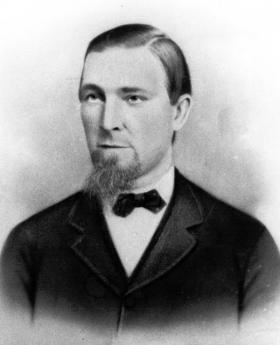
|
| John Sidney, founder WBA |
Meanwhile, what happened to the Molly Maguires? The financial panic of 1873, started by the collapse of Jay Cooke's financial company, precipitated layoffs and cost-cutting and stimulated a new rise of labor unrest. The Mollies shot some mine managers, but most of the labor organized under a fairly moderate union called the Workingmen's Benevolent Association. More moderate or not, they still threatened strikes and demanded concessions, and Gowen set about to wipe them out. As headstrong and impulsive as he was it's even possible he believed the Molly Maguire movement was stronger than it really was. But it would not have mattered. The Pinkerton agency was hired, detailed studies were prepared of the nature and leadership of the Molly movement, evidence of wrong-doing was collected, and some of the right people were hanged. Once more, the labor movement was crushed, largely by characterizing all labor unions as lengthened shadows of the Molly Maguires. And labor has never forgotten or forgiven. Even a century later, any sort of labor ruthlessness especially in Congress, is proclaimed justified since any capitalist, or even any Republican, is a covert Franklin B. Gowen. And quite possibly either English or protestant, as well, even though Gowen happened to be as Irish as any of the Mollies.
It's a great pity that seemingly the last opportunity for national adoption of the Whig philosophy of upward social mobility was exiled from American political discourse. Everybody is better off with peace, law and order; given time, our political system does offer everyone at the bottom of the heap a fair opportunity to rise to the top. After a couple of centuries, it thus ought to be obvious that class warfare hurts everyone, helps no one. But at election time, both parties feel compelled to characterize each other as either a Franklin Gowen, or a Molly Maguire.
As a footnote, Frank Gowen died from a gunshot in Washington DC in 1889. An extensive investigation was conducted, and there is almost complete certainty that no Molly Maguire was responsible. But the bullet came from a strange angle, there was no suicide note, and it remains possible that someone else, not suicide, was responsible. Gowen had plenty of other enemies.
Monocacy Creek and Monocacy River
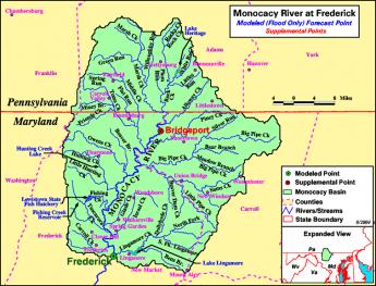
|
| Monocacy River |
Monocacy sounds like a Greek word for some form of government, but is in fact a Shawnee Indian term, meaning "crooked river". It might well be spelled as the Indians pronounced it, Monnockkesey. Confusion for history lovers is made worse by the existence of a Monocacy Creek about twenty miles long, flowing into the Lehigh River at Bethlehem. But there is a second stream, the Monocacy River, flowing about sixty miles south from Gettysburg, through the town of Frederick, Maryland, eventually merging with the Potomac River a few miles south of Harper's Ferry. Both forms of Monocacy do flow-- but do not connect-- along the base of the first mountain range of the Alleghenies, on its Eastern side. Pennsylvanians refer to this ridge as the Blue Mountain because looking westward it can be hazily seen across the plain from a great distance. In Maryland, it is called the South Mountain. In the early part of the Civil War, General Lee attempted to attack Washington DC from the rear by striking through several gaps (particularly "Fox's Gap") in that mountain. The Philadelphian General George McClellan uncharacteristically surprised him by getting masses of Federal troops through the mountain gaps before Lee could reach and fortify them from West Virginia. Although McClellan did intercept some of Lee's orders, it is now questioned whether this affected the outcome. The culminating result was what the Union side continues to call the Battle of Antietam Creek, but the former Confederates persist in naming the Battle of Sharpsburg. Antietam Creek is one of those many creeks which flow along either side of the long mountain range, fed by runoff rainwater from the ridge, and therefore has steep embankments. Regardless of the nomenclature quarrel, the main point is that both of these placenames refer to the west side of the mountain gap, putting Lee at a disadvantage for an attacker. He got there first, but he did not get there first with enough force to dominate the passes.
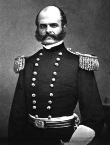
|
| General Ambrose Everett Burnside |
A horrendous slaughter of Federal troops took place when General Burnside was ordered by McClellan to get his troops across Antietam Creek immediately, and Burnside chose frontal attacks over a narrow stone bridge crossing the Antietam as the way to get there. Because of the creek's flow along the base of the mountain, once the bridge was crossed under constant sniper fire, the troops faced a sheer embankment which had to be climbed into the face of 500 Confederate sharpshooters shooting down from the top. Burnside and the Federal troops finally did accomplish this suicide mission after four hours of trying, mostly because the Confederate sharpshooters ran out of ammunition. At the end of that day, 23,000 troops on both sides were casualties. Toward the end of the war, similar casualties would be sustained fifty miles north at Gettysburg PA, along a branch of the Monocacy on the east side of the ridge. The two Monocacy streams, Creek and River, are entirely distinct but a natural source of confusion.
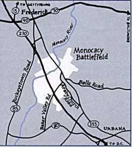
|
| Monocacy River Map |
It would seem a pity, however, to succumb to a fit of tidiness and change the name of either stream. The Shawnees were once the most important Indian tribe in this region, and at various times have achieved dominance over regions from the Delaware River to Oklahoma. As a major component of the Algonquin federation of tribes, they fought a losing battle with the Iroquois over a period now named the Sixty Years War, eventually retreating from the Eastern Alleghenies to Ohio. Meanwhile, the Iroquois were destroyed by the consequences of the Revolutionary War, while eventually, the Shawnees retreated to reservation areas in Oklahoma. The Monocacy streams, both of them, represent a high-water mark of Shawnee influence. It would be sad to see the last few vestiges of their pre-eminence, even if only names on a map, destroyed by inadvertence or indifference.
Joseph Priestley of Northumberland, PA
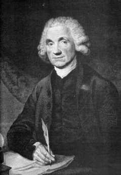
|
| Joseph Priestly |
There's one good thing about living near the confluence of two big rivers, and one very bad thing about it. The rivers provide transportation in three directions, but about once every twenty-five years the rivers rise astonishingly and threaten to carry everything away. That deposits rich topsoil, making it even more attractive for settlers to locate there. At what we now call Northumberland located on the junction of the North and West Branches of the Susquehanna, there is a monument marking off the flood levels of the past two centuries. Even the least of these floods must have covered a lot of ground, and the highest one is so far above the head of a visitor that it is hard to see how anything could have survived it. Right now, the little town of Northumberland is a burnished little jewel. One hopes the Army Corps of Engineers either has or soon will abate the potential flood danger. It would be interesting to know if flood insurance is available, just as a sign of how experts currently evaluate the risk. The Endless Mountains (that's really their name) stretching almost to Cooperstown, catch a lot of rainwater and snow and occasionally funnel it all down the North Branch to Northumberland. The West Branch is even bigger. Having observed the 1936 flood in Pittsburgh, I can testify it isn't an experience soon forgotten.
|
| Flood Levels |
It happens the most prominent resident of the area arrived there in 1794 and lived out the last ten years of his life as a widower. Joseph Priestley, an English dissenting minister had stirred up enough uproar to cause his house to be burned to the ground. No doubt, the English wanted to suppress any repetition of the French Revolution but were willing enough to be rid of a protege of Lord Shelbourne so the government made full restitution of the value of his property when he finally agreed to emigrate. Pennsylvania was chosen on the advice of his good friend Benjamin Franklin. He bought extensive land at the river junction and constructed what most people would describe as a beautiful mansion on reasonably high ground with a river entrance. Although it is built of wood and William Penn's Pennsbury was brick, there is a definite similarity. Priestley's house somehow seems more open and livable, although the outhouse reminds us that plumbing costs were moderate at the time. And furthermore, the original building survives as Pennsbury did not. The original plans for it were later discovered in England, and so it has been possible to make it what it used to be, outbuildings and all. Priestley and Lavoisier did not get along even though they share the honors for discovering Oxygen. Lavoisier was a rich aristocrat, while Priestley was a prominent member of the dissenting class with advanced ideas about democracy. It is said that many of the ideas Thomas Jefferson had about the natural rights of mankind were brought into sharper focus by his association with Priestley. Priestley was primarily a political theorist, acting in the role of a minister. He regarded his chemical experiments as a hobby, motivated by the hope of discovering a bridge between religion and science. The relationship between Priestley and Lavoisier was a strange one, but it had political conjunction as well as a scientific one. Priestley was driven to America by English Tories the same year that Lavoisier was guillotined by French revolutionaries.
Although oxygen had been discovered while Joseph Priestley was still in England, he discovered carbon monoxide in Northumberland, using retorts and scientific instruments he designed and sent to his friend Wedgwood to manufacture. He also devised the idea of carbonated water while he was here. For these as well as chemical methodologies he has been described, at least by Anglo Saxons, as the Father of Chemistry. Following what he considered to be his main occupation he meanwhile founded the Unitarian Church in America. In the little town at the Susquehanna forks, he was unable to establish a viable Unitarian congregation beyond a few followers who came to his home. So, he somehow found the energy to establish the First Unitarian Church in Philadelphia, at 21st and Walnut Streets. (Aside from its historic significance, the present church building is a distinguished work of architecture designed by Frank Furness). Meanwhile, he was very active in national politics; Jefferson's defeat of John Adams' reelection is often ascribed to his efforts.
His wife died of tuberculosis before they could move into the Northumberland plantation, but he lived there with his son and daughter-in-law for ten years, dying in 1804. The son was concerned with founding a utopian colony, but the wealthy daughter-in-law forced a return to England. The grandson generation returned to Northumberland, where the graveyard now has an impressive array of Priestley tombstones.
REFERENCES
| The Invention of Air: A Story of Science, Faith, Revolution,and The Birth of America, Steven Johnson ISBN: 978-1-59448-852-8 | Amazon |
Joseph Priestley, Shaker and Mover
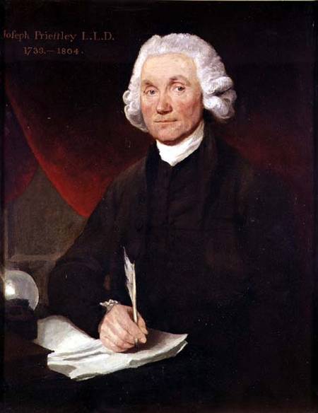
|
| Priestley |
Joseph Priestley, sometimes also spelled Priestly, is surely one of the more undeservedly neglected men of history. He has been called, with justice, the Father of the Science of Chemistry. He might also be called with equal justice, the father of the First Unitarian Church . The First Unitarian Church of Philadelphia, at 21st and Walnut, is the first and oldest Unitarian church and was indeed started at the urging of Priestley, whose principal residence was in Northumberland PA, at the confluence of the West and North Branches of the Susquehanna. Priestly wrote a scholarly work on the teachings of Jesus, which so captivated Thomas Jefferson that Jefferson wrote him the outline of another book that needed writing. Apparently, Priestley didn't have time, so in 1803 Jefferson wrote it himself, in the four languages he was fluent in, English, French, Latin, and Greek. Although those were simpler times, there have been few if any others who have told a President of the United States that he was just too busy to respond to a presidential request, particularly when the President could then find he had time to do it himself.
Priestley's theological teachings were based on scientific reasoning. They were highly controversial views, to say the least. He rejected the concept of a Trinity (he was a Calvinist minister, mind you), the divinity of Christ, and the immortality of the soul. Essentially, he rejected the concept of an immortal soul on the reasoning that perceptions and thought were functions of material structures in the human brain (Edmund O. Wilson's idea of Consilience is largely similar), and therefore will not outlive the cerebral tissue which produced them. In 1791, mobs burned his house in Birmingham, England, his patronage was revoked, and he hastily emigrated to Philadelphia. It isn't hard to see why these ideas were particularly unpopular with the Anglican church, which is probably the main reason England made him into a non-person, and his scientific ideas were denigrated as the product of other people.
That's too bad because he really was a scientist of immense importance. As a young man, he encountered Benjamin Franklin in England and was certainly a man after Franklin's heart. He noticed funny things about gases that rose from swamps and over mercury salts, and Franklin encouraged him to systematize and analyze his observations into theory. Although he called it anti-phlogiston, he had discovered oxygen. And then hydrogen, and nitrous oxide, and sulfur dioxide, and hydrochloric acid. Priestley really was the first organized and coherent scientific chemist, the Father of Chemistry. Franklin, Lavoisier, and Priestley became scientific friends, and enthusiastically exchanged ideas and observations, eventually leading to Lavoisier's fundamental principle: Matter is neither created nor destroyed, it only changes its form. In the end, it made no difference; Priestly had offended some pretty large religions, and nothing he did in chemistry was going to get much attention. Perceiving the value of the land at the confluence of rivers, he made his home for the last ten years of his life in Northumberland, Pennsylvania, now three hours drive Northwest, somehow managing to maintain an active scientific, political and theological influence worldwide. Visiting this rather sumptuous estate in a little river town is well worth a tourist visit. He died in 1804, just after his friend and kindred-religionist Thomas Jefferson became President of the United States.
Priestley's life can be summarized in one of his own most quoted remarks. "In completing one discovery we never fail to get an imperfect knowledge of others of which we could have no idea before so that we cannot solve one doubt without creating several new ones."
REFERENCES
| The Invention of Air: A Story of Science, Faith, Revolution,and The Birth of America, Steven Johnson ISBN: 978-1-59448-852-8 | Amazon |
Mauch Chunk, Jim Thorpe, and All That
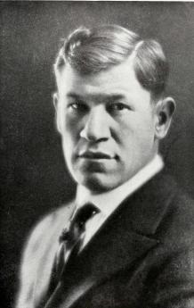
|
| Jim Thorpe, Himself |
Hundreds of millions of dollars were made in the anthracite mines during the 19th Century, and then Henry Frick invented a way to make steel with coke, a product of bituminous coal. Consequently, the steel industry moved from the Lehigh Valley to the Ohio Valley, greatly transforming the image of both the Philadelphia and Pittsburgh regions. While the town of Mauch Chunk was prospering, it was the center of activity of a financier named Asa Packer, whose mansion dominates what is left of the town in the mountains, next to a graceful church, a railroad abandoned except for scenic tourist rides, and subdued economic desperation. The mountainous valley on the north side of Blue Mountain called itself Pennsylvania's Switzerland, and it was once a scenic gem indeed, but is now choking up with traffic trying to get through the narrow passage down the hill. One of the relics of former prosperity is an Opera House, now used for rock concerts and related events in an effort to re-establish the town as an entertainment center.
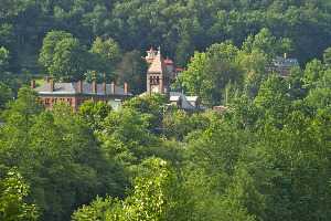
|
| The Town of Jim Thorpe |
John O'Hara wrote some stories using Mauch Chunk as the setting, and that author is getting to be better appreciated now that his level of bawdiness is more or less the norm. Being better appreciated is of course not the same thing as selling a lot of books, so it is now uncertain whether the transformation was mainly artistic or financial. There is no doubt that coal regions the world over tend to be pretty rough districts.
|
| Old Mauch Chunk Station |
Perhaps it was Asa Packer or some other financier who started the tradition of this town pushing the publicity button pretty hard. The town rightly promotes itself as a charming inexpensive place to spend a quiet weekend visiting the sights, including a ride on the now-abandoned rail line through the scenic mountains, the Asa Packer mansion, antique shops and that sort of thing. The Pennsylvania Switzerland moniker suggests a touch of the P.T. Barnum approach, although a fairly innocent one. But buying Jim Thorpe's body is on quite another level. There is very little question that this offspring of an Irish father and an Oklahoma Indian mother was a natural athlete of the very highest skill; whether he was mainly an Indian or mainly an Irishman is more debatable. Thorpe played professional football and professional baseball with distinction, after winning boxes full of Olympic track medals. Dwight Eisenhower played football against him once and expressed genuine admiration for the talent he encountered. Unfortunately, he had his medals taken away because it was discovered he had played for money before he was competing for the amateur Olympic prizes. After growing too old for athletics he turned into a chronic alcoholic with associated erratic behavior, embarrassing to his admirers. When he died, members of his family sold his body to the downtrodden town of Mauch Chunk, which renamed itself Jim Thorpe and greatly expanded its publicity efforts. His son has lately sued to have the body returned to Oklahoma, creating still more publicity, not all of it congratulatory.
It's sort of a sad story, but the Town of Jim Thorpe is only five miles from the Mahoning Valley exit of the Pennsylvania Turnpike extension. It's not hard to go satisfy yourself of the fairness of all this uproar.
Dingman's Ferry, Below Port Jervis
|
| Dingman Ferry Bridge |
Because the area was once covered with a glacier, the northeast corner of Pennsylvania is fairly deserted. That's always been good for hunting and fishing, and more recently is good for skiing. Although the topsoil is poor, it's a beautiful area, practically guaranteed to provoke confrontation between the environmentalist movement and the Marcellus shale-gas extraction industry. The history of anthracite coal demonstrates locally that the mineral extraction industry always wins these arguments in the short run, but ultimately the land seems to heal itself without much help from people living in city apartments. The followers of Gifford Pinchot and Teddy Roosevelt are slowly learning to concentrate on minimizing the damage and forcing the extraction industries to pay for clean-up afterward. Right now, this semi-wilderness area is a remarkably beautiful but deserted forest within two hours drive of Philadelphia and New York City. It contains the headwaters of the three main rivers of Northeastern United States.
Crossing those three rivers was the main geographical problem for the Connecticut invaders of Pennsylvania. Today, the landscape is not a great deal different except for the absence of Indians, and crossing the three rivers is the main event. There's a Hudson River bridge at Newburgh, and crossing the Susquehanna at Wilkes-Barre is a placid bridge within a town park. From the point of view of the Interstate highway, crossing Delaware occurs very near the highest point in New Jersey, over a deep rocky gorge with boaters deep below. Since the traveler is at a peak point within a long wide mountain valley, the view is spectacular in several directions.
However, for centuries the builders of roads had to operate on a modest budget, and the only reasonable place to cross Delaware in that region is a few miles south of Port Jervis, at Dingman's Ferry. The Dingman family prospered at their trade for many generations before they modernized and constructed a toll bridge, which is now one of the few remaining toll bridges in private hands, and possibly the oldest one. You don't have to ask the two jolly old toll collectors whether they are part of the Dingman family because they certainly act like it, adding to the wad of dollar bills in their left hand as they greet the fellas, josh the girls, and wave directions with a free hand. A quarter-mile to the south of the bridge on the Pennsylvania side is the entrance to a trail leading to a National Park Service station. The Park Guards are a friendly sort, most of them freely admitting they are members of the Dingman clan, available to help tourists interested in a trail walk, including a visit to the local waterfall. In spite of all this family connection, and Park Service training, nobody at the station had ever heard of the march of the Connecticut invaders. Or of the Proprietorships of West and East Jersey, or of the line between them which allegedly ends at Dingman's Ferry. The best they could do was the point to the local cemetery, which has a big rock at the entrance that somehow has some particular significance, or other.
As it turns out, the cemetery is quite large, with surely a thousand or more gravestones, a great many of which fly American Legion flags for veterans of one war or another, and many more are decorated with fresh flowers. Only a corner of this graveyard touches the curving road to The Bridge, and just inside the entrance is a very large, unmarked stone. Trees have been planted nearby, and their roots have half-covered the rock. But the roads and the cemetery, in general, seem designed around it. There's no marker to explain it, any more than there is a plaque at Stonehenge. As the Park Ranger said, it has clear significance, but no one now seems to know what it is significant of.
Well, if no one is likely to contradict, let's make the timid suggestion that this may be the terminus of the line dividing East from West Jersey. Yes, it's in Pennsylvania. But there is nothing more likely on the New Jersey side of the crossing, and the current Surveyor-General of West Jersey, William Taylor, is firm in the belief the line terminated at Dingman's Ferry. William Penn had hoped to control land on both sides of the river, and when he acquired Pennsylvania in addition to New Jersey, the issue became moot. The style of the survey had been to start at Beach Haven ("Ye inlet of ye beach of Egg Harbor") and follow the compass until it hit something large and heavy. That rock was marked, and another survey went the next step. About fifty of these markers have been discovered by later explorers, and officially represent the underlying fixed line which serves as a survey basis for every property in the state of New Jersey. Since I own some property in New Jersey myself, it seems important to be sure I know where it is, or else some trial lawyer may try to take it away.
Delaware Water Gap
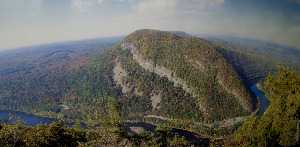
|
| Delaware Water Gap |
When we think of water gaps, we tend to think of Harrisburg or Pittsburgh, with a wide river turning abruptly to run through a sharp cleft in a single mountain ridge. West Point on the Hudson might be a third well-known example. But the frontal ridge of the Alleghenies, variously called Blue Mountain, Blue Ridge Mountain, South Mountain, or Kennesaw Mountains, is several ridges wide. A gap in that sort of complex mountain range must be crooked and several miles wide to let a river of any size find its way through it. Presumably, this gap at Stroudsburg was formed by some huge volcanic action, because thick sedimentary layers are upended and exposed at the river's edge, with the water winding between the towering formations. To avoid going up and over a thousand feet of the mountain, human travel must follow the same path; a railroad, a little town, and several highways are crowded into the base of the cleft now filling up with gravel eroded from the cliffs. Even the birds need to travel several miles through the winding cleft in the formidable forests, with eagles and occasional turkey vultures coasting overhead, enjoying a ride on windy updrafts, casually on the lookout for lesser prey.
The Gap is a great intersection between New Yorkers and Pennsylvanians, mostly going somewhere else. The dominant Philadelphians got there first and tended to congregate in Stroudsburg where the Waring Blendor was invented within the once-flourishing Pocono region for fishing and getting away from summer fevers. As the jolly guide at the visitor's center chuckled, the New Yorkers tend to arrive eight busloads at a time and head straight for the bathrooms. After that, nowadays most species of city dwellers buzz off for somewhere else, leaving the Water Gap to darkness, and to me.
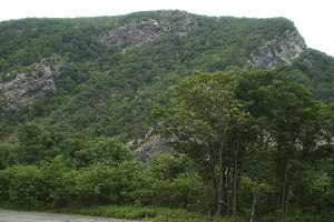
The Water Gap has at least two other outstanding attractions, however. For fifty or more miles along both New Jersey and Pennsylvania sides of the river, a Federal Game Preservation area stretches through the forests and cliffs to the New York border. You have to be pretty determined to get to it, however, because traffic is traveling in herds at eighty miles per hour past the few entrances. You can be hopelessly beyond the entrances before you recognize you are past the point of no return, or at a point where you can if you wish only make another try for it by finding a place to turn around, pay tolls, and risk your life between the cliffs and eighteen wheelers. If you have enough courage and eye/hand coordination, however, once you do get off into the quiet woods, you pretty much have Shawnee America to yourself. The Appalachian Trail crosses at this point, but hikers should remember you must wade the Delaware River to pick up the trail on the other side.
The other gem of this area is called the Shawnee, a 19th Century resort hotel of genteel note, with outstanding food and a famous golf course that you reach by footbridge to an island. PGA championships have been played here, and Fred Waring probably played some dance music once. At one time, there was a couple of dozen such mountain resort hotels scattered from Maine to Georgia, all of the American Plan, looking as though Scott Fitzgerald and Zelda would come lurching around the next corner. It's anybody's guess whether recessions and gasoline shortages will ruin these places, or whether the people who deserted this summer custom and went to Europe will remember these mountain resorts are here and save them. Right now, there are the golfers and the mountain hikers during the summer and the skiers in the winter. And then there are a few people who want to write or read novels, some conventions, a few tourists if they own a necktie.
This winding, several miles long canyon, once a forest fastness of the Shawnee, was perhaps their main bastion. That most powerful tribe of the Algonquin federation participated in a sixty-year war with the Iroquois and mostly lost. You can certainly imagine what a marvelous fortress this region was, containing protected fertile islands to grow food, interior forests which probably abounded in game, rivers full of fish, sheltering mountains with hidden entrance clefts from which to emerge and dominate the flatlanders in all directions. If you were going to be an Indian, this was surely the best place in the world to be an Indian.
James Buchanan: The President from Lancaster
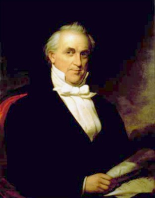
|
| President James Buchanan |
Digby Baltzell (writing in Puritan Boston and Quaker Philadelphia) uses the reputation of President James Buchanan among historians as an example of how poorly Quaker Pennsylvania compares with Puritan Massachusetts, which had four Presidents, all of the men of great stature, while Pennsylvania only had poor Buchanan. To a loyal Pennsylvanian, that's irritating talk, and to it must be added, the only national monument to Buchanan had to be paid for by his own niece, Harriet Lane; construction of even that dinky statue was held up nearly a century by his detractors. It sits in Meridian Hill Park in Washington DC, right next door to where I lived for two years while working at the National Institutes of Health. It seems a little like a personal insult to my little children who played there, that some group or other of historians talk unpleasantly about Pennsylvania's only President.
Buchanan started political life as an elected Federalist, so he seems unlikely to have been secretly sympathetic with secession. A quick look at the map of electoral voting in 1856 shows it was a three-way election, with the peculiarity of the anti-immigration (Know-Nothing) party removing the western part of the country from contention. Essentially, the election was evenly divided between the abolitionist Republicans in the North and the slave states of the South. Swing Pennsylvania and New Jersey toward one side or the other, and you win the election. Buchanan's attraction as Pennsylvania's favorite son won him the Democrat nomination, and hence the election. It's pretty clear that Buchanan politically did owe the South, big-time.
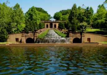
|
| Meridian Hill Park in Washington DC |
That doesn't necessarily make him pro-slavery, but it surely means the South thought he was their best choice. The reasons behind that trace back to his activities on behalf of annexing Cuba while he was Minister to Great Britain. Cuba was bankrupt and having revolutions, and Spain itself wasn't much more effective. These arguments were persuasive to Republicans forty years later when Teddy Roosevelt led the charge and McKinley provided the dubious pretext of the explosion of the battleship Maine. Underneath these jingoist pretexts, the real disputes about Cuba were the Manifest Destiny argument (The United States ought to absorb the whole Caribbean region), and the likelihood that Cuba would be a slave state. The United States House of Representatives had become hopelessly abolitionist as a result of European immigration, so the main hope of the South to stave off abolition of slavery rested with increasing its strength in the U. S. Senate. So the North was favorable to annexing Cuba for Manifest Destiny reasons, while the South was also in favor because of the Senate issue. Buchanan as a politician probably didn't have much trouble seeing himself as a hero by promoting the annexation of Cuba, by force if necessary. The South meanwhile made a decision to seek Senate votes in Kansas and Missouri, since to do so fitted in with another strategy of using their Congressional influence to weaken the military strength of the United States, since that would, of course, be used against them if it came down to a war of secession. It also made a Cuban conquest somewhat more dubious, but in politics, you always have to make choices.
Although it is not much mentioned by historians, that hidden second strategy did, in fact, work out for them. When poor Buchanan got elected and struggled to maintain peace, he found he lacked the military strength to make threatening noises, and indeed General Winfield Scott had to warn him against transferring troops to defend the installations at Fort Sumpter and other Southern locations. This weakening of Union strength is also a largely unmentioned factor in the miserable early performance of the Union armies, early in the Civil War.

|
| Electoral Vote 1856 |
Both the Abolitionists in the North and the Pro-slavery conspirators in the South presented a vexing pattern of intransigence to the beleaguered Democratic President; after all, they were still American citizens and voters. Although Lincoln in 1860 was not nearly so mindless as many of the other Abolitionist leaders, he was running for President with a clearly anti-slavery program. John Brown was starting insurrections. Whether the Southern hot-heads would blink at the last moment was not clear, but while the pressure on them was that time was running out for their cause, a President mostly elected with their votes still posed an issue that had to restrain them. Time seemed to be on the abolitionist side; no one ever suggests that we would still have slavery in 2011 if there had been no Civil War. If everyone had known we would have 600,000 deaths in that war, the alternative of playing for time would not have seemed so timid.
History is written by the victor, as they say. And then there is the Henry Ford theory of history. Some parts of it, at least, are bunk.
Gettysburg
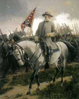
|
| General Robert E. Lee |
It's quite a long drive from Philadelphia to Gettysburg, but General Lee was attempting to disrupt supplies to the "Arsenal of the North" by capturing the railroad center at Harrisburg. Furthermore, Philadelphia reacted as if Lee's advance was aimed straight at us, creating hysterical preparations for an invasion which had to be stopped before it got here. And finally, George Gordon Meade, the Union commander, was a Philadelphia home town boy. So, regard the Battle of Gettysburg as part of Philadelphia history, please.
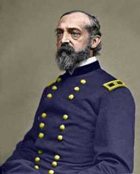
|
| General George Gordon Meade |
Major (ret.) Lawrence Swesey is a West Point graduate and currently Administrator of the 1st City Troop; because of his enthusiasm for the subject, he runs a tour agency which specializes in battlefields, especially Gettysburg. From him, the Right Angle Club recently learned much that made the whole episode comprehensible. Such as Lee's purpose in going there, which appears to have been based on the growing recognition that the South was likely to lose the war, and desperately needed some major victory in Northern territory, both to take the pressure off the Southern homeland and to improve whatever terms might be extracted at a peace negotiation. To fight successive battles against a larger enemy, with larger economic resources, was to doom the South eventually as resources and men were depleted with no hope of replacing them. Sooner or later, some Union General like Grant would settle down to a grinding unrelenting assault, with the willingness to trade one death for another, until only the larger side was left standing. That's quite different from guerilla warfare of the type Washington fought, where the way to win was simply to avoid losing until the stronger side lost its civilian support. Lee could feel the South beginning to lose its nerve to fight on indefinitely, without any visible route to victory. Although Grant eventually did defeat him by attrition, Grant's own opinion appears to have been more personalized. In every war, he was later to say, there comes a time when both sides want to quit. The side that wins is the one with a general who keeps fighting for no particular reason until the other side finally quits and he wins the war.
Major Swesey emphasizes that rifles were available, but they cost four times as much as smooth-bore muskets which were only effective for twenty or thirty yards. Rifles were reserved for sharpshooters, and the enemy at a distance was bombarded by artillery as the two sides approached. So, in Pickett's famous charge, most of the casualties took place in the last fifty yards. Pickett's men had to contend with trudging stoically through an exploding field of cannon fire, unable to fire effectively at the Union men behind a stone wall, who were also supposed to lie passively on the ground while the Confederate artillery pounded at a stationary target. Somehow, most of the Southern artillery fire went over the Union heads and landed beyond the crouching line; in many ways, this was the main factor in the Union victory.
As the waves of attackers got within musket shot of the wall, they formed into three ranks. Since it took about a minute to reload the musket, a more or less continuous fire could be maintained by rotating three successive volleys rank by rank, at more or less point blank range. Then, fix bayonets, and the real slaughter became a hand to hand, in the blazing heat of summer.
www.Philadelphia-Reflections.com/blog/1436.htm
Mennonites: The Pennsylvania Swiss
|
| On the Wall of the Mennonite Heritage Center |
Anabaptism, originally attributed to Ulrich Zwingli around 1525, centers around believing a baby is too young to understand baptism, so adults need to be re-baptized. The idea arose independently in Switzerland and Holland, and probably thousands of believers were unmercifully martyred for holding the belief. Because the worst persecutions took place during the War of Austrian Succession (1740-50), they are often attributed to the Roman Catholic Inquisition, but Magisterial Protestants, believing in the separation of church and state, were often also responsible. Many seemingly unrelated issues were introduced locally, and this period of unrest is known as the French and Indian War in America; its major battle took place in Louisburg, Nova Scotia, although George Washington's skirmish around Fort Duquesne (Pittsburgh) has acquired local fame as a major American manifestation.
The Swiss adherents moved to the Rhineland Palatinate, and from there were among the first to accept William Penn's offer of religious freedom. They were the settlers of Germantown, but have mainly moved a few miles west to southern Montgomery County, where the confusion about Pennsylvania Dutchmen is further confounded by the fact that they were Swiss. Menno the Dutchman gave his name to the order, but they themselves regard their true ethnic background as Swiss from the Zurich region. That, by the way, is not to be confused with Calvinism, which also comes from Switzerland, but by way of Geneva, not Zurich. The pacifism of the Mennonites made them mutually attractive with the English Quakers, who had made an appearance fifty or so years later in the region around Manchester, England; each group seems to have adopted some of the features of the other.
|
| Franconia Mennonite Meetinghouse |
Determined use of the German language has always held the Mennonites apart, however. From the start, it was really necessary to be somewhat bilingual in Montgomery County, using English for business conversation, and German at home and in the church. The idea of using a foreign language is based on the hope it would thus maintain a sense of distinctiveness or even remoteness from non-believers, without adopting the least hostility to them. It almost inevitably follows that the group has used its own schools, attached to their meeting houses. This sense of remoteness has persisted for almost four hundred years, surrounded by entirely different cultures. Starting only around 1960, this attitude has gradually softened, however, and it is widely assumed that in another few decades Mennonites will come to resemble the people in their environment a great deal more than they do at present. If you want to know where to find them, Harleysville is a good place to start. As the tinge of Pennsylvania Dutch accent gradually fades, and fewer of them wear the old costumes, a curious remaining hallmark of their presence can be noticed: an avoidance of foundation planting around their houses. The Mennonites themselves seem to be entirely oblivious to this unintended distinctiveness, which is however quite striking to non-Mennonite passers-by. Those who work in the fields all day have little interest in digging around their houses for decoration; those who have moved away from farming have seemingly adopted the bush-less style as a natural way of arranging things. There's no particular reason to change it, and so, there's no particular reason to notice it.
Three-Mile Island
|
| Three Mile Island |
On a mud flat of the Susquehanna River called Three Mile Island, a nuclear energy plant had been built around 1970. The mud flat was in front of the entrance of the Swatara Creek, where Middletown the first town in the County had been laid out in 1732. Later on, the town of Harrisburg became the capital city of Pennsylvania, located a few miles north of the Swatara Creek at what had been called Harris's Ferry, later Harrisburg. For quite a while, Middletown and Hummelstown, also on the Swatara Creek, were the two main towns in the area, but the location of the state capital attracted railroads and steel mills to Harrisburg. One of its main claims to fame was that Confederate General Robert E. Lee was thought to have it as his primary objective for invading the North, frustrated in this goal of course by his defeat at the battle of Gettysburg. Meanwhile, Middletown has declined to a small country town and was therefore originally glad to have the industry of electricity generation located next to it. It's true the huge cooling towers loomed ominously, and huge plumes of evaporated water rose in clouds to be seen for miles. But Middletown slowly took on the look of a refurbished 18th Century town, fancy new restaurants and all, prosperous and waiting to be discovered as a tourist attraction. Maybe in time, it would be the next Williamsburg.

|
| The China Syndrome |
On March 28, 1979, some valve got stuck within Reactor Number Two. The plant had two reactors, each with a spare cooling tower so it looked as though there were four nuclear plants instead of two. Warning lights and whistles went off, and it is easy to imagine a general panic within the operators of the plant, especially since a popular movie, The China Syndrome had just been issued two weeks earlier, depicting an imaginary implosion of a similar nuclear plant with famous movie actresses running around screaming. It took about five days for the plant operators to make a preliminary assessment of the TMI situation, which did not seem as bad as it might have been. It would take six months to reach a final evaluation of just what had gone wrong, and why. In the meantime, almost anyone could say or imagine almost anything; no one could prove they were wrong. The local citizens held a referendum; they wanted all of the facility to be closed, permanently. Secretary of Health Gordon MacLeod wanted a somewhat more reasonable thing, which was large supplies of sodium iodide pills to be distributed to the populace to prevent the radioactive iodine content of escaped gases from being attracted to the thyroid glands of the population, especially children and child-bearing mothers. Unfortunately, he took the unforgivable step of criticizing the state government for not having stock-piled the pills, and the Governor fired him, thus demonstrating strong decisive action in an emergency. The news media were equally at sea because this was big news. When all was finally said and done, there was no evidence that anyone was injured as a result of the accident. More than thirty years later, there is still no sign that anyone was ever hurt.
|
| Hiroshima Explosion |
We might not have been so lucky, of course. When the Russian plant at Chernobyl had a worse accident in 1986, literally thousands of Ukrainians were sickened, and the death rate was appreciable. In Japan, the victims of the Hiroshima explosion were closely followed for many years, and the incidence of cancer of the thyroid among the survivors was truly frightening. However, after more decades elapsed, it was possible to determine that the overall death rate from thyroid cancer was not increased, suggesting these new cancers were not particularly malignant. But in a different set of circumstances, when the Chinese set off their tests of nuclear weapons, it became clear that these tests were followed in a few years by a world-wide epidemic of Hashimoto's Disease of the thyroid. Radioactivity in mushroom clouds is mainly radioactive iodine, with a half-life of seven days. Unfortunately, the clouds sail around the earth, eventually settling into the dirt on the ground. Grass grows there, and cows eat the grass. By this time, the radioactivity is much diminished, but the digestive systems of cows concentrate this weak radioactive iodine, which then gets into milk in a more active form. The kids drink milk and get Hashimoto's disease. Whether they will later get thyroid cancer and die of it remains unknown, but possibly not, in view of the Hiroshima experience. So, amidst a welter of conflicting evidence, it is still possible to say almost anything about nuclear power risks without fear of provable contradiction. It is only safe to repeat that radioactive iodine exposure doesn't do anyone any good.
Unfortunately, thirty years after the accident, we now all understand it would be a good thing to develop energy independence from Middle East sources; but we remain unsure just how unsafe we are willing to become in order to re-adopt nuclear energy. Since the accident at Three Mile Island, our government has made it impossible for a single atomic plant to be built in America. And the politicians are surely right about frightening public opinion on the topic. Just look at pretty little Middletown: it's moving toward becoming a dilapidated ghost town.
Without claiming any expertise in atomic energy production, it is possible to quote others to the effect that the hesitation of the politicians is no longer focused on the danger that a plant will explode. Rather, the real dispute is about the disposal of nuclear waste. No one wants it nearby. The French have built nearly sixty plants in the thirty years we have hesitated; how do the French dispose of nuclear waste? The answer seems to be that waste disposal is not a problem with the French methodology, but a new problem surfaces that the French approach generates a type of waste which is much easier for an undeveloped country to deploy as material for atomic bombs. So, the rumor commonly circulating is that this is really the main practical objection to constructing nuclear energy plants in the French style. As is true for the entire nuclear topic, the rumors outrun the evidence.
Central Pennsylvania Settlers Before 1700

|
| German Rhineland |
Dates are unclear, but twenty-five families from the German Rhineland bought Pennsylvania land from William Penn prior to 1700, which is the earliest recognizable date on a gravestone in the Hummelstown Cemetery. Future research may narrow that time interval down, but it can confidently be said they got on a sailing ship bound for Philadelphia between 1682 and 1699. For reasons also unknown, tradition relates the Captain refused to stop in Philadelphia, putting them off in New York. They discovered they were unwelcome among the Dutch settlers in New York, who quite likely reflected the ancient hostility between the Dutch at the mouth of the Rhine River, and the Germans living upstream from there. Augmented by wars and invasions, the feeling persists to some degree even today. The twenty-five families sailed from New York, up to the Hudson River to Kingston the state capital, where they discovered they were even more unwelcome. The British under the command of the Duke of York took over New Amsterdam in 1664, but Dutch cultural control persisted long after the change of political control.
|
| Governor Keith of Pennsylvania |
Tradition continues that Governor Keith of Pennsylvania happened to be in Kingston at the time of the stranding of the migrants. He suggested they travel eighty miles overland to the Susquehanna River and then float down to land where topsoil was reputed to be several feet thick. Since Dutchmen everywhere concentrated on fur trading more than farming, it seems safe to guess reliable guides were easily found in Kingston. From there to what later became famous as Three-Mile Island below Harrisburg, the three-hundred-mile route of these pilgrims can be guessed by following valleys between towering ridges. Unfortunately for this surmise, there are two main canyons leading to Kingston from the Susquehanna, which improved Kingston as a choice for fur trading. The more northerly canyon is somewhat longer, but it might have been safer; perhaps the German pilgrims just flipped a coin. Taking either choice it's a hard trip however, even assuming the Indians were friendly and food sources abundant. It must have required at least a month to go the full distance to what is now Harrisburg, passing by a number of places which now support prosperous farms. That potential likely provoked demands of some travelers that they had gone far enough, as kids do today in the back of the station wagon. By luck or stubbornness, however, they kept right on into the wilderness, eventually making permanent settlements along the Swatara Creek in Dauphin County, which proves to have the richest farmland in America. Middletown and Hummelstown are thus the two oldest settlements in Central Pennsylvania. By the time the other German sects made their way up Germantown Avenue, out Germantown Pike, and then onward to the Great Valley beside Blue Mountain, the original settlers had ample time to discover the best land, the surest wells, and the best access to the creeks. Furthermore, they had several generations to notice which families produced the strongest lads, and which families were the best natural farmers. Since later incoming families were mostly penniless, they had to settle for less advantageous farmland and less endowed marriage partners. Dominance by the original farming families continued until the early Twentieth century when it became prestigious to enter one of the professions. Or even to move away from the Dutch Country and go to the city.
|
| Dutch Ships |
Getting back to their days in Kingston, it is not easy to tell what route they took, judging only from a highway map. We look for the largest towns and then the shortest highway route, but it seems likely Kingston was chosen as a trading center because it was the place where the fur traders brought their pelts to the Dutch ships on the Hudson. The roads chose the towns, not the other way. When you observe the valley beginning at Kingston, there remains little doubt the route to Harrisburg must have led that way. The local folks at the museums and stores of Kingston can't help; they never heard of any such migration, and most of them never had reason to travel in that direction. Kingston was burned to the ground (by the British) in 1777, the state capital moved to Albany, and the economic center went south to New York City. Kingston is just a nice little town on the Hudson, across the river from where rich folks put their mansions, and liberal-minded folks send their children to Bard College, a place where no two buildings follow the same architectural style.
So when you go West from that nice little town, it is only a mile or two before you are out in the woods, with farms here and there, and scattered cabins which look like fishing and hunting "lodges". There's a creek in the bottom of the valley, and if you look up, you see the road merely winds its way between parallel mountain ridges. Perhaps a glacier carved out this trail, perhaps a mighty river once ran there, perhaps volcanic action tented up and cracked. Anyway, you are not going to get lost if you follow the creek, going steadily uphill from Kingston for twenty or thirty miles. If this were a single mountain ridge, you would be approaching either a water gap or a wind gap. A wind gap is a water gap that has lost its river at the top.
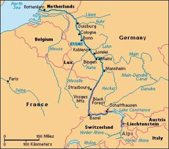
|
| The Rhine River |
What's at the summit is not a notch, however, it's a bowl. Out of this bowl flow the three main rivers of the eastern seaboard, the Hudson, Delaware, and the Susquehanna. The effect resembles what is said of Switzerland: The Rhine, the Rhone, Danube, and Po; They rise in the Alps, and away they go. The highway from Kingston runs along a creek which flows into the Hudson. At the top of the bowl are some nice dairy farms scattered along ten miles which drain into Delaware. The East Branch and the West Branch of the Delaware River are scarcely more than creeks at this point. At Delhi and Andes there is a further rise in the mountains, and then along twisting decline as you follow a branch of the Susquehanna down to its junction at Oneonta. As you cross the top of the ten-mile mesa you have perceived the answer to a natural question: how did those German families get across the big wide Delaware River that runs between Kingston on the Hudson -- and Cooperstown, where the Susquehanna begins? The answer is pretty evident. Delaware, while a mile wide at Philadelphia, narrows down to two little creeks on this mountain plateau. The Susquehanna system on one side and Hudson on the other have swallowed up the Delaware watershed between them. This might well have seemed a nice place for the German settlers to set up a few dairy farms, but it probably was an even more ideal place for the Iroquois to set up headquarters. Their favorite style of warfare was to occupy the high ground and make lightning raids (or quick escapes) on canoes down the various rivers starting from their origins. If it's of any interest, Charles Evans Hughes began his law practice in Delhi, and a lot of the town boys were killed at the battle of Antietam, thus illustrating the unwisdom of recruiting whole towns into regiments.
Down the mountain we go, into the broad Susquehanna valley. It was probably troublesome to manage wagons down a mountainside. But from here on the German families could stop walking, and float.
Bones in Duffy's Cut
THE Right Angle Club was recently honored by a talk by Professor William Watson, who teaches history at Immaculata University in Malvern, Pennsylvania. Although it is hard to find much memorial recognition of it, Immaculata is on the site of the Battle of the Clouds, of the Revolutionary War. Washington's army was retreating from the advancing British invaders from Elkton, Maryland, who were headed for the occupation of Philadelphia, in 1778. Although Washington had been outflanked at the biggest battle of the war at Brandywine Creek, he regrouped near Paoli and prepared to defend Philadelphia where the Continental Congress convened. A tremendous rainstorm, possibly a hurricane, hit the two armies as they formed for battle, and everyone's gunpowder was soaking wet. By mutual consent, the battle was called off. The Malvern area was also the site of the Paoli massacre, where General Anthony Wayne overestimated his understanding of the local area, and British troops attacked at night with orders to use bayonets, only.
|
| Duffy's Cut |
Professor Watson was, however, speaking about another massacre in the area, at Duffy's Cut. The Cut now belongs to Amtrak, but it was originally built in 1832, from Columbia on the Susquehanna River eastward, as the Philadelphia and Columbia RR, using horse-drawn rail carriages. That essentially means it went from Scotch-Irish Cumberland County, through the Pennsylvania Dutch territory, to Quaker Chester County and Federalist Episcopalian Philadelphia. The builders of the railroad contracted out mile-long sections of the construction to contractors, one of whom was Philip Duffy, who naturally imported southern Irish laborers to do the digging. As a sidelight, Duffy lived in Port Richmond, where he was buried, allegedly a very rich man. His work site was nearly 60 miles east of Columbia, the most expensive contract on the railroad because it involved more cutting and filling of the hilly countryside: Duffy's Cut.
|
| Duffy's Cut Marker |
Sanitary conditions at the dig site were probably pretty primitive, ideal for the spread of fecal-borne illnesses like cholera (and hepatitis, amoebic dysentery, Salmonella, and Shigella), which are characteristic of concentration camps, prison camps, army encampments, and the like. Many later epidemiologists now trace the introduction of cholera to Canada, with downward spread along the Susquehanna, but fifty years before Pasteur there was no sure way to make the diagnosis and no knowledge of its epidemiology. The Irish encampment at Duffy's Cut might just as well have died of bacillary dysentery, but it would have made little difference to know; they just died, and it was said to be cholera that did it. It was probably some kind of fecal contagion, but modern archaeology has recovered eight or ten skulls with bullet holes at the site, and historical investigation of the more usual type has recovered letters by President Clement of the Pennsylvania Railroad, ordering a cover-up. The rest of the story is necessarily conjectural, and we have to be uncertain whether Clement was concerned about hushing up cholera in the region, or ethnic riots, and if so whether he wanted to avoid scaring away replacement laborers, or avoid stirring up local antagonisms. Professor Watson describes considerable difficulty with getting cooperation from politicians and news media in pursuing his studies, where it is hard to see any non-railroad motive, except the motive of wanting to let sleeping dogs lie.
If so, it is a serious concern. It must be recalled that the Scotch-Irish of central Pennsylvania were located there as a result of the activities of James Logan, the agent of the Penn family. The Penns wanted to sell land to settlers and felt that fear of hostile Indians was inhibiting immigration. Logan, who was himself a Scot from Northern Ireland, suggested that the protestant Scotch Irish of that region were tired of combating their Catholic neighbors to the south, and were definitely the equal of the Indians in combativeness. This is the reason the Scotch Irish of Pennsylvania were located to the west of the German settlements of Dauphin and Lancaster Counties. It is also the cause of numerous clashes with the Indians (the Paxtang Boys), the Connecticut invaders of the three Pennamite Wars, and most notably -- the Irish Catholic Molly Maguires of the Pottsville region. Throughout all of these overtly military disputes ran the readily observable fact that the Scottish tribes were accustomed to guerrilla warfare in the woods. They mainly are responsible for winning the Revolutionary War, at least in the Appalachian regions stretching as far to the south as Georgia. They leave us a heritage of bagpipes, country music, very rough football, and airplane pilots. Unfortunately, rough behavior provokes rough behavior in return, and much of the unfortunate features of the labor conflicts of our national politics can be traced to the scars and antagonisms of the Molly Maguire episode of railroads and coal mining. This may or may not have been on Clement's mind when he tried to suppress the news of Duffy's Cut massacre, but it should have been, and to some extent it probably was.
There is no excuse for shooting people in the head or killing them with an ax. But the sixth or seventh generation descendants of the victims are urged to reflect that a campful of male laborers far away from home are apt to exhibit unfortunate behaviors. Remember that no one knew the cause of cholera, but it was new, and it certainly looked contagious. The laborers may or may not have brought it with them, but somebody introduced it to the region, and it looked as though the contagion would continue to spread as long as the laborers continued to be there. There might well have been some unfortunate economic incentives at work, like the disappearance of the Conestoga wagon industry among the Pennsylvania Dutch when the railroad came through. And the obvious concern of the railroad owners that the region has a peaceful, healthful, reputation. The almost total approval of slavery by the Pennsylvania Irish during the Civil War provoked Lincoln to send ten thousand troops to the area during the Civil War. And on, and on. There is almost no part of this region which does not have some remote history of savage behavior. Let's be careful not to stir it up.
American Chestnut Trees
|
| American Chestnut tree |
RECENTLY, John Wenderoth of the Tyler Arboretum visited the Right Angle Club of Philadelphia, bringing an astounding account of the triumph, near-extinction, and revival of the American Chestnut tree. The Tyler Arboretum, and this man, in particular, is at the center of the movement to rescue the tree, although the modern Johnny Appleseeds of the movement seem to be a Central Pennsylvanian named Bob Leffel, and a geneticist named Charles Burnham. Together, they had the vision and drive to enlist a thousand volunteers to plant seedlings in Pennsylvania; and there are many other volunteer groups in other states within Appalachia. About 45,000 Chestnut hybrids have been planted, surrounded by wire fencing to protect the new trees until they grow too tall for deer to reach the leaves. Here's the story.
In 1904 it was estimated that a fourth of all trees in the Eastern United States were American Chestnuts. The tree typically grew to eighty feet before permanent branches took over, so the shading and tall pillars of tree trunks gave the forest a particular cathedral-like distinctiveness, much celebrated by such authors as James Fennimore Cooper. The wood of the American Chestnut tree is rot-resistant, so it was favored by carpenters, log-cabin builders, and furniture makers. It once was a major source of tannin, for leather tanning. The nuts were edible, but it has been a long time since they were available for much eating. The chestnuts you see roasted by sidewalk vendors are primarily Chinese Chestnuts, which actually come to us from South Korea. The Buckeye, or horse chestnut, produces a pretty and abundant nut but is too bitter for most tastes. For whatever reason, a fungus was first discovered to infect the chestnuts of the Bronx Zoo in 1905, attracting the attention of Teddy Roosevelt and his Progressive naturalist friends, but to little avail. The fungus (Cryptomeria parasitic) enters the tree through cracks in the bark, flourishes in the part of the tree which is above ground, leaving the roots undisturbed. Ordinarily, when this sort of thing happens, the roots send up shoots which keep the tree alive and flourishing. Unfortunately, the abundant deer of this area quickly nipped off the shoots as they appeared, and finally, the trees died. It took only a decade or so for this combination of natural enemies to wipe out the species, and today it is unusual to see lumber from this source. The forests of Chestnuts have been replaced by other trees, mostly oaks. The Chinese chestnut, however, proved to be resistant to the fungus, even though it does not grow to the same height.

|
| Chinese Chestnuts |
After many futile but well-meaning efforts to save the trees by foresters, friends of the American Chestnut tree turned to geneticists. The goal was to transfer the fungus resistance gene from the Chinese Chestnut to a few surviving American Chestnuts. It took six or seven generations of cross-breeding to do it (four generations of seedlings, then crossing the crosses, then weeding out the undesirable offspring), but eventually, the Tyler Arboretum was supplying truckloads of seedlings to the volunteers to plant in likely places. It's going to take many years for the seedlings to grow in sufficient numbers to make an impact on our forests, and eventually on our carpenters, but that effort is underway with gusto. If anyone wants to volunteer to join this effort, there appears to be room for plenty more people to help.
Wyoming, Fair Wyoming Valley
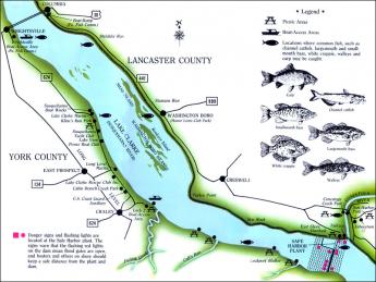
|
| Lake Clarke |
By 1750, or roughly ninety years after King Charles gave them their charter extending infinitely to the Pacific Ocean, the Connecticut Yankees with Old Testament first names had found their promised land was as disappointing as the King who promised it to them. So, two kings later, an exploratory party was sent west of the Hudson. The party returned with glowing tales of the Wyoming Valley in Northeastern Pennsylvania, just over the Blue Ridge Mountain. Only one white man had ever been there before them, Count Zinzendorf, the adventurous founder of the Moravian Sect.
|
| Iroquois |
The Wyoming Valley is certainly a jewel. It has comparatively mild weather as a result of being protected on all sides by mountains. The Susquehanna River runs through it, pinched by narrow valleys at both the top and the bottom, and filled with deep rich topsoil. In fact, it constitutes the remains of an ancient lake, whose Southern tip had broken through the Nanticoke Gap, draining the lake. It took another century or so to learn that underneath the topsoil was a thick deposit of anthracite coal. The Connecticut explorers were ecstatic about this little paradise in the mountains, and returned with news that it was everything the real estate promoters (The Susquehanna Company) wanted to hear. Indeed, the promotion of this valley almost got out of hand when news of it reached Europe at the start of the Romantic Period. Wyoming is what everybody wanted to hear about, the home of the noble savage. An epic poet named Thomas Campbell composed a long saga about Gertrude of Wyoming that caught the fancy of the Romanticists, with tales of Gertrude luxuriating on the ocean beaches of Pennsylvania, watching flocks of pink flamingos, and similar fancies, like Gertrude reading Shakespeare in the woods. In 1762 The Susquehanna Company sold six hundred shares to Connecticut adventurers, who were soon off to paradise.
The noble savages turned out to be Iroquois, who watched the new settlers on their land from behind neighboring trees. After a few months it became clear the white settlers intended to stay permanently in the valley, so one day the Indians emerged from the woods, and annihilated them.
Wyoming, Fair Wilkes Barre
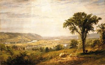
|
| Wyoming Valley |
There are a dozen or so places on the planet where a natural bowl formation famously moderates the climate. Cuernavaca in Mexico, the Canary Islands, and Chungking in Western China all claim to have temperatures which range from 70 to 75 degrees Fahrenheit, year-round. In Cuernavaca at least, they claim it only rains at night. These three places have a high plateau in the center of a mountain bowl, like an angel food cake pan, which may (or may not) contribute to the unusually mild climate effect. Several other places within inner China compete for the title of Shangri La, famous in song and story, never precisely located by tourists. The Wyoming Valley of the Susquehanna River once enjoyed a similar luster during the Romantic Period at the very beginning of the Nineteenth century, although unfortunately, its temperature is plainly not so balmy. Wyoming of song and poem was imagined to be the home of the Noble Savage, unstained by the wayward influences of civilization, and thus a model for the democratic ideal expected to emerge in Old Europe once the aristocrats were exterminated by nature's noblemen, European version. That seems to have been Robespierre in France, as disappointing to idealists as the Iroquois along the Susquehanna.
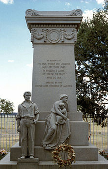
|
| Massacre Monument |
But one must not scoff. The Wyoming Valley was created long ago by a lake between two mountain ridges, which gradually dried up leaving flat topsoil deep at the bottom of the valley when the river finally broke through at Nanticoke and drained it. Its appearance is enhanced by surroundings in all directions of at least fifty miles of bleakness. Nowadays, the best way to appreciate the natural beauty of the place is to arrive from the south, gaining the summit of the ridge by one of the secondary roads. Housing development down below stops at the edge of the level plain, so as one ascends to the southern rim it is possible to see the inside of the bowl without seeing much of the town, and thus appreciate how it must have looked to frontiersmen searching for likely places to settle. It's quite beautiful. Descending into the bowl, the potholes in the road and roadhouses along the way to begin to make an impression. In full sight, it looks as though a city suburb has filled the place to its edge, with a rather decaying Nineteenth-century town center, but towering wooded mountainsides. There's a quiet park in the very center, through which the quiet river runs. In a little subdivision named Wyoming, there is a monument to The Massacre, now described as a hopeless defense by untrained Revolutionaries against the fearsome Indians and British Loyalists. The names of the fallen and the names of those who escaped are carved on this monument near Forty Fort. One presumes the wounded and some bystanders were massacred, the officers and trained infantry were more likely to escape the hopeless odds by fleeing into the woods. It is claimed that common soldiers were finished off by Indian Queen Esther smashing their heads between two flat rocks. Wounded officers were tortured to death.
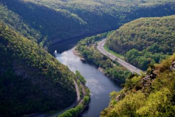
|
| Delaware Water Gap at Stroudsburg |
Just where the Connecticut immigrants, or invaders, first arrived in the Wyoming Valley is not known. Their most likely entrance was at the top of the northern end of the valley, where ski lodges now cluster, after coming up the mountains from the east. The hills rising from the Delaware watershed are wooded but too rocky for farming. It's therefore inexpensive to set aside parks named "Promised Land" and "The Lord's Valley" and such, with some Milford, scattered here and there in the woods. A section of the upper Delaware River fifty miles long, from Port Jervis down to the Delaware Water Gap at Stroudsburg is enclosed in a National Wildlife and Recreation Area of about a mile's width on either side of the river. It's surprising how little is said of this rather large national park close to two large metropolitan areas. No doubt the visitors are torn between wishing it was more appreciated, and hoping to keep it secret and unspoiled.
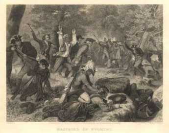
|
| Wyoming Massacre |
The Decision of Trenton(1782) simply gave the disputed land back to Pennsylvania. There is a strong presumption the Connecticut migrants were privately promised land in the Western Reserve, in Ohio, whenever Ohio became a state. In spite of the implicit guarantees, the Pennsylvanians nevertheless treated the usurpers pretty roughly, and traces of Connecticut trail westward toward the Ohio line. There's a Westmoreland County near Pittsburgh, where many stranded families in the bituminous coal regions can thus trace their ancestry back to the Mayflower. It is truly extraordinary that such bitterness could leave so little trace of itself later. History may not be bunk, but persistent grievances are surely a menace to a peaceful existence. The events of the Pennamite Wars are widely believed to have led to the slanting of the 1787 Constitution toward the protection of individual property rights, but the wording to that effect within the Constitution is hard to locate. Somehow, like the implicit promises of the Western Reserve, ways were found to provide credible promises that it soon wouldn't matter which state you lived in. Somehow the word got to John Marshall that in actual practice, what would matter was whether an identified person could demonstrate clear title to specific land back to, or a little beyond, 1787, no matter what state the land was in. And the obscurity of the complex connection between this revolution in the law of property, and the very sad events in the Wyoming Valley suited everybody concerned. Stare decisis.
Shale Fracking Arrives in Pennsylvania
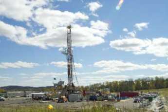
|
| Drilling for Gas |
As background for this story, let me say that I want to preserve the environment as much as anyone else. After considering the matter, it seemed to me that the largest contribution I could make to the "greening" effort would be to replace my home heating oil burner with a gas burner. That would improve my efficiency from 68% to 97% (or reduce the waste going up the chimney from 32% to 3%) of about 2600 gallons of fuel oil a year. The initial investment would be repaid in about three years, our dependence on imported oil would be reduced about as much as I could reduce it, and there was apparently a new abundant discovery of reliable gas production nearby. Compared with this, I barely use a tenth as much gasoline in my car, so potential savings in a hybrid car would seem trivial by comparison. And, sorry, I'm just not going to plant sedum on my roof, or dig water well through bedrock, or put a windmill in my front yard. Going to a gas furnace might be my big contribution to the environment, at least for the present.
It is, however, distressing to hear stories of gas wells poisoning water supplies, tearing up the roads, and destroying whole species of birds in their annual migrations. So, it was time to go look for me. My guide was an acquaintance of an acquaintance who lived in the midst of the gas region, a retired sergeant from the professional Army who had found the cost of living in the Endless Mountains was quite moderate, and just about everybody in the county was related to him or his wife. Mike will forgive me for saying he physically resembles Sergent Snorkel in the Beetle Baily cartoon but has the personality of everyone's favorite uncle. It's a three-hour drive into the Endless Mountains (that's really the name) in the center of the northern tier of Pennsylvania's counties. The big local town is Montrose, which has only one traffic light, only one police car, and only two policemen. It's really a charming little town, where nothing seems to have happened for excitement since the days of the Underground Railroad, whose headquarters still stands a block from the county courthouse. Montrose is the county seat of Susquehanna County. If this was the environment that gas fracking was going to destroy, that would be a pity.
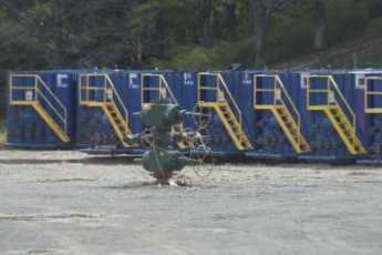
Except the people who live there don't think so at all. At first, the gas drillers came around and offered the farmers $25 an acre for drilling rights, but competition soon established they were worth closer to $1000. The conjecture is that Susquehanna County was singled out for early exploration because it is already crossed by the Tennessee pipeline, and thus the early gas discoveries could be quickly marketed. The full extent of the Marcellus Shale deposit is from Canada to Texas, although it may prove to be patchy, and its estimated content is greater than that of Arabia. Since there isn't much to talk about in Montrose except the deer hunting season, the drilling employees are a ready source of information about something local that is very big, very big indeed. The employees work 12-hour shifts, seven days a week for six weeks, and then have two weeks off. If that's too much for you, plenty of people can be imported from the Detroit area to drive trucks. There are essentially no hotels, so they live in rented rooms, and they like to talk to the locals.
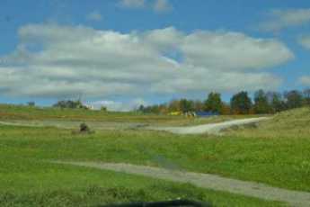
|
| Farmland |
It costs a million dollars to drill each well, and they finish it in three weeks. The work actually begins earlier, as a stone is quarried and crushed to construct a level platform. Then, glorified dumpsters on wheels are rolled to the site, the well goes up a hundred or more feet, and the sand, water, and secret chemicals are pumped seven thousand feet into the ground. Lateral drilling goes on at three thousand feet underground, and connections to neighboring wells go out at various levels. It a giant beehive of activity in the cornfield for three weeks, and then it's all over. The derrick comes down, the dumpsters are dragged away, the top of the well is capped. It takes about six months for the weeds to take over, and just about all that is left visible amounts to a rather large fire hydrant, sticking up ten feet in the woods or corn field. It is a considerable relief to hear that water injection ceases after the initial three weeks; visions of lakes and rivers drying up forever are not likely. The drilling companies are quite sensitive to the appearance they leave; as is sometimes said of good artisans, they are careful to leave a clean site when they leave. Yes, the heavy truck traffic breaks up roads, but mostly the roads were one-car wide and have been enlarged to all-weather two-lane roads by the drillers themselves, the local residents are quite proud of the improvement. In their eyes, the place looks a lot better. Since the region participates in the astonishing snowfalls for which Syracuse and other upstate New York cities are famous, there is a great deal of relief from the winter-long isolation caused by mounds of snow. As far as contaminated water is concerned, the water injected into the wells is trucked in from elsewhere in those wheeled dumpsters. As the technology evolves, the tendency now is to mix the sand and surfactants on the spot, when originally they were mixed off-site. Much of the used brine is pumped back out and evaporated on large plastic sheets, washed, and the residual sand is reused. Far from cutting corners, these drillers seem to be going to extremes to avoid complaints. And then, of course, there is the money they pay for drilling rights.
The most famous example of drilling royalties is known to every local, shown to every visitor. Owning 180 acres close to the pipeline, one widely-admired citizen is believed by everyone to be receiving $180,000 per month and will continue to receive it until the gas runs out. The rather large farmhouse could use a coat of paint, and as was made famously true in the play "Tobacco Road" the laundry is done on the porch and dried on a clothesline, also on the porch. The neighbors' joke that it has gone to his head because three new automobiles sit in the yard. One wisecrack was that he must have been playing the tuba on a day it rained gold. He, however, isn't a rarity, a great many neighbors for miles around are getting similar windfall payments. That seems to have two immediate consequences.
In the first place, it marshals local opinion strongly on the side of the drillers. One is not surprised to learn they hate taxes, favor depletion allowances, and generally take positions common in western Texas. One pert little hamlet in the valley has gone to court to insist on piped-in drinking water because methane gas bubbles out of their faucets. Just before an election, a local court granted that request in spite of learning that the water will cost $650,000 per house, more than most people would say the houses are worth. Local neighbors are far from sympathetic to this cause. They firmly believe the drilling company offered to solve the problem at far less cost by drilling wells with purification systems, but the lawyers advised their clients to hold out for bigger windfalls. It is widely believed by neighbors that gas has been bubbling out of well water in that region for a hundred years. If by any chance this legal action should kill the goose that laid this golden egg, these deer-hunting, gun-owning royalty recipients seem entirely capable of making an uncomfortable showing. Pennsylvania elects its judges, its legislators, and its congressmen. No doubt candidates for the November 2 election have been questioned for their views, and will learn the voters' views November 3rd.
|
| Montrose Courthouse |
The other response is just as expected as that one, and is called "The Dutch Disease" by economists. As these windfall enrichments seep out into the local community, the local economy will be upset just as the Dutch economy was upset by the discovery of oil and gas in the North Sea. Everyone would rather work for the drilling companies than for established local industries if indeed they see any sense in working at all. The clearest indication of what is coming is seen on a large sign attached to an old storefront: "Investment Advice Offered". It takes a long time to learn that the main difference between a good investment and a bad one is the hidden fees you pay. Not market timing, not stock picking, not diversification, not hot tips. Fees, charged by your new best friend, are the thing. So, here are two pieces of advice: investment management in size is worth 40 basis points or four-tenths of a percent; that's it and that's all. And the second piece of advice comes from your Pennsylvania grandmother: don't marry the first man who asks you.
And what are the rest of us to make of this shale gas thing? Well, I've already installed a new gas furnace in my house, the supply of gas seems assured enough for twenty years. Any politician who tried to tax this windfall out of existence will soon see what the political realities are. The environmental realities are quite favorable; once the drillers have stopped injecting water and taken down the equipment, there's not much to see except a ten-foot fire hydrant surrounded by weeds. All the connections are buried underground, leading to terminals many miles away. At first, the drillers may feel they need to post some guards, but it surely won't be necessary. The locals are convinced, and the environmentalists only need to drive up on a weekend and see for themselves.
Azilum: French Asylum on the Susquehanna
Off with their heads!, she said. They have refused my cake in preference of moldy bread, by God"
Bloomsburg / Danville
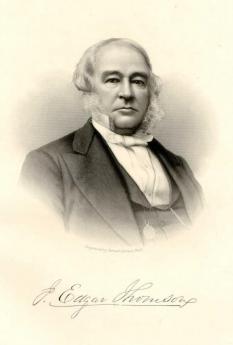
|
| J. Edgar Thomson |
The North Branch of the Susquehanna winds its way through the mountains of central Pennsylvania, particularly from Wilkes Barre to Danville. The zig-zag course of the river is confusing, with long stretches of westward flow reversing the long eastward flow between Binghamton and Sayre, between which are long stretches due south. At Danville, the river makes its final sharp turn and then begins a straight southern chute toward Harrisburg. The discovery of iron ore between Bloomsburg and Danville was just in time for the advancing railroads of J. Edgar Thomson, and the Iron King of the area was George Geisinger, whose widow Abigail founded the hospital of that name where the Geisinger Clinic now flourishes. As iron and steel moved west to the Pittsburgh region, the Geisinger Clinic now pretty much dominates the area, like a self-contained ocean liner at sea.
Around 1850, the county seat was moved to Bloomsburg, causing the irritated citizens of Danville to break tiny Montour County off from Columbia County, and making Danville at least the county seat of some county. Whatever else it does, this split-off stimulated a vigorous football rivalry between the two otherwise fairly friendly towns.
At the moment, the shale-gas bonanza is somewhat distant from this region. But it is fairly clear that legislative actions about extractive industries are just as closely watched as geological ones, for signs of a coming gold rush, or possibly tax rush.
At nearby Elysburg, the Knoebels Grove Amusement park provides an interesting footnote to a dramatic Pennsylvania development of 19th Century amusement parks. There are probably more surviving examples of this entertainment center in Pennsylvania than in the other 49 states, and Knoebels Grove founded in 1926 claims to be among the largest. Whether that so depends on the system of measurement employed, but Knoebels Grove is clearly unique in not charging an overall entrance fee. As well as being the home of the annual Fisher Family reunion, where in August State Policemen can be found directing traffic among the various family branches. For unexplained reasons, the members of this far-flung family bear a comparatively little physical resemblance to each other but claim to be descended from one Sebastian Fisher, who arrived around 1697 by way of New York. Sebastian had fourteen children, and most of them had similar numbers, so mathematics soon puts an end to most ancestral arguments around the picnic tables.
34 Blogs
Appalachian Geography
To have an opinion about Central Pennsylvania requires an overview from the Great Lakes to the Chesapeake Bay.
Headwaters of the Middle Atlantic Rivers
The three main rivers of the Mid-Atlantic states, the Hudson, Delaware and Susquehanna Rivers, share a comparatively small watershed.
Wellsboro: Grand Canyon
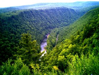 Wellsboro was a local center for lumbering in 1890, has declined with the lumber business, and is now the center of revival for the northern section of central Pennsylvania.
Cornell, For the Birds
The Cornell Ornithological Center may not be the largest institution devoted to birds, but it certainly looks as though it might be.
La Cosa Nostra Has an Apalachin Outing
For many years it was widely denied by many, including J. Edgar Hoover, that there was such a thing as organized crime. And then, on November 14, 1957, the State Police stumbled on their national convention in Apalachin, NY.
Marcellus, Where Shale Gas Comes From
The Marcellus shale formation stretches from Canada to Texas, mostly 5 thousand feet underground. But at Marcellus NY, you can really see it, pick it up, and take it home.
Marcellus Shale Gas: Good Thing or Bad?
There's a gold rush, in gas not gold, in Pennsylvania. What are the unintended consequences?
Great Bend: Joseph Smith Translates the Golden Plates
Joseph Smith announced he discovered the Golden Plates of Mormonism near Palmyra, NY. He spent three years translating them at his wife's home in Great Bend, Pennsylvania.
Harvard Men Suggest a Cold Place for Yale
The northeast corner of Pennsylvania was once covered by a glacier.
Sayre / Athens
The Susquehanna running due west, takes an abrupt turn south at Sayre, right on the Pennsylvania/New York border.
Star-Gazing in Cherry Valley
 Central Pennsylvania has one of the only two or three open-air astronomy centers in America, and it's great family entertainment. But check your almanac; a full moon makes it hard to see stars.
Stephen Foster, Susquehanna Schoolboy
Stephen Foster, often thought of as impoverished, was sent to boarding schools in Towanda and Athens, PA.
Wilkes-Barre, Site of the Wyoming Massacre
Wilkes-Barre has certainly seen better days, but if you speed by without knowing its past, you are missing a lot.
Boalsburg
 Eight generations of the Boal family have lived in the house in Boalsburg, where you can see five signatures of Presidents of the United States, and the personal possessions of -- you heard me -- Christopher Columbus.
Molly Maguires of Pennsylvania (1)
The main features of the Molly Maguires of Pennsylvania can be found in the Molly Maguires of Ireland, and perhaps far earlier than that.
Molly Maguires of Pennsylvania (2)
Almost everything the Molly Maguires said about their ruthless enemy the mine owner was accurate. Unfortunately, much of what he said about them was also accurate. And both sides said things that were pure fabrications.
Monocacy Creek and Monocacy River
 An ancient Shawnee Indian word causes confusion along the Blue Mountain.
Joseph Priestley of Northumberland, PA
If asked to name the residence of Joseph Priestley, the Father of Modern Chemistry, most people would not think of Northumberland, PA.
Joseph Priestley, Shaker and Mover
The father of the science of chemistry was also the founder of the Unitarian Church in America.
Mauch Chunk, Jim Thorpe, and All That
Pennsylvania's Switzerland was founded on the anthracite business and died when it did. The Jim Thorpe business is an embarrassment, but a sign of revival.
Dingman's Ferry, Below Port Jervis
The northeastern corner of Pennsylvania has a deep gorge for the Delaware River. Just south of it, the river narrows to a crossing at Dingman's Ferry, now occupied by Dingman's Bridge.
Delaware Water Gap
Somehow, we all got tired of the Delaware Water Gap and forgot it was there. It's one of the great scenic places in America.
James Buchanan: The President from Lancaster
Historians rank Buchanan as our worst President. Since he is Pennsylvania's only President, let's see how we might defend his reputation.
Gettysburg
 The strategy of both sides in the Battle of Gettysburg was shaped by the type of weapons in use.
Mennonites: The Pennsylvania Swiss
Mennonite Pennsylvania Dutchmen actually came here from Switzerland. The book of their religious martyrs is more than a foot thick since they practice non-resistance, a belief significantly more pacifist than non-violence. Nevertheless, they prosper abundantly in Montgomery County.
Three-Mile Island
An ominous-looking nuclear energy plant developed some sort of difficulty, a few miles from the State Capital of Harrisburg. The direct effects were minor, but the political and psychological ones have endured for half a century.
Central Pennsylvania Settlers Before 1700
When German-speaking religious sects migrated into the "Pennsylvania Dutch" area around 1730, they found German Lutherans had been living there for nearly fifty years.
Bones in Duffy's Cut
They are digging up bones in Malvern, finding evidence of murder. Some people are uneasy about perpetuating ethnic strife.
American Chestnut Trees
Scarcely a century ago, American Chestnut trees were a quarter of all trees in America. Now, they are almost all gone, but a thousand volunteers are trying to rescue them.
Wyoming, Fair Wyoming Valley
Even the present residents of Wilkes-Barre PA would have to giggle at descriptions of the Wyoming Valley written by poets during the Romantic Era. This is where the noble savage originally came from.
Wyoming, Fair Wilkes Barre
The city of Wilkes Barre pretty well fills up the Wyoming Valley, transforming a once famous agricultural paradise into a crowded suburb.
Shale Fracking Arrives in Pennsylvania
Drilling for gas has started in upstate Pennsylvania. It's time to go look at it.
Azilum: French Asylum on the Susquehanna
The French Revolution and the slave revolt in Haiti created the need for a French-speaking refuge for fleeing aristocrats, and some francophile Philadelphians organized one, including a futile effort to rescue Marie Antoinette.
Bloomsburg / Danville
Bends in the North Branch of the Susquehanna River created islands and mud flats suitable for farming in the Endless Mountains, but deposits of iron ore were the cause of industrialization at Bloomsburg and Danville.