2 Volumes
Tourist Trips: Philadelphia and the Quaker Colonies
The states of Pennsylvania, Delaware, and New Jersey all belonged to William Penn the Quaker in one way or another. New Jersey was first, Delaware the last. Penn was the largest private landholder in American history.
Regional Overview: The Sights of the City, Loosely Defined
Philadelphia,defined here as the Quaker region of three formerly Quaker states, contains an astonishing number of interesting places to visit. Three centuries of history leave their marks everywhere. Begin by understanding that William Penn was the largest private landholder in history, and he owned all of it.
Sights to See: The Outer Ring
There are many interesting places to visit in the exurban ring beyond Philadelphia, linked to the city by history rather than commerce.
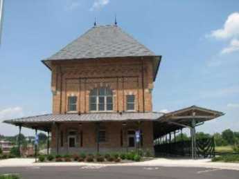
Brandywine Museum
 |
| Wyeth Ann's House |
Artistic talent must be inherited; some of us don't have any at all, while other families seem to have unusual talent in every member. Around Philadelphia, one notable example is the Peale family, and another is the Wyeth clan. Three generations of Wyeth's show their work as a group in a former Brandywine Creek grist mill which has been elaborately restored and enlarged for the purpose. Using large glass windows, part of the display is the Brandywine Creek itself, with the high banks that once made it seem like a perfect defense line for George Washington in the biggest battle of the Revolutionary War. Outside the museum entrance are several of those inevitable Delaware tip-offs, large millstones that may in this case have ground grist, but often were used to grind gunpowder.
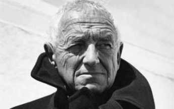 |
| Andrew Wyeth |
Andrew Wyeth spent much of his early career doing watercolors and then turned to tempera as re-popularized by N.C. Wyeth, his father. That's a fairly drastic change, since a watercolor must be completed in one sitting before it dries. Oil base paint dries slowly and allows the painter to work on a piece for a number of days. Tempera, using the protein in milk and eggs to hold the pigment, dries hard and fairly quickly. But another layer of tempera can be painted on top of the hardened base layers, making a glowing effect possible, a peculiar luminosity if the artist chooses to bring it out. Andrew Wyeth migrated to what he called dry-brush, where the paint on the brush is mostly squeezed out, so extremely detailed fine lines can be painted. Thus, he spent his early years with fast blurred watercolors, and the rest of his life with meticulous slow painting, where detail is everything. He chose to use this technique to produce a haunting silent scene, even if it contained people. His son, Jamie, tends to emphasize dancers so you can see the typical family rebellions alternating between generations, at the same time that the Wyeth's (and Howard Pyle, the artistic forefather) preserve strong family unity. From what the neighbors say, there were plenty of family clashes, but that's artists for you.
Bristol, PA
|
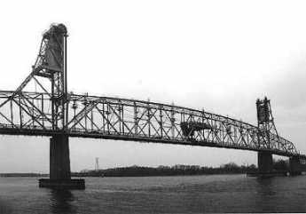
| Burlington Bristol Bridge |
In 1681, Samuel Clift activated a local land conveyance, written to go into effect as soon as King Charles II signed the overall land grant to William Penn. In this way, Bristol claims to be the oldest settlement in English Pennsylvania; Clift got here before Penn did. He chose the narrowest spot in the river as an excellent place to run a ferry which was only replaced by the Burlington Bristol Bridge in 1930. A ferry landing is an excellent place for an Inn, which he also built there. The town he founded was called Buckingham, and the surrounding county became Buckinghamshire, Bucks for short. The name later changed to Bristol. The New Jersey town on the other end of the ferry ride was called Bridlington, later Burlington. North of this narrow spot in the river was a several-mile extent of marsh and swampy inlets, and then the river turns abruptly northwest at what used to be called the falls at Trenton.
William Penn had considered building his house sixty miles south of there at the Southern end of Philadelphia Bay, at Chester, then pondered building it on the Faire Mount where the Philadelphia Art Museum now overlooks the Schuylkill. In the end, he built a Philadelphia house near Dock Creek (subsequently covered over and renamed Dock Street) and a palatial manor house, Pennsbury, in the swampy marshes above Bristol, where a tourist visit is now a valuable experience.
|
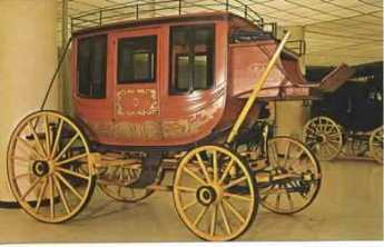
| Stagecoach |
No doubt being near the Proprietor's estate gave Bristol some class, but it was also half-way on a two-day stagecoach ride from Philadelphia to New York. A succession of inns and resorts grew up in Bristol, and it became a busy transshipment place, a good place to build schooners. A local Captain John Cleve Green is celebrated as first to carry the American flag to China, although it must be admitted his cargo included opium; Green is regarded as the financial founder of the nearby Lawrenceville School. The terminus of the Delaware canal brought coal from the anthracite region in 1827; more prosperity ensued as coal was loaded on ships in Delaware, or utilized instead of water power for the Bristol Mills which had been founded by Samuel Carpenter in 1701. John Fitch invented the first steamboat and tried it out here; more prosperity ensued, although not for poor Fitch, who committed suicide. Little Bristol gradually filled up with imposing waterfront mansions, the declining shells of which can still be admired.
|
| Bristol Railroad |
The advent of the railroad isolated Bristol when it cut off the corner of the bend in the Delaware River. Four-lane highways eventually consolidated the isolation of the little river town, but the turning point was around the time of the Civil War. For nearly a century, between the Revolution and the Civil War, Bristol was the booming little queen of northern Philadelphia Bay, and the Bay itself was an American Lake Como, lined with Federalist and Victorian mansions, their lawns sweeping down to the water's edge. Small wonder there was so much social interaction between the railroad-isolated Bristol, and planters of Chesapeake Bay. The strip of quiet charm begins at Pennsbury Manor and pretty continuously extends to Bristol, where you can go under the rail embankment and on to Philadelphia, or alternatively cross the Burlington Bristol Bridge to New Jersey. A couple of miles further south, the river edge is a little ragged but includes some yacht clubs and several famous mansions, notably Nicholas Biddle's Andalusia, the Foerderer family's Glen Ford, and the former mansion of Saint Katherine Drexel.
The Bristol area has had moments of fame. George Washington had originally planned to attack Trenton from both the north and the south simultaneously. He came over what is now called Washington's Crossing amid the ice floes on the north side of the Pennsbury delta, and General Cadwalader was to cross Delaware at Bristol, on the south side of the marshes. As it turned out, the ice was worse at Bristol and the river wider, so Cadwalader was late for Trenton but caught up with Washington to help with the battle at Princeton. President Tyler's daughter married a dashing gentleman from Bristol. Republican politicians from Bristol teamed up with some others in West Chester to decide that favorite-son Seward couldn't win, so they backed Abraham Lincoln for the presidential nomination, and Pennsylvania was therefore in time richly rewarded for its political acumen. Despite the arts and crafts group that moved in around New Hope PA, Bucks County has remained a Republican stronghold ever since. The region's influence was long symbolized by Joseph P. Grundy, the gentle Quaker manufacturer from Bristol whose name struck terror in Republican politicians as well as Democrat ones, but for opposite reasons.
The Burlington Bristol Bridge is now getting a little narrow and ancient, but is still serviceable. It long charged only a dime's toll because that was enough for painting and upkeep. Together with the Tacony Palmyra Bridge, which charged the same low toll, these locally owned bridges stuck a thumb in the eye of the tax-and-spend folks who owned the Philadelphia bridges and who wanted to charge three dollars toll, spending most of it on non-bridge activities. As Tacony Palmyra Bridge rests on both sides of the river, the local politics gradually shifted enough to permit a restoration of toll "equity".
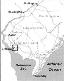
British Headquarters: Perth Amboy, New Jersey, in its 1776 Heyday (B 608)
Not many now think of the town of Perth Amboy as part of Philadelphia's history or culture, but it certainly was so in colonial times. Sadly, the town has since declined to a condition of a quiet middle-class suburb. There are quite a few Spanish-language signs around and some decaying factories. The little house of the Proprietors on the town square and the remains of the Governor's mansion overlooking the ocean are about all that remain of the early Quaker era.
|
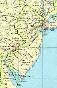
| NJ MAP |
To understand the strategic importance of Perth Amboy to Colonial America, remember that James, Duke of York (eventually to become King James the Second) thought of New Jersey as the land between them North (Hudson) River, and the South (Delaware) River. This region has a narrow pinched waist in the middle. It's easy to see why the land-speculating Seventeenth Century regarded the bridging strip across the New Jersey "narrows" as a likely future site of important political and commercial development. The two large and dissimilar land masses which adjoin this strip -- sandy South Jersey, and mountainous North Jersey -- was sparsely inhabited and largely ignored in colonial times. The British in 1776 developed the quite sensible plan that subduing this fertile New Jersey strip would simultaneously enable the conquest of both New York and Philadelphia at the two ends of it. It was a clever plan; it might have subjugated three colonies at once.
|
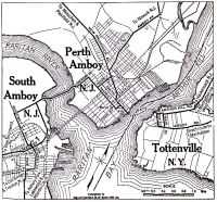
| PERTH AMBOY MAP |
Perth Amboy is a composite name, adding a local Indian word to a Scottish one because East Jersey had been intended for Scottish Quakers. Like Pittsburgh at the conjunction of three rivers, Perth Amboy's geographical importance was that it dominated the mouth of Raritan Bay (Raritan River, extended) as it emptied into New York Bay just inside Sandy Hook. Two of the three "rivers" of the three-way fork are really just channels around Staten Island. Viewed from the sea, Perth Amboy sits on a bluff, commanding that junction. Amboy became the original ocean port in the area, although it was soon overtaken by New Brunswick further inland when increasing commerce required safer harbors. Perth Amboy was the capital of East Jersey, and then the first capital of all New Jersey after East and West were joined in 1704 by Queen Anne. The Royal Governor's mansion stood here, as well as grand houses of Proprietors and Judges overlooking the banks of the bay. The main reason for the Nineteenth-century decline of the state capital region was the narrowness of the New Jersey waist at that point; its main geographical advantage became a curse. Canals, railroads and astounding highway growth simply crowded the Amboy promontory into an unsupportable state of isolation. The same thing can be said of Bristol, Pennsylvania, and New Castle, Delaware, but local civic pride has somehow not risen to the challenge to the same degree.
Pirate Lair

|
| Jolly Roger Flag |
Delaware takes a ninety-degree turn right at about the place where the Salem nuclear cooling towers are visible on the Jersey shore, and great quantities of silt have piled up in the river there, making marshes and swamps. There is a rumor that Captain Kidd tied up among these marshy islands, and much better evidence that Blackbeard the Pirate used the Delaware marshes as a hideout. Since a high-speed highway, with limited access, now rushes visitors to the slot machines of Dover and the beaches of Lewes, no one much notices that this area hasn't changed much from what it probably looked like three hundred years ago.
But if you take the old road, Delaware Route 9, you wander through the backcountry and are only likely to meet duck hunters. At one point, with a lake to one side and the river on the other, a watchtower has been erected for bird watchers and the like. It's very beautiful there, and quiet.
So one day I drove up, parked my car at the base of the tower, and climbed a hundred steps to the top. Blackbeard was not in evidence, but it was easy to see how he might feel pretty secluded in the coves and behind the trees. There were lots and lots of birds, interesting enough but mostly unidentifiable by me. Like most big-city lovers of the environment, I mostly classify birds as little brown jobs (LBJ) and big black buggers (BBB). And then a car drove up, with some chattering teenagers.
|
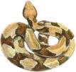
| Copperhead |
From a hundred feet up, it was hard to tell what they were saying, and it probably didn't matter much. Until suddenly one of the girls screeched out, "Oh look! There's a big snake under that man's car! "
One of the boys in the car shouted out, "That's a copperhead snake! I've never seen one so big!"
And so, they roared off into the distance, leaving the marshy paradise to me and the snake. What do I do now?
I waited, hoping the snake would go away. But it started to get dark, and now it was even more unattractive to chase around with snakes. So, creeping to the bottom of the stairs, I made a dash for the car door, jumped in, and slammed it tight.
As I drove away, I could not see any snake on the ground under the place where I had parked. To this day, I don't know if there really was a snake there or not.
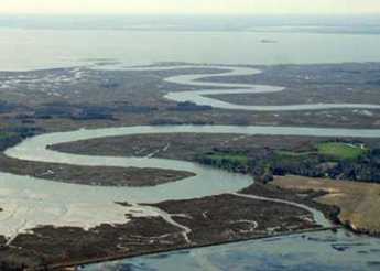
Greenwich, Where?
 |
| Greenwich NJ |
If you sail north up the Delaware Bay, you would go past Rehoboth, Lewes, Dover, New Castle, Wilmington -- on the left, or Delaware side. On the right, or New Jersey side, it's a long way from Cape May to Salem, the first town of any consequence. That is, the Jersey side of the riverbank is still comparatively uninhabited. When the first settlers came along, with vast areas to choose among, it might have seemed attractive to settle on the Delaware side, because the peninsular nature of what is now called Delmarva (Del-Mar-Va) would provide land access to two large navigable bays, the Delaware, and the Chesapeake. To go all the way up the Delaware to what is now Pennsylvania would give trading access to a whole continent, so that eventually proved to be where immigration was headed. But as a matter of fact, the marshy Jersey shore seemed more attractive for settlement by the earlier settlers.
A settler has to think about starving the first year or two, because trees have to be cut down, and stumps pulled up before the land can even be plowed. After that, comes planting and growing, then finally harvesting. Trees, behind which Indians can hide, are a bad thing all around in the eyes of a settler. The flat swampy meadows of the Jersey bank were just exactly what the Dutch knew how to manage. Dam up the creeks and drain the ground, and you will soon have lots of lands ready for the plow, without any confounded trees. By the end of the seventeenth century, the English who had made the mistake of settling in rocky Connecticut finally saw what the Dutch were able to do, and came down to take it away from them.
 |
| Greenwich scenery |
That's why there is a Salem, New Jersey, and also a Greenwich, New Jersey. Greenwich ( around here they pronounce it green-witch) had 870 residents at the last census. It is one of the cutest little colonial villages you are likely to encounter. The local historians refer to it as an unreconstructed Williamsburg, drawing prideful attention to the fact that these houses were really built in the colonial period, and are in no way imitation reconstructions. The isolated charm of this place is in large part due to being surrounded by a maze of wandering creeks, so visitors by land travel don't get there in time for lunch unless they take great care to follow a local road map. If you arrive by water, it's no problem; just navigate up the crooked and twisting Cohansey River.
Although pioneer settlement was much earlier, the oldest house still standing in that rather damp area was built in 1730. Things are pretty much the way they were before the American Revolution because the Calvinists who settled here were not prepared for the Jersey mosquito, which obviously is abundant in such a marshy area. With the mosquito comes relapsing (Vivax, malaria, black water (Falciparum) malaria, and Dengue Fever (graphically known locally as break-bone fever). As a matter of fact, encephalitis is also mosquito-borne. When you don't understand the insect carrier situation, survival in such an environment depends on local fables and lore, like going to the mountains for the summer after the planting season, and only returning at harvest time. That sounds to a New Englander newcomer like a superstitious cloak for lazy living, especially since masses of fish come up the river in teeming waves, looking for mosquitoes to eat. So, Greenwich is charming, but it never was thriving.
Working hard to find something to say about the town, it would appear that Paul Revere himself came riding into Greenwich in December 1774, urging the town to join their Boston relatives in the destruction of tea belonging to the British East India Company. Greenwich accordingly had a public tea burning on December 22. Since the more notorious Boston tea party took place on December 16, 1773, and the British Tea Act was passed in May, 1773, it is not exactly accurate to say the rebellion spread like wildfire. One has to suppose that the inflammatory tale told to the local farmers by Paul Revere was likely a little enhanced, since a careful recounting of the events in Boston suggests a number of ways the uproar might have been avoided if Samuel Adams and his friends had been less provocative. Or if Massachusetts Royal Governor Thomas Hutchinson had been less flighty. Or for that matter, if Benjamin Franklin had restrained himself when he got hold of Hutchinson's letters at a critical moment when he was in London. In retrospect, the best model for behavior was provided by the Royal Navy; the whole Boston Tea Party was surrounded by armed British naval vessels, who did not lift a finger throughout the demonstration.
Anyway, little Greenwich had its minute of fame with a tea burning. Otherwise, it has had a very quiet existence for three centuries.
REFERENCES
| Paul Revere & The World He Lived In | Amazon |
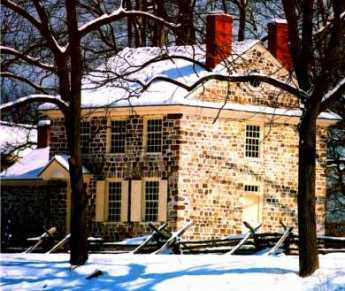
Washington Lurks in Bucks County, Waiting for Howe to Make a Move
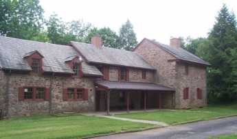
|
| Moland House |
Although Bucks County, Pennsylvania, is staunchly Republican, it has been home to Broadway playwrights for decades; this handful of Democrats have long been referred to as lions in a den of Daniels. One of them really ought to make a comic play out of the two weeks in August 1777, when John Moland's house in Warwick Township was the headquarters of the Continental Army.
John Moland died in 1762, but his personality hovered over his house for many years. He was a lawyer, trained at the Inner Temple and thus one of the few lawyers in American who had gone to law school. He is best known today as the mentor for John Dickinson, the author of the Articles of Confederation. Our playwright might note that Dickinson played a strong role in the Declaration of Independence, but then refused to sign it. Moland, for his part, stipulated in his will that his wife would be the life tenant of his house, provided -- that she never speak to his eldest son.
Enter George Washington on horseback, dithering about the plans of the Howe brothers, accompanied by seven generals of fame, and twenty-six mounted bodyguards. Mrs. Moland made him sleep on the floor with the rest.
Enter a messenger; Lord Howe's fleet had been sighted off Patuxent, Maryland. Washington declared it was a feint, and Howe would soon turn around and join Burgoyne on the Hudson River. Washington had his usual bottle of Madeira with supper.
A court-martial was held for "Light Horse Harry" Lee, for cowardice. Lee was exonerated.
Kasimir Pulaski made himself known to the General, offering a letter of introduction from Benjamin Franklin, which letters Franklin noted had been requested by Pulaski himself. As it turned out, Pulaski subsequently distinguished himself as the father of the American cavalry and was killed at the Battle of Savannah.
|
| Lafayette |
And then a 19 year-old French aristocrat, the Marquis de Lafayette, made an appearance. Unable to speak a word of English, he nevertheless made it clear that he expected to be made a Major General in spite of having zero battlefield experience. He presented a letter from Silas Deane, in spite of Washington having complained he was tired of Ambassadors in Paris sending a stream of unqualified fortune hunters to pester the fighting army. Deane did, however, manage to make it clear that the Marquis had two unusually strong military credentials. He was immensely rich, and he was a dancing partner, ahem, of Marie Antoinette.
In Mrs. Moland's parlor, Washington sat down with Lafayette to tap-dance around his new diplomatic problem. It was clear America needed France as an ally, and particularly needed money to buy supplies. But it was also clearly impossible to take a regiment away from some American general, a veteran of real fighting, and give that regiment to a Frenchman who could not speak English and who admitted he had no military experience. Fumbling around, Washington offered him the title of Major General, but without any soldiers under his command, at least until later when his English improved. To sweeten it a little, Washington seems to have said something to the effect that Lafayette should think of Washington as talking to him as if he were his father. There, that should do it.
It seems just barely possible that Lafayette misunderstood the words. At any rate, he promptly wrote everybody he knew -- and he knew lots of important people -- that he was the adopted son of George Washington.
Well, Broadway, you take it from there. At about that moment, another messenger arrived, announcing Lord Howe at this moment was unloading troops at Elkton, Maryland. General Howe might have been able to present his credentials to Moland House in person, except that his horses were nearly crippled from spending three weeks in the hold of a ship and needed time to recover. Heavy rains were coming.
(Exunt Omnes).
Suggested Stage Manager: Warren Williams
Delaware's Court of Chancery
 |
| Chancery |
Georgetown, Delaware is a pretty small town, but it's the county seat so it has a courthouse on the town square, with little roads running off in several directions. The courthouse is surprisingly large and imposing, even more, surprising when you wander through cornfields for miles before you suddenly come upon it. The county seat of most counties has a few stores and amenities, but on one occasion I hunted for a barbershop and couldn't find one in Georgetown. This little town square is just about the last place you would expect to run into Sidney Pottier and all the top executives of Walt Disney. But they were there, all right, because this was where the Delaware Court of Chancery meets; the high and mighty of Hollywood's most exalted firm were having a public squabble.
Only a few states still have a court of Chancery, but little Delaware still has a lot of features resembling the original thirteen colonies in colonial times. The state abolished the whipping post only a few decades ago, but they still have a chancellor. The Chancellor is the state's highest legal officer, and four other judges now need to share his workload, which was almost completely within his sole discretion seventy-five years ago. In fact, the Chancellor usually heard arguments in his own chambers, later writing out his decisions in longhand. The Court of Chancery does not use juries.
Going back to Roman times, the Chancellor was the highest office under the Emperor, and in England, the Lord Chancellor is still the head of the bar in a meaningful way. Sir Francis Bacon was the most distinguished British Chancellor and gave the present shape to a great deal of the present legal system. A court of Chancery is concerned with the legal concept of equity, which is a sense of fairness concerning undeniable problems which do not exactly fit any particular law. The Chancellor is the "Keeper of the King's conscience" concerning obvious wrongs that have no readily obvious remedy. You better be pretty careful who gets appointed to a position like that, with no rules to follow, no supervisor, no jury, dealing with mysterious issues that have no acknowledged solution.
 |
| George Read |
Delaware's Court of Chancery evolved in steps, with several changes of the state Constitution over a span of two hundred years. As you might guess, a few powerful chancellors shaped the evolution of the job. Going way back to 1792, Delaware changed its Supreme Court from the design of its Constitution, and George Read was the new Chief Justice. However, it was all a little embarrassing for William Killen, who had been the Chief Justice, getting a little old. Read refused to have Killen dumped, and in this he was joined by John Dickinson, who had been Killen's law clerk. So Killen was made Chancellor, and a court of Chancery was invented to keep him busy.
Under a new 1831 Constitution, the formation of corporations required individual enabling acts by the Legislature and limited their existence to twenty years. However, the 1897 Constitution relaxed those requirements and permitted entities to incorporate under a general corporation law and allowed them to be perpetual. By this time, other states were distributing equity cases to the county level, but Delaware was too small to justify more than a single state-wide Court. That court was attractive to corporations because it could become specialized in corporate matters, but retained a pleasing number of equity cases among common citizens, thus retaining a folksy point of view. In unique situations or those without a significant history of public debate, it was thought especially desirable to strive for unchallenged acceptance of the court's decision.
But other states thought they could see what Delaware was up to. In 1899 the American Law Review contained the view that states were having a race to the bottom, and Delaware was "a little community of truck farmers and clam-diggers . . . determined to get her little, tiny, sweet, round baby hand into the grab-bag of sweet things before it is too late." However, that may be, corporations stampeded to incorporate in the State of Delaware, and the equity of their affairs was decided by the Chancellor of that state. In one seventeen year period of time, the U.S. Supreme Court reversed the decision of the Chancellor only once.
 Chancery's jurisdiction was complementary to that of the courts of common law. It sought to do justice in cases for which there was no adequate remedy at common law.  |
| A. H. Manchester Modern Legal History of England and Wales, 1750-1950 (1980) |
Some legal scholar will have to tell us if it is so, but the direction and moral tone of America's largest industries has apparently been shaped by a small fraternity or perhaps priesthood of tightly related legal families, grimly devoted to their lonely task in rural isolation. The great mover and shaker of the Chancery was Josiah O. Wolcott (1921-1938), the son and father of a three-generation family domination of the court. Most of the other members of the court have very familiar Delaware names, although that is admittedly a common situation in Delaware, especially south of the canal. The peninsula has always been fairly isolated; there are people still alive who can remember when the first highway was built, opening up the region to outsiders. Read the following Chancelleries quotation for a sense of the underlying attitude:
"The majority thus have the power in their hands to impose their will upon the minority in a matter of very vital concern to them. That the source of this power is found in a statute, supplies no reason for clothing it with a superior sanctity, or vesting it with the attributes of tyranny. When the power is sought to be used, therefore, it is competent for anyone who conceives himself aggrieved thereby to invoke the processes of a court of equity for protection against its oppressive exercise. When examined by such a court, if it should appear that the power is used in such a way that it violates any of those fundamental principles which it is the special province of equity to assert and protect, its restraining processes will unhesitatingly issue."
That is a very reassuring viewpoint only when it issues from a person of totally unquestioned integrity, a member of a family that has lived and died in the service of the highest principles of equity and fairness. But to recent graduates of business administration courses in far-off urban centers of greed and striving, it surely sounds quaint and sappy. And many of that sort have found themselves pleading in Georgetown. Just let one of them a bribe, muscle, or sneak into the Chancellor's chair someday, and the country is in peril.
Disorderly Retreat: From Trenton Back to Perth Amboy
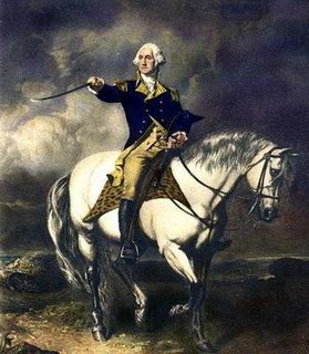
|
| George Washington on a Horse |
A week later, they got a bad jolt; Washington declined to play by their winter rules. At the Battle of Trenton, Washington was 44 years old, six feet four inches tall or more, a horseman and athlete of outstanding skill, and as the husband of the richest woman in Virginia, accustomed to housing, feeding, transporting and getting cooperation from two hundred slaves. All of those qualities may have been of some use in the battle. But after the Battle of Trenton, Washington also emerged as a remarkably bold and creative General. In the Battle of Trenton ca-----------------999999 seen the elements of audacity, timing and courage that were notable in Stonewall Jackson, George Patton -- Virginians, both -- the Normandy Invasion, and the Inchon Landing. He forged, if he did not create, the American military tradition of inspired risk-taking. And he did it with a collection of starving amateurs, up against the best Army in the world at the time. Probably without realizing it, his coming victory at Trenton also gave Benjamin Franklin in Paris a major enticement for the French King to support the American cause. Washington produced a significant achievement, but just to make sure, Franklin exaggerated it just as much as he could.
On December 21, Washington thought Howe was immediately going to sweep on through Trenton to Philadelphia. In a day or two, he saw that wasn't the plan, organized the famous re-crossing of Delaware in bad weather, and caught and captured a thousand Hessians with a three-pronged attack which cut off their retreat and made resistance useless. The main military feature of this attack was not Christmas drunkenness among the Hessians, but the fact that General Knox had somehow transported eighteen cannon to the occasion. Nowadays, the event is marked by a reenactment on Christmas Morning, although it took place on December 26, 1776. The timing did not have to do with religious observance, it had to do with hangovers. To the great disappointment of his troops, he made them abandon the great stores of booze in Trenton because a second detachment of Hessians was in nearby Bordentown, and meanwhile, he retreated back to the Pennsylvania side of the river. As might be imagined, Howe's Cornwallis promptly came charging down from New Brunswick to exact bitter vengeance. Instead of trying to rescue their comrades in Princeton, the Bordentown Hessians took off for New Brunswick. Defiantly, Washington taunted his enemies by again recrossing Delaware to the New Jersey side, put up fortifications, just waited for them to make something of it.
Well, that's the way it was meant to seem. On the night of January 2, the two armies were facing each other with about five thousand men on both sides, but with the British much better trained and equipped. The Americans had the advantage of not being exhausted by a fifty mile forced march, except for about a thousand who had been deployed forward to skirmish and delay the British advance with sniping from the bushes. The Americans made a great deal of noise and lit many bonfires behind their fortifications. But when they advanced the next morning, the British found out where the Americans really were -- by hearing distant cannon fire coming from Princeton, ten miles back toward the north.
Washington had slipped five thousand men wide around the enemy flank during the night and had taken a parallel country road to Princeton where he defeated a rear guard of British at the Battle of Princeton. An infuriated Cornwallis wheeled his army around in pursuit, and the race was on for the supplies left undefended in New Brunswick. Washington might have been able to get there first, except his men were too exhausted, and he was afraid to risk his long-run strategy, which was to avoid head-on collisions with the main British Army.
So Washington went into winter quarters in Morristown still further to the north, and thousands of British soldiers were thus bottled up in winter quarters in Perth Amboy and New Brunswick, where scurvy, lack of firewood and smallpox gave them a few months to consider their miscalculations. But the most important action of all was getting the news to Benjamin Franklin in Paris, to tell the French king of the victory. Franklin even dressed it up a little.
REFERENCES
| New Jersey in the American Revolution: Barbara J. Mitnick: ISBN-13: 978-0813540955 | Amazon |
Potts
Rebecca Potts used to say there were three towns in Pennsylvania named after her family -- Pottstown, Pottsville,
|
| Pottsville biennial |
and Chambersburg. Becky never designed to explain whether Chambersburg was just a joke or whether her very extensive family really had connections in Chambersburg. It's possible either way; there were certainly Potts inValley Forge where Washington's Headquarters, which everyone visits, had been home to Isaac Potts, the third generation of Dutchmen named Potts to live there. Isaac ran a grist mill, the others mostly were ironmasters. The family seat in Pottstown was named Pottsgrove, still open for visitors. Holland Dutch they may have been, but Pottsgrove architecture is definitely of the Welsh style.
|
| Pottsville Coal |
Pottsville, much further up in the anthracite region, became notable through the novels of John O'Hara, a native son. For a whole generation, just about everybody in Pottsville was uneasy that O'Hara would confirm just who certain characters in his moderately raunchy novels represented in real life. Pottsville's main business for a century was extracting coal for the Girard Estate, which had its coal-mining headquarters in the town, based on Stephen Girard's shrewd purchase of nearly all of Schuylkill County.
The broad sweeping view from the interstate highway going north from Valley Forge makes it easy to see how Pottstown was created by the upheaval of a mountain ridge, which split open to let the Schuylkill River wind through. Pottstown is a water gap. The huge cooling towers of The Limerick nuclear power plant dominate one side of the river cliff and can be seen for miles. The cliff on the other side of the river, behind which hides the town of Pottstown, used to shelter the Wright aircraft factory, much of which was underground. That gave it a railroad (The Reading RR) and ready access to the river, plus privacy from the land side. Down to the right a mile is the Pottstown Hospital, on the edge of town, quite near the campus of the famous Hill School, fierce competitors of the Lawrenceville School in sports. Just about everything in this area is on top of some kind of hill.
Just back of the hospital, seemingly on the grounds of it, rises a peculiar steel tower, which the local workmen report is a sending station for cellular telephones. However, one of the doctors of the hospital relates a somewhat different history. He says he was once called on a medical emergency, told to ring the elevator at the little house beside the steel antenna, and travel down, down, into secret depths. He found himself in the headquarters of the Northeastern Air Defense Command, which was certainly hidden in an ideal place if the story has any truth to it. Unfortunately, that story-teller was a famous cocktail-party raconteur whose wild tales were never to be taken completely seriously. For many years, the hospital on a cliff was surrounded by corn fields, and it is certainly true you could look out the windows at a sea of corn, never suspecting you were very close to a railroad and a river, quite possibly right over an underground aircraft factory. Someday it may be possible to find out the truth of these tales of the Dutch country.
During the American Revolution, the British blockaded the coast and landed troops on the main coastal highways. The Americans responded in a quite natural way by building an inland north-south forest trail, sort of on the order of the Ho Chi Minh Trail. Pottstown was one natural stop on this trail, which tended to intersect with many roads coming up along the banks of the coastal rivers. In one very famous episode, wagon loads of Philadelphia Quakers were arrested and taken up the Schuylkill to Pottstown, then south to internment at Winchester, Virginia. They weren't exactly Tories, but they certainly were not sympathetic to revolutions. One of the most famous of these semi-prisoners was Israel Pemberton, one of the leaders of the Quaker colony. He later reported he was treated well, but onlookers in Pottstown described him as being thoroughly abused.
Pottstown had a century of prosperity during the industrial age, then declined and decayed. In recent years. The interstate highway has brought a migration of exurbanites whose taste in architecture tends toward McMansions. Let's hope they can acquire a dose of local history, starting a new historical revival of a town with great potential, considerable past glory, and a wonderful natural setting.
Harriton House
|
| Harriton House |
Three hundred years ago, in 1704, Roland Ellis acquired 700 acres of the Welsh Barony in what is commonly called Philadelphia Main Line and built a palatial house on it. He called his homestead Bryn Mawr, or great hill, after his ancestral home in Wales of the same name, thereby explaining why Bryn Mawr College and Bryn Mawr town have the name but are not notably situated on hills. The town of Bryn Mawr was once called Humphryville. But Bryn Mawr sounded nicer, even though there are plenty of Humphries still around to defend the older designation.
About fifty thousand acres were set aside by William Penn as the Welsh Barony, and there was the willingness to allow it to be self-governing, although that didn't much happens because the inhabitants saw no point in being self-governing. Nevertheless, the term isn't just an ethnic allusion, but has some historic meaning.
In any event, Ellis proved to be an unsuccessful manager of his estate, which rather soon passed into the hands of the Harrison family, who lived on it for about two hundred years until real estate development, and the taxes related thereunto, forced the creation of a complicated arrangement, with the township of Lower Merion owning the property and a non-profit group called the Harriton Association managing it. They have luckily obtained the services of a famous curator, Bruce Gill, who does research, writes papers, and organizes programs for visitors. The neighbors in the area, all living on land that formerly belonged to the Harrisons, are said to constitute the richest neighborhood in America. By building the original farmhouse rather far from the main road (Old Gulph) and remaining surrounded by neighbors who want to have privacy, Harriton House has fewer visitors than it deserves because it is so devilish hard to find.
There was a little local skirmishing during the Revolutionary War, but the main historical significance of the House was that Charles Thomson married a Harrison and lived there all throughout the period of the Revolution and the Articles of Confederation (1774-1789) as the Secretary of the Continental Congress. His little writing desk is, therefore, the most notable piece of furniture at Harriton House since every piece of official paper involved in the whole Revolutionary episode passed through it or over it. Modern organizations would do well to notice that Thomson was not given a vote and was expected to be totally unbiased about Congressional affairs. Even in those days, there must have been cautionary experience with secretaries who tinkered with the minutes for their own preferences. It certainly was entirely fitting that this last steward of the Articles of Confederation was designated to carry the news to George Washington at Mount Vernon, that he had been elected President of the new form of government. No doubt, Washington was pleased but unsurprised to learn of it.
While Harriton House is imposing on the exterior, and was the likely prototype of many characteristic Main Line stone mansions, the inside of the house is quite primitive. In those days it was cheap to build a big house but expensive to heat it. In 1704 surrounded by a continent of a forest, firewood may not have seemed a problem, but it quickly posed a transportation problem, and later houses tended to shrink in size. In any event, the interior of the house seems strangely bleak and bare, quite in keeping with the early Quaker principle of building a structure "without paint, or other adornments". Bruce Gill spent quite a lot of time and effort to determine that the random-width flooring had never received any shellac, varnish or wax. Those are beautiful floors, but the "finish" is just three hundred years of oxidized dirt.
The original Bryn Mawr, now called Harriton House, is well worth a visit. If you can find it; GPS is the modern solution.
Gardens for Posterity
|
| J. B. Garden |
We must be indebted to "Several Anonymous Philadelphians" who wrote a book published in 1956 called Philadelphia Scrapple, now out of print but subtitled "Whimsical Bits Anent Eccentricities and the City's Oddities." The Athenaeum librarian has carefully penciled in the names of Harold Donaldson Eberlein and Mrs. Henry Cadwalader as the probable authors of this work, and it's likely that is the fact of it.
Chapter XIV of "Philadelphia Scrapple" discusses a class of notable public gardens not designed to be show gardens, but originally the hobbies or passions of the original owner for private enjoyment, and later were opened to the public. These abound in Philadelphia, sometimes somewhat decayed, often truncated as the land was sold off, but constantly increasing in interest as the boxwood, trees, and shrubs continue to grow in size and rarity. The Anonymous Philadelphians have classed these lovely and somewhat unknown places as "Gardens for Posterity". Quite often, the estate houses to which they belong are better known than their gardens, and the original owners just regarded their gardens as a normal part of the house.
While there are dozens of such places, the more notable ones are Grumblethorpe in Germantown, The Grange in Delaware County, Andalusia along the Delaware, and two famous gardens in decrepit neighborhoods along the lower Schuylkill, John Bartram's Gardens and William Hamilton's ("Woodlands"). There is a record that the Continental Congress once adjourned to visit Bartram's garden, and Hamilton's garden is mentioned by several famous Revolutionary figures since it was on what was then the main route from Philadelphia to the Southern Colonies. John Wister's 1744 garden at Grumblethorpe was 188 by 450 feet in size; some of the boxwood have had a long time to grow.
|
| Pennsylvania Hospital |
To these should be added the hospital gardens at the Pennsylvania Hospital, at Friends Hospital along Roosevelt Boulevard, and the garden of Chester-Crozier Hospital, all of which are especially spectacular in early May when the Azaleas are in bloom. Just about every surviving mansion of colonial rich folks had such a garden at one time.
And tucked away behind many current mansions are lovely gardens that are considered to be just as private as their living rooms. While they are proudly displayed to friends, strangers knocking at the garden door would be considered the height of rudeness. It will take another generation or so for them to be thrown open to the public. By that time, who knows what state of repair they will be in.
For a unified access point for 30 gardens in the Philadelphia area, try www.greaterphiladelphiagardens.org
Georgetown Returns Day
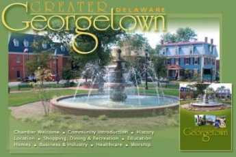
|
| Georgetown |
Early in November, two days after each election, Georgetown Delaware puts on a festival called Returns Day. About two hundred years ago, there was a law that all ballots had to be cast in person at the courthouse in the county seat (Lewes, at that time), and it took two days to count the votes. Everyone, candidates included, would hang around at the courthouse to learn who had won. After a few elections, except in wartime when the ceremony was temporarily skipped, the popular tradition has continued even though of course the election results are known much earlier. Although the function of revealing election results has yielded to the news media, the ceremony has assumed importance for its own sake. Unless it rains pretty hard, the parade lasts three hours, with ten or twelve marching bands, and local amateurs struggling with bagpipes. The candidates, winner, and loser, ride gamely around the square in horse-drawn carriages. You can imagine what would happen to the political future of any candidate who declined to participate in what is now a mandatory public entertainment.
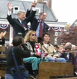
|
| U.S. Senator from Delaware |
Two features of this festival are especially notable. There is a hatchet-throwing contest, trying to get the flying hatchet to catch one corner in a post. It's not an easy thing to do. And then there is hatchet-burying, which is said to date back to the Nanticoke Indians. The traditional hatchet is brought from Lewes, as is the sand. This is all said to be the origin of the folk-saying about burying the hatchet, and it's really very heart-warming to believe the election is only an election, and the competition is over. It's probably not entirely true, of course, but it symbolizes what the public wants to believe is true. And what the public is telling politicians -- had soon better become true, again.
Sullivan's March
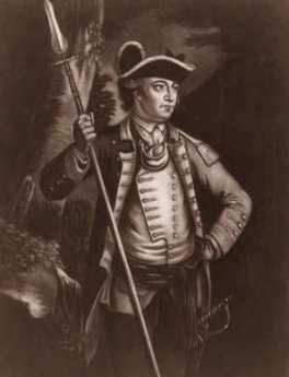
|
| Sullivan |
George Washington had plenty of other problems to contend with in 1778, but an Indian uprising led by Loyalists was too much. He singled out General John Sullivan, a celebrated Indian fighter from New Hampshire, gave him four thousand troops, and told him to eliminate this Indian threat to the Continental Army's rear, remove the safe haven for Loyalists, and assist the new Indian allies which LaFayette had befriended in the Albany area before the battle of Saratoga.
From long experience, Sullivan knew what to do, and did it without remorse. Ignoring skirmishes and ambushed sentries, he marched his troops from the scene of the massacre straight into the heart of Iroquois homeland, destroying every source of food or Indian settlement he could find. He was not interested in winning battles, he was determined to starve the Indians into extinction, once and for all. After these two slaughters, a white one in the Wyoming Valley (the Connecticut squatters in Wilkes-Barre), and now a red one in upstate New York, the entire frontier north of Pennsylvania has left a scene of devastation. Not much was heard of Indian fighting on this frontier for the rest of the Revolutionary War. Indeed, only the novels of James Fennimore Cooper make much subsequent mention of the Iroquois in American history.
Joseph Priestley, Shaker and Mover
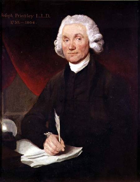
|
| Priestley |
Joseph Priestley, sometimes also spelled Priestly, is surely one of the more undeservedly neglected men of history. He has been called, with justice, the Father of the Science of Chemistry. He might also be called with equal justice, the father of the First Unitarian Church . The First Unitarian Church of Philadelphia, at 21st and Walnut, is the first and oldest Unitarian church and was indeed started at the urging of Priestley, whose principal residence was in Northumberland PA, at the confluence of the West and North Branches of the Susquehanna. Priestly wrote a scholarly work on the teachings of Jesus, which so captivated Thomas Jefferson that Jefferson wrote him the outline of another book that needed writing. Apparently, Priestley didn't have time, so in 1803 Jefferson wrote it himself, in the four languages he was fluent in, English, French, Latin, and Greek. Although those were simpler times, there have been few if any others who have told a President of the United States that he was just too busy to respond to a presidential request, particularly when the President could then find he had time to do it himself.
Priestley's theological teachings were based on scientific reasoning. They were highly controversial views, to say the least. He rejected the concept of a Trinity (he was a Calvinist minister, mind you), the divinity of Christ, and the immortality of the soul. Essentially, he rejected the concept of an immortal soul on the reasoning that perceptions and thought were functions of material structures in the human brain (Edmund O. Wilson's idea of Consilience is largely similar), and therefore will not outlive the cerebral tissue which produced them. In 1791, mobs burned his house in Birmingham, England, his patronage was revoked, and he hastily emigrated to Philadelphia. It isn't hard to see why these ideas were particularly unpopular with the Anglican church, which is probably the main reason England made him into a non-person, and his scientific ideas were denigrated as the product of other people.
That's too bad because he really was a scientist of immense importance. As a young man, he encountered Benjamin Franklin in England and was certainly a man after Franklin's heart. He noticed funny things about gases that rose from swamps and over mercury salts, and Franklin encouraged him to systematize and analyze his observations into theory. Although he called it anti-phlogiston, he had discovered oxygen. And then hydrogen, and nitrous oxide, and sulfur dioxide, and hydrochloric acid. Priestley really was the first organized and coherent scientific chemist, the Father of Chemistry. Franklin, Lavoisier, and Priestley became scientific friends, and enthusiastically exchanged ideas and observations, eventually leading to Lavoisier's fundamental principle: Matter is neither created nor destroyed, it only changes its form. In the end, it made no difference; Priestly had offended some pretty large religions, and nothing he did in chemistry was going to get much attention. Perceiving the value of the land at the confluence of rivers, he made his home for the last ten years of his life in Northumberland, Pennsylvania, now three hours drive Northwest, somehow managing to maintain an active scientific, political and theological influence worldwide. Visiting this rather sumptuous estate in a little river town is well worth a tourist visit. He died in 1804, just after his friend and kindred-religionist Thomas Jefferson became President of the United States.
Priestley's life can be summarized in one of his own most quoted remarks. "In completing one discovery we never fail to get an imperfect knowledge of others of which we could have no idea before so that we cannot solve one doubt without creating several new ones."
REFERENCES
| The Invention of Air: A Story of Science, Faith, Revolution,and The Birth of America, Steven Johnson ISBN: 978-1-59448-852-8 | Amazon |
Kenneth Gordon, MD, Hero of Valley Forge
|
| Valley Forge |
There's no statue of Ken Gordon at Valley Forge National Park, although it would be appropriate. No building is named after him; it's probable he isn't even eligible to be buried there. But there would be no park to visit at Valley Forge without his strenuous exertions.
One day, Ken's seventh-grade daughter came home from school with the news that the father of one of her classmates said that Valley Forge Park was going to be turned into a high-rise development. That's known as hearsay, and lots of things you hear in seventh grade are best ignored. But this happened to be substantially true. At that time, the Park was owned by the Commonwealth of Pennsylvania, and Governor Shapp was finding the upkeep on the Park was an expense he needed to reduce. The historic area had two components, the headquarters area, and the encampment area. One part would become high-rise development and the other would become a Veteran's Administration cemetery. Although any form of rezoning has the familiar sound of politics to it, Dr. Gordon (a child psychiatrist) had the impression that Sharp was mostly interested in reducing state expenses, and had no particular objection to some better use of the historic area. At any rate, when Gordon went to see him, he said that he would agree to a historic park if Gordon could raise the money somehow. The Federal Government seemed a likely place to start.
Well, the sympathetic civil servants at the National Park Service told him how it was going to be. You get the consent of the local Congressman (Dick Schulze) and it will happen. If you don't get his consent, it won't happen. It seemed a simple thing to visit that Congressman, persuade him of the value of the idea, and it would be all done; who could refuse? After the manner of politicians, Schulze never did refuse, but somehow never got around to agreeing, either. It takes a little time to learn the political game, but after a reasonable time, the National Park employees told Gordon he was licked. Too bad, give up.
He didn't give up, he went to see his Senators, at that time Scott and Clark. They instantly thought it was a splendid idea, and instead of going pleasantly limp, they sent Citizen Gordon over to see Senator Johnson of Louisiana, the chairman of a relevant committee. Johnson also thought it was a great idea, and called out, "Get me a bill writer!" A bill writer is usually a government lawyer, tasked with listening to some citizen's idea and translating it into that strange language of laws -- section 8(34), sub-chapter X is hereby changed to, et cetera. Bill writers have to be pretty good at it, or otherwise, they will misunderstand the intent of the original idea, modified by the personal spin of the committee chairman, the comments of the authorizing committee, and later bargains struck in the House-Senate conference committee. Having negotiated all those hurdles, a bill has to be written in such a prescribed manner that it won't be found to have multiple loopholes when it later reaches the courts in a dispute. A good deal of the time of our courts is taken up with making sense of some careless wording by bill writers. That's what is known as the "Intent of Congress", an ingredient that may or may not survive the whole process.

|
| Dick Schulze |
Ken Gordon had to go through this process, including testimony at hearings, for three separate congressional committees. To get everybody's attention, he organized several hundred supporters to write letters and get petitions signed by several thousand voters. These supporters, in turn, influenced the media and started a lot of what is known as buzz. All of this is an awful lot of work, but there is one thing about this case that can make us all proud. Not once did a politician suggest a campaign contribution was essential in this matter.
In time, ownership of the Park did in fact migrate from the Commonwealth to the U.S. Department of the Interior, hence to the National Parks Service. Everyone agrees it has been well managed, and increasing droves of visitors come here every year. It is now clearly a national treasure. Unfortunately, the encampment area got away and has been commercially developed, although not nearly as high-rise as originally contemplated. Along the way, many discouraging words were spoken about the futility of fighting against such odds. The outcome, however, is the embodiment of two slogans, the first by Ronald Reagan. "It's amazing what can be accomplished, if you don't care who gets the credit for it." The other slogan is older, and Quaker. All you need, to accomplish anything, is leadership. And leadership -- is one person.
One day Ken Gordon, the very busy doctor, was asked how much of his time was taken by this effort. His answer was, ten hours a week, every week for five years.
The Origins of Haddonfield
|
| Haddonfield's Dragon |
Haddonfield, New Jersey is named after Elizabeth Haddon, a teenaged Quaker girl who came alone to the proprietorship of West Jersey in 1701 to look after some land which her father had bought from William Penn. Geographically, the land was on what later came to be called the Cooper River, and it must have been a scary place among the woods and Indians for a single girl to set up housekeeping. It was related in the "Tales of a Wayside Inn" that Elizabeth proposed to another young Quaker named John Estaugh. Because no children resulted, she sent to her sister in Ireland to send one of her kids, a girl who proved unsatisfactory. So the kid was sent back, and Ebenezer Hopkins was sent in her place. Thus we have Hopkins pond, and lots of Hopkins in the neighborhood ever since. Eventually, the first dinosaur skeleton was discovered in the blue clay around Hopkins Pond, and now can be seen in the American Museum of Natural History, so you know for sure that Haddonfield is an old place. Eventually, the Kings Highway was built from Philadelphia to New York (actually Salem to Burlington at first) and it crosses the Cooper Creek near the old firehouse in Haddonfield, which claims to house the oldest volunteer fire company in America, but not without some argument about what was first, what is continuous, and therefore what is oldest. Haddonfield is, in short, where the Kings Highway crosses the Cooper, about seven miles east of City Hall in Philadelphia. The presence of the Delaware River in between makes a powerful difference since at exactly the same distance to the west of City Hall, is the crowded shopping and transportation hub at 69th and Market Street. Fifty years ago, Haddonfield was a little country town surrounded by pastures, and seventy years ago the streets were mostly unpaved. The isolation of Haddonfield was created by the river and was ended by the building of the Benjamin Franklin Bridge in 1926. If you go way back to the Revolutionary War, the river created a military barrier, and many famous patriots like Marquis de Lafayette, Dolley Madison, Anthony Wayne and others met in comparative safety from the British in the Indian King Tavern. In a famous escapade, "Mad" Anthony Wayne drove some cattle from South Jersey around Haddonfield to the falls (rapids) at Trenton, and then over the back roads to Washington's encampment at Valley Forge. In retaliation, the British under Col John Simcoe rode into nearby Salem County and massacred the farmers at Hancock's Bridge who had provided the cattle. At another time, the Hessians were dispatched through Haddonfield to come upon the Delaware River fortifications at Red Bluff from the rear. Unfortunately for them, they encamped in Haddonfield overnight, and a runner took off through the woods to warn the rebels at Red Bank to turn their cannons around to ambush the attackers from the rear, who were therefore repulsed with great losses. These stories are told with great relish, but my mother in law found out some background truths. Seeking to join the Daughters of the Revolution in Haddonfield, she was privately told that the really preferable ladies' the club was the Colonial Dames. Quaker Haddonfield, you see, had been mostly Tory.
|
||
| Alfred Driscoll |
A local boy named Alfred Driscoll became Governor of New Jersey, but before he did that he was mayor of Haddonfield. He had gone to Princeton and wanted to know why Haddonfield couldn't look like Princeton. All it seemed to take was a few zoning ordinances, and today it might fairly be claimed that Haddonfield is at least as charming and beautiful as Princeton, maybe nicer. At the very least, it has less auto traffic. Al Driscoll went on to be CEO of a Fortune 500 pharmaceutical corporation, and everyone agrees he was the world's nicest guy. The other necessary component of beautiful colonial Haddonfield was a fierce old lady who was married to a lawyer. Any infraction of Al's zoning ordinances was met with an instant attack, legal, verbal, and physical. A street-side hot dog vendor set up his cart on Kings Highway at one time, and the lady came out and kicked it over. If you didn't think she meant business, there was always her lawyer husband to explain things to you. She probably carried things a little too far, and one resident was driven to the point of painting his whole house a brilliant lavender, just to demonstrate the concept of freedom. Now that she and her husband are gone, the town continues to be authentic and pretty, probably because dozens of other citizens stand quietly ready to employ some of her techniques if the need arises.
The Swedenborgian Church
|
| Emanuel Swedenborg |
Among the many churches centered in Philadelphia, the Swedenborgian is probably the least typical and most difficult to understand. The church does not actively seek out a new membership, but it welcomes everyone, in the spirit of Emanuel Swedenborg's observation that "All people who live good lives, no matter what their religion, have a place in Heaven." Without attempting to define the teachings of Swedenborg (1699-1772), who was quite able to speak for himself, it can be approximated that Heaven plays a central role in this belief system, and predestination does not. Although the ceremonial features of this religion are very similar to the Episcopal Church, its main emphasis is on good works as a way of attaining the reward of Heaven. In some ways, that is an unexpected position for a noted scientist like Swedenborg to take, since generally scientists lean toward Calvinism, with the mechanistic view that if God is all-powerful, then human free will must be impossible.

|
| cross |
There are at least four divisions of the Swedenborgian religion, but the Bryn Athyn branch is most notable in the Philadelphia region. A very wealthy adherent of Swedenborg named John Pitcairn bought a large tract at Bryn Athyn and gathered the local church to live around a perfectly magnificent cathedral and church school. It is hard to think of any church in the Philadelphia region which approaches the magnificence of the Bryn Athyn cathedral. It has a special character that it was conceived and built during the crafts movement of the early twentieth century, with imported European workmen deliberately organized like medieval craft guilds. The central features of this workmanship reflect and then project the belief in personal individuality within the whole religion. No two windows, or doorknobs, or carvings are the same in the cathedral, reflecting the wish for each workman to devise his own unique creation and show the way of personal responsibility to the faithful. This cathedral is one of the things in the Philadelphia region most worth visiting, but to appreciate its quality you have to know what you are looking at.
Everybody in this church is unexpectedly hard to characterize. The Pitcairn Foundation was such a successful investor that it formed a mutual fund for others to share in its good fortune. Its central philosophy is to invest only in corporations which have been dominated by a single family, preferably the founding family, for at least fifteen years. There are about six hundred eligible corporations, and recent management scandals in the newspapers illustrate the Pitcairn's exactly knew the dangers of handing your assets over to a hired manager. This family-centered investing approach consistently yields better than the S & P 500, which in turn beats ninety percent of investment managers. You sort of get the idea you know where this family is coming from when you meet a courtly, meek, retiring but friendly person, who can say, "My mother is the only person I ever met who looked perfectly at home seated under a sixty-foot ceiling."
|
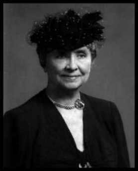
| Helen Keller |
Two other famous Swedenborgians illustrate the unusual individualism of this religion. Helen Keller, the deaf-blind girl who overcame her handicap by going to Radcliffe and becoming a successful author and lecturer, for one. The other would be Johnny Appleseed (1774-1845), whose real name was John Chapman. Grammar school legends would have this bearded, barefoot vegetarian adopting a life of poverty like St. Francis, but in fact, he was an extremely shrewd businessman who died rich. He developed the business plan that American settlers would be going West into what was then the Northwest Territory, and having a tough time getting enough to eat the first year or two. So, he anticipated the paths of frontier settlement, and went ahead among the Indian tribes, planting apple trees. When the settlers arrived in the region, he sold them young apple trees and showed them what to do with them. Apples grown from seed are not the tasty morsels we know today but tend to be rather shriveled and bitter. So Johnny showed them how you make cider, and if you let it sit around a while, hard cider. The settlers would use the pulpy squeezing for compost, and he would be back to collect the seeds from them so he could continue his business plan in the next county. In short, he showed them how to drink the apples. He also let the Indians pick the apples, so they liked him and spared him the common troubles of the frontier.
If you are going to boil apples, you need a pot, and Johnny often carried his like a hat. He wasn't a nut, at all, he was a showman. In his backpack, he was also carrying a Bible. And in his head, he carried a motto, "All religion has to do with life, and the life of religion is to do good."
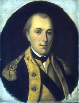
La Fayette, We Are Here
 |
| Gilbert du Motier, marquis de La Fayette |
It will be recalled that La Fayette was 19 years old at Valley Forge, spoke no English, had no previous military experience. He nevertheless demanded, and got, a commission as Major General on the prudent condition that he have no troops under his command, at least for a while. Washington had been strongly reminded by various people that this young Frenchman was one of the richest men in France, a personal friend of the Queen, and thus critical to the project of enlisting French assistance in the war. Under the circumstances, it was shrewd to send him on the project of enlisting Indian allies among the Iroquois, since many tribes, particularly the Oneida, spoke French and held their former allies in the French and Indian War in great esteem. The chief of the Oneida Wolf clan (Honyere Tiwahenekarogwen) was visiting General Philip Schuyler in Albany at about the time LaFayette showed up on his mission to get some help for Valley Forge. General Horatio Gates was busy at the time rallying a colonist army to defend against the British under Burgoyne, coming down from Quebec, eventually to collide at the Battle of Saratoga.
Earlier in the war, Honyere's Oneida tribe had tangled with their fellow Iroquois under the leadership of Joseph Brandt (the Dartmouth graduate who was both biblical scholar and commander of several frontier massacres); the Oneida had many new scores to settle with the English-speaking Iroquois tribes. Honyere made the not unreasonable request that before his warriors went off to war, his new American allies would please build a fortification to protect his women and children from Brandt's Mohawks. LaFayette readily put up the money for this project, quickly becoming the Great French Father of the Oneidas. After some scouting and patrolling for Gates, Honyere and about fifty of his braves followed LaFayette to Valley Forge, where they soon made a nuisance of themselves to the Great White Father George Washington. Finally, word of the official French alliance with the colonists reached London, Howe was replaced by Clinton, and the British began to withdraw from their isolated position at Philadelphia.
It was thus that the jubilant rebels at Valley Forge learned that the fortunes of war had turned in their favor, and the French alliance was the source of it. With the British making preparation to abandon Philadelphia, it seemed a safe thing for Washington to give LaFayette command of two thousand troops, including the fifty Oneida Indians, and post them to Barren Hill (now LaFayette Hill), along Ridge Pike near Plymouth Meeting. Washington gave the strictest orders that they were to take no chances with anything, and particularly were to remain mobile, moving camp every day. This was not exactly what the richest man in France was anticipating, and wouldn't make a very saucy story to tell Marie Antoinette about. So, he promptly set about fortifying Barren Hill. Local Tory spies quickly spread this news to General Clinton, who promptly led eight thousand redcoats up the Ridge Pike to capture the bloody Frog. Clinton's plan was good; a detachment went around LaFayette in the woods and came back down Ridge Pike from the other direction, driving the Americans down the Pike into the open arms of the main body of British troops, coming up Ridge Pike. From this point onward, two entirely different stories have been told.
The more widely-held account has LaFayette climbing the steeple of the local church and noticing that there was an escape path, leading down the hill to the Schuylkill River at Matson's Ford. The Indian scouts were sent forward to hold off the British while the troops made their escape. Clinton sent a cavalry charge of Dragoons forward, yelling and waving their sabers, generally making a terrifying spectacle. The Indian scouts, as was their custom, were lying in the brush shoulder to shoulder, and at command by Honyere rose from the ground to let out a resounding chorus of war whoops. The Indians had never seen a cavalry charge, the Dragoons had never heard a war whoop, so both sides fled the battlefield without doing much damage. Meanwhile, LaFayette and his troops escaped to safety on the far side of the Schuylkill.
Other accounts of this episode relate that when Washington heard of it he remarked sourly that either they were pretty lucky, or else the enemy was pretty sluggish. In any event, a few soldiers were killed on both sides, the Americans crossing the River were described as "kegs bobbing on the pond", and it does seem the British army mostly just watched them do it. In the confusion, of course, everyone involved was fearful of being surrounded by unseen troops, and the British may well have worried the whole thing was a trap.
The saddest postscript to the Battle of Barren Hill is the fate of the Indians. After the war was over in 1783, the colonists busied themselves with taking over Indian land. Honyere pitifully petitioned the New York legislature for some consideration of his tribe's wartime service. They ignored him.
Lambertville and Lewis Island
 |
| Atlantic Shore Railroad |
Recall that open Atlantic shoreline once stretched from Perth Amboy to New Castle, Delaware. Glaciers pulverized the nearby mountains and dumped a huge moraine of sand into the ocean, creating southern New Jersey as an offshore island in geological times. The bay silted up and eventually attached that island to New Jersey. The silting-up probably would have continued for another sixty miles, making Philadelphia a land-locked inland city, except that the true
 |
| Delaware River |
Delaware River came tumbling down from the mountains to Trenton, turning sharply right and then maintaining an open shallow channel to the sea. From Lambertville to Trenton, the river drops over a series of small falls or rapids, easily visible except when heavy rains "drown" them.
 |
| Pennsylvania Railroad |
So, geography accounts for the scenery and early history of the upper end of Delaware Bay. It's still a beautiful hilly countryside with small antique villages, sparsely populated in spite of two nearby cities. Water power at the Fall Line, and then anthracite from the upstate mountains once encouraged early industry in an area that was rather poor farm country. But the Pennsylvania Railroad then rearranged commerce so that a blossoming New Jersey industrial area withered into quaintness. The early railroads mostly all ran East-West along the rivers, since investors in Atlantic port cities obtained both finance and protection from their state legislatures; railroads had almost reached the Mississippi before any were able to establish North-South connecting spurs. A seaboard trunk line was almost impossible to imagine. Finally, a consortium organized by
J.P. Morgan bullied through the main trunk line running through the bituminous coal areas of Pennsylvania and on to the West, with the major port cities connected by the great Northeast Corridor of the Pennsy. This corridor would run on the Pennsylvania side of Delaware. Industry on the bypassed New Jersey side would just wither and decline, and eventually so would the anthracite cities. Since the original colonies and states all ran from the ocean to the interior, each had a vital political interest in resisting this outcome. Only a strong and brutal corporation could bring it off.
When George Washington was circling around Trenton to attack it on Christmas, a narrow spot up-river with a dozen houses on either side was called Coryell's Crossing or Ferry. That's now Coryell Street in Lambertville, linked to the other side of the river at New Hope, after first crossing a narrow wooden bridge to Lewis Island, the center of shad fishing, or at least shad fishing culture.
The Lewis family still has a house on Lewis Island, and they know a lot about shad fishing, entertaining hundreds of visitors to the shad festival in the last week of April. The river is cleaning up its pollution, the shad are coming back, but they, unfortunately, took a vacation in 2006. At the promised hour, a boatload of men with large deltoids attached one end of a dragnet to the shore, rowed to the middle of the river, floated downstream and towed the other end of the net back to the shore. The original anchor end of the net was then lifted and carried downstream to make a loop around the tip of Lewis Island, and then both ends were pulled in to capture the fish. There were fifty or so fish in the net, but only two shad of adequate size; since it was Sunday, the fish were all thrown back.
But it was a nice day, and fun, and the nice Lewis lady who explained things knew a lot. Remember, the center of the river is a border separating two states. You would have to have a fishing license in both states to cross the center of the river with your net; game wardens can come upon you quickly with a power boat. But the nature of fishing with a dragnet from the shore anyway makes it more practical to stop in the middle, where shotguns from the other side are unlikely to reach you. An even more persuasive force for law and order is provided by the fish. Fish like to feed when the sky is overcast, so there is a tendency on a North-South river for the fish to be on the Pennsylvania (West) side of the river in the morning, and the New Jersey (East) side in the evening. During the 19th Century when shad were abundant, work schedules at the local mills and factories were arranged to give the New Jersey workers time off to fish in the afternoon, while Pennsylvania employers delayed the starting time at their factories until morning fishing was over.
Somehow, underneath this tradition one senses a local Quaker somewhere with a scheme to maintain the peace without using force. Right now, there aren't enough fish to justify either stratagem or force, but one can hope.
Lindbergh Baby Kidnapping Trial
 |
| Lindberg |
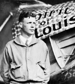
In 1935, Bruno Hauptmann was executed for kidnapping the baby of America's "Lone Eagle". Swarms of competing police and reporters made chaos of the scene, and Charles Lindbergh made it all worse by dealing directly with the crime underworld. Even today, some question the guilt of Hauptmann, and even whether the baby is really dead.
We are indebted to George Hawke, who went to prep school near the scene of the crime, for becoming an expert, perhaps the preeminent expert, on the Lindbergh Baby Kidnapping Trial. Charles Lindbergh, the son of a midwest pro-German congressman, flew an airplane alone across the Atlantic in 1927. He became instantly famous, wrote a best-seller called Alone, became Colonel Lindbergh, married Anne Morrow the daughter of Senator Morrow of New Jersey. That's how in short order they came to settle in Englewood, New Jersey, and also could afford an elaborate country place in Hopewell, Hunterdon County. That put them physically at the northern edge of the Philadelphia region at least on weekends, although psychologically they remained part of the New York scene, where many people attracted to publicity seem to gravitate. In 1932 they had a 19-month old son, John, who one evening disappeared from Hopewell, apparently kidnapped.
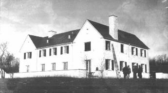 |
| Charles Lindberg Home |
What followed was a Keystone Kops Komedy in the midst of a publicity storm. The local, county, and state police, plus the FBI struggled with each other for the fame of solving the case. Newspaper reporters from all over the country swarmed down the little country road to set up shop. To illustrate the consequences, a home-made ladder was found sixty feet from the house, but no fingerprints were found by the first investigators. By the time the last investigators were done, the ladder had 150 sets of fingerprints on it. Police involvement on all levels can be summarized as a frenzy to be first to solve the case, followed in time by a frenzy to avoid being known for failing to solve it.
Although most of us eagerly following the case were unaware of it, the Colonel decided to take matters into his own hands. As a new celebrity, he was surrounded by many new best friends, and it was suggested to him that he should put out feelers into the Underground, the Mafia Mob. He would pay a ransom, and no questions would be asked. Somehow, a Bronx school principal, Dr. John Condon, was designated to respond to feelers, among them a particularly likely one, from a man who demanded to be met in a cemetery at night. As proof that the baby was still alive, the cemetery lurker sent Dr. Condon the baby's sleeping suit. Ransom was then paid in cash, unmarked, but entirely in gold certificates which had stopped being issued after President Roosevelt took us off the gold standard. The serial numbers carefully recorded. The extortionist then disappeared from sight, and the baby was never heard from again.
As time passed, two things happened. A partially decomposed baby's body was found buried a couple of miles from Hopewell, although it must be admitted it was only a quarter of a mile from an orphanage. The baby's pediatrician could not identify the body, although at the trial others claimed to make such identification. The baby's skull had been fractured, but several detectives had been seen turning it with sticks. The other development was that gold certificates bearing the recorded serial numbers began turning up in the Bronx.
 |
| Bruno Richard Hauptmann |
Bruno Richard Hauptmann was apprehended at a filling station after passing a ten dollar bill of the ransom money, and when his house was searched, $14,000 more was found hidden. The police had their man. To say that the house had been searched thoroughly was quite an understatement, but a number of detectives said there was no visible disturbance in the attic. Later on, a rung of the homemade ladder found at Hopewell was found to have exactly the same grain pattern as a piece of attic floorboard, now found to be missing in the Bronx house. Although there was testimony that Hauptmann had been beaten with a hammer, he was deemed a highly suspicious character. He had a criminal record in Germany, and was in this country illegally after jumping ship.
 |
| Lindberg Trial |
The Trial of Bruno Hauptmann in the Hunterdon County Courthouse at Flemington was a tumultuous circus. The state of New Jersey spent well over a million dollars on the prosecution, while Hauptmann spent $2900 on his defense, most of it provided by a newspaper, and most of it spent on a defense lawyer who appeared before a jury of farmers dressed in a cutaway, wearing a Carnation and Spats, and who told people in a bar that Hauptmann was anyway guilty. That lawyer seemed visibly inebriated much of the time, and often walked down the main street with a girl on both arms. Miles of new telephone wire were strung into the courthouse area for the reporters, and two switchboards were provided.
There were legal difficulties. At that time in New Jersey, kidnapping was only a misdemeanor, so accidental death in the course of kidnapping was not a capital offense. The Lindbergh Kidnapping Law was hastily enacted to make kidnapping a federal felony, but for the purposes of this trial, it was necessary to prosecute Hauptmann for the crime of Burglary of the sleep suit, with accidental death in the course of that burglary. Hauptmann steadfastly, and to some convincingly, denied everything. He was keeping the gold certificates for a friend.
The jury was understandably confused by all this, but it looked to them as though Hauptmann was surely guilty of something, perhaps extortion, and for all the jury knew Congress would now pass a special law about that, too. The defense did not make enough of the sleep suit, but all the jurors surely knew that such garments could be bought in any department store. There was even some question whether the Lindbergh Baby might not be dead at all, but the fact remained that Hauptmann was definitely guilty of something. He was electrocuted, and the newspapers made a great fuss about that, too.
The Philadelphia Bay (1)
It's about sixty miles from Salem, New Jersey where the river takes an abrupt turn to the right, to Trenton, where the river takes an equally abrupt turn to the left. This is the area that could be called the Philadelphia Bay, a protected extension of Delaware Bay. Benjamin Franklin, who sailed down this bay on his many trips to Europe, noticed that it was not exactly a river, because the salt water seemed to invade it, whereas most big rivers have fresh water pushing out to sea. The true Delaware River comes down from the north and empties into Philadelphia Bay at Trenton. We now know that barrier islands begin out at sea every three hundred years or so, gradually move toward the shoreline, and pack themselves against the mainland about three hundred years later. Depending on circumstances, there are usually several sand reefs in various stages of development. Southern New Jersey is made up of a number of barrier islands packed together as they moved toward the mainland of Pennsylvania. The barrier islands actually have packed solid against the Pennsylvania coast, from Trenton to New Brunswick, closing off the ancient northern inlet to the bay. Barnegat Bay is a more recent variant of the same process, running parallel to the more ancient Philadelphia Bay. Since its northern inlet is almost closed at Barnegat Inlet, this seems to be a regular phenomenon of Atlantic barrier island development. Lower Delaware Bay, from Salem to Cape May, appears to have a different history, probably a volcanic split.
|
||
| Joshua Fisher's 1778 Map of Delaware Bay |
In the days of sail, Philadelphia Bay was the main artery of internal commerce. When the Delaware-Chesapeake canal was dug in 1829, it extended the inland waterway from Trenton to Norfolk VA. The earliest commerce took advantage of the tide and the bends in the "river" which was actually just the remnant of ocean between mainland Pennsylvania and the former barrier island of New Jersey. It had tides, but not much in the way of waves. Flatboats filled with Garden State produce would be carried up and across the river by the incoming tide, and down and across the river by the outgoing tide. When ships, particularly steamships, came along, this was the way to carry goods of all sorts up and down the Bay. At Odessa, it's only five miles between the Chesapeake and Delaware Bays, so even prior to the old Delaware-Chesapeake Canal sailing commerce was natural from Trenton to Norfolk, Virginia, and all points in between. The next step was building canals, up to the Raritan to New York Bay, and even up the "Main Line" west to Pittsburgh and beyond. The war of 1812 blocked off ocean shipping, and then another canal carried anthracite to Philadelphia, emptying at Bristol, briefly enriching Bristol, but then leaving it reduced to its present vestigial state when the tracks of the Pennsylvania Railroad cut it off. After canals came railroad tracks, usually following the path of the canals, making smoke and noise, constructing a dangerous, impenetrable barrier between the land and the water beside it. Superhighways do the same thing, replacing soot with gasoline fumes. There's a river out there somewhere, but you can't get to it. It now takes a twenty story high rise to give you a river view; even that is best seen on Sunday when lessened traffic reduces gasoline haze.
It's really hard to imagine that main attractions to living on the river once included not merely the view and the transportation, but also wonderful fishing and hunting among the bullrushes. Down around the Delaware Chesapeake Canal, Blackbeard the Pirate used to hide his ship and merry men in the shallow marshes among the mud islands. There's a reminder of it as you speed along the elevated multi-lane highway, or maybe it's just another reminder of political correctness. If you know the way well enough to take your eye away from the traffic pattern, off to the right is a directional sign pointing to the little cove where pirates used to convene. It says, "Blackbird".
Litchfield County, Extended (1771-1775)

|
| Wilkes-Barre |
FOR four years, the Connecticut settlers considered the apparently peaceful Wyoming Valley of Pennsylvania to be part of Litchfield County, Connecticut, and its main little town was called Westmoreland (now Wilkes-Barre, although it still has a Westmoreland Club). However, the high-living, non-Quaker sons of William Penn were ill content to let matters remain that way. Their response was to sell large tracts of land in the area, on condition the purchasers would do whatever fighting was needed to conquer and hold it. The main purchasers were Scotch-Irish from Lancaster County, and the main speculators were prominent Philadelphians with names like Francis, Tilghman, Shippen, Allen, Morris, and Biddle. This speculative land sale was to be the source of trouble for decades because it conflicted with titles to the same land issued by the Susquehanna Company.
The predictable trouble surfaced in 1775, with the Second Pennamite War. Under the command of a man named >Plunkett, 700 Pennsylvania soldiers marched to liberate Wyoming and were soundly defeated by the Connecticut soldiery under the command of Zebulon Butler. There might have been further fighting in this expanded war, except for the other eleven colonies applying great pressure on these two colonies fighting each other with potential jeopardy to the united rebellion against British rule. While the Penn family were definitely royalist in their sympathies, their colonial property put them in an awkward position with their Scotch-Irish allies, who were, in all colonies, the main leaders in the revolution. The effect was to isolate the Connecticut invaders, even though they were the victors in the fighting.
Military School
|
| VFMS Crest |
In the middle of the pacifist Quaker farm region, in fact in the middle of William Penn's Quaker Welsh Barony, sits Valley Forge Military Academy. Its location seems even stranger when you consider the nearest town, within easy walking distance, is Wayne, PA described by David Brooks in Bobos in Paradise as the East-Coast epicenter for yuppie education-based elitism, with all its air of entitlement. In fact, Brooks does not mention the Academy once in his three hundred page book about the town. What is VFMA and why is it located where it is? Three names, Baker, Mellon, and Annenberg pretty much explain it. Lieutenant General Milton Baker, a great friend of the Eisenhower family, was passionate about Valley Forge, its history, its parks, its military hospital, its renovation, and its preservation. If Baker founded a school (in 1928), it was going to be here. The money was Mellon and Annenberg money, but Baker was their man.
|
| Military school |
Military schools are now in a period of decline. A flurry of a building after the Civil War created about 600 of them, in recognition that the North nearly lost the Civil War to the Confederate States who had a much stronger military tradition, especially in Virginia. It's therefore not surprising that Valley Forge wanders from Southern traditions, and is consciously modeled after Sandhurst, the British Royal Military College. Valley Forge competes with Canada, Australia and Great Britain for foreign students, while the Southern schools are more provincial. There seem to be two main reasons to send your son to a military boarding school.
The first is the tradition of military aristocracy, traceable in a sense to feudalism and the Knights of the Round Table. There's little patience with a politically correct speech in the military, who readily tell you that many rich families encourage their daughters to marry career military officers, as a way of strengthening loyalties between these two power groups. During the formative years of the American republic, the resounding emphasis was placed on having no standing army. That was a cloaked way of restraining a military aristocracy and seems to have provided the main reasoning behind the constitutional Second Amendment, which projects a general right of all citizens to bear arms. It follows the model of Switzerland where military service is universal, as contrasted with limiting firearms to specialists, whether police or military. If that was the goal, it seems to have been effective; military elites now seem most appealing to foreign cultures, like Latin America, Korea, Saudi Arabia. Tony DeGeorge, the current president of Valley Forge, tells of an astounding phone call from one Saudi prince, who responded to an alumni fund-raising appeal by offering to buy the whole school. The Saudi noticed one supposes, that "Storming' Norman" Schwarzkopf, the hero of the First Gulf War, was an alumnus of Valley Forge.
The other main reason to send your son to military boarding school, is because he's too unruly to handle at home. Here is another seemingly delicate matter the school makes no bones about. All new entrants must spend six weeks as "plebes", enduring a ferocious hazing discipline that weeds 'em out. The solution to cell phones and Internet games is to forbid them. Valley Forge confronts the matter of recreational drugs head-on. All students are subject to random drug testing, and a positive test means get off the school grounds -- permanently -- within four hours. The exercises program is not only mandatory, but it is also rigorous beyond description. The result is that fifteen alumni are currently playing professional football in the NFL, the polo team is regularly the national champion. Somewhere General Baker got the idea that playing music helps your mathematical ability, so every single 9th grader plays the violin. The marching band is internationally famous, and by gad, it better stay that way. Only about a third of the graduates go on to a lifetime military career, but another third of the alumni are CEOs of companies. Even what happens to the remaining third bears some thought.
|
| J.D. Salinger |
J.D. Salinger and Edward Albee were both alumni of Valley Forge Military Academy. True, General Baker told Salinger that The Catcher in The Rye was rubbish, and one need not speculate much on how he would have reviewed Who's Afraid of Virginia Woolf? Nevertheless, it cannot be denied that the collision between these two social misfits and the plebe hazing experience contributed significantly to the depth and power of the serious literature they produced. It is not easy to name two alumni of Andover, Exeter or Lawrenceville who have contributed as much to 20th Century American fiction. Salinger and Albee hated the place, but it made them what they became. "Whatever that was," you can almost hear the other two-thirds of the alumni mutter.
In a day that echoes No Child Left Behind, it is a little hard and it is certainly politically incorrect, to give this devil its due. But all Armies live by the slogan, that if you must take an objective, you must take some casualties.
New Castle, Delaware
New Castle is easy to get to, but hard to find. It's right on Delaware Bay, at the start of the old National Road (Route 40), next to two huge bridges, a few miles from the main north-south turnpikes, a couple of miles from an airport -- and lost in a sea of suburban housing and highway slums. It's lost, so to speak, in plain sight.
|
| New Castle, Delaware |
And yet it is a perfect jewel of early American history and architecture. It's just as attractive and historically important as Williamsburg, Virginia, except these buildings are not reproductions, but the real thing. The town says it was founded in 1651 by Peter Stuyvesant, but Peter Minuit in 1638 could make a claim to be even earlier. Located at the narrow neck of the funnel that is Delaware Bay, it was a natural place to start a colony, eventually to be the capital of the state. The Delaware River makes a rightward turn at that point, and creates a river highway all the way to Trenton. But a few miles upriver at Tinicum, now Philadelphia International Airport, the river started to fill up with islands and snags; was it better to locate upriver or downriver from the narrows? New Castle was placed downriver.
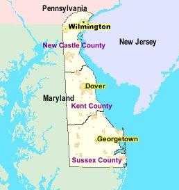
|
|
New Castle's courthouse is the epicenter of the arc from Maryland to the Delaware River. |
But in 1777 the British fleet came to visit with hostile intent, and New Castle could look out the windows along the Strand right into the mouths of ships with twenty or thirty cannons pointing at them. Philadelphia, on the other hand, was protected upriver by a series of mud flats and barricades at Fort Mifflin that could quite effectively bar passage to enemy sailing ships. Delaware got the point, and shortly thereafter, the capital of Delaware was prudently moved to Dover, while even the county seat of New Castle County was moved to Wilmington. New Castle had a big fire in 1824; rebuilding afterward accounts for much of the present uniformly Federalist architecture. The final nail in the commercial coffin of the town was driven by the Pennsylvania Railroad, which just by-passed the town. For a century, this little architectural jewel just sat there in the fields, until the narrow neck of the Delmarva Peninsula became such a transportation crossroads that the fields filled up with construction more appropriate to Los Angeles. New Castle disappeared, without moving an inch.
|
|
100 Harmony St., New Castle, DE 19720 (302) 328-2413 |
For fifty years in Colonial days, the rector of Immanuel Episcopal Church in New Castle was one George Ross. His son, also named George Ross became a lawyer in Lancaster and signed the Declaration of Independence. His widowed daughter, Gertrude Ross Till married George Read, a lawyer in New Castle who also signed the Declaration. And, a third signer Thomas McKean, lived two houses away. George Read had studied law under John Moland, whose house served as Washington's headquarters in 1777.
The northern border of Delaware is a semicircle, with a twelve-mile radius based on the cupola of the New Castle courthouse. It was originally the border of New Castle County, and it proved to be slightly imperfect. In the first place, it extended across the Delaware River into New Jersey, but it was a nuisance to go there, so that segment of land was abandoned to New Jersey. However, the legal border of the State of Delaware, therefore, extends to the high-water bank of the river on the New Jersey side, rather than running down the middle of the river. The significance of this curiosity appeared when the Delaware Memorial Bridges were built, and all of the tolls go to Delaware, instead of being split between the states as is more customary. The other problem with the semi-circular arc was that three lines meet at the northwestern corner of Delaware, and each was defined in its own way. The Mason-Dixon line goes due east-west, the border with Maryland goes north-south, and the idea was that the semicircular arc would meet the other two lines at a point. However, the instructions could be read in two different ways, leaving a little "wedge" of territory that could be reasonably said to lie in either Pennsylvania or Delaware, depending on the sequence of describing them. This was certainly a circumstance where any decision was better than no decision, but it took until 1921 for the states to harrumph their way to a final pronouncement. In the meantime, the disputed wedge of land was a good place to have duels, cockfights and other matters of questionable legality.
REFERENCES
| Lewes, Delaware: Celebrating 375 Years of History Kevin N. Moore ASIN: B006DL8TC6 | Amazon |
Wyoming, Fair Wyoming Valley
|
| Lake Clarke |
By 1750, or roughly ninety years after King Charles gave them their charter extending infinitely to the Pacific Ocean, the Connecticut Yankees with Old Testament first names had found their promised land was as disappointing as the King who promised it to them. So, two kings later, an exploratory party was sent west of the Hudson. The party returned with glowing tales of the Wyoming Valley in Northeastern Pennsylvania, just over the Blue Ridge Mountain. Only one white man had ever been there before them, Count Zinzendorf, the adventurous founder of the Moravian Sect.
|
| Iroquois |
The Wyoming Valley is certainly a jewel. It has comparatively mild weather as a result of being protected on all sides by mountains. The Susquehanna River runs through it, pinched by narrow valleys at both the top and the bottom, and filled with deep rich topsoil. In fact, it constitutes the remains of an ancient lake, whose Southern tip had broken through the Nanticoke Gap, draining the lake. It took another century or so to learn that underneath the topsoil was a thick deposit of anthracite coal. The Connecticut explorers were ecstatic about this little paradise in the mountains, and returned with news that it was everything the real estate promoters (The Susquehanna Company) wanted to hear. Indeed, the promotion of this valley almost got out of hand when news of it reached Europe at the start of the Romantic Period. Wyoming is what everybody wanted to hear about, the home of the noble savage. An epic poet named Thomas Campbell composed a long saga about Gertrude of Wyoming that caught the fancy of the Romanticists, with tales of Gertrude luxuriating on the ocean beaches of Pennsylvania, watching flocks of pink flamingos, and similar fancies, like Gertrude reading Shakespeare in the woods. In 1762 The Susquehanna Company sold six hundred shares to Connecticut adventurers, who were soon off to paradise.
The noble savages turned out to be Iroquois, who watched the new settlers on their land from behind neighboring trees. After a few months it became clear the white settlers intended to stay permanently in the valley, so one day the Indians emerged from the woods, and annihilated them.
Odessa, Delaware
Delaware is a pretty small state to be divided into two civilizations, and in fact, it seems safe to predict that division will soon become meaningless. New Castle County and Wilmington are up north in DuPont country, with more Ph.D.'s than anywhere else in America, chateaux in the suburbs, plenty of Porsche's and other elements of the finer life. The other two counties, "South of the Canal," are rural, marshy, or beach front. Wal-Mart country. Aside from a distinct difference in the weather patterns, all of this is destined to change, and soon. A limited-access toll road, probably mostly intended to carry people to the slot machines of Dover Downs, makes it breezily simple to go from one end of the state to the other in an hour. A ferry from Cape May to Cape Henlopen makes sailing across the mouth of the bay a shorter simpler way to go from the urban areas of New York to and from Washington, Norfolk and points South. And changes in the tax laws make Delaware a great place to avoid sales taxes, estate taxes, business taxes, usury laws and lots of other things. That brings in businesses, and they, in turn, will bring in a swarm of home builders. It looks very likely Delaware will go the way of Luxembourg, urbanized from border to border.
|
|
The Corbit-Sharp House Built in 1774 Located in Odessa, Delaware. |
Little Odessa (population 280) sits right at the pivotal point in this transformation. Here is the very narrowest point of the peninsula between Delaware and the Chesapeake bays. In the Seventeenth Century, there was only a five-mile portage from the head of one creek to the head of the other; the town there was called Cantwell's Bridge. Just why the two Delaware-Chesapeake canals were built a few miles further North is an engineering question, but they tended to shelter Cantwell's Bridge from Northern influences. The neck was so narrow, however, that the road couldn't avoid the town, and for a century it was a pleasure to find a little Colonial town, a little Williamsburg so to speak, popping up among the fields of clover bordering a drive to Dover. A few miles to the West, a very fine boy's boarding school adds to the tone of the place, and it's only a short 9-mile commute to the University of Delaware. The finest 18th Century country house, the Corbit-Sharp House sets the tone for the area, and Christmas season in Odessa is quite memorable. Rodney Sharp was the son of the local school teacher who acquired financial substance, private jet airplanes and all that, on the other side of the canal, and then restored his old home the Corbit house into the Corbit Mansion, bringing the whole farm village up to an elegant level. A visit to Odessa at Christmas, touring the open houses and visiting the festivities, is well worth the trip.
You have to hold your breath to see what is going to happen to real estate in the area. The toll road sweeps around the edge of Odessa, and now the people going to the slot machines and the beaches can hardly see it as they race past. But that's mostly weekend traffic, and during the week all of those cornfields are quickly turning into easy commuter villages, full of McMansions. They are going to fill up the schools, demand better ones, demand traffic signals to protect the kiddies, demand retail outlets for all those upscale stores with catalogers, demand to be noticed. Eventually, all those three-car families will choke up the toll-road, and it will become a great big congested parking lot at rush hour. Sad.
One final comment about the origin of Odessa. It's named after the city in Russia because both of them were wheat exporting cities at one time, although it is doubtful if they were ever comparable in the steamy nightlife. However, the one in Delaware is actually the older of the two. Cantwell's Bridge, Delaware was founded in 1731. For reasons unclear, its name was changed to Odessa in 1845, perhaps in the mistaken idea that the Russian city was where Odysseus once landed. That's what many Russians claim, but the place they have in mind was really in Bulgaria. The place the Russians call Odessa was founded by Catherine the Great in 1794, some sixty years after Cantwell began collecting toll at his bridge in Delaware. When the Bulgarian mistake was pointed out to Catherine the Great, she wouldn't change the name; she sort of liked it that way.
Pea Patch Island
|
| Fort Delaware |
There's a tradition that a boatload of peas ran aground on the mudflats of Delaware Bay near Salem in the Sixteenth Century, turning the flats into a patch of peas. In any event, the island is known to have been growing in size for centuries, and now is home to about 12,000 families of Herons. The number of mosquito families has not been accurately counted as yet, but they are even more numerous. The island doubled in size when the Army Corps of Engineers built the present Fort Delaware on it in 1847-59.
The War of 1812, which included the burning of Washington DC and bombardment of Baltimore, propelled America into a frenzy of coastal defense, and the first fortification of Pea Patch Island took place in 1813. A plan was adopted by Congress in 1816 to build 200 coastal forts, and about forty of them were actually completed by the time of the Civil War. These forts all had a similar appearance; the most notable example of the style was at Fort Sumter near Charleston, South Carolina, which was nearly complete by the time of its famous bombardment. In fact, it was first hastily occupied by Northern defenders arriving just in time to be evicted. In essence, these forts were huge walls of bricks with a concrete outer shell, holding a couple dozen very large cannons and a parade ground.
The new river defenses of Philadelphia were to be provided by three forts, Fort DuPont at the mouth of the old Delaware-Chesapeake canal, Fort Delaware on the island, and Fort Mott on the New Jersey side. You can now take a ferry ride to all three, between April and September; it's a pleasant afternoon excursion. Not so many years ago, you had to go into an ominous little taproom in Delaware City and ask in a loud voice if someone wanted to take you to Pea Patch in a fishing boat. The scene was reminiscent of old movies about derelicts hanging out in Key West, complete with George Raft and Ernest Hemingway, but now the National Park Service has given it the characteristic NPS spruce-up, with pamphlets and restrooms.
The place never had any serious military activity except when it was used to house Confederate prisoners after the Battle of Gettysburg. Over 12,000 prisoners were brought there, and there were about 3000 deaths among them. Historians have compared the treatment of Confederate prisoners with the treatment of Union prisoners at Andersonville, Georgia, and it would be hard to say which place was worse. There are certain diseases of poor sanitation, like typhoid, cholera, amoebic and bacillary dysentery, and hepatitis, which decimate all concentration camps at all times. And adding to them the mosquito-borne diseases of both Delaware and Georgia at the time, you don't really need to assert prisoner mistreatment to account for the morbidity and mortality. Undoubtedly there was some of that.
Philadelphia Gardens
|
| Ernesta Drinker Ballard |
There are many show gardens, mainly on former large estates, scattered around the United States, and the ones on Southern plantations are quite famous.
However, the fact of gardening is that the climate has a lot to do with success. The really premier gardens of America are found in an East Coast strip from northern Virginia to southern Connecticut, with Philadelphia in the center of things. There is also a good-gardening area from Oregon to British Columbia, with a particularly notable garden in Vancouver, named after a sort of Philadelphian named Inazo Nitobe whose story is related in another blog. To have a really notable variation of exotic display plants, you need a lot of rain, a long cool spring, and a tradition of cultural association with the British Isles. Alkaline soils, generated by limestone, will produce a fine lilac display. Denmark would be a good place to go see that, but most of the show gardens in America are based on acid soils, with dogwood and azalea the predominant background coloration in May and June. A visitor from Michigan was once heard to ask what all the pink bushes were around Philadelphia, so it's likely the soil is not acid in Michigan. On the other hand, Korea is where wild azaleas originally came from, making the acid-soil hills crimson in the spring there. It should be noted in passing that Japan, Korea, and the Delaware Bay are on the same 40-degree latitude, but Japan escaped the loss of species caused by glaciers of the ice age.
Many of the Philadelphia suburbs have thousands of azalea bushes in each town, and hundreds if not thousands of pink and white dogwood, or purple Empress Trees, or magnolias. When you have a lot of those as background to start with, you are ready to begin planting a show garden. For that, we can largely thank John Bartram the botanist, one of the earliest Philadelphia settlers. The grounds of Friends Hospital are particularly notable for azalea display, and the Pennsylvania Hospital is pretty good, too. Although they are closer to Wilmington, the two most famous show gardens in the Philadelphia area are on DuPont properties, Winterthur, and
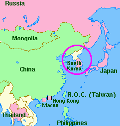
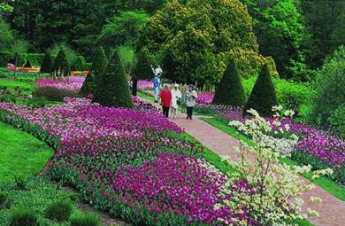
|
| Longwood Gardens |
Longwood Gardens, They feed you pretty well in the associated restaurants there, and the bookstores and gift shops are truly outstanding. But what in many ways is the best show garden in Philadelphia is Chanticleer, the former estate of a family that founded what is now Merck Pharmaceuticals, located in the suburb of Wayne, across the street from where Tracy Lord, the heroine of The Philadelphia Story, lived on two square miles of the Main Line.
|
| Philadelphia Flower Show |
It's not clear why Chanticleer is such a well-kept secret, but it's sure worth the trip to see it at almost any season, May preferred. Interest in gardening is not limited to just a few big estates, it's a Philadelphia sport. Therefore it's not surprising to learn that the largest flower show in America is held in Philadelphia at Convention Hall in the Spring. If your feet aren't flat when you go in, they will surely be flat when you come out because a complete tour would be miles long, threading among the aisles. It's not easy to guess how much money each exhibitor spends on a display, but it's surely not a cheap hobby when you get to this level. If you notice the landscaping on public grounds in the city, it's always a fair guess that it was paid for by the profits generated by The Flower Show. Almost everybody has heard of the Burpee Seed Company, and Mr. Burpee summed up the prevailing attitude of Philadelphia gardeners: "If you want to be happy for a day -- get drunk. If you want to be happy for a week -- get married. But if you want to be happy for a lifetime -- get a garden."
REFERENCES
| Gardens of Philadelphia and the Delaware Valley William Klein Jr. ISBN-10: 1566393132 | Amazon |
Doylestown
|
| James Michener |
Caught between the expansion of two metropolitan areas, Bucks County is inevitably doomed to extinction as a culture. Chester County and Bucks are in similar situations, as the suburbia devours exurbia, in this case, the Quaker farm communities. So you better go have a look, while they still survive to some degree.
The political unit of the area has been the county, and the county seat is in Doylestown, population about 8000. Within a few decades, it seems safe to predict the county population will approach a million. The town has lots of pride in itself and is just as cute as any town could possibly be. New Castle, Delaware has been preserved with the same pride but is uniform of a single period of architecture; Doylestown is a carefully preserved jumble of styles and periods, sizes and shapes. Like Princeton, NJ, and Odessa, DE, it is so attractive it brings hordes of visitors, which in turn quickly strangle it with traffic and lack of available parking space. There is an attempt to rescue the town with a by-pass highway, and blessings on the attempt. But the problem for these exurban jewels is not that people want to go around them, the problem is they are the main destination.
|
| Mercer Museum |
Doylestown was created in 1745 when William Doyle built a tavern at the crossroads. The county seat brings the courthouse with eleven judges and who knows how many lawyers, and the hospital. Henry Chapman Mercer brought three astonishing buildings, his 44-room mansion on 70 acres in the center of town, his famous Mercer tile factory in his back yard, and his multi-story museum of tools and crafts. All three of Mercer's buildings are made of concrete, built by craftsmen and himself with essentially unlimited personal funds derived from fabric manufacture in New England. And then this last bastion of the crafts movement embraced the artist colony established by Redfield at New Hope, and both of them attracted all those rich Broadway stars and publishing moguls. Right in the center of town, the Mercer crafts museum sits across the street from the James A. Michener Art Museum, small but very tasteful, the museum home of the Pennsylvania Impressionist school of art. The essence of this style is a smooth careful background, overlaid with quick thick foreground brushwork, producing a strong three-dimensional effect.
Schoolchildren in buses delight in the dolls house aspects, tourists admire the very fine art, everybody likes the cute little jumble of well-preserved eclectic buildings. It's all in a setting of Quaker farmhouses for the time being, but the split-levels and the McMansions by the thousands are coming. Visitors throng to see, and the residents are proud of what they have. But, really, does everybody have to bring his car?
While the City Sleeps

|
| David Dinges |
For almost a century, it's been a settled rule that it takes "half an hour" to get from home to work. In a sense, that's just a figure of speech because it rather obviously takes most people longer than that. But in another sense, the thirty-minute rule persists in fact, because that's how long it takes to travel to the outer edge of the suburbs. That time requirement has not changed in decades. As people increasingly live beyond the outer edge of the suburbs, it takes them thirty minutes to get to that point, with "exurban" travel time as an extra, often significantly extra. It would appear from common parlance that the thirty-minute distance is fixed and settled; the exurban extra time consumption is open to argument, still subject to change.
Let's restate this business. Thirty-minute commuting is what everyone must do, but travel beyond the suburban line is still considered an elective option. Other options are to read books, go to professional society meetings, fiddle with computers, or chat using a variety of new electronic instruments. One option is at least briefly considered by everyone: get less sleep. The World Health Organization has shown that finding extra time to commute by sleeping less is nearly universal. Philadelphia's Institute for Experimental Psychiatry has measured the physical cost of doing so. Essentially, you can accumulate a deficit of sleep for a week, then restore your freshness by one or two good sleep. At the very least, biological pressure of that sort is going to compete with Sunday morning church attendance. Of course, maybe it works the other way; maybe atheists feel free to move to the exurbs.
There's another residential option, to build vertically upward in what is commonly called "condos". From the church attendance point of view, it's an interesting observation that people who live in houses downtown seem to get dressed for church, followed by Sunday Strollers Brunch. Dwellers in condos, however, seem to prefer to spend the time at sidewalk tables on Rittenhouse Square, South. Quite obviously, some other considerations may be dominant. When the housing bubble finally bursts, it will be interesting to see what it will uncover in the way of convoluted social effects.
Certain facts will remain hard facts. According to Euclid, the area within a circle expands three times as fast as the square of the radius. Hence the population is first to spread thinner as it expands outwards, then silts up with more people. In our case, the census bureau reports exurban commuting time has about doubled in fifteen years, so traffic gets more crowded at that rate. People make up for it by sleeping late on Sunday, then start giving up something else. They don't want to give these things up, so they skirt the edge of chronic sleep loss. They fall asleep in movies, or in lectures -- or at the wheel of the moving car. The cities grow larger, urban sprawl spreads further out. Mixing all factors together, one would suppose there's an invisible limit to how wide each city can grow. After that point is reached, there's only increased density insight if population numbers continue to increase.
Perth Amboy Revisited
|
| Perth Amboy |
It's now moderately complicated to find Perth Amboy, New Jersey, even after you locate it on a map. Like New Castle DE it flourished early because it was on a narrow strip of strategic land, and like New Castle, eventually found itself cut off by a dozen lanes of highways crowded together by geography. It's an easy drive in both cases only if you make the correct turns at a couple of crowded intersections. Both towns were important destinations in the Eighteenth century, but by the Twentieth century, both were pushed aside by traffic rushing to bigger destinations. Industrialization hit the region around Perth Amboy somewhat harder than New Castle, destroying more landmarks, and bringing to an end its brief flurry as a metropolitan beach resort. If you aspire to preserve your Eighteenth-century glory, it's easier if you don't have too much progress in the Nineteenth. In Perth Amboy's defense, it must be noted that Jamestown and Williamsburg, Virginia had just about totally disappeared when noticed by Charles Peterson and John Rockefeller, but neither of those towns was run over by Nineteenth century industrialization. So, while New Castle has treasures to preserve and display, Perth Amboy seems to have only the Governor's mansion like the one notable building to work with. William Franklin, the illegitimate son of Benjamin, was the royal governor installed in this palace shortly before 1776.

|
| Governor's mansion in Perth Amboy |
While it is true that some wealthy local inhabitants did a lot to restore and maintain New Castle (and Williamsburg), the Governor's mansion in Perth Amboy was bought and made the home of Mathias Bruen, who is 1820 was thought to be the richest man in America. If Bruen had only had the necessary imagination and generosity, this was probably the best moment for Perth Amboy to have had a historical restoration. Instead, he added some unfortunate features to the mansion; it later became a hotel, and later on, an office building. Public-spirited local citizens are now trying to set things right, but the costs are pretty daunting. Someone has to find an inspired Wall Street billionaire like Ned Johnson to make over an entire town. Occasionally, a state government will do it, as has been done with Pennsbury. Or a national organization might become inspired, as happened with Mt. Vernon and Arlington. Its present state of peeling paint and makeshift repairs suggests uninterest in Perth Amboy's Governor Mansion by the State, and the absence of whatever it is that occasionally inspires fierce and determined local leadership. Perth Amboy needs some help and needs to forget about its handicaps. Sure, it's hard to commute anywhere, it's even hard to drive across the highways to the countryside. The bluff on the promontory was once quite arresting, now a rusting steel mill occupies that spot. Other than that, it doesn't look ominous or dangerous at all. It's just forgotten.
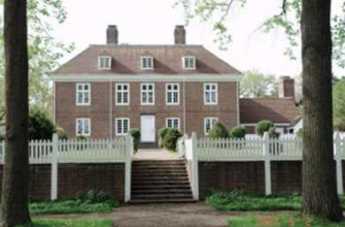
|
| Pennsbury Mansion |
Aside from the Royal Governor's former mansion, it is hard to find a historical marker or monument in this scene of former prosperity and glory, but there is one. Down on the beach is a bronze plaque, commemorating the 150th anniversary of the founding of -- Argentina. So there's a clue, which is not difficult to associate with all of the Hispanic names on the stores, and the Hispanics in evidence on all sides. They all seemed to know that this was once the capital of New Jersey, seemed pleased with it, and could point out the famous building. They are pleasant and friendly enough. Perhaps even a little too comfortable. Because, as William Franklin's famous father once said, all progress begins with discontent.
Morris Arboretum
|
The former estate of John and Lydia Morris is run as a public arboretum, one of the finest in North America.
|
Morris is the commonest Philadelphia name in the Social Register, derived largely from two unrelated Colonial families. In addition to their city mansions, both families had country estates. The country estate once belonging to the Revolutionary banker Robert Morris was Lemon Hill, just next to the Art Museum, where Fairmount Park begins. But way up at the far end of the Park, beyond Chestnut Hill, was Compton, the summer house of John and his sister Lydia Morris. This Morris family had made a fortune in iron and steel manufacture and were firmly Quaker. Both John Morris and his sister were interested in botany and had evidently decided to leave Compton to the Philadelphia Museum of Art as a public arboretum. John died first, leaving final decisions to Lydia. As the story is now related, Lydia had a heated discussion with Fiske Kimball, at the end of which the Art Museum deal was off. She turned to her neighbor Thomas Sovereign Gates for advice, and the arboretum is now spoken of as the Morris Arboretum of the University of Pennsylvania. It is also the official arboretum of the State of Pennsylvania. To be precise, the Morris Arboretum is a free-standing trust administered by the University, with the effect that five trustees provide legal assurance that the property will be managed in a way the Morrises would have wished. In Quaker parlance, Lydia possessed "steely meekness."
A public arboretum is sort of an outdoor museum of trees, bushes, and flowers, with an indirect consequence that many museum visitors take home ideas for their own gardens. Local commercial nurseries tend to learn here what is popular and what grows well in the region, so there emerges an informal collective vision of what is fashionable, scalable, and growable, with the many gardeners in the region interacting in a huge botanical conversation. The Morris Arboretum and two or three others like it go a step further. There are two regions of the world, Anatolia and China-Korea-Japan, with much the same latitude and climate as the East Coast of America. Expeditions have gone back and forth between these regions for a century, transporting novel and particularly hardy or disease-resistant specimens. An especially useful feature is that Japan and parts of Korea were never covered with glaciers, hence have many species found nowhere else in the temperate zone. Hybrids are developed among similar species found on different continents, and variants are found which particularly attract or repel the insects characteristic of each region. The Morris Arboretum is thus at the center of a worldwide mixture of horticulture and stylish outdoor fashion, affecting millions of home gardeners who may never have heard of the place.
Tree Huggers: Delaware Valley College
|
| Doylestown, PA |
At the time when Philadelphia and New York were both occupied by the British during the Revolutionary War, a backwoods highway connected the thirteen colonies. Doylestown is 35 miles due north of Philadelphia City Hall, at the point of intersection of this variant of the Ho Chi Minh Trail with the path which Philadelphia Tories took in their flight to Kingston, Ontario. No doubt there were some interesting conversations in Mr. Doyle's tavern at the crossroads.
Doylestown is also on the invisible border between the hegemonies of Philadelphia and New York, where descendants of German and Quaker farmers make a cautious contact with the distinctly non-Quaker artists and writers fleeing south from New York. James Michener and Pearl Buck once represented Philadelphia in the cultural stew with New Yorker ex-patriots, Somehow in this interface, a place is found for the Delaware Valley College, which started life in 1896 with Jewish founders of the National Farm School. The original board of trustees included such names as Gimbel, Lit, Snellenburg, and Erlanger, but the three-year curriculum was entirely agricultural. The founder himself was Joseph Krauskopf, who got the idea after an inspiring interview with Count Leo Tolstoy.
|
| Baruch Blumberg |
From a single building which served as classroom and dormitory, the college has grown into a four-year institution in numerous buildings scattered over a 570-acre plot with a second 120-acre farm in Montgomery County. The school is determinedly non-sectarian, and for forty years has been coeducational. It has had several changes of name, from the National Farm School, eventually to its present name. The curriculum has expanded as well, with masters degree programs in business and education. Baruch Blumberg, the Nobel Prize winner in Medicine, maintains an office there, and it is clear the college means to shift its emphasis toward the scientific basis of agriculture and the environment. It's also pretty clear that rising agricultural prices will soon re-establish agriculture as a dominant feature of our economy, although agriculture in the modern sense is quite a distance from farming in the old sense, and requires a different sort of educational preparation.
The Right Angle Club of Philadelphia recently heard from Joshua Feldstein the chairman of the board of trustees, and the brand-new president, just moving in from Columbia University. Sixty-eight years of driving ambition is personified in one, and the bright shining future in the other. We wish them well.
By the way, the tree hugger nickname comes from a campus tradition of this college, very much an active ceremony, of hugging the 400-year-old oak standing beside the president's house on the campus. The College, of course, is 250 years younger than the tree.
WWW.Philadelphia-Reflections.com/blog/1295.htm
Gardening Survives
Adam Levine, the author of a new book about the Philadelphia public garden scene was recently the featured guest speaker at the Franklin Inn. He's a charming person, and has given us a great book.
He draws to our attention that the Philadelphia region is pre-eminent in the garden world, and has been so for several centuries. While it is true that Philadelphia has a mild enough climate to be suitable to two climate zones, the early settlers came from a region of middle England that has been a garden center since Roman times. And they were Quakers, uncomfortable with the outward show in buildings and furnishings, but flowers were innocent instruments of the display. Although Chanticleer was created by a Pennsylvania German family, the great centers of public gardens are mostly traceable to the influence of Quakers, and the du Pont family. Since one or two years of neglect will ruin almost any garden, the essence of great gardens lies in the ability to survive.
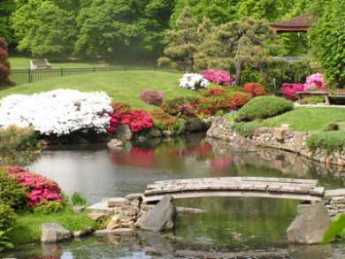
|
| The Horticultural Society |
In fact, the Philadelphia area contains hundreds of gardens which have decayed and virtually disappeared. The Horticultural Society is at the heart of garden preservation, financed in large part by the annual flower show, but even that thriving organization is hard pressed to do justice to the vast areas that need tending. Woodlands would be an example of an area needing tending, and Friends Hospital is an object lesson. When that venerable institution was sold to sharp pencil types from out of town, the Azalea gardens on the grounds were closed to visitors, except for two hours a year. It makes you tremble to imagine how long this famous azalea collection will probably survive. Meanwhile, Germantown's famous gardens are maintained in a minimal way, stretching the resources of the owners who have more urgent demands to meet in their buildings and furniture. Indeed, it is hard to name a really outstanding garden within the city limits, with the exception of the Morris Arboretum, which barely makes it within city boundaries. The area back of the Art Museum along Boathouse Row makes a brave attempt in the spring, but it's a pale reminder of the glory which used to be seen in East Fairmount Park, especially at Lemon Hill, Stenton, and Cliveden. Stotesbury is just a relic.
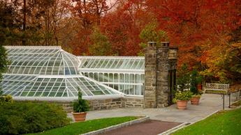
|
| Morris Arboretum |
Gardens have moved to the suburbs. Chanticleer, the Morris Arboretum, Longwood Gardens, Nemours, the Scott Arboretum at Swarthmore, West Laurel Hill, The University of Delaware in Newark, Cabrini College in Villanova, Haverford College Arboretum, Temple University's Ambler campus, and the Trenton Sculpture Gardens on the old fairgrounds -- all would demand mention in any list of outstanding gardens in America. But only a few of them aspire to the standards of an outdoor sculpture garden, where the goal was to surround each piece of sculpture with a garden in such a way that only one sculpture could be seen at a time. Now, that was gardening on the grand scale.
Hidden in a regional garden scene is the seed merchants, starting with John Bartram and famous under the Burpees, which make gardens possible. After all, there has to be a place to find these things. Perhaps the catalog stores, like Wayside Gardens, are the hope for the future. Every shrub or tree transported from a nursery takes up a ball of topsoil along with the specimen, and the appearance of nurseries around the periphery of a city is usually the first step in the development of housing projects. If there is an investment of topsoil in every garden, perhaps we ought to think a little bit about the way we let the investment dry up and blow away.
REFERENCES
| Gardens of Philadelphia and the Delaware Valley William Klein Jr. ISBN-10: 1566393132 | Amazon |
Dog Days
Teddy Roosevelt was a great conservationist, promoting the outdoors life, establishing the National Park Service and so on. At the same time, the walls of Sagamore Hill his home on Oyster Bay were covered with the stuffed heads of big game animals he had personally shot for no better reason than it pleased him to shoot them. This paradox is a convenient symbol of the mixed-up ideas and conflicted attitudes of the public at large about animals. We love them, but we also eat them for dinner.
The two sides of this tension have at their extreme some pretty rich nut cases, or some pretty nutty rich folks, however, you wish to style them. One woman has bought half the country of Paraguay for a nature preserve. On the other extreme, it is said that one wealthy Philadelphia lady has contributed enough money to attract the solicitude the Governor, in the interest of animal rights legislation. Since his political enemies call him "Fast Eddie", that isn't his usual image. It is rumored that he loves his pet terrier, but the center city cynics gathered around lunch tables on Camac Street surmise that his really influential friends could be real estate developers. This all does require a little explaining, which is a full-time occupation in some circles.
Jim Scharnberg was entertaining Inmates the other day about his almost full-time avocation of hunting rabbits in Chester County with a pack of French hounds. Hounds, mind you, not dogs. There are thirty clubs in Chester County alone concentrated on packs of hunting hounds, not to mention all the other counties in the state, and not to mention the hunters on horseback, the fox hunters, the deer hunters, and lots of other kinds of hunters, sometimes with but mostly without guns. Most of these groups have frequent outings together in the countryside, followed by jolly dinners and gatherings, and with newsletters, websites, intermarriages and lots of other associations. Social scientists would call these networks, a trendy phrase, that..
To illustrate how easily networks are formed between hound lovers and politicians, Jim tells the story of living in Manhattan near Gracie Mansion, with his hounds of course. Hounds have to be walked, you see, and the New York police are not particularly friendly to the idea, nor are other inhabitants of the skyscraper canyons, who promote pooper scooper laws and encourage police harassment of hounds. One evening a dog belonging to a native New Yorker was attacked by 27 East River rats. Jim's hounds were unleashed, the dog was rescued. It turned out to belong to Mayor Lindsay, who was quickly persuaded to create special privileges for hounds in Carl Shurtz Park and other East Side grasslands.
|
| French Hounds |
Some members of hound packs are into the whole thing, as Jim is, but most members merely enjoy an excuse to wander in the outdoors with convivial company, or else enjoy the parties afterward; some people just like to write newsletters and send out meeting notices. Everybody likes to talk, that's one sure thing. These things flourish in the exurbs, the farm areas just beyond the edge of development. In Chester County, such farmland is quickly disappearing at the rate of 13,000 acres a year as real estate developers find it is cheaper to build in the countryside than where you have to tear down old buildings to build new ones. Inevitably, the people whose ancestors started the farms 300 years earlier are upset at seeing the old place go. There's an economic issue as well, because farmers need local canneries and wholesalers to take their farm products; these support systems tend to wither as farming gets sparser. And the new neighbors are not accustomed to farm sounds or farm smells. The idea of living next to a pig farm is not softened by the knowledge that the pig farm was there first. Perhaps you get the idea; conflict is how politics gets into it, and these are the networks who will prostrate themselves in the middle of the highway to preserve their heritage. All it takes is a couple of rich ladies to get excited enough to donate lobbying money, and wondrous inanities can get taken seriously. There is now a bill before the Pennsylvania Legislature which in other times would be referred to as a "tickle" bill, one of ten thousand annual bills submitted by legislators to placate constituents, but widely observed never to go anywhere. But put some serious money behind a tickle bill, hire a few consultants who know exactly which levers to pull and which clauses to include for support, and you could have a law to air condition all dog kennels, thus making Pennsylvania the laughing stock of the country's legislative circles. There can be rules governing the size and cleanliness of dog runs, rules about Fido's required breakfast content, and rules to sterilize every domestic animal so that in one generation we will be animal free.
Grown ups are actually saying such things, and legislators are growing afraid to oppose them. Back home in the real estate office, everybody can be all smiles. Because this is how you can get some nice zoning changes if you play your cards right.
Germantown Avenue, One End to the Other

|
| Germantown Map |
Chestnut Hill really is a big hill poking up in the middle of Philadelphia, and Germantown Avenue follows an old Indian trail from the Delaware River right up to that hill. The waterfront area of the city has been built and rebuilt to the point where it's now a little hard to say just where Germantown Avenue begins. From a map viewpoint, you might look for a four-way intersection of Frankford Avenue, Delaware Avenue, and Germantown Avenue, underneath the elevated interstate highway of I-95. The present state of demolition and rubble heaps suggests that a Casino might be built there sometime soon, politics and the Mafia permitting.
|
| Fair Hill Cemetery |
Although Germantown Avenue has wandered northwestward from this uncertain beginning for over 300 years, up to the rising slope of the town toward Broad Street, it is now rather difficult to make out anything but industrial slum along its path which could be called historic. There is hardly any structure standing which has a colonial shape, and no Flemish bond brickwork is seen in the tumble-down buildings. When with the relief you finally approach Temple University Medical Center at Broad Street, the Fair Hill cemetery does show some effort at preservation, and a sign says that Lucretia Mott is buried there. But that's about all you could photograph without provoking suspicious stares. Here's the first of four segments of Germantown Ave., and it's a pretty sorry sight.
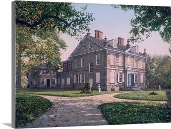
|
| Chew Mansion |
Crossing Broad Street, the busy intersection suggests 19th Century prosperity in its past, and on the west side of Broad, you can start to see signs of historic houses, either in colonial brickwork or grey fieldstone. The road gets steeper as you go west past Mt. Airy, where it almost brings tears to the eyes to see brave remnants of another time. George Washington lived here for a while, and the Wisters, Allens, and Chews; Grumblethorp and Wyck. The huge stone pile of the Chew Mansion glares at the imposing Upsala mansion, where British and Americans lobbed artillery at each other during the Battle of Germantown. Benjamin Chew the Chief Justice built this house as a summer retreat, to get away from Yellow Fever and such, and started the first migration to the leafy suburbs. His main house was on 3rd Street in Society Hill, next to the Powels and where George Washington stayed. At the peak of the hill in Chestnut Hill, a suburb within the city. Germantown Avenue rather abruptly goes from the relics of Germantown to the charming elegance of Chestnut Hill, but during a recession, it frays a little even there. At the very top is the mansion of the Stroud family, now in the hands of non-profits; across the road in Chestnut Hill Hospital, once the domain of the Vaux family. Then down the hill to Whitemarsh, where the British once tried to make a surprise raid on Washington's army. As you cross the county line into Montgomery County, it's conventional to start calling the Avenue, Germantown Pike. Germantown Pike was in fact created in 1687 by the Provincial government as a cart road from Philadelphia to Plymouth Meeting. Farmers used to pay off their taxes by laboring on the dirt road, at 80 cents a day. Germantown Pike, Ridge Pike, Skippack Pike, Lancaster Pike, and others are a local reminder that Pennsylvania was always the center of turnpike popularity; that's how we thought roads should be paid for. The present governor (Rendell) hopes to sell off some better-paying turnpikes to the Arabs and Orientals, possibly imitating Rockefeller Center by buying them back and reselling them several times by outguessing the business cycle. Parenthetically, the Finance Director of another state at a cocktail party recently snarled that the purpose of privatizing state infrastructure was not to raise revenue, but to provide collateral for more state borrowing. He wasn't at a tea party, but he may soon find himself there.
From a modern perspective, the third segment of the Germantown road runs from Chestnut Hill to Plymouth Meeting, with lovely farmhouses getting swallowed up by intervening, possibly intrusive, exurbia. The township of Plymouth Meeting is a hundred years older than Montgomery County, having been built to be near a natural ford in the Schuylkill River. Norristown, a little downstream, is the first fordable point on the Schuylkill, with Pottstown making a third. Plymouth's colonial character survived a period of industrialization based on local iron and limestone, and has established several prominent schools for the surrounding area. But the construction of a substantial highway bridge attracted a large and busy shopping center. The shopping center looks as though it will eradicate the quaint historical atmosphere more effectively than industrialization ever could.
The fourth and final segment of Germantown Pike starts at the Schuylkill and goes over rolling countryside to its final destination at Perkiomenville, where it joins Ridge Pike at the edge of the Perkiomen Creek. That's an Indian name, originally Pahkehoma. Perkiomenville Tavern claims to be the oldest inn in America, although that honor is contested by another one along the Hudson River near Hyde Park. The WPA during the Great Depression constructed a large park along the Perkiomen Creek for several thousand acres of camping and fishing, so Perkiomenville has several large roadhouse restaurants and antique auctions for bored wives of the fishermen. In the V where Ridge Pike and Germantown Pike come together, a dozen or more colonial houses are tucked away in a town called Evansburg. This formerly Mennonite terminus of Germantown Pike obviously still has a lot of charm potential, and its local inhabitants are very proud of the place. But it's easy to zip past without noticing the area, which includes an 8-arch stone bridge, said shyly to be the oldest in the country. It's hard to know whether you wish more people would visit and appreciate; or whether you are happy that obscurity might permit it to survive another century or so.
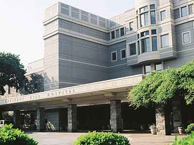
|
| Chestnut Hill Hospital |
The name change of the Germantown road from Avenue to Pike is probably not precisely where the turnpike began, but it is now notable for some pretty imposing mansions, standing between the humble and even somewhat dangerous slums along Delaware, and the charmingly humble but well-preserved Mennonite villages, at the other end. It is arresting to consider the two ends, whose houses were built at the same time; only the Mennonites endure. Somewhere just beyond the Chestnut Hill mansions is an invisible line. West of that point, when you say you are going to town, you mean Pottstown. When you say you are going to the City, you mean Reading. And as for Philadelphia, well, you went there once or twice when you were young.
Burlington County, NJ
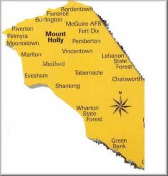
|
| Burlington County Map |
Burlington County used to be called Bridlington. It contains Burlington City, formerly the capital of West Jersey, which is how they styled the southern half of the colony, the part controlled by William Penn. In colonial times, the developed part of New Jersey was a strip along the Raritan River extending from Perth Amboy, the capital of East Jersey, to Burlington. To the north of the fertile Raritan strip, extended the hills and wilderness mountains; to the south extended the Pine Barrens loamy wilderness. The Raritan strip was predominantly Tory in sentiment, while the remaining 90% of the colony consisted of backwoods Dutch farmers to the north, and hard-scrabble "Pineys" to the south, except for the developments farmed by Quakers. The Quakers had ambiguous sentiments during the Revolution, leaving conflicts between pacifism and self-defense to individual discretion. The real fighting mostly went on between the Episcopalian Tories and the Scottish-Presbyterian rebels, both of which were sort of newcomer nuisances in the minds of the Quakers. The warfare was bitter, with the Tories determined to hang the rebels, and the rebels determined to evict or inflict genocide on the loyalists. Standing aside from such blood-letting of course inevitably led to a loss of Quaker political leadership. When East and West Jersey were consolidated by Queen Anne into New Jersey in 1702, the main reason was ungovernability, with animosities which endure to the present time in the submerged form. Benjamin Franklin's son William was appointed Governor through his father's nepotism, but when he turned into a rebel-hanging Tory, his father extended his bitterness about it into a hatred of all Tories. The later effect of this was felt at the Treaty of Paris, where Ben Franklin would not hear of leniency for loyalists, striking out any hint of reparations for their property losses. In a peculiar way, the factionalism resurfaced at the time of the Civil War, where the slave-owning Dutch in the North came into conflict with the slave-hating Quakers in the South. The problem would have been much worse if the Jersey slaveholders had been contiguous with the Confederacy, but it was still bad enough to perpetuate local sectionalism. A few decades ago, it was actually on the ballot that Southern Jersey wanted permission to secede.
Under the circumstances, when James K. Wujcik wanted to work for progress in his native area, he avoided any ambition to enter State politics and concentrated his efforts on Burlington County. He is now a member of the Board of Chosen Freeholders of Burlington County, along with four other vigorous local citizens. Most notable among them is William Haines, the largest landholder by far in the area, whose family still controls the shares of the Quaker Proprietorship. Membership on the Burlington County Board of Freeholders is a part-time job, so Mr. Wujcik is also president of the Sovereign Bank. We are indebted to him for a fine talk to the Right Angle Club avoiding, with evident discomfort, many mentions of state politics or sociology.
|
| Congressman Saxton |
Burlington is the only New Jersey county which stretches from the Delaware River to the Atlantic Ocean, including the Pine Barrens occupying 80% of the land mass in the center; fishing and resorts dominate near the ocean and former industrial areas along the river. Much of the area has been converted to agriculture for the Garden State, but about 10% is included in a National Preserve. The population has doubled in the past fifty years, so urbanization is replacing agriculture, which had earlier displaced wilderness. The county includes Fort Dix and Maguire Air Force Base, strenuously promoted for decades by now-retired Congressman James Saxton.
Somewhere in the past few decades, Burlington became quite activist. Although many tend to think of real estate planning as urban planning, this largely rural county went in for planning in a big way, deciding what it was and what it wanted to be. Generally speaking, its decision was to replace urban sprawl with cluster promotion. The farmers didn't like an invasion by McMansions or industries, while the towns lost their vigor through tax avoidance behavior of the commuter residents. Overall, the decision was to push urban development along the river in clusters surrounding the declining river towns, while pushing exurban development closer to logical commuting centers, leaving the open spaces to farmers. Incentives were preferred to compulsion, with a determination never to use eminent domain except for matters of public safety. To implement these goals, two referenda were passed with 70% majorities to create special taxes for a development fund, which bought the development rights from the farmers and -- with political magic -- re-clustered them around the river towns. The farmers loved it, the environmentalists loved it, and the towns began to revive. The success of this effort rested on the realization that exurbanites and farmers didn't really want to live near each other, and only did so because developers were looking for cheap land. Many other rural counties near cities -- Chester and Bucks Counties in Pennsylvania, for example -- need to learn this lesson about how to stop local political warfare. Corporation executives don't want to live next to pig farms, but pig farmers are quite right that they were living there, first. When this friction seeps into the local school system, class warfare can get pretty ugly.
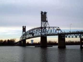
|
| Burlington Bristol Bridge |
In Burlington County, they thought big. The central project was to push through the legislature a billion-dollar project to restore the Riverline light rail to the river towns, along the tracks of the once pre-eminent Camden and Amboy Rail Road. It was an unexpected success. During the first six months of operation, ridership achieved a level twice as large as was projected as a ten-year goal. Along this strip of the Route 206 corridor, the old Roebling Steel Works are becoming the Roebling Superfund Site, now trying to attract industrial developers. The Haines Industrial Site originally envisioned as a food distribution center was sold to private developers who have created 5000 jobs in the area. Commerce Park beside the Burlington Bristol Bridge is coming along, as are the Shoppes of Riverton and Old York Village in Chesterfield Township. As Waste Management cleans up the site of the old Morrisville Steel plant across the Delaware River, a moderate-sized development project is becoming an interstate regional one.
No doubt there will be bumps in these roads; the decline of real estate prices nationally is a threat on the horizon, because it provokes a flight of mortgage credit. It works the other way, too, as banks decide to deleverage by reducing outstanding loans; this is the way downward spirals reinforce themselves. And anyone who knows anything about all state legislatures will be skeptical about political cooperation in a state as tumultuous as New Jersey. The Pennsylvania Railroad destroyed the promise of this state once; some other local interest could do it again. Nevertheless, right now Burlington County looks like a real winner, primarily because of effective leadership.
Gettysburg
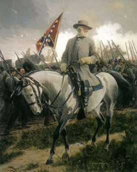
|
| General Robert E. Lee |
It's quite a long drive from Philadelphia to Gettysburg, but General Lee was attempting to disrupt supplies to the "Arsenal of the North" by capturing the railroad center at Harrisburg. Furthermore, Philadelphia reacted as if Lee's advance was aimed straight at us, creating hysterical preparations for an invasion which had to be stopped before it got here. And finally, George Gordon Meade, the Union commander, was a Philadelphia home town boy. So, regard the Battle of Gettysburg as part of Philadelphia history, please.
|
| General George Gordon Meade |
Major (ret.) Lawrence Swesey is a West Point graduate and currently Administrator of the 1st City Troop; because of his enthusiasm for the subject, he runs a tour agency which specializes in battlefields, especially Gettysburg. From him, the Right Angle Club recently learned much that made the whole episode comprehensible. Such as Lee's purpose in going there, which appears to have been based on the growing recognition that the South was likely to lose the war, and desperately needed some major victory in Northern territory, both to take the pressure off the Southern homeland and to improve whatever terms might be extracted at a peace negotiation. To fight successive battles against a larger enemy, with larger economic resources, was to doom the South eventually as resources and men were depleted with no hope of replacing them. Sooner or later, some Union General like Grant would settle down to a grinding unrelenting assault, with the willingness to trade one death for another, until only the larger side was left standing. That's quite different from guerilla warfare of the type Washington fought, where the way to win was simply to avoid losing until the stronger side lost its civilian support. Lee could feel the South beginning to lose its nerve to fight on indefinitely, without any visible route to victory. Although Grant eventually did defeat him by attrition, Grant's own opinion appears to have been more personalized. In every war, he was later to say, there comes a time when both sides want to quit. The side that wins is the one with a general who keeps fighting for no particular reason until the other side finally quits and he wins the war.
Major Swesey emphasizes that rifles were available, but they cost four times as much as smooth-bore muskets which were only effective for twenty or thirty yards. Rifles were reserved for sharpshooters, and the enemy at a distance was bombarded by artillery as the two sides approached. So, in Pickett's famous charge, most of the casualties took place in the last fifty yards. Pickett's men had to contend with trudging stoically through an exploding field of cannon fire, unable to fire effectively at the Union men behind a stone wall, who were also supposed to lie passively on the ground while the Confederate artillery pounded at a stationary target. Somehow, most of the Southern artillery fire went over the Union heads and landed beyond the crouching line; in many ways, this was the main factor in the Union victory.
As the waves of attackers got within musket shot of the wall, they formed into three ranks. Since it took about a minute to reload the musket, a more or less continuous fire could be maintained by rotating three successive volleys rank by rank, at more or less point blank range. Then, fix bayonets, and the real slaughter became a hand to hand, in the blazing heat of summer.
www.Philadelphia-Reflections.com/blog/1436.htm
Broad Street North and South
Following the instructions of William Penn, all of Philadelphia's original numbered streets are laid out by the compass, due North and South. Without getting into a history of how the street names then got modified somewhat, Broad Street by the present system would be 14th Street. Center Square of the original five parks is placed at the intersection of Broad and Market Streets. After a period functioning as the city water-works, the intersection has been occupied by City Hall for over a century. Originally intended to be the tallest building in the world, the tower of City Hall still dominates the landscape in all four directions for a considerable distance. It also stands at the foot of the diagonal Benjamin Franklin Parkway, so City Hall stands like a Parisian intersection rather than the Scotch Irish Diamond it once was. Nevertheless, when you look down the long canyon of each intersecting street, the tower in the middle of the street dominates the view. Let's begin a tour of the whole extent of the longest street in Philadelphia, at the southernmost end of Broad Street, at the Philadelphia Navy Yard.
|
| Gene Tunney vs Jack Dempsey |
Although the guard will be happy to tell you it's a dumb regulation, you aren't allowed to take pictures of the Navy Yard, or visit without a pass, in spite of the fact the area of the yard is fast being converted into business properties. A great many of the warships that won our wars were built in this yard, and many rests in a sort of floating Navy graveyard, or mothball fleet, which is best seen from the elevated highway nearby, Interstate 95. The shipyards rest on the filled-in area around Hog Island, home of the hoagie sandwich. Just north of the Navy Yard are several sports stadiums and a great deal of parking space to service them. Much muttering is heard about the tax cost of this stadium farm, whose many-million-dollar facilities are only used for between eight and eighty home games apiece each year. The stadium-sprouting process began with Municipal Stadium which was built for the Dempsey Tunney prize fight, and held 110,000 spectators. In the time it housed the annual Army-Navy football game, but not much else, and has since been demolished. It certainly seemed to be the windiest, coldest place on earth, but that's just a child's recollection. At that time and for many years the area around the stadium was one huge garbage dump, and before that it was a huge swamp, the source of mosquitoes, malaria, typhoid and yellow fever. Fish like to eat mosquitoes, so filling in the South Philadelphia swamp badly injured the seafood industry of Delaware Bay, while admittedly ridding us of Yellow Fever epidemics. The swamp once extended as far as Gray's Ferry where the University of Pennsylvania now looms, with patches of quite rich farmland scattered in the swamp. Stephen Girard had a large farm just to the West of what is now South Broad Street where he cultivated vegetables necessary for the French cooking he favored.
|
| Mayor Richardson Dilworth |
As you drive north on Broad you begin to notice the quaint Philadelphia custom of parking your car in the center of the wide street. Mayor Dilworth once announced this had to stop, but the uproar from local residents forced even this ex-Marine officer to retreat. Down the side-streets a variation is seen; when the local resident drives off, he leaves trash cans in the street, indicating it is private property. Rumor has it that people who ignore the warning can get their windshields smashed with a brick. This area is as urbanized as you can get, but the spirit of the wild, wild West nevertheless prevails.
Rancocas Valley: Mt. Holly, Eayrestown, Medford
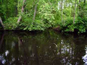
|
| Rancocas River |
The southern half of New Jersey, once called the Province of West Jersey, is sandy and flat, mostly not more than twenty feet above sea level. So, there is an extensive lacy network of slow-moving branches to the several creeks and rivers draining the area. Some of these rivers drain toward the Atlantic Ocean, some drain the other way to Delaware; it scarcely makes much difference. Almost as soon as the Quaker proprietors settled the area in the Seventeenth century, the broad Rancocas River (draining into Delaware) stood out as a wonderfully protected region to settle. The Rancocas wanders through the woods but is tidal all the way to Mt. Holly, which later even became a shipbuilding center. That's now the centrally located county seat of Burlington County, from which several branches extend in various directions. One southerly branch drains the water coming from Medford Lakes, once a summer cottage community miles deep in the Pines, now a place for fancy houses with lakes in the backyard. The cute little nearby town of Medford has a Braddock Tavern, reminding visitors that General Braddock stopped off here on his way to his own ambush at Fort Duquesne in the French and Indian War. The Medford-Mt. Holly Road follows the southern branch of Rancocas creek, running through somewhat broken ground greatly resembling Northern Virginia. And, that resemblance is enhanced by a number of horse farms with white-board fences, many of them looking quite historical, and very well manicured. Here's a drive worth taking, especially in late April when the trees are just budding out, the grass is green, and the azaleas are blooming. Starting in Mt. Holly, which is recognizably colonial but unfortunately somewhat under-maintained, you can recognize that the road once started at the Three Tun Tavern, of colonial fame. The confluence of creek branches made a natural place for a farmers market in the center of the road. A short distance down one of the branching streets of Mt. Holly is the red-brick home John Woolman built to keep his daughter from moving away with her Philadelphia husband. We talk more about John Woolman in another section of Philadelphia Reflections.
|
| Rancocas Map |
One of the interesting features of the "lost" colonial community along the Mt. Holly-Medford Road grows out of the Rancocas curving east toward the ocean and then branching south. That means that if you drive from Haddonfield or Camden to the ocean beaches you go through the pine woods and then come upon this ancient Medford community before you re-enter the pine barrens and go on toward the ocean. That gives the impression the Medford area was somehow a lost frontier, when in fact it was a part of one of the oldest settlements in the state. It's a strip community, running along the banks of the Rancocas from Medford to Mt. Holly; houses along the banks, farmland stretching behind the houses. Most people on the way to the shore just go through the traffic light and keep on going without realizing what they are missing. And, indeed, if all that traffic stopped to browse, it would quickly ruin the place.
Along the Medford-Mt. Holly Road is seen an occasional McMansion, with "Atlantic City" sort of written all over it, but in general, the houses are pretty upscale and restrained. There is a nursery farm which must stretch a full mile, full of flowering shrubs and trees, looking very manicured and attractive. To some extent, a nursery improves a neighborhood, since it supplies lots of flowering shrubbery ideal for the local soil conditions. But in a larger sense, a nursery is almost always bad news for a neighborhood. Every time a plant is dug up and sold, it takes away a bushel of topsoil. No farmer would normally consent to such treatment of his most valuable asset, so the sale of property for nurseries is a sign the farmers are selling out, urban development is looming. Unfortunately, this certainly also means the novel hidden river community in the pines is on the brink of being wiped out. Tourist visits are, well, now or never.
REFERENCES
| The Pine Barrens: John McPhee: ISBN-13: 978-0374514426 | Amazon |
Country Auction Modernized
Only a decade ago, the Quakertown exit of the Pennsylvania Turnpike made possible a quick trip from the city to the country, letting you off in the cornfields between Sumneytown and Lansdale. Today, the rush hour traffic is as bad as anywhere else, even on the four-lane express highway known as Forty Foot Road. A comfortable two-lane highway would be about forty feet wide, so presumably, the name denotes what was once a modern miracle of a two-lane highway, in this case until quite recently. It's all built up for miles, but almost all the commercial buildings are new. Exurban sprawl has positively lurched across the landscape, making prosperous people rich, and poor people prosperous. It won't be long before the housing subdivisions demand traffic signals to protect the school children, speed limits to reduce the collisions by teenagers, and other things destined to bring high-speed travel to a crawl, all day long. When that happens, it won't be called farm country anymore.
|
| Alderfer Auction Company |
On Fairground Road, where occasionally corn is still growing, a number of large new commercial enterprises have located, among them a moving and storage company with ten or so truck loading platforms in the back. Behind that is another large new building, also with a parking lot for fifty or so cars, the auction house. Different categories come up for auction on different days, so used furniture, for example, comes up every few weeks and has to be stored as things accumulate for the big day. With a moment's thought, you can easily see why the auction is affiliated with or owned by a moving and storage company. As you go through the entrance, you are invited to sign up and identify how you plan to pay, just in case you buy something; the product of this registration is a card with a number in big colored letters. That's your number, your payment arrangement, and soon you will find no one cares anything about you except that number. The auction I was interested in was for used books, one of three or four auctions conducted in different rooms.
|
| Auctioneer |
Nearly a hundred people had numbers for used books, maybe a similar number for antique furniture and paintings. Obviously, one other purpose of the registration process is to create a mailing list of customers interested in various objects, possibly linked to a program which sends out flyers and announcements. Country auctions have always been a source of local entertainment, so non-buying spectators are able to come and watch if they wish. There seemed to be few if any casual sight-seers; just about everybody is a buyer or a potential buyer. Players, as they say.
Most of the customers probably set their alarm clocks for 5 AM or earlier; the auction is centrally located, but most everybody comes from a considerable distance. At 9 AM, very promptly, the auction began, and from his manner, you could tell the auctioneer was anxious to get started. The object for sale had been on display for a day, but most people arrived around 7 AM to examine the goods, which are frequently sold in lots, meaning a box full of thirty or forty books more or less on the same topic. At the stroke of nine, the auctioneer chanting began, "Do I have ten dollars, yeh, ten, ten, ten, five, five, ten, fifteen, twenty, twenty, sold for fifteen. Your number, sir?" Two assistants took down the customer number, and the lot number, and the price; one of the two recorded the transaction in a computer, the other on a list by hand. One gathers the man without a computer was on the look-out for shills, people trying to bid up to the price without getting stuck for a purchase. The auctioneer repeatedly assured the audience that no one but a real bidder was allowed to bid, you owned it, and no excuses about being confused. When he reached he hundredth sale, he stopped for a drink of water, and proudly noted the first hundred sales took thirty-seven minutes. It required four other assistants to fish out the lots next in line, holding them up for confirmation only, since inspecting them at as the distance was out of the question. After each sale, the assistant dumped the prize in the new owner's lap.
|
| Auction Paddle |
And yet entitled to wonder a little. The ordinary run of books thirty or forty years old will sell for between ten and twenty dollars. Books about golf, just about any old book about golf, "go" for about forty dollars. Children's books are about sixty dollars. And, to my great surprise, boxes or albums of old photographs go for over a hundred dollars. A lady next to me excitedly brought an album of old photos back to her seat and thumbed through them. "Are you a dealer?" Yes. "Who buys this stuff?" I don't know, they come to my store and just buy it. Like the Auctioneer, she had a feeling for what the retail price would be, made a calculation, and knew what she could afford to pay wholesale. What the stuff actually represented, why people wanted it, what was a good one and what was a bad one--these people in the trade had very little idea. But they knew very precisely what a fair price, and gradually lowers it until it sells. Fun Lots of fun. When a familiar insider makes a mistake and pays too much, the others laugh heartily at him. Why this funny system works has long been a mystery, but everyone except a socialist readily acknowledges it does work. At least it works better than any known substitute.
Although the ritual of the country auction has been essentially unchanged for the centuries, it is just another transaction system. In the past fifty years, the world economy has been transformed by computerized efficiencies in transaction systems, with vast prosperity resulting from small saving endlessly repeated. Banking and Wall Street have concentrated most of the standardized transaction, in perfectly astounding volume; lots and lots of people have become immensely rich for producing small efficiencies in high volume. Those of us who have not become immensely rich can easily identify trivial innovations which resulted in wealth, and we easily sense the unfairness of old photos worth more than books of poetry. After all, the country auction is still grossly inefficient; the seller pays the auction company 20% of the price, and the buyer pays another 10%. There's 3% for the credit card company and &% for the sales tax. Forty percent of this transaction is going to the middle man, over and over and over again. The goal is to reduce transaction costs to the level of Wall Street, considerably less than one percent, Which still lots of yachts for middlemen.
As you walk out of the country auction, it doesn't take a mathematical genius to multiply thirty percent times the number of transactions, times a guess at the average sales price. No wonder these auction people are so cheerful, so much in love with their work. But two other parties are cheerful, too. That is, the buyer and the willing seller.
SEPTA's Long Term Planning
|
| Septa |
Byron S. Comati, the Director of Strategic Planning and Analysis for SEPTA (Southeastern Pennsylvania Transportation Authority), kindly gave the Right Angle Club an inside look at the hopes and plans of SEPTA for the near (five-year) future. Students of large organizations favor a five or six-year planning cycle as both short enough to be realistic, and long enough to expect to see tangible response. If plans continuously readjust to fit the five-year horizon, the concept is that the organization will move forward on these stepping stones, even accounting for setbacks, disappointments, and surprises. Furthermore, a serious level of continuous planning puts an organization in a position to react when funding opportunities arise, such as the sudden demand of the Obama Administration that economic stimulus proposals be "shovel ready."
|
| The Silverline V |
So, SEPTA is currently promoting five major expansions, based on the emerging success of an earlier plan, the Silverliner V. Silverline is a set of 120 shiny new cars, built in Korea on the model of electrical multiple units, which are expected in Spring 2011 to replace 73 cars or units which were built in 1963. Obviously, 120 are more expensive than 73, but they are more flexible as well. And less wasteful; most commuters are familiar with the model of three seats abreast which unfortunately conflict with the social preferences of the public, tending to make the car seem crowded even though it is a third empty. When a misjudgment like this is made, it takes fifty years to replace it with something better. For example, there's currently a movement toward "Green construction", which is acknowledged to be "a little bit more expensive". The actual costs and savings of green construction have yet to become firmly agreed on, so there's an advantage to being conservative about what's new and trendy in things that take fifty years to wear out.
|
| Septa Regional Map |
Four of SEPTA's five major proposed projects are in the Pennsylvania suburbs. New Jersey has its own transportation authority, and Philadelphia is thus left to struggle with the much higher costs of urban reconstruction assigned to its declining industrial population. And left unmentioned is the six hundred pound gorilla of the transportation costs of new casinos. A great many people are violently opposed to legalized gambling, and even more upset by the idea of crime emerging in the neighborhoods of gambling enterprises. Even the politicians who enacted this legislation are uncomfortable to see the rather large expenditures which will eat into the net revenue from this development. Nevertheless, if you are running a transportation system, you have an obligation to plan for every large shift in transportation patterns, no matter what you might think of the wisdom of the venture. The alternative is to face an inevitable storm of criticism if casinos come about, but without any preparation having been made for the transportation consequences. At present, the public transportation plan for the casinos is to organize a light rail line along the Delaware waterfront, connecting to the rest of the city through a spur line west up Market Street; it may go to 30th Street Station, or it may stop at City Hall. That sounds a lot like the present Market-Frankford line, so expect some resistance when the cost estimates are revealed. Because all merchants want to have the station stops near them, and almost no residents want a lot of casino foot-traffic near their homes and schools, expect an outcry from those directions, as well. It would be nice to integrate this activity with something which would revive the river wards, but it seems a long stretch to connect with Wilmington on the south, or Trenton on the north.
The planned expansions in the suburban Pennsylvania counties will probably encounter less controversy, although it is the sorry fate of all transportation officials to endure some hostility and criticism for any changes whatever. Generally speaking, the four extensions follow a similar pattern of building along old or abandoned rail lines, following rather than leading the population migrations of the past. When you are organizing mass transit, there is a need to foresee with some certainty that there will be a net increase in commuters in the region under consideration. The one and two passenger automobile is a much more flexible instrument for adjusting to the growth of new development, schools, retail, and industry. Once the region has become established, there is room for an argument that transportation in larger bulk is cheaper, cleaner or whatever.
The Norristown extension follows the existing but underused rail connections to Reading. Route US 422 opened up the region formerly serving the anthracite industry, but now the clamor is rising that US 422 is impossibly crowded and needs to be supplemented with mass transit.
The Quakertown extension follows the rail route abandoned in 1980 to Bethlehem and Allentown, although the extension is only planned as far as Shelly, PA.
The Norristown high-speed extension responds to the almost total lack of public transportation to the King of Prussia shopping center, and will possibly replace the light rail connection to downtown Philadelphia.
And the Paoli extension follows the mainline Amtrak rails as far as Coatesville.
All of these expansions can expect to be greeted with huzzahs by developers, land speculators, and newsmedia, but resistance will inevitably be as fierce as it always is. Local business always fears an expansion of its competitors; the feeling is stronger in the suburbs than the city, but local business always resists and local politicians always follow their lead. To some extent, the suburbs have a point, since radial extensions are usually much cheaper to build than lateral or circumferential transportation media; bus routes are the favored pioneers in connecting one suburb with another. Therefore, the tendency in these present plans remains typical by threatening the suburbs with a need to travel toward the center hub, then take a reverse branch back in the general direction of where they started, in order to go a short distance to a shopping center or school system. The two main river systems around Philadelphia interfere with the construction of big "X" routes from the far distance in one direction to the far distance in the opposite direction. Euclidian geometry makes the circumferential route elongate as the square of the radius. And jealousies between the politicians in three states create rally foci for the special local interests which feel injured. Since it seems to be an established fact that the proportional contribution to mass transportation by the surrounding suburbs of Philadelphia is traditionally (and considerably) lower than the national average, a political reconciliation might do more for the finances of SEPTA than any federal stimulus package could do. For such reconciliation, a few lateral connections in the net might pacify the suburbs enough to justify the extra cost. Unfortunately, the main source of unjustified cost in regional mass transit is the high wage and benefit levels of the employees, a situation inherited from the old days when commuter rail was part of the stockholder-owned regional railroads. Just as featherbedding was the main cause of the destruction of the mainline railroads, health and pension benefits threaten the life of mass transit. In the old days, local governments acted as a megaphone for union demands. So the railroads just gave the commuter system to the local governments, and let them wrestle with the unions themselves. Since the survival of the urban region depends on conquering this financial drain, the problem must be gradually worn down. But it has been remarkable how long the region has been willing to flirt with bankruptcy rather than bite this bullet.
If anything, this friction threatens to get worse. In 2009, for the first time, a majority of union members in America -- work for the government, the one industry which thinks it cannot be destroyed by losing money. True, SEPTA is not exactly a government function, but it has enough in common with a government department to arouse suburban voters, who regularly refer to it as an arm of the urban political machine. SEPTA isn't too big to fail, but there exists little doubt that government at some level would probably try to bail it out if it did.
Heron Rookery on the Delaware
 |
| Great Blue Heron |
When the white man came to what is now Philadelphia, he found a swampy river region teeming with wildlife. That's very favorable for new settlers, of course, because hunting and fishing keep the settlers alive while they chop down trees, dig up stumps, and ultimately plow the land for crops. As everyone can plainly see, however, the development of cities eventually covers over the land with paving materials; it becomes difficult to imagine the place with wildlife. But the rivers and topography are still there. If you trouble to look around, there remain patches of the original wilderness, with quite a bit of wildlife ignoring the human invasion.
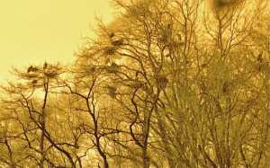 |
| Heron Nests |
Such a spot is just north of the Betsy Ross Bridge, where some ancient convulsion split the land on both sides of the Delaware River; the mouth of the Pennypack Creek on the Pennsylvania side faces the mouth of the Rancocas Cree on Jersey side. In New Jersey, that sort of stream is pronounced "crick" by old-timers, who are fast becoming submerged in a sea of newcomers who don't know how to pronounce things. The Rancocas was the natural transportation route for early settlers, but it now seems a little astounding that the far inland town of Mt. Holly was once a major ship-building center. The wide creek soon splits into a North Branch and a South Branch, both draining very large areas of flat southern New Jersey and making possible an extensive network of Quaker towns in the wilderness, most of whose residents could sail from their backyards and eventually get to Europe if they wanted to. In time, the banks of the Rancocas became extensive farmland, with large flocks of farm animals grazing and providing fertilizer for the fields. Today, the bacterial count of Delaware is largely governed by the runoff from fertilized farms into the Rancocas, rising even higher as warm weather approaches, and attracting large schools of fish. My barber tends to take a few weeks off every spring, bringing back tales of big fish around the place where the Pennypack and Rancocas Creeks join Delaware, but above the refineries at the mouth of the Schuylkill The spinning blades of the Salem Power Plant further downstream further thin them out appreciably.
Well, birds like to eat fish, too. For reasons having to do with insects, fish like to feed at dawn and dusk, so the bottom line is you have to get up early to be a bird-watcher. Marina operators have chosen the mouth of the Rancocas as a favorite place to moor boats, so lots and lots of recreational boaters park their cars at these marinas and go boating, pretty blissfully unaware of the Herons. Some of these boaters go fishing, but most of them just seem to sail around in circles.
 |
| As Seen From Amico Island |
Blue herons are big, with seven-foot wingspreads as adults. Because they want to get their nests away from raccoons and other rodents, and more recently from teen-aged boys with 22-caliber guns, herons have learned to nest on the top of tall trees, but close to water full of fish. And so it comes about that there is a group of small islands in the estuary of the Rancocas, where the mixture of three streams causes the creek mud to be deposited in mud flats and mud islands. There is one little island, perhaps two or three acres in size, sheltered between the river bank and some larger mud islands, where several dozen families of Blue Herons have built their nests. One of the larger islands is called Amico, connected to the land by a causeway. If you look closely, you notice one group of adult herons constantly ferries nest building materials from one direction, while another group ferry food for the youngsters from some different source in another direction. At times, diving ducks (not all species of ducks dive for fish) go after the fish in the channel between islands, with the effect of driving the fish into shallow water. The long-legged herons stand in the shallow water and get 'em; visitors all ask the same futile question -- what's in this for the ducks? The heron island is far enough away from places to observe it, that in mid-March its bare trees look to be covered with black blobs. Some of those blobs turn out to be heroes, and some are heron nests, but you need binoculars to tell. When the silhouetted birds move around, you can see the nests are really only big enough to hold the eggs; most of the big blobs are the birds, themselves. There are four or five benches scattered on neighboring dry land in the best places to watch the birds, but you can expect to get ankle-deep in the water a few times, and need to scramble up some sharp hills covered with brambles, in order to get to the benches. In fact, you can wander around the woods for an hour or more if you don't know where to look for the heron rookery. Look for the benches, or better still, go to the posted map near the park entrance south of the end of Norman Avenue. There are a couple of kiosks at that point, otherwise known as portable privies. Strangers who meet on the benches share the information supplied by the naturalists that herons have a social hierarchy, with the most important herons taking the highest perches in the trees. That led to visitors naming the topmost herons "Obama birds", and the die-hard Republicans on the benches responding that the term must refer to dropping droppings on everybody else. That's irreverent Americans for you.
There is quite a good bakery and coffee shop just north on St. Mihiel Street (River Road), and the new diesel River Line railroad tootles past pretty frequently. That's the modern version of the old Amboy and Camden RR, the oldest railroad in the country. It now serves a large group of Philadelphia to New York commuters, zipping past an interesting sight they probably never realized is there because they are too busy playing Hearts (Contract Bridge requires four players, Hearts are more flexible). However, there's one big secret.
The birds are really only visible in the Spring until the trees leaf out and conceal them. Since spring floods make the mud islands impassible until about the time daylight savings time appears, there remains only about a two-week window of time to see the rookery, each year. But it is really, really worth the trouble, which includes getting up when it is still dark and lugging heavy cameras and optics. Dr. Samuel Johnson once remarked that while many things are worth seeing, very few are worth going to see. This is worth going to see.
And by the way, the promontory on the other side of the Rancocas is called Hawk Island. After a little research, that's very likely worth going to see, too.
Chester County, Pennsylvania
|
| Map of Chester County |
Chester County was one of the four original counties of Pennsylvania, as first laid out by its first white owner, William Penn. Although several parts of Chester County have been cut away, what's left is still quite large. Lancaster County was separated in 1729, and in 1785 Dauphin County was separated from that. In 1789, Delaware County was separated. If you stand in the horse country of Chester County, you still might find it hard to believe anything much has happened in three hundred years. But as a matter of fact, the present population residing within Penn's original boundaries of Chester County would make it the most populous county in the state and growing steadily. Since Philadelphia and Pittsburgh are meanwhile shrinking in population, projected future relationships would strike most residents of Chester County as quite remarkable. Horses, that's what Chester County wants to be all about. Even the mushroom growers of Kennett Square sort of count as part of the horse industry, because mushrooms are grown on horse manure, in the dark. Electronics and steel mills are not exactly traditional, but they reside here, too. As a small footnote, the Lukens Steel Company was recently purchased by an investor named Ross, who lumped it with several other steel mills and then sold the bundle to an owner in India. The consequence is that Chester has a footprint of the largest steel company in the world, or the largest steel company in India, whichever way you wish to style it. Nevertheless, the neighborhood still looks like horse country.
Furthermore, southern Chester County is socially part of the state of Delaware, while western Chester County is thoroughly Pennsylvania Dutch. Up north, the Philadelphia Main Line is building mansions as fast as mortgage originators will allow, and many of them end up paying Chester County taxes. All along Route 202, the central artery of the Great Valley, stretches a burgeoning electronics industry, within which is found Vanguard, the largest investment company in America, or possibly the second largest, depending on temporary quirks of mark-to-market pricing. Chester County presently has the highest average personal income of any county in America. It is far from true that everybody has a horse farm or a trust fund.
|
| David Rittenhouse's compass |
In a spiritual sense, Chester County horse culture contiguously spreads far beyond even historic outlines of Chester County. The boundaries of southeastern Pennsylvania were laid out with David Rittenhouse's compass, so the rolling hills suitable for horse farming extend into the states of Delaware and Maryland, and of course out into Lancaster and Dauphin counties, without much visible sign of individual state or county. In Europe, by contrast, almost all boundaries are set by rivers and mountain ranges, so the physical appearance of the countryside is apt to change sharply when crossing political borders. In fact, it is possible to say it in reverse: the State of Delaware is mostly Chester County extended, at least in its upper third. Below that lies urban and suburban Wilmington, and below that ("south of the canal") spreads loamy flat farm country, formerly slave country. Maryland divides similarly; an upper third of Maryland's rolling hillsides (sometimes known colloquially as Chester County extended), followed on the south by tidewater Maryland, in turn, followed by the suburbs of Washington, DC. The remnants of Baltimore are mixed in there somewhere, too. When you drive through miles of silent prosperous farms, regardless of highway signs, it is natural to think of yourself in the heart of America.
The one thing Chester County never much warmed to was Universities. It may shock residents of New York City to hear that Chester County never thought much of having its own art museums, classical music, theater performances or opera. However, Chester County doesn't share typical urban dislikes, either. Local speech patterns suggest Appalachian hillbillies and the Pennsylvania Dutch L'il Abners are just like us, just not so rich. Chester County sometimes thinks of itself as nobility, but it isn't Ivy League nobility, it's a country squire. We all like horses, dogs, and guns, we can't imagine why everyone else doesn't like them, too. Chester County has more history than almost anybody; it just doesn't talk much about it.
|
| Josiah Harlan |
So let's mention just the highlights: George Washington fought the battle of the Brandywine, the biggest battle of the American Revolution, in Chester County, the Paoli Massacre was long regarded as the second nastiest event of that campaign. A local farmer's son, Josiah Harlan (1799-1871), did what the Tsars and Dictators of Russia and the Kings and Queens of England couldn't do; he conquered Afghanistan. Moreover, he did it single-handedly, making himself King. Even the 350 American Rangers who conquered Afghanistan in 2002 can't match that exploit by this local Quaker boy. The first intern doctor of the first hospital in America (Jacob Ehrenzeller) spent his long life practicing in Chester County. The only President of the United States to come from Pennsylvania (James Buchanan) hailed from Lancaster, not terribly long after it split off from Chester County. In a wry sort of way, it can be said that Buchanan created the Republican Party by almost getting us to annex Cuba. Harrisburg, the present capital of the state, was once part of Chester County. Major portions of both British General Howe's and General Washington's armies left the Brandywine battlefield and swept up the Great Valley of Chester County to Philadelphia and Valley Forge, respectively. Conestoga Creek was once part of Chester County, and Conestoga wagons took many generations of settlers westward to build the new nation; wagons do go pretty naturally with horses. But drive through miles of Chester County today, usually alone through the silent stone barns and rolling grasslands: nothing much seems to have happened except real estate is more expensive.
But then, just drive up Route 202 from Wilmington to King of Prussia, at rush hour. This may be the Great Valley where Washington retreated to Valley Forge, but now it's where employees of the electronics industry ferry children to school, in order to get into the Ivy League, and maybe to shop at fancy stores in King of Prussia. With time out for a recession, it could be wall-to-wall McMansions around here in a generation. It seems almost certain the future will bear little resemblance to the past. It's sort of a pity, it is a great economic opportunity, and it seems inevitable.
Central Pennsylvania Settlers Before 1700
|
| German Rhineland |
Dates are unclear, but twenty-five families from the German Rhineland bought Pennsylvania land from William Penn prior to 1700, which is the earliest recognizable date on a gravestone in the Hummelstown Cemetery. Future research may narrow that time interval down, but it can confidently be said they got on a sailing ship bound for Philadelphia between 1682 and 1699. For reasons also unknown, tradition relates the Captain refused to stop in Philadelphia, putting them off in New York. They discovered they were unwelcome among the Dutch settlers in New York, who quite likely reflected the ancient hostility between the Dutch at the mouth of the Rhine River, and the Germans living upstream from there. Augmented by wars and invasions, the feeling persists to some degree even today. The twenty-five families sailed from New York, up to the Hudson River to Kingston the state capital, where they discovered they were even more unwelcome. The British under the command of the Duke of York took over New Amsterdam in 1664, but Dutch cultural control persisted long after the change of political control.
|
| Governor Keith of Pennsylvania |
Tradition continues that Governor Keith of Pennsylvania happened to be in Kingston at the time of the stranding of the migrants. He suggested they travel eighty miles overland to the Susquehanna River and then float down to land where topsoil was reputed to be several feet thick. Since Dutchmen everywhere concentrated on fur trading more than farming, it seems safe to guess reliable guides were easily found in Kingston. From there to what later became famous as Three-Mile Island below Harrisburg, the three-hundred-mile route of these pilgrims can be guessed by following valleys between towering ridges. Unfortunately for this surmise, there are two main canyons leading to Kingston from the Susquehanna, which improved Kingston as a choice for fur trading. The more northerly canyon is somewhat longer, but it might have been safer; perhaps the German pilgrims just flipped a coin. Taking either choice it's a hard trip however, even assuming the Indians were friendly and food sources abundant. It must have required at least a month to go the full distance to what is now Harrisburg, passing by a number of places which now support prosperous farms. That potential likely provoked demands of some travelers that they had gone far enough, as kids do today in the back of the station wagon. By luck or stubbornness, however, they kept right on into the wilderness, eventually making permanent settlements along the Swatara Creek in Dauphin County, which proves to have the richest farmland in America. Middletown and Hummelstown are thus the two oldest settlements in Central Pennsylvania. By the time the other German sects made their way up Germantown Avenue, out Germantown Pike, and then onward to the Great Valley beside Blue Mountain, the original settlers had ample time to discover the best land, the surest wells, and the best access to the creeks. Furthermore, they had several generations to notice which families produced the strongest lads, and which families were the best natural farmers. Since later incoming families were mostly penniless, they had to settle for less advantageous farmland and less endowed marriage partners. Dominance by the original farming families continued until the early Twentieth century when it became prestigious to enter one of the professions. Or even to move away from the Dutch Country and go to the city.
|
| Dutch Ships |
Getting back to their days in Kingston, it is not easy to tell what route they took, judging only from a highway map. We look for the largest towns and then the shortest highway route, but it seems likely Kingston was chosen as a trading center because it was the place where the fur traders brought their pelts to the Dutch ships on the Hudson. The roads chose the towns, not the other way. When you observe the valley beginning at Kingston, there remains little doubt the route to Harrisburg must have led that way. The local folks at the museums and stores of Kingston can't help; they never heard of any such migration, and most of them never had reason to travel in that direction. Kingston was burned to the ground (by the British) in 1777, the state capital moved to Albany, and the economic center went south to New York City. Kingston is just a nice little town on the Hudson, across the river from where rich folks put their mansions, and liberal-minded folks send their children to Bard College, a place where no two buildings follow the same architectural style.
So when you go West from that nice little town, it is only a mile or two before you are out in the woods, with farms here and there, and scattered cabins which look like fishing and hunting "lodges". There's a creek in the bottom of the valley, and if you look up, you see the road merely winds its way between parallel mountain ridges. Perhaps a glacier carved out this trail, perhaps a mighty river once ran there, perhaps volcanic action tented up and cracked. Anyway, you are not going to get lost if you follow the creek, going steadily uphill from Kingston for twenty or thirty miles. If this were a single mountain ridge, you would be approaching either a water gap or a wind gap. A wind gap is a water gap that has lost its river at the top.
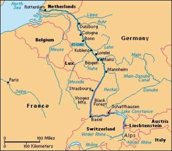
|
| The Rhine River |
What's at the summit is not a notch, however, it's a bowl. Out of this bowl flow the three main rivers of the eastern seaboard, the Hudson, Delaware, and the Susquehanna. The effect resembles what is said of Switzerland: The Rhine, the Rhone, Danube, and Po; They rise in the Alps, and away they go. The highway from Kingston runs along a creek which flows into the Hudson. At the top of the bowl are some nice dairy farms scattered along ten miles which drain into Delaware. The East Branch and the West Branch of the Delaware River are scarcely more than creeks at this point. At Delhi and Andes there is a further rise in the mountains, and then along twisting decline as you follow a branch of the Susquehanna down to its junction at Oneonta. As you cross the top of the ten-mile mesa you have perceived the answer to a natural question: how did those German families get across the big wide Delaware River that runs between Kingston on the Hudson -- and Cooperstown, where the Susquehanna begins? The answer is pretty evident. Delaware, while a mile wide at Philadelphia, narrows down to two little creeks on this mountain plateau. The Susquehanna system on one side and Hudson on the other have swallowed up the Delaware watershed between them. This might well have seemed a nice place for the German settlers to set up a few dairy farms, but it probably was an even more ideal place for the Iroquois to set up headquarters. Their favorite style of warfare was to occupy the high ground and make lightning raids (or quick escapes) on canoes down the various rivers starting from their origins. If it's of any interest, Charles Evans Hughes began his law practice in Delhi, and a lot of the town boys were killed at the battle of Antietam, thus illustrating the unwisdom of recruiting whole towns into regiments.
Down the mountain we go, into the broad Susquehanna valley. It was probably troublesome to manage wagons down a mountainside. But from here on the German families could stop walking, and float.
Mennonites: The Pennsylvania Swiss
|
| On the Wall of the Mennonite Heritage Center |
Anabaptism, originally attributed to Ulrich Zwingli around 1525, centers around believing a baby is too young to understand baptism, so adults need to be re-baptized. The idea arose independently in Switzerland and Holland, and probably thousands of believers were unmercifully martyred for holding the belief. Because the worst persecutions took place during the War of Austrian Succession (1740-50), they are often attributed to the Roman Catholic Inquisition, but Magisterial Protestants, believing in the separation of church and state, were often also responsible. Many seemingly unrelated issues were introduced locally, and this period of unrest is known as the French and Indian War in America; its major battle took place in Louisburg, Nova Scotia, although George Washington's skirmish around Fort Duquesne (Pittsburgh) has acquired local fame as a major American manifestation.
The Swiss adherents moved to the Rhineland Palatinate, and from there were among the first to accept William Penn's offer of religious freedom. They were the settlers of Germantown, but have mainly moved a few miles west to southern Montgomery County, where the confusion about Pennsylvania Dutchmen is further confounded by the fact that they were Swiss. Menno the Dutchman gave his name to the order, but they themselves regard their true ethnic background as Swiss from the Zurich region. That, by the way, is not to be confused with Calvinism, which also comes from Switzerland, but by way of Geneva, not Zurich. The pacifism of the Mennonites made them mutually attractive with the English Quakers, who had made an appearance fifty or so years later in the region around Manchester, England; each group seems to have adopted some of the features of the other.
|
| Franconia Mennonite Meetinghouse |
Determined use of the German language has always held the Mennonites apart, however. From the start, it was really necessary to be somewhat bilingual in Montgomery County, using English for business conversation, and German at home and in the church. The idea of using a foreign language is based on the hope it would thus maintain a sense of distinctiveness or even remoteness from non-believers, without adopting the least hostility to them. It almost inevitably follows that the group has used its own schools, attached to their meeting houses. This sense of remoteness has persisted for almost four hundred years, surrounded by entirely different cultures. Starting only around 1960, this attitude has gradually softened, however, and it is widely assumed that in another few decades Mennonites will come to resemble the people in their environment a great deal more than they do at present. If you want to know where to find them, Harleysville is a good place to start. As the tinge of Pennsylvania Dutch accent gradually fades, and fewer of them wear the old costumes, a curious remaining hallmark of their presence can be noticed: an avoidance of foundation planting around their houses. The Mennonites themselves seem to be entirely oblivious to this unintended distinctiveness, which is however quite striking to non-Mennonite passers-by. Those who work in the fields all day have little interest in digging around their houses for decoration; those who have moved away from farming have seemingly adopted the bush-less style as a natural way of arranging things. There's no particular reason to change it, and so, there's no particular reason to notice it.
Fort Washington, PA
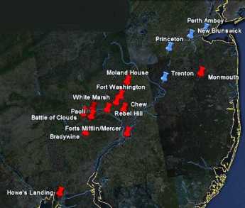
|
| British Campaigns |
The Revolutionary War lasted eight years, so there are a half dozen Fort Washingtons, in several states. Pennsylvania's Fort Washington gets free advertising from being a stop on the Pennsylvania Turnpike at the intersection of the East-West branch and the North-South branch, near some very large shopping malls. Nevertheless, the suburbs haven't reached it yet, and it is on a series of wooded mountain ridges discouraging housing development. Another way of describing its location is that it is several miles north of Chestnut Hill along the Bethlehem Pike, a road which begins in the center of Chestnut Hill at Germantown Avenue. The Pike is quite old, with many surviving colonial-era houses and inns to liven up the trip.
A third way to describe Fort Washington is that the headquarters were at the point where Bethlehem Pike crosses the Wissahickon Creek. How's that again? How does the western Wissahickon Creek then flow uphill to Chestnut Hill? Of course, it doesn't, but the appearance takes some explaining. The northwestern end of Philadelphia is reached by two ancient roads running on ridges quite close together like the split tail of a fish. Germantown Avenue runs up one ridge, and Ridge Avenue runs up the second ridge closer to the Schuylkill. The Wissahickon runs in the gully between these two ridges and tumbles down the hill at Wissahickon Avenue, or Rittenhousetown if that is more understandable. The ridge of Ridge Avenue is essentially cut off by the creek, but engineers have put Ridge Avenue on a high arching bridge as it crosses the creek far below, and by this magic Ridge Avenue and Germantown Avenue are at about the same height most of the way. The Wissahickon Creek is really running downhill the whole way, but sort of disappears from sight and reappears as it twists through the gorges, misleading the casual visitor (or commuter). As happened so often during the Revolutionary War, Washington showed his understanding here of geography in the service of guerrilla warfare.
Since the British were headquartered in Germantown, and the Americans have camped a few miles away on the same creek, it was inevitable there would be some sort of battle in the region. Washington launched a three-pronged attack on the British soon after arriving at Fort Washington, but his troops fired at each other in the fog, and apparently, two prongs more or less got lost in the gorges. The Americans retreated, and the British consolidated their conquest of Philadelphia. They did launch one surprise attack on the American encampment (the Battle of Whitemarsh), but that was mainly a reconnoiter, given up after a few days when it became clear Washington's troops held the high ground. It really is high ground (hawk-watching platforms and all) for reasons already stated. Chestnut Hill is a pinnacle sticking up on the west side of the Creek, with the Wissahickon snaking around its base.
This really was a perfect place for Washington to aim for after the Brandywine Battle, close enough to threaten the British, located in a bowl-like valley for camping, but terminating at the top of a mountain ridge in case the British counter-attacked. And with plenty of running water from the Wissahickon. However, it was a little too close for comfort, and he withdrew across the Schuylkill into Valley Forge as a more substantial natural fortress. Valley Forge is also on a hilltop, but one sitting in the middle of the Great Valley (Route 202 to Wilmington), as the center of an angel food cake tin. No doubt, the advantages of this new location became evident to him at the earlier skirmishes of the Battle of the Clouds, and the Paoli Massacre, which occurred nearby.
In retrospect, these maneuvers and skirmishes were of little military significance, except for the major Battle of Brandywine. The lost opportunity was the chance to catch the British Army without supplies or access to the Navy, aborted by what was probably a hurricane, the so-called Battle of the Clouds. Philadelphia was lost, and the opportunity to win the war early by smashing a third British army was gone for good. The defeat of the Hessians at Trenton, the loss of Burgoyne's army at Saratoga, and a victory on the outskirts of Philadelphia might together just have finished the War. But things didn't work out, the British similarly missed some opportunities, and the war was to last another five years. Once the French allied themselves, their wealth and naval strength tended to make French priorities dominate strategy.
Nevertheless, a perfectly splendid tourist trip awaits the history buff who travels from Elkton, Maryland, where the British landed, to the Battle of Brandywine battlefield, up the Great Valley to Immaculata University where the Battle of the Clouds took place, over to the Battlefield of the Paoli Massacre, crossing the Schuylkill and going to Whitemarsh, then to Fort Washington, and back up Bethlehem Pike to Germantown Avenue, and down to the Chew Mansion. The campaign for the conquest of Philadelphia ended with the fall of Ft. Mifflin when the British fleet was finally able to re-supply Howe's army. This direct auto tour is a little out of chronological sequence, but it can be done in one day if you don't dawdle. If you slow down and spend an extra day, you can include the Moland House where Washington waited to see where General Howe was going. At the right season, there's hawk watching on the ridge at Fort Washington Park, and maybe on to Trenton, or even up the New Jersey waist to Perth Amboy on lower New York Bay, where the Howe brothers began and ended their Philadelphia adventure. That would take you past Princeton and New Brunswick, or even include a trip to the Monmouth Battleground. With this extension, you have traveled much of the extent of the Revolutionary War in the Mid-Atlantic states.
Conowingo
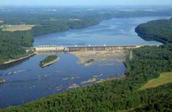
|
| Conowingo Dam |
IT was once a major hazard of travel between Philadelphia and Virginia, to cross the Susquehanna River along the way. The river is wide at the top of Chesapeake Bay, and the cliffs are high on both sides. Consequently, the cute little towns of Port Deposit and Havre de Grace grew up as places to stay in inns overnight, perhaps to throw a line into the water and catch your breakfast. Today, these little towns can be seen to have millions of dollars worth of cabin cruisers and sailboats at anchor, at least during certain seasons of the year. In 1928 the Conowingo Dam was built about ten miles north of the mouth of the river in order to harness the water power, and the Philadelphia Electric Company put a power station there as part of the dam, to generate electricity for Philadelphia. It doesn't seem so long ago, but it gave a mighty boost to the electrification of Philadelphia and its industries at the end of its industrial decline from 1900 to 1929. Unfortunately, competitive forms of power generation have now reduced the dam's output of electric power to periodic bursts during the day, and Philadelphia no longer enjoys a reliable cheap water-powered electricity advantage. Coal and nuclear came along, and now shale gas looks like the coming future.
|
| Bald Eagle Fishing |
Although water power could be claimed to be not merely cheap but environmentally friendly, the unvarnished fact is fish get caught in the turbines and rather chewed up by being sucked from the tranquil lake on the upside, emerging at the bottom as a diced fresh fish salad. That attracts seagulls and other fish lovers to the base of the dam. Some fish escape the meat grinder and merely are stunned by the experience, floating downstream to be attractive to eagles, turkey vultures, hawks, and owls. The consequence is that many thousands of gulls sit on the downside of the dam, while hundreds of turkey vultures and eagles sit on the higher levels of the power generation apparatus. And hundreds of bird-watching nature lovers stand on the southern shore below the dam, poised with many thousands of dollars worth of camera equipment and binoculars. If you don't have a pair of binoculars, your visit there will certainly be substandard. Lots of fishermen are there, too, but depending on the waves of spawning fish at different seasons of the year; shad is particularly favored. You can now begin to see the prosperity of Port Deposit and Havre de Grace has a wider variety of attractiveness than merely sailboating and crabbing. There is, however, a large and ominous yellow warning sign.
The sign says you are standing on a riverbank where the water can suddenly rise without warning; if the red lights start blinking and the warning siren starts honking, immediately gather up your tripods and head for higher land. It looks pretty peaceful, however, and the people with tripods are mostly chatting happily with their friends. It can be pointed out, however, that about two hundred bald eagles are perched on the superstructures roundabout. Cameras are mostly digital these days, attached to the rear of a telescopic lens three feet long, and when they shoot bursts of exposures they sound like a machine gun. So, the bird photographers follow a swooping eagle eagerly, shooting away and hoping to catch the bird in an attractive pose, throwing away the rest of the pictures. Good shots are called "keepers", which the photographer is happy to show onlookers on the rear view screen of the camera/machine gun. More sedate bird watchers carry binoculars made in Germany or Switzerland, which cost thousands of dollars and produce really spectacular images. It's unclear whether all this expenditure is worth it, but there is little doubt in the bird lovers' minds you are wasting significant parts of the trip without some kind of binocular.
Suddenly, ye gods, the lights start to flash and the siren starts to honk loudly. Not knowing exactly what to expect, first-time visitors head for the hills. The old-timers with a Gatling gun on a tripod are much more casual, picking up their apparatus and scuttling several feet up the river bank. The birds seem to know what the signals mean, scramble into the air, or start to arrive from far perches. The electric company seems to have received a notice that more electric power generation is needed, so the gates at the bottom of the dam are lifted and water gushes forth; the water does indeed rise rather rapidly. The birds divide themselves into two groups: the gulls' circle in a thick spiral at the base of the dam, while the eagles and vultures circle independently in a second spiral, several hundred yards below the dam. One group looks for fish salad, and the other group prefers stunned whole fish. Photographers however much prefer the eagles downstream, circling and then swooping to the water's surface to grab a wiggling fish and running off with it. Some of the bigger bullies prefer to let others do the fishing, simply swooping to steal the fish. Ratta-tap-ratty tap goes the digitals. After twenty minutes it is all over, and the birds seem to realize it before the water stops gushing into geysers. The river recedes, birds go back to their perches, and quiet again rules the land.
On the way home, you notice something you perhaps should have known. Interstate 95 takes people speeding down the turnpike, just out of sight of the dam. You get there quicker, but don't see the sights. Coming back from the bird watching parking area which the electric company provides, you are more or less compelled to recognize that U.S. highway Number One goes right across the top of the dam, up to the hill and over the charming rolling countryside. Back to Philadelphia.
| Posted by: Sherry | May 27, 2010 3:19 PM |
It's much appreciated by this newcomer to the area! Thanks for all the time and energy spent in sharing your wealth of knowledge!
Thanks, Cathy
| Posted by: Cathy | Apr 30, 2008 9:11 PM |
I will be passing the link on to a teacher friend.
Thank you for all the hard work that went into developing such a wonderful resource for all to enjoy. Keep up the good work.
Joni
| Posted by: Joni | Apr 7, 2008 7:35 PM |
48 Blogs
Brandywine Museum
The Wyeths, one of the great artistic families of America, display their work in the Brandywine Museum, which is itself a work of art.
Bristol, PA
Bristol is at a narrow point of the river, long the main crossing point for New York-to-Philadelphia traffic. William Penn placed his mansion nearby and for decades Bristol was a flourishing social center. The Pennsylvania Railroad cut it off, just as it cut off New Castle, Delaware, and both towns are now essentially museums.
British Headquarters: Perth Amboy, New Jersey, in its 1776 Heyday (B 608)
Now dispirited and forgotten, Perth Amboy was once the glamorous capital of New Jersey. Its harbor and neighboring Staten Island were headquarters for the Admiral Howe's British fleet during most of the Revolution.
Pirate Lair
Did Blackbeard use the Delaware marshes as a hideout?
Greenwich, Where?
A charming little colonial village in the Pine Woods of New Jersey has a long history, few visitors, and nothing reconstructed. It's the real thing.
Washington Lurks in Bucks County, Waiting for Howe to Make a Move
Washington, LaFayette, and twenty-seven other famous heroes of the Revolution spent a week in this Bucks County farmhouse, waiting for the British to make a move. Washington had a bottle of Madeira every day for lunch, but Mrs. Moland made him sleep on the floor, and pay for cleaning up when they left.
Delaware's Court of Chancery
Georgetown, Delaware is a pretty small town, but it's where the major corporations of the nation plead their case.
Disorderly Retreat: From Trenton Back to Perth Amboy
At the Battle of Trenton, George Washington established his military reputation for all time.
Potts
Once you get north of the falls of the Schuylkill in Fairmount Park, there aren't many places to ford the river until you get to Norristown, and then Pottstown. That brought commerce to the towns and a lot of military activity during the Revolution.
Harriton House
The original house in the old Welsh barony gave its name to Bryn Mawr, and once was the home of the secretary of the Continental Congress.
Gardens for Posterity
New flowers can be planted each year, but forests take generations to grow. What you plant depends on who is meant to look at the result.
Georgetown Returns Day
Glimpse what American democracy was supposed to be in the little Delaware village of Georgetown, even after nearly three centuries have gone by. Two days after the election, the victorious and the defeated candidates still appear for announced election results, ride around the courthouse in a carriage together, and actually bury a hatchet.
Sullivan's March
With Washington beleaguered at Valley Forge, an Indian massacre of the nearby Wyoming Valley was a serious threat from the rear. General Sullivan was sent to exterminate the Iroquois, and proved utterly ruthless.
Joseph Priestley, Shaker and Mover
The father of the science of chemistry was also the founder of the Unitarian Church in America.
Kenneth Gordon, MD, Hero of Valley Forge
This soft-spoken child psychiatrist was mainly responsible for keeping real estate developers from building houses all over the Valley Forge encampment.
The Origins of Haddonfield
Haddonfield was founded by a 19-year-old Quaker girl in 1701 when it was still a fairly dangerous place to walk around. She has over 140 direct descendants, and forty of them still live in the town. Some famous scenes from the Revolutionary War took place here.
The Swedenborgian Church
The Swedenborgians belong to the Church of the New Jerusalem, following the teachings of Emanuel Swedenborg, and strongly emphasizing personal responsibility, individuality, and good works. The Philadelphia branch is particularly strong, centered around a magnificent medieval cathedral in Bryn Athyn. Johnny Appleseed and Helen Keller were notable adherents, and a driving force has been the Pitcairn family of industrialists.
La Fayette, We Are Here
LaFayette's first experience in charge of troops very nearly ended in his capture.
Lambertville and Lewis Island
As Philadelphia and New York City gradually expand until they meet, they could meet at Lambertville.
Lindbergh Baby Kidnapping Trial
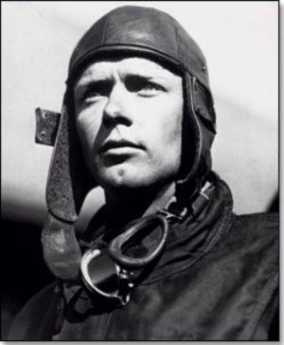 Bruno Richard Hauptmann was surely guilty of something, although it remains doubtful if he deserved to be electrocuted for the death of Charles Lindbergh's baby.
The Philadelphia Bay (1)
 In geological times, New Jersey and Delaware were barrier islands of the Atlantic, and lower Delaware Bay was the inlet between them. Then, we silted up and formed land bridges, leaving a twisting extension of a river which originally ended at Trenton. Upper Delaware Bay is Philadelphia Bay.
Litchfield County, Extended (1771-1775)
Connecticut won the Second Pennamite War, occupying Pennsylvania territory for four years. The American Revolution caused the other colonies to put a stop to the fighting.
Military School
Valley Forge Military Academy takes rambunctious boys and makes them into leaders. Even some of the misfits and dropouts seem to benefit from the difficult experience.
New Castle, Delaware
A short history of a historically significant town, now off the beaten path.
Wyoming, Fair Wyoming Valley
Even the present residents of Wilkes-Barre PA would have to giggle at descriptions of the Wyoming Valley written by poets during the Romantic Era. This is where the noble savage originally came from.
Odessa, Delaware
Rodney Sharp fixed up his old home town, and it's an architectural jewel worth visiting. Christmas is the best time.
Pea Patch Island
A string of three forts at the level of the Delaware-Chesapeake Canal once guarded the approaches to Philadelphia but were never needed. After the Battle of Gettysburg, Fort Delaware on Pea Patch Island served as a deplorable prison camp for Confederate prisoners; it's now a tourist stop.
Philadelphia Gardens
Philadelphia loves its gardens, particularly boxwood and azalea.
Doylestown
Doylestown is trapped between the steadily advancing edges of New York and Philadelphia, and must soon submerge. For now, the town's a lovely little jewel.
While the City Sleeps
Sleep time is in direct competition with commute time. It shapes the city in unrecognized ways.
Perth Amboy Revisited
Perth Amboy was once the capital of New Jersey and the entry point of General Howe's invasion of the rebellious colonies. Except for one old building, you might never guess.
Morris Arboretum
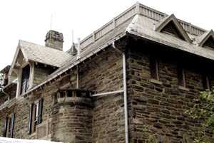 At the furthermost corner of Fairmount Park, the former estate of John and Lydia Morris is run as a public arboretum, one of the two or three finest in North America.
Tree Huggers: Delaware Valley College
Delaware Valley College is a curious mixture of farm school with scientific aspirations and a Jewish history, located in Doylestown, where New York City and Philadelphia meet,
Gardening Survives
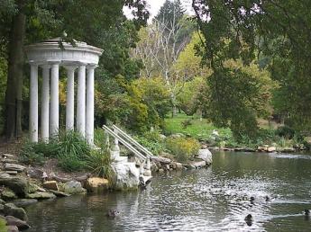 A new book has arrived, describing the 90 great public gardens of the Philadelphia regions, and discussing the best 40 of them in detail.
Dog Days
Hunting rabbits with a pack of French hounds scarcely sound like a matter to agitate the Pennsylvania Legislature and its Governor, so maybe something else is afoot.
Germantown Avenue, One End to the Other
 An old Indian trail cuts diagonally across Penn's street grid, from the Delaware River to Chestnut Hill, and beyond. Lots of history, there.
Burlington County, NJ
Burlington County in New Jersey is on the move. This rural county puts the urban ones to shame.
Gettysburg
 The strategy of both sides in the Battle of Gettysburg was shaped by the type of weapons in use.
Broad Street North and South
 Broad Street in Philadelphia stretches due north from the old Nary Yard on the Delaware River, past City Hall in the center of town, to the northern edge of the city at Elkins Park. Further North of the City Route 611 continues straight on through Doylestown to Easton, where it rejoins the Delaware River.
Rancocas Valley: Mt. Holly, Eayrestown, Medford
The many branches of the Rancocas River spread out within the forests of southern New Jersey once supported a hidden colonial community. It was once considered for historical restoration but lost out to Williamsburg.
Country Auction Modernized
On Fairgrounds Road, in the Quaker farmlands of Bucks County, efficiency and computerized streamlining are nibbling at the enduring customs of country auctions.
SEPTA's Long Term Planning
SEPTA is slowly making progress, but it's a struggle, every step of the way.
Heron Rookery on the Delaware
Two or three miles from Philadelphia City Hall, a large flock of Blue Herons with seven-foot wingspreads are nesting in the trees, largely unnoticed.
Chester County, Pennsylvania
When you say Chester County, you are probably talking about horses. There's much more to say.
Central Pennsylvania Settlers Before 1700
When German-speaking religious sects migrated into the "Pennsylvania Dutch" area around 1730, they found German Lutherans had been living there for nearly fifty years.
Mennonites: The Pennsylvania Swiss
Mennonite Pennsylvania Dutchmen actually came here from Switzerland. The book of their religious martyrs is more than a foot thick since they practice non-resistance, a belief significantly more pacifist than non-violence. Nevertheless, they prosper abundantly in Montgomery County.
Fort Washington, PA
Fort Washington PA was never much of a fort, and nothing of it remains to be seen. Rather, it was mostly a large campground north of Philadelphia between the Battle of Brandywine and the Battle of Germantown. An interesting visit, nonetheless. A side-visit to Hope Mansion would add some local color.
Conowingo
After ancient disputes between William Penn and Lord Baltimore, the mouth of the Susquehanna into the Chesapeake Bay is located in Maryland. However, the Philadelphia Electric Company got its power from the Conowingo Dam, and Philadelphia bird watchers by the hundreds go there to watch thousands of birds, attracted by millions of fish. But when the buzzers sound and the red lights flash, run for higher ground.