3 Volumes
Regional Overview: The Sights of the City, Loosely Defined
Philadelphia,defined here as the Quaker region of three formerly Quaker states, contains an astonishing number of interesting places to visit. Three centuries of history leave their marks everywhere. Begin by understanding that William Penn was the largest private landholder in history, and he owned all of it.
Nineteenth Century Philadelphia 1801-1928 (III)
At the beginning of our country Philadelphia was the central city in America.
Pre-Revolutionary Ben Franklin
Poor Richard was able to retire at the age of 42, and spent the rest of his life as a rich man, dying at the age of 82 with an eye-popping estate.
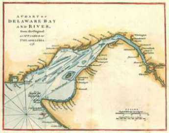
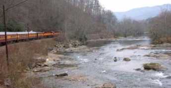
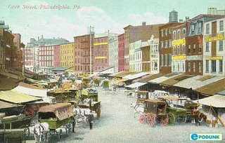
City of Rivers and Rivulets
Philadelphia has always been defined by the waters that surround it.
New Phillies Stadium
|
| Phillies Stadium |
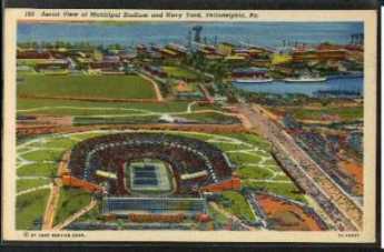
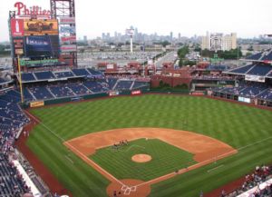
Built to house the Dempsey Tunney prize fight, we have seen six stadiums built there in one lifetime, a seventh in prospect, and three torn down. Building stadiums well are not the same as playing sports well, just as buying cameras is not the same hobby as taking photographs. In both cases, it is possible to get confused as to what hobby you are trying to excel in. Anyway, we have just opened stadium number six, for baseball, named Citizens Bank Stadium.
The new baseball park holds 43,500 spectators, and recently it fills to capacity. There are four or five million people in the region, so if everybody goes there just once to see what it looks like, it should stay full for four or five years. On the days of baseball home games, that is, since it is dead empty for away games, and on days when football and basketball are played in the nearby stadiums dedicated to those sports.
|
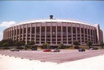
| Veteran's Stadium |
That is, at best it will be empty most of the time. New tickets will be $90 apiece in really choice sections, not to mention the corporate boxes, and the ordinary first-class tickets will be $40. The most expensive seats in the old, so-called Veteran's Stadium, were $28. You can take that either way. Perhaps we are pricing ourselves out of major league baseball. And perhaps a willingness to fill the stadium at these new prices is a sign we should have built a new ballpark long ago.
The first step in building Citizens Park
|
| Citizens Park |
was to dig a big hole in the ground. The playing field ends up twenty-five feet below ground level, so that half of the people who arrive at the park will walk downstairs to their seats, and half will walk upstairs. Never mind; when the game is over, the ones who went down will have to climb up, and the people in the balcony can walk down. That's pretty fair. Of more concern is the water level of the former swamp between two rivers. It was necessary to put in a powerful set of pumps to keep the stadium from turning into a lake. If the power goes out for any extended duration, some interesting photographs could emerge.
It's reassuring to know that the Veteran's was built along the same principles.

|
| Vet Stadium Implosion |
When the Vet was famously imploded into a pile of rubbish, the disintegrated remains of the stadium didn't quite fill the hole. Here's some forward planning, all right. If we are in the business of constructing serial stadiums, the cost of this hobby is appreciably reduced by incorporating the self-service rubbish removal feature. If there are other features like this one, perhaps this stadium collecting hobby isn't as expensive as it sounds.
Germantown Nurses the Yellow Fever, 1793
|
| Yellow Fever, Phila |
The French Revolution continued from 1789 to 1799 and created the opportunity for a second revolution in the New World which a second overstretched European country would lose. The slaves of Haiti just about exterminated the white settlers, except for the few who escaped, taking Yellow Fever and Dengue with them. Both diseases are mosquito-borne, so they flare up in the summer and die down in the winter, although the Philadelphians who welcomed the exiles didn't know that. Yellow Fever in Philadelphia was bad in 1793, came back annually for three more years, and flared up once again in 1798. It could be easily observed to be more frequent in the lowlands, absent in the hills. Seasonal, it reached a peak in October, disappeared after the first frost. In the early fall, people died a horrible yellow death, jaundiced and bilious.
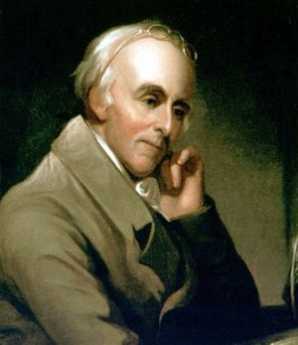
|
| Dr. Rush |
The Yellow Fever epidemic had a profound effect on many things. It was one of the major reasons the nation's capital did not remain in Philadelphia. It made the reputation of Dr. Benjamin Rush who announced a highly unfortunate treatment -- bleeding the victims -- thus provoking numerous anti-scientific medical doctrines based on the relative superiority of doing nothing at all. In Latin, Galen had capsulized the doctrine of Hippocrates in the "Epidemics" as premium non-nocere ("At least do no harm.") It took a full century for American scientific medicine to recover from this blow to its reputation. Whatever criticism Rush may deserve for his Yellow Fever blunder, it definitely is not true that he was a scientific lemon. Medical students are regularly surprised to learn that he is the physician who first identified and described the tropical disease of Dengue, or "break-bone fever", which was a somewhat less noticed feature among the Haiti exiles in Philadelphia. In still other scientific circles, Benjamin Rush is often referred to as the "Father of American Psychiatry". He was one of the founders of the College of Physicians of Philadelphia, the oldest medical society in North America. Medical colleagues who today scoff at the yellow fever episode seem to forget that Rush stayed behind to tend the sick during a devastating epidemic, while many of his more cautious colleagues fled for their lives. An unhesitating signer of the Declaration of Independence, whatever Rush did, he did courageously. Non-academic physicians have sarcastically referred to this episode ever since, as proving that "some people" think it is "better to publish than to perish".
One very good non-medical thing the Yellow Fever epidemic accomplished was to put an abrupt end to the torch-light parades of window-breaking rioters agitating, with Jefferson's approval, for an American version of the guillotine and the terror. Federalists like John Adams and William Bingham never forgave Jefferson or his admirers for this, so the class warfare movement might likely have got much worse if everyone had not suddenly dropped tools, and headed for the hilly safety of Germantown.
The President of the new republic, George Washington, was in Mt. Vernon in the summer of 1793, wondering what to do about the Yellow Fever epidemic, and particularly uncertain what the Constitution empowered him to do. He finally decided to rent rooms in Germantown and called a cabinet meeting there. His first rooms were rented from Frederick Herman, a pastor of the Reformed Church and teacher at the Union School, although he later moved to 5442 Germantown Ave, the home of Col. Franks. Jefferson chose to room at the King of Prussia Tavern.
During this time, Germantown was the seat of the nation's government. As was fervently hoped for, the cases of yellow fever stopped appearing in late October, and eventually, it seemed safe to convene Congress in Philadelphia as originally scheduled, on December 2.
Although Germantown was badly shaken by the experience, it was a heady experience to be the nation's capital. Meanwhile, a great many rich, powerful and important people had come to see what a nice place it was. Germantown then entered the second period of growth and flourishing. Walking around Germantown today is like wandering through the ruins of the Roman forum, silently tolerant of visitors who would have never dared approach it in its heyday.
REFERENCES
| Benjamin Rush: A Discourse delivered before the College of Physicians of Philadelphia: Thomas A. Horrocks ASIN: B0006FCBXS | Amazon |
| Bring Out Your Dead: The Great Plague Of Yellow Fever In Philadelphia In 1793: J.H. Powell ISBN-13: 978-1436715881 | Amazon |
| Germantown and the Germans: An Exhibition from the Collection of the Library Company of Philadelphia: Edwin, II Wolf ISBN-13: 978-0914076728 | Amazon |
John Bartram's Garden
|
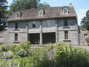
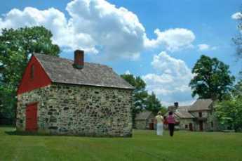
| Bartram Gardens |
It's worth a visit to Bartram's Gardens, if only for the astonishment of finding a very large farm and stone Quaker farmhouse within a few blocks of our largest medical center, a stone's throw from the biggest oil refinery on the upper East Coast. And located on the edge of a neighborhood that is, well, past its prime. The trees on the farm are centuries old, so walking around the grounds imparts the feeling of being hundreds of miles from civilization when in fact you are only a hundred yards away from streets that are very urban, indeed. When you turn in certain directions, an occasional skyscraper peeps over treetops, and down the meadows, at the farm's dock on the leafy-banked Schuylkill, you can see oil storage tanks across the river, just a long shot with a 2-iron away. Look upward, to see the upper half of shining towers of Center City.
The farm property as it now stands dates back to 1728, but the site marks the earliest beginnings of the city, nearly a hundred years earlier. The river curves around this hill then snake on down to Delaware through flatlands which were originally swamps ("wetlands", as they say). The hill is as far downriver into malaria territory as the Indians were willing to go, so the Dutch traders had to sail upriver and dock there in order to take thirty or forty thousand fur pelts back to Holland each year. One thing or another has been dumped on the swamps for three hundred years, and the oil companies found it a cheap place to buy enough land for their refineries, close to four or five railroads near Bartram's place, and with access to the high seas. Right now, most of the oil comes from Nigeria, emptying two or so supertankers a week. There has to be enough storage capacity to take care of delays caused by bad weather on the Atlantic, and there has to be access to railroads and highways to carry the finished product away. The rest of a refinery is just thousands of miles of metal pipes, gleaming in the sun.
Sun Oil is trying to be a good neighbor, turning more and more of the area over to nature preserve, as chemical engineers have learned how to work in a smaller space with fewer employees. The banks of the lower Schuylkill are now mostly grown to shrubs and trees, concealing from boat travelers the rather extensive dumps of old auto tires and similar refuse. It's a placid winding trip, increasingly coming to resemble what the Dutch traders once encountered. Especially in May, when the Palomino or Empress trees are in purple bloom. It seems the Chinese packed their porcelains in dried Palomino seed pods, and the discards have grown up to quite a nice display. Logan Square is filled with such trees, quite artfully pruned and maintained; just imagine several miles of the river lined with them, and you can see why the Tourist Bureau is excited about the potential. If you have been to San Antonio you know the potential of an urban river ride, which in this case might go all the way up to the Art Museum. Given enough public response, you can envision two or three-day barge rides from New Castle, Delaware to Pennsbury, with side trips up past Bartram's to the Waterworks. Right now, trips are comparatively limited by the tides, with a few trips a year down from Bartram's to the refineries, and a few more up to the river to the Art Museum. They use floating docks, and permanent docks will need to be built.
|
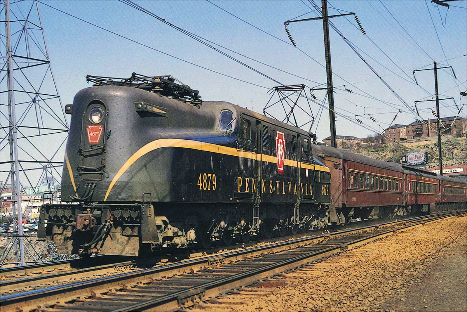
| Pennsylvania Railroad |
Originally, the crude oil came from upstate Pennsylvania, near Bradford, and was the main source of the dominance of the Pennsylvania Railroad. Baltimore and New York were also the beginnings of transcontinental railroads, but their freight cars came back empty. The upstate Pennsylvania oil gave the PRR a dominant edge by supplying cargo for two-way revenue.
When George Washington had to retreat from the Battle of Brandywine, the armies had to cross the wetlands, and the river, to get to Philadelphia. Washington got there first and burned the boats after his army got across. He knew, but the British probably did not fully realize, that the first place to ford the Schuylkill was at Norristown. When the British finally got that far, Washington was waiting for them, but a fall hurricane came along and soaked everybody's gunpowder before there could be much of a battle. Unfortunately, Mad Anthony Wayne was unprepared for a nighttime bayonet charge, and there was still quite a slaughter.
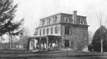
You can't wander around John Bartram's house and gardens without getting the impression of considerable wealth. Bartram was interested in botany, becoming the most eminent authority on plants of the Western hemisphere, a very close friend of Benjamin Franklin, and probably the main force behind the creation of the American Philosophical Society. But although Bartram was a hobbyist, he was a shrewd businessman, selling curiosity plants to Europeans, and commercially improved fruits and vegetables to local farmers. There are still some Bartrams around Philadelphia, with a strong Quaker air about them. Around 1850 the place was sold to a zillionaire railroad magnate named Eastwick, who fixed up the place in the high style he learned building the railroads of Russia for the Tsar. The mansion has been torn down, but the stone farmhouse, stone barn, stone sheds, stone outbuildings, stone everything -- endures, like many of the curiosity trees and bushes. Well worth a visit.
Lambertville and Lewis Island
 |
| Atlantic Shore Railroad |
Recall that open Atlantic shoreline once stretched from Perth Amboy to New Castle, Delaware. Glaciers pulverized the nearby mountains and dumped a huge moraine of sand into the ocean, creating southern New Jersey as an offshore island in geological times. The bay silted up and eventually attached that island to New Jersey. The silting-up probably would have continued for another sixty miles, making Philadelphia a land-locked inland city, except that the true
 |
| Delaware River |
Delaware River came tumbling down from the mountains to Trenton, turning sharply right and then maintaining an open shallow channel to the sea. From Lambertville to Trenton, the river drops over a series of small falls or rapids, easily visible except when heavy rains "drown" them.
 |
| Pennsylvania Railroad |
So, geography accounts for the scenery and early history of the upper end of Delaware Bay. It's still a beautiful hilly countryside with small antique villages, sparsely populated in spite of two nearby cities. Water power at the Fall Line, and then anthracite from the upstate mountains once encouraged early industry in an area that was rather poor farm country. But the Pennsylvania Railroad then rearranged commerce so that a blossoming New Jersey industrial area withered into quaintness. The early railroads mostly all ran East-West along the rivers, since investors in Atlantic port cities obtained both finance and protection from their state legislatures; railroads had almost reached the Mississippi before any were able to establish North-South connecting spurs. A seaboard trunk line was almost impossible to imagine. Finally, a consortium organized by
J.P. Morgan bullied through the main trunk line running through the bituminous coal areas of Pennsylvania and on to the West, with the major port cities connected by the great Northeast Corridor of the Pennsy. This corridor would run on the Pennsylvania side of Delaware. Industry on the bypassed New Jersey side would just wither and decline, and eventually so would the anthracite cities. Since the original colonies and states all ran from the ocean to the interior, each had a vital political interest in resisting this outcome. Only a strong and brutal corporation could bring it off.
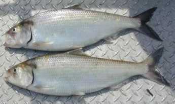
When George Washington was circling around Trenton to attack it on Christmas, a narrow spot up-river with a dozen houses on either side was called Coryell's Crossing or Ferry. That's now Coryell Street in Lambertville, linked to the other side of the river at New Hope, after first crossing a narrow wooden bridge to Lewis Island, the center of shad fishing, or at least shad fishing culture.
The Lewis family still has a house on Lewis Island, and they know a lot about shad fishing, entertaining hundreds of visitors to the shad festival in the last week of April. The river is cleaning up its pollution, the shad are coming back, but they, unfortunately, took a vacation in 2006. At the promised hour, a boatload of men with large deltoids attached one end of a dragnet to the shore, rowed to the middle of the river, floated downstream and towed the other end of the net back to the shore. The original anchor end of the net was then lifted and carried downstream to make a loop around the tip of Lewis Island, and then both ends were pulled in to capture the fish. There were fifty or so fish in the net, but only two shad of adequate size; since it was Sunday, the fish were all thrown back.
But it was a nice day, and fun, and the nice Lewis lady who explained things knew a lot. Remember, the center of the river is a border separating two states. You would have to have a fishing license in both states to cross the center of the river with your net; game wardens can come upon you quickly with a power boat. But the nature of fishing with a dragnet from the shore anyway makes it more practical to stop in the middle, where shotguns from the other side are unlikely to reach you. An even more persuasive force for law and order is provided by the fish. Fish like to feed when the sky is overcast, so there is a tendency on a North-South river for the fish to be on the Pennsylvania (West) side of the river in the morning, and the New Jersey (East) side in the evening. During the 19th Century when shad were abundant, work schedules at the local mills and factories were arranged to give the New Jersey workers time off to fish in the afternoon, while Pennsylvania employers delayed the starting time at their factories until morning fishing was over.
Somehow, underneath this tradition one senses a local Quaker somewhere with a scheme to maintain the peace without using force. Right now, there aren't enough fish to justify either stratagem or force, but one can hope.
Life On The River (3)
|
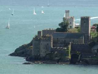
| Darth Mouth Castle |
All over Europe the scene is repeated: a market town and seaport at the mouth of a river, with many miles of riverbank castles in the hinterland. The seaports had to be fortified against pirates, the hinterland against marauding brigands. But the two flows of commerce consisted of baronies upriver feeding the seaport, while secondarily their seaports carried on trade with nearby river-organized economies. From time to time, someone like Julius Caesar, Napoleon, Bismarck or Hitler would try to unify the various river economies, usually unsuccessfully. In fact, the same pattern was seen along the Pacific Coast of South America, until the Incas figured out how to go along the mountain ridge in the far interior, and then come down the rivers from the sparsely populated areas to the maritime settlements at the mouth of the river, whose defenses were planned for enemies from the sea. Philadelphia followed the commercial pattern, but without fortresses and castles.
Because of the vagaries of King Charles II, and underneath that, because of marshes and their mosquito-borne diseases, the Delaware Bay was settled fairly late in colonial times -- and almost entirely by Quakers. The Dutch were interested in fur trading rather than settlement, the Dutch were anyway too few, their sovereign too indifferent, and William Penn took care of the Indians. So the English settlers had no one to fight except other Englishmen, once the French stab at Inca-like strategy was put down in 1753. After 1783, or perhaps 1812, the world finally left us alone. The Delaware Bay and River are essentially free of fortresses, Philadelphia has no castles. The peaceful sixty miles of upper Delaware Bay became lined with big farmhouses, or big Federalist and Victorian mansions. For a century, from the Revolutionary War to the Civil War, and even for a time after that, the history of this peaceful pond reads like a novel by Jane Austen.
As a playground for menfolk, it would be hard to improve on Victorian Delaware Bay. The river was full of fish, notably shad. In the fall, the migrating ducks and geese made for marvelous hunting. In the countryside behind the riverfront, houses were found all the sports having to do with horses; fox hunting, racing, horses shows. The kids could putter around in small sailboats, the adult sailors could sail a yacht to Europe if they wanted to. After John Fitch invented the Steamboat, it was possible to take a daily commute to the best male game of all -- trading, investing and gambling in the financial and commercial center of Philadelphia.
|
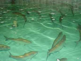
| Shad |
Marion Willis Rivinus and Katherine Hansel Biddle wrote a little book in 1973 called Lights Along the Delaware which tells the river story from the female point of view. The woman of the house was sort of the mayor of a little city, organizing the staff, supervising the garden, educating the children, planning the household, and organizing the dinners and social events. Educated and trained to the role, she knew what to do and enjoyed doing it. Jane Austen wrote the handbook. And while the menfolk were essential members of the cast of characters, women were the managing directors. The men were off with their horses, or sailboats, or fishing rods, or their faraway big-deal mergers and acquisitions. True, it was not a notably intellectual community, there was no Edith Wharton, Abigail Adams or Emily Dickinson. You might find some of that in Germantown, perhaps. The professions, law, and medicine, lured the more studious male members away from Society, but the international diplomatic circle was seen as the ideal career for any truly graceful graduates of this environment.
|
| Riverbank Railroad |
As the riverbank was gradually destroyed by railroads and expressways, only a few mansions like Andalusia remain in good repair. Curiously, what endures best are the clubs. The fishing club variously called the Fish House, the Castle, the Colony in Schuylkill, or the Schuylkill Fishing Company of the State in Schuylkill, has moved as many times as the name has changed. Started in 1732, it is the oldest continuously existing men's club in the world. It moved to the Delaware River from the Schuylkill when the Fairmount dam was built, and to its present location at Devon, the estate of William B. Chamberlain in 1937. New members do the cooking, cleaning, and serving, older members tell stories. When the river pollution is finally controlled, they may go back to catching the fish as well as cooking them. There's the Philadelphia Gun Club, which before 1877 was the Public Holiday Shooting Club of Riverton NJ. And then there's the Gloucester (NJ) Fox Hunt, which during the Revolution turned into First Troop, Philadelphia City Cavalry. After escorting George Washington to the battles of Boston Harbor, The Troop has been an active fighting unit of the National Guard (most recently in Bosnia) as well as a devoted center of male horsemanship between wars. The Farmer's Club, the Agricultural Society, and the Horticultural Society all reflect the rural interests that once predominated just behind the riverfront estates, still thriving aloof after 150 years of suburbia, exurbia and urban revival.
|
| Philadelphia Gun Club |
Although the riverfront industrial slums which destroyed the Philadelphia branch of Jane Austen's gracious living subculture are themselves declining and seem about to go away, it would take a real visionary to imagine how the Grand Life on the River will ever return. The banks of Delaware are much lower than the bank of the Hudson, for example. They make a great place to put high-speed rail lines and even higher speed interstate highways. The patrons of Hyde Park, West Point, and Poughkeepsie are much higher up a cliff and can overlook the river without much noticing an occasional whoosh. The mansions along Delaware have to look right at the tracks. Except for a few places like Bristol which have become isolated on the river side of the tracks and highway, it's not easy to see how you would get from here to there, or when.
Look Out For That Ship!
 Tales of the Sea abound, even a hundred miles from the ocean. 
|
We are indebted to the President of the Maritime Law Association of the U.S., Richard W. Palmer, Esq. (who unfortunately died in March 2017 at the age of 97), for both a strange definition and an amusing story. An "allusion" is a collision between a ship and a stationary object, such as a bridge or a dock. As you might imagine, the ship is almost invariably at fault, mainly through errors of the pilot, although hurricanes and other severe weather conditions can make a difference. Moving ships have been running into stationary objects for many centuries, and almost every allision contingency has been explored. Ho hum for maritime law.
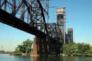
The Delair railroad drawbridge over the Delaware River at Frankford Junction is just a little different. It was built in 1896 when the Pennsylvania RR decided it needed to veer off from its North East Corridor to take people to Atlantic City. For reasons relating to the afterthought nature of the bridge, the tower for the drawbridge is located half a mile away, out of a direct vision of the ships going through. Also, a late development in the history of the river was the construction of U.S. Steel's Morristown plant, bringing unexpectedly huge ore boats from Labrador to the steel mill. The captains of the ships pretty much turned things over to the river pilots, for the last hundred miles of the trip.
|
| Delair Railroad Drawbridge |
Shortly after this iron ore service was begun, the inaugural ore boat Captain had a little party with some invited guests. So it happened that the Commandant of the Port, the Admiral in Charge of the Naval Yard, and other equally high ranking worthies like the head of the Coast Guard were on the bridge of the ore boat, taking careful notes of the procedure.
The ship tooted three times, the shore answered back with three toots. In real fact, they were connected by ship-to-shore telephone for most of the real business, but this grand occasion called for an authentic nautical ceremony. Three toots, we're approaching your bridge. Three toots back, come ahead, the coast is clear. The admirals scribbled it all down.
As the ship approached the point of no return, beyond which it could no longer stop or turn in time to avoid an "allusion", the people on the bridge were appalled to see a train crossing the bridge ahead. Several toots, loud profanity on the ship to shore phone.
No worry, answered the bridge, we'll lift the drawbridge in plenty of time. But half a minute later the bridge controller made the anguished cry that the drawbridge was apparently rusted and wouldn't open, to which the captain shouted, "This ship is going to take away your blankety-blank bridge and sail right through it".
At this point, the pilot took matters into his own hands, and violently threw the rudder hard left, swinging the ship sideways, soon nudging the bridge with some damage, but nothing like the damage of a head-on allision. The lawsuit, as one might imagine, was the outcome.
The attorneys for the railroad were pretty high-powered, too, and had piles of legal precedents to cite. But they were quite unprepared for Dick Palmer to put the Commandant of the Port on the witness stand, reading slowly and painfully from his very detailed notes about the conversations on the bridge, about the approaching drawbridge.
And so, Philadelphia can now claim to have experienced one of the very few instances where a ship ran into a bridge -- and the court found the bridge to be entirely at fault.
Nature Preservation

|
| Former Local Resident |
Although Philadelphia is proud of its history and its historical buildings, it would be my observation that Philadelphia is not as intense about the preservation of Nature as some other parts of the country appear to be. Philadelphians like nature all right, but it tends toward azaleas a little, and only infrequently do you meet someone in our town who could fairly be sneered at as a tree-hugger. In fact, I believe I sense it being implied that non-Philadelphians are so impassioned about minnows and spotted owls because they have no old houses to be worked up about. But perhaps I only read that into their unguarded remarks.
It must be admitted that some efforts to preserve nature have had unintended consequences. In the Serengeti region of Africa, a grassland between Kenya and Tanzania, about two million animals migrate in great herds, following the equatorial rainfall. The zebra and gnu are the main herds, with lions and leopards lurking around the edge, and vultures in the trees and hyenas and baboons further out, waiting for something edible to stumble. Several dozen jeeps and land rovers carry the tourists around to see the fun. It's a Disneyworld for American tourists. It's a little disquieting to learn that the local government sends helicopters around to machine-gun the poachers, and thus it's a little disturbing to think that starving people are being shot for the benefit of the tourist trade, if not for the tourists personally. Perhaps it doesn't matter, because most of the locals will be dead from AIDS in ten years, but most of the tourists who hear these arguments rehearsed fall strangely silent.
|
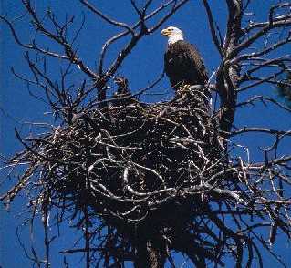
| Eagle Nest |
And then, back in old Philadelphia again, a lady at an Athenaeum reception was telling her circle of friends about an eagle's nest that appeared on her country place, but don't tell anyone. The nest last year was as big as a Volkswagen, this year it's as big as a Subaru, but don't tell anybody about it. Well, why not? Her husband quickly intervened to relate that the laws protecting the bald eagle and its nests are so severe that people for several miles around such a nest are bound by terribly onerous restrictions and subject to strict penalties. So? Well, the people who have been annoyed by these unwelcome laws will sneak in and shoot the eagle, just to get rid of the whole nuisance. So, the laws intended to protect our symbolic national birds actually have the effect of provoking their slaughter.
It's my view that these stories with an unspoken moral reflect discomfort with having people in one region of the country promote laws which mainly affect people in some other part of the country. We don't want people in Oregon to introduce legislation regulating the restoration of Society Hill buildings. So, we are not quick to support legislation regulating the drilling for oil in that remote mosquito-infested swamp called the Arctic Wildlife Preserve, when we hear that the local Alaskans are cool to the idea. It begins to sound like R versus D, so let's dance away from the topic. If there's some way to let Alaskans decide what's good for Alaska, maybe it's better.
The Delaware valley had been settled by Europeans for sixty years before William Penn arrived. Roughly, fifteen years of the Dutch, followed by fifteen years of Swedes, fifteen years of Dutch again, fifteen years under the English Duke of York. There were over a thousand people living here who spoke Swedish. With a focus on what the environment was like and how the early settlers treated it, listen to a passage from The Making of Pennsylvania by Sidney George Fisher.
The woods at that time were quite free from the underbrush and afforded a short nutritious form of grass. It was easy to ride on horseback anywhere among the trees. But the second growth, which came after cutting or burning the primeval forest, brought on the underbrush and destroyed the woodland pasturage.
The Swedes never attempted to clear the land of trees. They took the country as they found it; occupied the meadows and open lands along the river, liked them, cut the grass, plowed and sowed, and made no attempt to penetrate the interior. But as soon as the Englishman came he attacked the forests with his ax, and that simple instrument with a rifle is the natural coat-of-arms in America for all of English blood. In nothing is the difference in nationality so distinctly shown. The Dutchman builds trading posts and lies in his ship offshore to collect the furs. The gentle Swede settles in the soft, rich meadowlands, and his cattle wax fat and his barns are full of hay. The Frenchman enters the forest, sympathizes with its inhabitants, and turns half savage to please them. All alike bow before the wilderness and accept it as a fact. But the Englishman destroys it. There is even something significant in the way his old charters gave the land straight across America from sea to sea. He grasped at the continent from the beginning, and but for him, the oak and the pine would have triumphed and the prairies still are in possession of the Indian and the buffalo.
Nevertheless, the Swede seems to have lived a very happy and prosperous life on his meadows and marshes. He was surrounded by an abundance of game and fish and the products of his own thrifty agriculture, of which we can now scarcely conceive. The old accounts of game and birds along Delaware read like fairy tales. The first settlers saw the meadows covered with huge flocks of white cranes which rose in clouds when a boat approached the shore. The finest varieties of fish could be almost taken with the hand. Ducks and wild geese covered the water, and outrageous stories were told of the number that could be killed at a single shot. The wild swans, now driven far to the south and soon likely to become extinct, were abundant, floating on the water like drifted snow. Onshore the Indians brought in fat bucks every day, which they sold for a few pipes of tobacco or a measure or two of powder. Turkeys, grouse, and varieties of songbirds which will never be seen again were in the fields and woods. Wild pigeons often filled the air like bees, and there was a famous roosting-place for them in the southern part of Philadelphia, which is said to have given the Indian name, Moyamensing, to that part of the city.
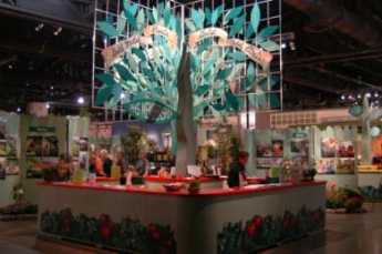
Philadelphia Green
|
| Pennsylvania Horticultural |
The Philadelphia Flower Show is the best in the country. Getting crowds of visitors every March, it would get even more if Convention Hall were bigger. Obviously, it is a financial success for its owner, the Pennsylvania Horticultural Society. What six or eight million dollars of profits go for is a city-wide outdoor beautification effort called Philadelphia Green. That, too, is the biggest, oldest and best effort of its kind in the country
About a hundred employees and four thousand enthusiastic volunteers spread out over the City, to make it look half-way decent. As the momentum grows, the political strength grows, too; and politicians notice that. The ladies who run this effort hit the school system pretty hard for volunteers and the enthusiasm of inner-city kids for an activity not often seen in the asphalt jungle is very heartening. The Horticultural Society also hits local businesses with appeals; if flower gardens aren't your thing, just give us the money and we'll do it for you.
Philadelphia Green has created four hundred community gardens, seventy neighborhood parks, planted 20,000 trees in 4 years, and vigorously pursued vacant land management. If the ground is hopelessly covered with concrete they bore holes in it to drain off the water, and pour on enough dirt to get grass to grow. Among the many things which volunteers contribute, novel ideas rank high.
Someone approached the Wharton School, and it is asserted that unbeautified vacant lots are worth 18% less than average, while beautified ones are worth 30% more. Since only 10% of the City's many vacant lots have been cleaned up, there's lots of room for economic improvement in the future. But the improvement is already quite visible, isn't it?
REFERENCES
| Standardized Plant Names: American Joint Committee on Horticultural, Frederick Law Olmsted | Google Books |
Philadelphia Food: Ingredients
|
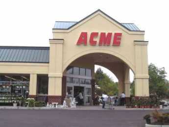
| Super Market |
There was a time when locally grown farm produce was much more critical than it is at present. There were even resort hotels with their own farms that offered fresh vegetables as the main attraction for vacationers, but now almost any supermarket will supply reasonably good produce to most places in the country. Nevertheless, certain things like fresh corn on the cob must be cooked and eaten almost the same day they are picked, and such seasonal local produce is better around Philadelphia than any other metropolitan area.

|
| Campbell Soup Kids |
The states of Delaware and New Jersey were once Atlantic barrier islands, so the sandy loam is particularly favorable for growing asparagus, for example. An asparagus field is planted as perennials, with new shoots harvested by stoop labor fields of asparagus is difficult to plant and quite valuable once established. Tomatoes are annuals, which in their finest form will continuously produce all summer. It's only worth planting "steak" tomatoes, or so-called Jersey Tomatoes, if there is a local market willing to pay premium prices for the fact that the human picker can tell a green one from a red one. The tomato industry which once supplied Campbell Soup to the world has now mostly moved to California where improved varieties of soup-grade tomatoes all ripen simultaneously, thus can be harvested with machinery at a single pass. Lancaster County in Pennsylvania boasts the best topsoil in the country, although it must be admitted that the glaciers dumped topsoil fourteen feet deep around northern Illinois. Such topsoil is almost too valuable to be used for truck gardens. Lancaster County grows fodder for cattle, and the cattle are hidden away in barns where passersby never see them, just as you never see chickens when you drive through Delaware. What visitors see are silos in Lancaster County and chicken sheds in the lower counties, and acres and acres of animal-feed crops (field corn and soybeans) surrounding the farms. A century ago, all those Swamps("wetland") around Delaware Bay held lots of ducks, geese, quail, and other game, but the game is less popular than it used to be. Location, location is always the true source of value, and in this case, the source of good Philadelphia food is the local location of a vast variety of fresh produce.
|
| Brandywine Battlefield |
Somewhere, the story needs to be retold of the mushroom growers of Kennett Square. This little nondescript town near the Brandywine Battlefield at the top of the state of Delaware was the mushroom capital of the world. It stayed that way for generations, by keeping the secrets of the mushroom trade a strict family secret. Among the various oddities was the production around Thanksgiving time of the first crop of the season, which were often as large as grapefruit, and usually only given to members of the family or special friends actually to be carved at the Thanksgiving table next to the turkey. During the Second World War, Franklin Roosevelt (his daughter-in-law was Ethel DuPont, who lived nearby) personally appealed to the mushroom farmers to reveal their secret methods to the makers of penicillin, needed for the war effort. The farmers gave it up, penicillin saved thousands of lives. And nowadays, most mushrooms in American supermarkets are grown in Taiwan, flown in at prices the Kennet Square growers cannot match.
Real estate developers are doing their best to fill up those truck gardens with split-level houses, of course, and the lovers of good food are allies of the lovers of the environment. So, the individual householder needs to know how to find the Red, Blue and Green Dot roadside farm stands along the highway to the Jersey shore, when the Jersey corn, tomatoes, and melons are at their best, or earlier in the year when Jersey berries are available. You need to know about the Reading Terminal Marketplace, the South Philadelphia street markets, the ethnic neighborhood butcher shops and bakeries, the Kutztown Fair and the farmer's markets in Lancaster County. It's surprising what you can order over the internet, but for the really choice fresh produce in season, you have to hunt around a little.
The farmers of South Jersey have traditionally been Quakers. One Quaker family named Taylor has had a farm right next to the Delaware River in Cinnaminson, just north of the Tacony Palmyra Bridge, since the days of William Penn. Taylors signed the 1783 minute of the Yearly Meeting of Quakers to the Continental Congress, advocating an end to slavery. As the Cinnaminson area became built up, the Taylors had a thriving fruit and vegetable stand, which was left unattended. That is, Joe Taylor brought out the corn and other produce and left it on the stand, while the customers just came up and left their money in a box on the same table. No one stole the money for a century, just as no one in the neighborhood ever locked the door of his house. As things evolved, Joe Taylor, Jr. eventually won the 1993 Nobel Prize in Physics for discoveries helping to explain the force of gravity. But in time, the family decided to give up the farm and turned it over to the State as a nature preserve. Undoubtedly a major factor in the decision, if not the only deciding factor, was the repeated discovery that people were stealing the money from the vegetable stand box.
|
| Market on Spruce Street |
For the most part, however, the supermarkets and the chefs of Philadelphia's restaurant revolution nowadays just need to go to the South Philadelphia Food Distribution Center, down in the old filled-in swamp and garbage dump area at the foot of the Walt Whitman Bridge. This is Harry Batten's gift to his city. The former chief of the N.W. Ayer advertising agency made it a personal crusade to put across a remarkable transformation in his home town. Until well past the Korean War, wholesale food distribution took place in the streets of the former Society Hill, never mind how historic it is. Traffic was at a crawl, cartons of vegetables were strewn over the streets, the noise and stench of America's Most Historic Square Mile was a disgrace. The city was persuaded to set aside land for the purpose, and the wholesale grocers were persuaded to move their warehouses to one combined location with rail, bridge, highway and local access. Within months of opening, the wholesale grocery business had moved to the new location, where it became an international marvel. Meanwhile, Charles E. Peterson bought a Spruce Street mansion that once belonged to Stephen Girard from the old Spruce Street Osteopathic Hospital for $8,000.00, rehabilitated it in absolutely authentic style, and moved into the new home, himself. Society Hill Restoration had begun, Philadelphia's restaurant revolution had begun, a great many people became millionaires out of the commercial side of the process, tax ratables soared, tourists poured into the Independence Park area and Penn's Landing and the Camden waterfront. It's been a long time since Harry Batten's name was heard much, but he ought to have a bronze statue sixty feet high. As the Quakers say, you can do anything if you have leadership. And leadership is one man.
Philadelphia Food: Traditional
|
| The Ritz Carlton |
New Orleans is famous for its cooking, and its residents claim it is impossible to get a bad meal in NOLA. New York is famous for its restaurants, where you can get things to eat that are available nowhere else, even though there is lots of bad cooking in that city. Philadelphia is famous for its food, which puts a slightly different twist on the matter. The Delaware Bay provides seafood, the Garden State of New Jersey provides fresh fruit and vegetables, the Pennsylvania Dutch Farm area provides meat and produce, the Diamond State of Delaware is famous for poultry, and lately, the shipping for Chile brings in fruit and vegetables out of normal season. Philadelphia is within easy distance of the very best and freshest of groceries. The city responded with bakeries, meat markets, fish markets, breweries, dairies. One by one, the latest ethnic arrivals brought in new recipes, quickly modified to fit the local style. All of this explains why Philadelphia can be famous for its ice cream, for example, even though it was not invented here as some local patriots carelessly contend.
Snapper soup is certainly one of the traditional Philadelphia dishes. To make it in the traditional way, you have to dedicate a stove for the process. New material is dumped in the top and today's soup is taken out the bottom, imitating the process for making sherry wine. The Old Original Bookbinder's restaurant had such a dedicated stove, but it has gone out of business, apparently leaving the Union League as the only traditional snapper soup source. Philadelphia Pepper Pot Soup is pretty much the same as Snapper soup, substituting tripe for the turtle as the meat base.
Scrapple is not to everyone's taste in this age of cholesterol fears, but it is certainly a locally famous dish, usually served as fried slices for breakfast. Scrapple is actually a mixture of cornmeal mush and Pennsylvania Dutch Puddin', a stew of scrap meats which is also sold as a chilled loaf. Puddin' is a dish for real traditionalists who have inherited low cholesterol to protect them from it. Only one or two old stands in the Reading Terminal market still carry it, and then only at butchering season. The Reading and Lancaster farmers markets are a more dependable source for Puddin', and Scrapple survives as more popular because it can be obtained in cans in the supermarkets. While you are there in a farmers market, you might get a loaf of head cheese, which substitutes gelatin for congealed fat as the binder for cooked meat chips with spices. Among the local heavy breakfasts must be mentioned stewed kidneys on waffles. The local belief is that this surprisingly delicious dish was introduced from Virginia, by steamboat vacationers to Cape May who mixed with Philadelphia vacationers at places like the Chalfonte Hotel, where stewed kidneys can/may still be obtained on Sunday morning.
Cinnamon buns, or Philadelphia Sticky Buns, are a local delicacy with the tradition of coming from Saxony in what is now Germany. The more butter and sugar the better, and real Philadelphians fry the sticky buns for breakfast. Out in San Francisco, they are famous for sourdough bread, while in Philadelphia the locally famous bread is black bread, a form of pumpernickel. Unfortunately, it is easily imitated by putting cocoa in white bread, so you need to lift a loaf before you buy it. Real black bread is as heavy as a cannonball, and about the same size and shape; it's even better with raisins in it. Toasted Crumpets are a Scottish introduction to the town's traditions, ambrosial if you can get fresh crumpets. Crumb cake is another traditional breakfast bun, known as coffee cake in the Dutch country, and imitated in commercial form as Tastykake.

|
| Snapper |
When turtles were more abundant, snapper stew, fried oysters and sherry were favorites, but now terrapin is such a rarity that it is saved for special occasions and special guests. It's usually served in a cream sauce in Philadelphia, whereas cream sauce is called abhorrent in Baltimore. Because of the availability problem, the party dish nowadays is apt to be fried oyster and chicken salad, and even oysters are getting a little scarce.
No one seems to challenge the idea that iced tea originated in Philadelphia, and in the Dutch Country, it is quite common to have iced tea 365 days a year, pitcher after pitcher. Let's not forget meatloaf, and corned beef hash with an egg, which is both perfectly delicious when served by someone who knows how to make them. They sound like leftovers, but it depends on where you get them. In the men's clubs, and in some Reading Terminal Restaurants, they are a star feature of the menu.
|
| Shad |
Around March 15, it is a good idea to ask if shad or shad roe is available. The trick is to get the fish with the bones removed. In recent years, shad is increasingly abundant, but it isn't so easy to find a butcher or chef who knows how to excise the bones while leaving the filet intact. At the moment, just about the only place that serves traditional planked shad is the Salem Country Club, out on the tip of the abrupt bend in the river above Salem, New Jersey. The ceremony is to split the big fish and nail it to a board, which is then placed in the open fireplace to cook, snapping and popping while its marvelous aroma fills the dining area. Owen Johnson once wrote a famous Lawrenceville book about The Tennessee Shad, so other towns must enjoy shad, too, but we wouldn't really know.
Special Philadelphia dishes may be a little hard for the tourist visitor to find. If you click on this link , you'll find a website put together by an enthusiast, who lists some of the better places for a wandering tourist to find local specialties. Philadelphia has quite a few high-toned fancy sit-down restaurants, too, but these are cheap, good, and easy to find.
Riverline: Camden and Amboy Revival
The RiverLine, a sort of diesel-powered overgrown trolley car line, has just opened on the Conrail tracks from Camden to Trenton. It runs every 30 minutes in both directions but unfortunately stops at 10 PM to let Conrail run freight trains at night. That's almost a perfect fit for the two operations, although it can leave baseball fans stranded at a night game at Campbell Park, or concertgoers at the Tweeter Center. The trains are running fairly full, partly because of their novelty, and partly because of the initial decision not to collect the $1.10 fare on Sunday, but mostly because the Riverline proved to be a better idea than anyone realized it would be. It's considerably cheaper for Philadelphia commuters to Wall Street to take the Riverline and transfer to New Jersey Transit at Trenton, for one thing. Even Amtrak encourages that, because high gasoline prices have filled up the Amtrak trains.
It's well worth a historical excursion on the RiverLine, which runs on the former right of way of the Camden and Amboy RR, the first railroad in New Jersey, chartered in 1830 by Robert L. Stevens. A genius of many talents, Stevens invented the iron rail which looks like an inverted "T," held in place by a system of plates and broad-headed spikes. The system is still in use today. Stevens also devised the use of wooden cross ties rather than granite ones, finding they resulted in a smoother ride. In 1834, he joined forces with another many-talented genius, Robert F. Stockton, who had earlier constructed a canal from New Brunswick to Trenton. Stevens then built a railroad beside the canal, subsequently extending it from Trenton to Camden. Stockton ran ferry boats from Perth Amboy to New York, and from Camden to Philadelphia. The full trip from New York to Philadelphia took nine hours, a remarkable improvement over the horse-drawn competition. The partnership also got the Legislature to confer monopoly rights, so the arrangement was highly profitable as well as an engineering marvel. Sixty years later, the Sherman Act would declare such monopolies to be crimes, but in 1830 they were considered a clever way for Legislatures to stimulate risky investment. The Pennsylvania Railroad bought the partnership and its monopoly in 1871, but preferred to bridge the Delaware River at Trenton, so the towns and track along the Jersey side of the river soon dwindled away. The RiverLine now provides a pleasant one-hour excursion along the riverbank, down the main streets of some cute little towns, past some remarkable woods and wilderness up near Trenton, and past Camden's urban revival at the other end.
Stephen Girard 1750-1831
|
| Stephen Girard |
Girard was born in Bordeaux, France and never went to school. By the age of 23, he had become a sea captain, like his father and grandfather. By the age of 27, he owned his own ship and was thus launched on a successful career in a very dangerous occupation. Depending on the destination and weather during that era, up to forty percent of sailors were lost at sea on long voyages. From the point of view of the passengers and shippers, when you were selecting a captain you wanted one who had returned unharmed from many voyages. It was irrelevant whether he had been lucky, or diligent, or had learned a lot from his relatives in the trade.
Stephen Girard did start with a handicap, being born blind in one eye. It may have been a personality disorder which drove him to precise, minute instructions to his subordinates in excruciating detail; he might now be called a "control freak" and be disliked for it. For example, he kept a handwritten copy of all letters he wrote, and at his death, there were 14,000 of them, sorted and filed. His wife went insane, and after spending years at the Pennsylvania Hospital, was buried on the grounds. If this is the price of being rich, some might consider remaining poor. During his working years in Philadelphia, he would normally get to the counting-house at 5 AM, go to his bank at noon, and go to work on his 600-acre farm in South Philadelphia after 5 PM. He said he liked farm work the best. The image left behind by this role model, then, was workaholic. Nevertheless, if you wanted to become the richest man in America, here was the pattern to follow.
Girard probably came as close as any rich man in history, to "taking it with him" when he died. His innately compulsive personality, combined with the sure knowledge that his relatives and others would probably try to break his will for their own benefit, led to the construction of a last will and testament that withstood a century of court challenges. It launched remarkable philanthropy for thousands of orphans and organized the whole Delaware Valley into an industrial machine unlike anything else in the country. Although he left the largest estate in the nation's history, that estate continued to accumulate money from his minute instructions to executors, eventually enlarging his vast fortune fifty-fold, a century after his death. In retrospect, Philadelphia might well have slowly declined into obscurity after the nation's capital moved to Washington in 1800. Instead, the coal, canal, railroad and industrial empire of the Philadelphia region became the "arsenal of the North" during the Civil War, and the main wealth generator of the Gilded Age which followed.
Girard's business career can be somewhat oversimplified as consisting of shipping at the base of his early good fortune, followed by banking during the era when banking was poorly understood and usually ineptly managed. He ended his career with an eager and successful embrace of the emerging Industrial Revolution. Throughout all of this, he characteristically took great risks for great profits, through recognizing what others were too timid to accept fully. On many occasions, his risky ventures resulted in very large losses, made acceptable by other risky ventures proving unexpectedly successful. An example would be Girard's Bank. When the Federal Government first started and then abandoned the First National Bank Girard bought up the remnants and made a great private success of banking, where he had little previous experience. He saw the potential of the canals, and later the railroads when others were content to be farmers or country gentlemen. When he was 79 years old, he purchased vast tracts of wilderness containing some outcroppings of coal, because he could foresee a great industrial future for the region. No pain, no gain.
Another way of looking at Girard was as the most prominent French-American citizen of his time. He arrived in Philadelphia at about the same time Benjamin Franklin stepped off another boat, returning from abusive treatment by British officials which finally flipped him for American independence. Franklin recognized that independence from England meant an alliance with France, or else it meant defeat. It is possible to view the American Revolution as an episode of France searching for an American foothold after its expulsion fifteen years earlier in the French and Indian War; trouble between Britain and its colonies might re-open opportunities for France. Girard was extremely friendly with Thomas Jefferson, the most Francophile of founders and early American presidents. When the War of 1812 with Great Britain threatened disaster for the new American state, Girard staked $8 million dollars, his whole fortune, on financing that war. During the entire period from 1776 to the Louisiana Purchase, America was wavering between its gratitude to France and underlying loyalty to the English-speaking community. During that long formative period, Girard the very rich Frenchman was hovering in the background, probably influencing American foreign policy more than is known, even today. But the France that Girard stood for was neither aristocratic of the LaFayette variety nor intellectual of the Robespierre sort. It was France of the French peasant, crabbed, acquisitive, and morose, forever responding to a "hidden hand" of his own self-interest in a way that paradoxically benefited his whole community, and thus would have hugely amused the Scotsman Adam Smith.
The Houses in the Park
|
| Strawberry Mansion |
Fairmount Park is said to be the largest park (7000+ acres) within the limits of an American city, and in fact, maybe just a little bigger than the city can afford to maintain. It was established in the middle of the 19th Century through the efforts of the College of Physicians of Philadelphia to reverse the Industrial Revolution's relentless pollution of Philadelphia's Schuylkill River and the water works. The waterworks were built in 1801 in the mistaken belief that Yellow Fever was caused by pollution; Fairmount Park more accurately responded to the idea that Typhoid Fever was waterborne from upstream pollution. Lemon Hill, the nearby mount containing Robert Morris' Mansion, was purchased to expand the reservoir capacity of the waterworks and thereby made the Art Museum possible where the reservoirs were originally located.
The Park has long constituted a symbolic interval between center city and the suburbs. Since the construction of the river drives and later the expressway, the commute along the river amidst trees and parkland has made an entrance to town a pleasant experience. If the town planners had been able to foresee automobile commuting, they might have anticipated that the sun would be in the driver's eyes coming East during morning rush hour, and in his eyes as he went home toward the West in the evening. Driving safety might perhaps have been impaired by the tendency of this glare to direct attention to the park rather than straight ahead, but nevertheless redoubles the effect of the park views as a daily aesthetic experience. Even the pollution idea had its ambiguous side since animals increase the bacterial runoff from their grazing areas, and the original houses in the park had many pastures. Strip mining, however, allows mineral contaminants to be washed by rain into the watershed. The city waterworks today extract nearly 800 tons of sludge from the water supply, daily. Whatever the effect downstream, the high ground had less malaria and less typhoid than swampy lowlands, so many of the original houses were useful summer retreats for city dwellers during the early years of the city.
The park is governed by the Park Commission, and at one time had its own police force, the fourth largest police force in the state. Started in 1868, the Park Guards changed their name to the Park Police and then became part of the Philadelphia Police in 1972. The original 28 officers had grown to 525, had their own police academy and a proud tradition. It seems very likely that some deep and dirty politics were played in this shift of authority, and it might be a fair guess that some bitterness still survives in the circles who know and care about these things. In 2008 a scarcely-noticed rule change gave the Park to the City Department of Recreation, thus placing it just a little closer to ambitious real estate development. Our present concern, however, is with the houses in the park.
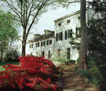
There are seven of them, kept up and maintained by the Philadelphia Museum of Art. Guided tours are provided intermittently by the museum, but since funds are limited only three of the houses are open year round. The others are equally worth a visit but unfortunately, are closed during the height of the spring flowering season. Two of the year-round houses represent the two extremes of Philadelphia culture, since Mount Pleasant was owned by a buccaneer ("privateer") named McPherson who lived at the height of 18th Century elegance, while Cedar Grove was originally a Quaker farmhouse of the greatest simplicity consistent with honest comfort, a style which persisted relatively unchanged until late in the 19th Century. Benedict Arnold and Peggy Shippen looked at Mount Pleasant with an eye to purchase but never lived there because they were called away by national events. With the addition of modern plumbing and air conditioning, Mount Pleasant would be an elegant place to live, even today. McPherson had to sell the place to pay his debts, whereas the Wister and Morris descendants of Cedar Grove still populate the Social Register in large numbers. The two houses completely typify the underlying philosophies of the two leading Philadelphia classes of leadership. One group measures itself by how much it spends, the other group measures success by how much it has left.
REFERENCES
| Treacherous Beauty: Peggy Shippen, the Woman behind Benedict Arnold's Plot to Betray America: Mark Jacob:978-0762773886 | Amazon |
The Walking Purchase
|
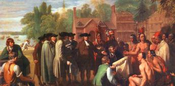
| William Penn and the Indians |
Any fair discussion of Quaker relations with the Indians must emphasize that almost all other colonists of the time regarded Indians as subhuman components of the local wilderness. Only William Penn was careful to treat the Indians as fellow human beings, entitled to fair play, dignity, and respect. Like a good politician, he entered into their games with enthusiasm and definitely earned their respect by outdoing them all in the broad jump contests. Even though he had bought the land from King Charles II, he took care to buy it a second time from the Indians, and for many decades was able to enforce the wise rule of never permitting settlers on the land before the Indians agreed to its purchase. After Penn's death, however, and particularly from 1726 to 1736, a major wave of German and Scotch-Irish immigration created an overwhelming population pressure on the seaboard areas, resulting in much unauthorized pioneering and settlement. Since William Penn spent only a few years in the colonies his agents chiefly James Logan, had long set the tone.
|
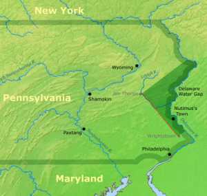
| Walking Purchase |
Logan had been equally famous for his many efforts to treat the Indians fairly, and the grounds of Stenton, his manor house, were often filled with Indians come to pay their respects. Against all this evidence of the benign attitudes of both Penn and Logan, there stands the episode of the Walking Purchase of 1737. No doubt about it, the Indians were treated badly.
In the triangle between the Neshaminy Creek and the Delaware River, the Delaware Indians agreed to a sale with the third side of the triangle established at a distance from Wrightstown, as far as a man could walk northward toward the Wind Gap in a day and a half. That was a common form of boundary for Indian land sales, and its distance was fairly well understood. In anticipation of pacing out the distance, the colonists sent out explorers to find the easiest path, then sent out woodsmen to clear a path in the forest, and selected three of the fastest runners in the colony to do the running. The pace was so fast that two of the runners had to drop out, and the third one nearly did so. The resulting boundary was nearly twice as far into the wilderness as was commonly accepted for the measurement, taking advantage of the sharp bend in the river which widened the land in question by a great deal. The Indians were so disgusted they refused to leave the territory. Logan had already made an agreement with the Iroquois nation, to whom the Delawares were subject, and the Delawares only surrendered the land when the Iroquois began to look as though they really would act as enforcers for the bargain. Although serious Indian warfare did not break out for another twenty years, the Walking Purchase went a long way toward convincing the Delaware tribe that the Quakers were no more trustworthy than the settlers in other colonies, and is said to have been on their minds when twenty years later they helped the French decimate General Braddock's army.
There will probably never be a clear resolution of the paradox of Quakers, particularly Logan, behaving in this reprehensible manner within a very long history of the unusually honorable treatment of the Indians. With William Penn now dead and gone, no doubt Logan was caught in a squeeze between the two rather dissolute sons of William Penn, neither of them Quaker, who had over-indebted themselves with high living and were pressing their agent to make land sales to pay for it. Then there was the pressure of the new German and Scotch-Irish immigrants, brought to the New World by real estate promises, and stranded in the seaport unable to complete their land purchases. Under this pressure, Logan may have been unduly persuaded that the 1684 treaties with the Indians, along with many other treaties and understandings, were all the legal justification he needed. Whatever the specifics of the situation at the time, it is now clear the Walking Purchase was a blot on the Quaker record that can never be entirely justified within the Quakers' own standards of fairness. Within the Society of Friends, whatever other English colonists might have done in their position, let alone what French and Spanish regularly did to the Indians, doesn't matter in the slightest.
Ownership of the Port
|
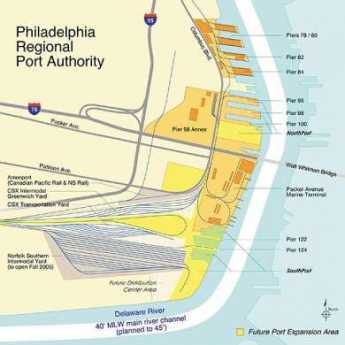
| Delaware Port |
One of my children studied for a graduate degree in Economics, and once remarked there only seemed to be one thing worth learning, namely Comparative Advantage. How's that, again, child? Free trade is good, dummy. By inference, tariffs and subsidies of local industries are a bad thing. All this talk about losing jobs to China is misguided, holds back world prosperity. If that's the case, Child, then why is the Philadelphia port run the way it is? Because Philadelphia is in a life struggle with other ports, and they all run the same way.
There are 23,000 people working in and around Philadelphia port, almost all of them paid wages that are a little surprising to hear. If you include such things as worker's compensation, the wage cost of a Philadelphia longshoreman is about fifty dollars an hour. With such a wage cost, the port cannot compete with other ports, particularly when you see how easily a shipping line can unload the ship elsewhere, with lower wage costs. The consequence is that no private company can afford to own and operate a marine cargo terminal. In our case, they are owned by the Philadelphia Regional Port Authority, which is indirectly to say they are owned by the State of Pennsylvania. The regional port authority has a $300 million annual budget, owns eight terminals, loses money, and is taxpayer subsidized. If you skip all the intermediate steps, the taxpayers of the state subsidize the port workers. In return, the rest of the state gets its Cocoa and steel shipped. What Philadelphia gets is union domination of its politics.
|
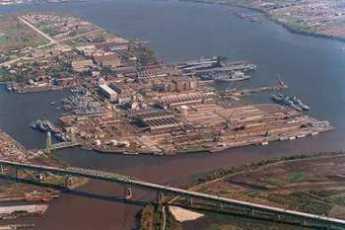
| Ship Yard |
It's easy to be too glib about all this. Billions of dollars have been invested in the transportation infrastructure and distribution organization, organized around this particular structure. Furthermore, many billions more have been invested in the industries which are based on the assumption that this distribution system will serve them. Philadelphia has the port, but a vast region depends on it and will react swiftly if changes are made too precipitously. There really does seem to be a need for the Foundations and Universities to support some useful studies about what direction the region ought to take, however slowly we move to get there. At the least, we could give some serious thought to the wisdom of going further in the direction we are going.
Finger Piers are a thing of the past and must be replaced by container cargo terminals, we are now told. Should we really spend the billions of dollars it would take to make this change? It would obviously be unprofitable for some private corporation to undertake this effort, so what can we do to make it profitable?
The natural depth of the river channel is 17 feet and needs to be dredged to 40 feet to accommodate the container ships, which we're told carry more profitable cargo than bulk carriers. We are also told this is being blocked by the New Jersey government, responding to competitive pressure from Northern New Jersey interests who want the cargo to go to Hudson River terminals. Presumably, this is a sign that New Jersey and New York are subsidizing their ports, too, and we are in a bidding war.
Thank goodness for the Constitution, which discourages shooting wars between the states.
River City
|
||||||||||||||||||||||||||||||||||||||||||||||||||||||||||||||||||||||||||||||||||||||||||||||||||||||||||||||||||||||||||||||||||||||||||||||||||||||||||||||||||||||||||||||||||||||||||||||||||||||||||||||||||||||
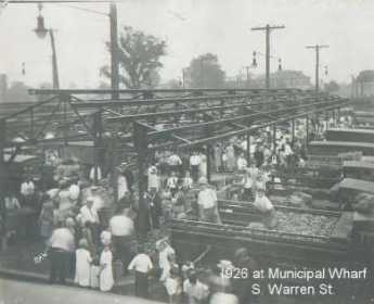
Dock Street
Founding Fish
In 2002, John McPhee brought out a perfectly splendid book about fish and fishing history in this region, with particular emphasis on shad. He makes the whole topic remarkably interesting, but you have to be a little wistful about the way he demolished a splendid story of fish in Philadelphia during the Revolutionary War. The book is called The Founding Fish. As everyone knows, George Washington and the Continental Army were starving and freezing at Valley Forge, a few miles up the Schuylkill, while Major Andre and the other British officers were cavorting downtown with the Tory ladies, grr. The story has long been told that things got to a desperate state at Valley Forge when, lo, the annual shad run was several weeks early and mountains of fish came roaring up the river to the excited shouts of the starving patriots and rescued the raggedy starving Continental Army. It would make a wonderful scene in a movie. McPhee tells us that George Washington was in fact a shady merchant, having caught and pickled many barrels of shad coming up the Potomac River. The annual shad excitement was no news to him, and it seems quite possible he selected the campsite at Valley Forge with this spring event in mind. Shad was no news to the British, either; there are records of their trying to block off the Schuylkill with nets to prevent the fish from getting upriver to Valley Forge. Unfortunately, a careful search of letters and records fails to record any shad run earlier than April that year. The rescue of song and story does not appear in contemporary documents. What's more, some unnecessarily diligent scholars have sifted through the garbage heaps of the encampment area, and have only found pig and sheep bones, no shad bones. Those graduate students undoubtedly deserve to be awarded degrees for their work, especially the digging in garbage part. But nevertheless, it all does seem a pity to ruin a good story that way. Fair Mount
Although the Art Museum now dominates the end of the Benjamin Franklin Parkway, the earlier focus of the acropolis once called Fair Mount is just down the hill behind it, in the old Grecian complex of the Philadelphia waterworks. When the Schuylkill was dammed at that point, the effect was to calm the rapids, drown the falls at Midvale Avenue upstream, and turn this portion of the river into a placid fresh-water lake. Fairmont Park was then created upstream in an effort (originally stimulated by the College of Physicians of Philadelphia) to reduce pollution of Philadelphia's water supply going into the pumps at the Waterworks, by replacing, with parkland, the wards, and industrial slums at the terminus of the canal bringing anthracite from upstate. The result was the creation of an ideal place for public boating and skating. The transformation of this area can be seen in retrospect as an impressive civic response to economic upheaval. The War of 1812 (by cutting off ocean access to bituminous via the Chesapeake) had first forced Philadelphia to use anthracite hard coal, and the discovery of anthracite's superiority in making steel caused a continuing reliance on it and the canals
that brought it here. By 1850, the Philadelphia and Reading Railroad made the canals obsolete and created this splendid opportunity for urban renewal. The waterfalls had created a natural boundary between industry oriented to upstate coal and other industry oriented to oil and commerce coming up Delaware. It is a great pity that the lower section of the Schuylkill, once so famously beautiful, has never stimulated the same vision and imagination in response to the eventual decline of the industrialization which defaced it. To return to Boathouse Row, a large azalea garden starts the Park, and then the East River Driver winds along the attractively landscaped riverbank. Just beyond the azalea garden, the first of ten Victorian-style boathouses starts the home of the Schuylkill Navy, an association of rowing clubs which are now a century and a half in residence there. When the Schuylkill auto expressway was created on the other side of the river, someone had the bright idea of decorating the rowing houses with lights along their edges in the manner used for Christmas decorations in South Philadelphia, especially on Smedley and Colorado Streets. Ever since the entrance to Philadelphia from the West has become one of its most arresting beauties.
Add a few cherry blossom trees in the spring, and you have quite a memorable centerpiece. Rowing sometimes called crewing, or sculling, is a central focus of Philadelphia society, and is curiously not something in which the city can claim to be first or the oldest. As you might expect, "regatta" is a word invented in Venice five hundred years ago, there are records of rowing races as far back as 400 BC, and New York -- ye Gods! -- had the first American boating club. The Philadelphia Schuylkill Navy was formed as an association of rowing clubs in 1858, and the oldest member, the Bachelor's Barge, was only formed in 1856. The development was largely spontaneous and is said to have been briskly stimulated by a beer garden nearby, run by a former Philadelphia sheriff. About the same time, the British became crazy about the sport, having the Henley Races as the most famous regatta in the world, and both the Australians and the Bostonians occasionally have the largest, most expensive, most widely advertised regattas. Foo. Philadelphia has the Schuylkill Navy, and it is central to our existence. There are a couple of things which are unique about rowing. In the first place, it is hard to think of a way to cheat. You can hire engineers to redesign the shape and size of your boat, but engineering really doesn't make a lot of difference once the basic development of oarlocks and movable seats was perfected. A good boat can cost as much as $30,000, but that is large because all boats approach the limit of speed. If you have heavier or stronger oarsmen, it doesn't make that much difference. What matters is coordination, and in the longer boats, teamwork. Pull up with your shoulders, push with your legs, don't start with your buttocks, the art of rowing involves your whole body. The greatest champion of all time, Edward "Ned" Hanlan,
only weighed 155 pounds. Not only was he world champion from 1876 to 1884, he was undefeated in any race during the last four years. True, he was born in Toronto, and eventually he was thrown out of polite Philadelphia racing for deliberately ramming another boat, but those are private Philadelphia comments, not something you want to talk too much about. The whole secret of rowing is to manage the fact that the boat travels farther between strokes than while the oars are in the water; if you row too fast, you actually slow the boat. There are two other Philadelphia names associated with the Schuylkill Navy. One is Thomas Eakins, the great American painter, one of whose most famous pictures is that of Max Schmitt in a Single Scull (on the Schuylkill). The other name is Kelly. John B. Kelly of Philadelphia won two Olympic gold medals in 1920 and did it within one hour. He won a Third Olympic gold medal in 1924. But when he tried to race in the Henley Regatta, he was declared ineligible to row, because he had worked with his hands (summer work as a bricklayer), and thus could not really be called a gentleman. Anyone who has ever heard Irishmen talk about Englishmen can imagine the reaction this caused in the Kelly family. The resentment took the form of pushing his son, Jack, into racing, and in 1947 John B. Kelly, Jr. won the Diamond Sculls at Henley. Meanwhile, the father vindicated himself in other ways. The firm of Kelly for Brickwork was an enormous financial success, right up there next to Matthew H. McCloskey and John McShain, the political builders of the Pentagon and numerous other government buildings. John B. Kelly unsuccessfully ran for Mayor of Philadelphia in 1935 during the 75-year period when Philadelphia Mayors were always Republicans, but for decades was in the much more powerful position of head of the local Democratic party. The Republicans at that time would meet for lunch at the Union League, and so John Kelly reserved a lunch table at the Bellevue Hotel, next door, where he could be seen holding court every day.
The result was not entirely favorable for the Bellevue; more than one wedding reception was rescheduled to some other hotel in order to avoid the Democrat taint. But you always knew where you could find Kelly at lunch, and it was fun to watch the various minions come forward to the table, almost as if they were in chains, to pay homage which involved provoking loud laughter from the great man with a salacious joke. The rowing clubs are mostly big barns with old boats high up on the walls, and silver cups and wooden memorial plaques lower down. They have lockers and showers, but no dining rooms, except at catered in the evening for parties. For a century, no women came there, but now almost half of the rowers are female. Membership is not difficult to obtain, although you have to be good to get on the club teams, and the dues are not expensive. If you show promise, you are expected to spend most of your waking hours working at it. Jack Kelly was famous for rowing three hours every morning, going to lunch, and then coming back for a couple of hours of more rowing. That doesn't leave much time in your life for anything else, so the friendships developed among active club members are very strong, just like the horsemen over at the City Troop. They sort of life in the past a little, with many anecdotes about a skull that broke apart and sank in the midst of a race, or a race that was lost because of too much recreation the night before. The lingo has to do with the fine points. A race can be between "eights" or "fours", or doubles, or singles. It can have a coxswain, or not, and be coxed or unboxed. When a pair of rowers have two oars apiece, it is the normal arrangement. A much more difficult boat to control has two rowers, with one oar apiece. Like Hercules or Achilles, stories are told of Hanlan, great Hanlan, who sometimes would win a one-mile race by eleven lengths. Or who would get so far ahead of his competitors that he would lie down in the boat and wait for another boat to catch up -- and then race ahead to beat him. This sort of person can be a little hard to take, and it is privately muttered that Hanlan was sent off to Australia, where people do that sort of thing more commonly. Gunk, 27 Million Tons of It
When Henry Hudson reached the mouth of Delaware Bay in 1609, the river was so full of snags he simply went up to what is now the Hudson River in New York rather than try to wiggle his little sailboat up Delaware. By 1900, there had been enough dredging and removal of islands that the channel was 17 feet deep all of the ninety miles up to Philadelphia. One of the consequences was that the new river edge was down at Delaware (Columbus) Avenue, rather than up at Front Street. When you make it deeper, the width of a shallow river often narrows. Now, the proposal is to deepen the channel to 42 feet, a number mandated by the present size of cargo container ships. Another limiting factor is the construction of the bridges, so the Port of Philadelphia is moving South of the Walt Whitman bridge. That's potentially of great value to the longshoremen who live in that region, although whether it will really bring prosperity is up to them, depending on whether they restrain their aggressive wage and work-rule proposals. There are serious students of the Philadelphia economy who maintain that the economic decline of Philadelphia is more traceable to the intransigence of the longshore unions than to any other factor. Since that comment is specifically made in comparison with the railroad brotherhoods, it is a dramatic accusation indeed. If you deepen the channel to 42 feet, 800 feet wide (1300 feet at bends in the river), you can be calculated to bring up 27 million tons of sludge. You have to dump that stuff somewhere else, and the current plan is for Philadelphia to build a retaining wall out into the river next to the Packer Avenue terminal area, and dump Philadelphia's share of the stuff behind it. In time, the water will drain out of the gunk, and quite a few acres of dry land would make its appearance. Some engineers question whether the force of the river would permit this. Environmentalists have objections to this project relating to stirring up pollutants lying dormant on the river floor, but without likely effect on the tin ears of those who are presently congratulating themselves on obtaining Federal money to accomplish this "big dig". The really serious obstructions are coming from the State of New Jersey, which would acquire 9 million tons of gunk as their fair share. Right now, New Jersey is raising taxes and cutting state spending because of a budget deficit, so they are not anxious to take on another big project, particularly one whose benefits will have to be shared with Pennsylvania. Pennsylvania was momentarily sympathetic with this problem until it was learned that New Jersey is actively promoting a FIFTY-foot channel in the Hudson River. Immediately it becomes obvious that there is not enough money for two projects, and there are more New Jersey voters up near the port of New York than down around the Port of Philadelphia. Both New Jersey and Pennsylvania have Democrat governors, while New York has a Republican one. Ordinarily, this would be a decisive point, but the preponderant location of voters up in North Jersey seems to trump that. Keep watching the Saturday papers, on the editorial page down below the fold, the place newspapers ordinarily reserve for retractions, apologies, and local political truths. What's going on here is attempted exploitation of geographical advantages. Philadelphia is at one of three navigable openings in the Atlantic coast barrier islands adjoining the New York-Washington megalopolis, or five openings if you call it a Boston-Richmond megopolis. Obviously, a seaway opening in the middle is superior to one at the ends, so it really comes down to a New York and Philadelphia competition, with Baltimore a poor third because European ships have to go down to Norfolk and then come come back up the Chesapeake, like Lord Admiral Howe in 1777. There's a huge amount of rail and truck traffic North and South, so crossing the T with ocean traffic arriving in the middle could make quite an economic center. Passenger rail traffic from Philadelphia to Pittsburgh and beyond is pretty anemic, but freight traffic is healthy and could be more so with cargo supplied by container ships. This is the dream, New York is the enemy, New Jersey is the villain, and the longshoremen are the main beneficiary. It is even possible to imagine eighty dollars per hundred in wages for Workman's compensation, but that would be cynical. Because of the New Jersey problem, proposals have been made to fill up abandoned coal mines with dredging sludge and let the water seep out wherever it, please. Somehow, this isn't thought to be practical, and other suggestions seem to be very welcome, a rather unusual circumstance in itself. Let's ask ourselves whether we want to return Philadelphia to its old industrial mightiness, or whether we want to encourage the development of a service economy, computers and all that. One way to measure success in the container cargo race is to count the unloading cranes. Philadelphia has about five of them, and most of the time they are sticking straight up, unused. There are many times that many in Seattle, and in Yokohama, there are over a hundred. The port of Kobe has far more, too many to count as you go past on the bullet train. However, there's a secret truth about container ships. When they get to Seattle, there is no cargo to fill them with for a return voyage, and in fact, the empty container pile-up is a rather serious problem. Bill Gates is shipping lots of software to Japan, but it doesn't fill cargo containers, and the economy of the region is going to have high transportation costs until someone figures out a bulk cargo product to ship from Seattle. This is exactly the situation of a century ago when the New York Central, the Baltimore and Ohio, and the Pennsylvania RR were battling it out for transcontinental supremacy. The Pennsy won that battle because oil was discovered in Bradford Pennsylvania, and refineries were built on the Schuylkill to process the oil. The Pennsy had thus found a round-trip cargo for filling its empty East-bound freight cars, and it beat out the other two railroads which didn't. Cheaper freight rates became possible, and therefore other industries prospered in the region. Right here is a topic which somebody at the Wharton School had better start talking about. No matter how much software and other service industry prosperity a city region may support, it has to find a way to supply bulk cargo to all those container ships that are bringing in the BMW's for the service industry hotshots to drive. Meanwhile, what does New Jersey do with 9 million tons of gunk? Battleship New Jersey: Home is the Sailor
Home is the sailor, wrote A. E. Housman, Home from the sea. In this case, the sailor is the Battleship New Jersey. The U.S.S. New Jersey rides at permanent anchor in the Delaware River, tied to the Camden side. You can visit the ship almost any afternoon, and with reservations can even throw a nice cocktail party on the fantail. It's an entertaining thing to do under almost any circumstances, but the trip is more enjoyable if you spend a little time learning about the ship's history. The volunteer guides, many of them still grizzled veterans of the ship's voyages, will be happy to fill in the details. In the first place, the ship's final bloody battle was whether to moor the ship in the Philadelphia harbor, or New York harbor, when the U.S. Navy had got through using it. You can accomplish that and remain in the state of New Jersey either way, but there's a big social difference between North Jersey and South Jersey, so the negotiations did get a little ugly. Because of the way politics go in Jersey, it wouldn't be surprising if a few bridges and dams had to be built north of Trenton to reconcile the grievance, or possibly a couple of dozen patronage jobs with big salaries but no work requirement. The struggle surely isn't over. Battleships are expensive to maintain, even at parade rest; if you don't paint them, they rust. Current revenues from tourists and souvenirs do not cover the costs, so the matter keeps coming up in corridors of the capitol in Trenton.
Battleship design gradually specialized into a transport vehicle for big cannon, ones that can shoot accurately for twenty miles while the platform bounces around on the ocean surface. Situated in turrets in the center of the vessel, they can shoot to both sides. That's also true of armored tanks in the cavalry, of course, with the history in the tank's case of the big guns migrating from the artillery to the cavalry, causing no end of a jurisdictional squabble between officers trained to be aggressive for their teams. Originally, the sort of battleship which John Paul Jones sailed was expected to attack and capture other vessels, shoot rifles down from the rigging, send boarders into the enemy ships with cutlasses in their teeth, and perform numerous other tasks. In time, the battleship got bigger and bigger so in order to blow up other battleships had to sacrifice everything else to sailing speed and size of cannon. Protection of the vessel was important, of course, but in the long run, if something had to be sacrificed for speed and gunpowder, it was self-protection. There's a strange principle at work, here. The longer the ship, the faster it can go. Almost all ocean speed records have been held by the gigantic ocean liners for that reason. If you apply the same idea to a battleship, the heavy armored protection gets necessarily bigger, and heavier as the ship gets longer, and ultimately slows the ship down. As a matter of fact, bigger and bigger engines also make the ship faster, until their weight begins to slow them down. Bigger engines require more fuel and carrying too much of that slows you down, too. Out of all this comes a need for a world empire, to provide fueling stations. Since the Germans didn't have an empire, they had to sacrifice armor for more fuel space and more speed, to compensate for which they had to build bigger guns but fewer of them. Although the British had more ships sunk, they won the battle of Jutland because more German ships were incapacitated. When you are a sailor on one of these ships, it's easy to see how you get interested in design issues which may affect your own future. An underlying principle was that you had to be faster than anything more powerful, and more powerful than anything faster. The point here is that the New Jersey, as a member of the Iowa class of battleship, was arguably the absolutely best battleship in world history. At 33 knots, it wasn't quite the fastest, its guns weren't quite the biggest, its armor wasn't quite the thickest, but by multiplying the weight of the ship by the length of its guns and dividing by something else you get an index number for the biggest worst ship ever. The Yamamoto and the Bismarck were perhaps a little bigger, but the New Jersey was at least the fastest meanest un-sunk battleship. Air power and nuclear submarines put the battleship out of business so the New Jersey will hold the world battleship title for all time. Strange, when you see it from the Ben Franklin Bridge, it looks comparatively small, even though it could blow up Valley Forge without moving from anchor. One story is told by Chuck Okamoto, a member of the Green Berets who was sent with a group of eight comrades into a Vietnamese army compound to "extract" an enemy officer for interrogation. When enemy flares lit up the area, it was clear they were facing thousands of agitated enemy soldiers, and Okamoto called for air support. He was told it would take thirty minutes; he replied he only had three minutes, and to his relief was told something could be arranged. Almost immediately the whole area just blew up, turned into a desert in sixty seconds. The guns of the New Jersey, twenty miles away, had picked off the target. The story got more than average attention because Okamoto's father was Lyndon Johnson's personal photographer, and Lyndon called up to congratulate. A number of similar stories led to the idea that naval gunfire might have destroyed some bridges in Vietnam which cost the Air Force many lost planes vainly trying to bomb, but, as the stories go, the Air Force just wouldn't permit a naval infringement of its turf. This sort of second-guessing is sometimes put down to inter-service rivalry, but it seems more likely to be just another technology story of air power gradually supplanting naval artillery. Plenty of battleships were sunk by bombs and torpedo planes before the battleship just went away. If you sail the biggest, worst battleship in world history, naturally you regret its passing. Tourists will forever be intrigued by the "all or nothing" construction of the New Jersey. Not only are the big guns surrounded by steel armor three feet thick, but the whole turret for five stories down into the hold is also similarly encased in a steel fortress. This design traces back to the battle of Jutland, where a number of battlecruisers were blown up because the ammunition was stored in areas of the hold not nearly so protected as the gun itself. Putting it all within a steel cocoon lessened that risk, and had the side benefit that when ammunition accidentally exploded, the damage was confined within the cocoon. It must have been pretty noisy inside the turret when it was hit, sort of like being inside the Liberty Bell when it clangs. But not so; stories have been told of turrets hit by 500-pound bombs which the occupants didn't even notice. The term "all or nothing" refers to the fact that the gun turrets are sort of passengers inside relatively unprotected steering and transportation balloon. In order to save weight, most of the armor protection is for the gun. That's a 16/50, by the way. Sixteen inches in diameter, and fifty times as long. With the weight distributed in this odd manner, the Iowa class of dreadnought was more likely to capsize than to sink. Accordingly, the interior of the hull is broken up into watertight compartments, serviced by an elaborate pumping system. Water could be pumped around to re-balance a flooded hull perforation, certainly a tricky problem under battle conditions. Brandywine Museum
Artistic talent must be inherited; some of us don't have any at all, while other families seem to have unusual talent in every member. Around Philadelphia, one notable example is the Peale family, and another is the Wyeth clan. Three generations of Wyeth's show their work as a group in a former Brandywine Creek grist mill which has been elaborately restored and enlarged for the purpose. Using large glass windows, part of the display is the Brandywine Creek itself, with the high banks that once made it seem like a perfect defense line for George Washington in the biggest battle of the Revolutionary War. Outside the museum entrance are several of those inevitable Delaware tip-offs, large millstones that may in this case have ground grist, but often were used to grind gunpowder.
Andrew Wyeth spent much of his early career doing watercolors and then turned to tempera as re-popularized by N.C. Wyeth, his father. That's a fairly drastic change, since a watercolor must be completed in one sitting before it dries. Oil base paint dries slowly and allows the painter to work on a piece for a number of days. Tempera, using the protein in milk and eggs to hold the pigment, dries hard and fairly quickly. But another layer of tempera can be painted on top of the hardened base layers, making a glowing effect possible, a peculiar luminosity if the artist chooses to bring it out. Andrew Wyeth migrated to what he called dry-brush, where the paint on the brush is mostly squeezed out, so extremely detailed fine lines can be painted. Thus, he spent his early years with fast blurred watercolors, and the rest of his life with meticulous slow painting, where detail is everything. He chose to use this technique to produce a haunting silent scene, even if it contained people. His son, Jamie, tends to emphasize dancers so you can see the typical family rebellions alternating between generations, at the same time that the Wyeth's (and Howard Pyle, the artistic forefather) preserve strong family unity. From what the neighbors say, there were plenty of family clashes, but that's artists for you. Bristol, PA
In 1681, Samuel Clift activated a local land conveyance, written to go into effect as soon as King Charles II signed the overall land grant to William Penn. In this way, Bristol claims to be the oldest settlement in English Pennsylvania; Clift got here before Penn did. He chose the narrowest spot in the river as an excellent place to run a ferry which was only replaced by the Burlington Bristol Bridge in 1930. A ferry landing is an excellent place for an Inn, which he also built there. The town he founded was called Buckingham, and the surrounding county became Buckinghamshire, Bucks for short. The name later changed to Bristol. The New Jersey town on the other end of the ferry ride was called Bridlington, later Burlington. North of this narrow spot in the river was a several-mile extent of marsh and swampy inlets, and then the river turns abruptly northwest at what used to be called the falls at Trenton. William Penn had considered building his house sixty miles south of there at the Southern end of Philadelphia Bay, at Chester, then pondered building it on the Faire Mount where the Philadelphia Art Museum now overlooks the Schuylkill. In the end, he built a Philadelphia house near Dock Creek (subsequently covered over and renamed Dock Street) and a palatial manor house, Pennsbury, in the swampy marshes above Bristol, where a tourist visit is now a valuable experience.
No doubt being near the Proprietor's estate gave Bristol some class, but it was also half-way on a two-day stagecoach ride from Philadelphia to New York. A succession of inns and resorts grew up in Bristol, and it became a busy transshipment place, a good place to build schooners. A local Captain John Cleve Green is celebrated as first to carry the American flag to China, although it must be admitted his cargo included opium; Green is regarded as the financial founder of the nearby Lawrenceville School. The terminus of the Delaware canal brought coal from the anthracite region in 1827; more prosperity ensued as coal was loaded on ships in Delaware, or utilized instead of water power for the Bristol Mills which had been founded by Samuel Carpenter in 1701. John Fitch invented the first steamboat and tried it out here; more prosperity ensued, although not for poor Fitch, who committed suicide. Little Bristol gradually filled up with imposing waterfront mansions, the declining shells of which can still be admired.
The advent of the railroad isolated Bristol when it cut off the corner of the bend in the Delaware River. Four-lane highways eventually consolidated the isolation of the little river town, but the turning point was around the time of the Civil War. For nearly a century, between the Revolution and the Civil War, Bristol was the booming little queen of northern Philadelphia Bay, and the Bay itself was an American Lake Como, lined with Federalist and Victorian mansions, their lawns sweeping down to the water's edge. Small wonder there was so much social interaction between the railroad-isolated Bristol, and planters of Chesapeake Bay. The strip of quiet charm begins at Pennsbury Manor and pretty continuously extends to Bristol, where you can go under the rail embankment and on to Philadelphia, or alternatively cross the Burlington Bristol Bridge to New Jersey. A couple of miles further south, the river edge is a little ragged but includes some yacht clubs and several famous mansions, notably Nicholas Biddle's Andalusia, the Foerderer family's Glen Ford, and the former mansion of Saint Katherine Drexel. The Bristol area has had moments of fame. George Washington had originally planned to attack Trenton from both the north and the south simultaneously. He came over what is now called Washington's Crossing amid the ice floes on the north side of the Pennsbury delta, and General Cadwalader was to cross Delaware at Bristol, on the south side of the marshes. As it turned out, the ice was worse at Bristol and the river wider, so Cadwalader was late for Trenton but caught up with Washington to help with the battle at Princeton. President Tyler's daughter married a dashing gentleman from Bristol. Republican politicians from Bristol teamed up with some others in West Chester to decide that favorite-son Seward couldn't win, so they backed Abraham Lincoln for the presidential nomination, and Pennsylvania was therefore in time richly rewarded for its political acumen. Despite the arts and crafts group that moved in around New Hope PA, Bucks County has remained a Republican stronghold ever since. The region's influence was long symbolized by Joseph P. Grundy, the gentle Quaker manufacturer from Bristol whose name struck terror in Republican politicians as well as Democrat ones, but for opposite reasons. The Burlington Bristol Bridge is now getting a little narrow and ancient, but is still serviceable. It long charged only a dime's toll because that was enough for painting and upkeep. Together with the Tacony Palmyra Bridge, which charged the same low toll, these locally owned bridges stuck a thumb in the eye of the tax-and-spend folks who owned the Philadelphia bridges and who wanted to charge three dollars toll, spending most of it on non-bridge activities. As Tacony Palmyra Bridge rests on both sides of the river, the local politics gradually shifted enough to permit a restoration of toll "equity". Corinthian Epistle
Philadelphia had ups and downs as a maritime center. Right now, it's rather down, but what's bad for commercial shipping sort of encourages recreational boating. There was once a time when almost everyone in town had some connection with the sea, and there were a hundred sailing clubs, many of them quite rowdy. Out of this environment grew the Corinthian Movement of amateur sailors, sometimes stated as requiring the owner to sail his own boat. Wanamaker, Drexel, and similar names were once associated with the formation of sailing clubs that wanted to distance themselves from the characteristic rowdy behavior of professional sailors. Yachting thus acquired a snooty flavor. It also had to contend with the plain fact that people with enough money to own a big sailboat were often not agile enough to handle them. Corinth is not terribly far from Olympia in Greece, and it seems likely that qualification for entry into the Olympics was influential in the development of sailing club rules, which tend to emphasize the manner in which the sailor learned his skills. If you learned to sail as an amateur, you qualified, even if you were crewing on someone else's boat. Learning your skills in the Navy is also sort of an ambiguous situation, so membership in a Corinthian Yacht Club cleans up your Olympic credentials.
It thus happens there are quite a number of Corinthian Yacht Clubs in America, mostly unrelated to each other except competitively. Philadelphia has a Corinthian Yacht Club founded in 1892 out of the remnants of other clubs, and located in Essington on the grounds of former Governor Printz's estate. The food there is famously good, and sunset buffets at the head of Delaware Bay are quite memorable.
Unfortunately, there are only about fifteen J-boats moored there. Most of the members use some other harbor as their home port, and the blame is placed on the Philadelphia International Airport. The runway was extended out into the river, causing changes in the current to pile up silt outside the yacht club. The club has so far been unable to overcome the Governmental rules which prevent private dredging, so there is gridlock. One can also easily imagine a little class warfare with local politicians, who might not be enthusiastic about using taxpayer's money for the benefit of rich yacht owners, etc, etc. A river full of lovely sailboats, or even an exciting river race, would greatly enhance the attractiveness of the city as a place to live. Just notice how residents and tourists flock to the riverbank to watch the Occasional visit of tall ships. To the extent that modified dredging and navigation rules would help the process, it certainly needs to be helped. Home of the U.S. Naval AcademyGray's Ferry, the first non-swamp ground as you come up the Schuylkill, is the oldest part of Philadelphia, and one of the saddest. This was the place where Washington and the other Southern delegates came to the Continental Congress along the main North-South route of the Colonies. John Bartram's gardens are nearby, and Andrew Hamilton's mansion. But things are in a sorry state nowadays, and neighborhood residents believe it is unsafe even to drive through there. Of all the areas in the city, this one cries out most for rehabilitation. Well, Toll Brothers, the mass builders, are doing something there. Almost any construction, or any demolition, would seem like an improvement. But you have to hold your breath when you see bulldozers in the old Naval Home, a large and stately building along the river, hidden behind a long wall. Some pretty old and historic buildings are in danger of being torn down. This was, for example, the original home for six years, of the United States Naval Academy. You know, the one that is now at Annapolis. Doesn't anyone care? Measures of PhiladelphiaThe City of Philadelphia and the County of Philadelphia have had the same borders since the consolidation of 1855. Their area is 135 square miles. There are 14 square miles of municipal parkland. Philadelphia has 22 miles of riverfront. Since the days of William Penn, the streets have been laid out in a grid. The North-South streets are almost but not quite due North. The perpendicular East-West streets are, therefore, also, almost but not quite in true compass direction. At the time of the spring and fall equinoxes, it can be seen that the error from true compass direction is about 10%. 30,000 gun permits are in circulation in the City, compared with 16,000 in New York City, and 1000 in the entire state of New Jersey. The former Managing Director of the City, Philip R. Goldsmith, responded heatedly to the statistical lack of population growth, particularly when compared with other large cities. Phoenix, San Antonio, and Las Vegas have grown all right, but have done so by increasing their land mass by 45, 55, and 105% respectively, in the past decade. He points out that the population growth of Austin, Phoenix, Houston and Dallas is composed of foreign-born persons to the degree of 35, 51, 68 and 91 percent, respectively. Pea Patch Island
There's a tradition that a boatload of peas ran aground on the mudflats of Delaware Bay near Salem in the Sixteenth Century, turning the flats into a patch of peas. In any event, the island is known to have been growing in size for centuries, and now is home to about 12,000 families of Herons. The number of mosquito families has not been accurately counted as yet, but they are even more numerous. The island doubled in size when the Army Corps of Engineers built the present Fort Delaware on it in 1847-59. The War of 1812, which included the burning of Washington DC and bombardment of Baltimore, propelled America into a frenzy of coastal defense, and the first fortification of Pea Patch Island took place in 1813. A plan was adopted by Congress in 1816 to build 200 coastal forts, and about forty of them were actually completed by the time of the Civil War. These forts all had a similar appearance; the most notable example of the style was at Fort Sumter near Charleston, South Carolina, which was nearly complete by the time of its famous bombardment. In fact, it was first hastily occupied by Northern defenders arriving just in time to be evicted. In essence, these forts were huge walls of bricks with a concrete outer shell, holding a couple dozen very large cannons and a parade ground. The new river defenses of Philadelphia were to be provided by three forts, Fort DuPont at the mouth of the old Delaware-Chesapeake canal, Fort Delaware on the island, and Fort Mott on the New Jersey side. You can now take a ferry ride to all three, between April and September; it's a pleasant afternoon excursion. Not so many years ago, you had to go into an ominous little taproom in Delaware City and ask in a loud voice if someone wanted to take you to Pea Patch in a fishing boat. The scene was reminiscent of old movies about derelicts hanging out in Key West, complete with George Raft and Ernest Hemingway, but now the National Park Service has given it the characteristic NPS spruce-up, with pamphlets and restrooms. The place never had any serious military activity except when it was used to house Confederate prisoners after the Battle of Gettysburg. Over 12,000 prisoners were brought there, and there were about 3000 deaths among them. Historians have compared the treatment of Confederate prisoners with the treatment of Union prisoners at Andersonville, Georgia, and it would be hard to say which place was worse. There are certain diseases of poor sanitation, like typhoid, cholera, amoebic and bacillary dysentery, and hepatitis, which decimate all concentration camps at all times. And adding to them the mosquito-borne diseases of both Delaware and Georgia at the time, you don't really need to assert prisoner mistreatment to account for the morbidity and mortality. Undoubtedly there was some of that. Skating and Humane
There was a time when ice skaters and rowing enthusiasts were having a little war on the Schuylkill, and the rowers won. We are indebted to our dear friend the late Elmer Hendricks Funk MD, a past president of the Philadelphia Skating and Humane Society, for some of the history. Ice skating is both dangerous and seasonal. In the Eighteenth Century, ice skating was concentrated near the center of population on the Delaware River, and that's where you found the Skaters Club. You also found the Humane Society, whose main function was to pull drowning skaters out of the water. The Humane Society got to be quite rich because people were inclined to be sympathetic to lifesavers. In time, however, people moved away from Delaware and the two clubs, Skating and Humane, merged. No doubt the skaters thought they would be acquiring the substantial endowment of the life-saving club, but in fact, the Pennsylvania Hospital got most of the money in one of those genteel struggles that volunteer organizations sometimes get into. Skating moved from Delaware to the Schuylkill, and the club built a little house on what is now boathouse row, right next to the lighthouse.
The lighthouses at Turtle Rock was useful for the southern terminus of the canal just across the river on the West Bank, and for many years there was a little canal house on the Westside, making it easier to see what this was all about. The lighthouse became incorporated into a boathouse for the first women's rowing club, but the club died out and this combined, Sedgley, is now a women's luncheon club. Next door was the Skaters and Humane, fighting to survive among all the rowers. Since rowing has a much longer season than skating, the skaters feared they would be overwhelmed. They passed a club by-law that no officer of the club could be a rower. However, the skaters had another enemy in the ice companies, who tended to chop up the first and best ice to form in the area. And the final blow came when the Arena was built at 45th and Market Street with artificial indoor ice. So, the boathouse became the home, in 1938, of the Philadelphia Girls Rowing Club, and the skaters and lifesavers moved first to the Arena, and then to Ardmore. Haverford College was glad to sell them a swamp they owned there since it wasn't much good for a college but the local springs provided needed water for the skating rink. With a rink, skating became year-round, and there was a roof to protect against snow and rain. You can't fall through the ice in a rink. The club had a number of lucky breaks by being first, constructing its building cheaply in the depression, being able to use ammonia as a refrigerant, and getting cheap land. There are other skating clubs, but few of them own their own rinks, and no other skating club has the national prestige of the Philadelphia Skating and Humane Society. It is the oldest, the first, the best, and the most famous. If you are anybody in skating, this is where you want to skate. The Philadelphia Bay (1)It's about sixty miles from Salem, New Jersey where the river takes an abrupt turn to the right, to Trenton, where the river takes an equally abrupt turn to the left. This is the area that could be called the Philadelphia Bay, a protected extension of Delaware Bay. Benjamin Franklin, who sailed down this bay on his many trips to Europe, noticed that it was not exactly a river, because the salt water seemed to invade it, whereas most big rivers have fresh water pushing out to sea. The true Delaware River comes down from the north and empties into Philadelphia Bay at Trenton. We now know that barrier islands begin out at sea every three hundred years or so, gradually move toward the shoreline, and pack themselves against the mainland about three hundred years later. Depending on circumstances, there are usually several sand reefs in various stages of development. Southern New Jersey is made up of a number of barrier islands packed together as they moved toward the mainland of Pennsylvania. The barrier islands actually have packed solid against the Pennsylvania coast, from Trenton to New Brunswick, closing off the ancient northern inlet to the bay. Barnegat Bay is a more recent variant of the same process, running parallel to the more ancient Philadelphia Bay. Since its northern inlet is almost closed at Barnegat Inlet, this seems to be a regular phenomenon of Atlantic barrier island development. Lower Delaware Bay, from Salem to Cape May, appears to have a different history, probably a volcanic split.
In the days of sail, Philadelphia Bay was the main artery of internal commerce. When the Delaware-Chesapeake canal was dug in 1829, it extended the inland waterway from Trenton to Norfolk VA. The earliest commerce took advantage of the tide and the bends in the "river" which was actually just the remnant of ocean between mainland Pennsylvania and the former barrier island of New Jersey. It had tides, but not much in the way of waves. Flatboats filled with Garden State produce would be carried up and across the river by the incoming tide, and down and across the river by the outgoing tide. When ships, particularly steamships, came along, this was the way to carry goods of all sorts up and down the Bay. At Odessa, it's only five miles between the Chesapeake and Delaware Bays, so even prior to the old Delaware-Chesapeake Canal sailing commerce was natural from Trenton to Norfolk, Virginia, and all points in between. The next step was building canals, up to the Raritan to New York Bay, and even up the "Main Line" west to Pittsburgh and beyond. The war of 1812 blocked off ocean shipping, and then another canal carried anthracite to Philadelphia, emptying at Bristol, briefly enriching Bristol, but then leaving it reduced to its present vestigial state when the tracks of the Pennsylvania Railroad cut it off. After canals came railroad tracks, usually following the path of the canals, making smoke and noise, constructing a dangerous, impenetrable barrier between the land and the water beside it. Superhighways do the same thing, replacing soot with gasoline fumes. There's a river out there somewhere, but you can't get to it. It now takes a twenty story high rise to give you a river view; even that is best seen on Sunday when lessened traffic reduces gasoline haze. It's really hard to imagine that main attractions to living on the river once included not merely the view and the transportation, but also wonderful fishing and hunting among the bullrushes. Down around the Delaware Chesapeake Canal, Blackbeard the Pirate used to hide his ship and merry men in the shallow marshes among the mud islands. There's a reminder of it as you speed along the elevated multi-lane highway, or maybe it's just another reminder of political correctness. If you know the way well enough to take your eye away from the traffic pattern, off to the right is a directional sign pointing to the little cove where pirates used to convene. It says, "Blackbird". The Swamps of Philadelphia
Fort Mifflin has been restored, somewhat, and gets a surprising number of visitors at Hallowe'en. The explanation offered is that it seems somewhat spooky. A far greater number of people go to Philadelphia International Airport, or the several sports stadia constructed nearby in a project whose financing is described as "borrowing to expand the tax base". In so doing, visitors travel at some height above the edge of the now-closed Philadelphia Naval Base, with a large number of very large naval vessels in storage, the so-called Mothball Fleet. All visitors are naturally impressed with a view of the wide expanse of the deep and impressive Delaware River. How could such a mighty river be the site of mud islands and narrow channels so shallow that British sailboats couldn't navigate past the Friesian Horses sunk on the bottom? Well, as water spreads out, it gets shallower. Conversely, as water is compressed into narrower channels, the channel gets deeper, eventually deep enough for nuclear aircraft carriers. So, think back to the days when the Dutch sailed around here, finding the first solid land along the Schuylkill at Gray's Landing, opposite where the University of Pennsylvania now has a row of medical skyscrapers on the West Bank. Everything South of that point was once swamp, so there were miles and miles of shallow water before you got to the Delaware; you could sort of say that the Delaware River was five miles wide at that point. Lots of fish, and ducks, muskrats and beaver. The main highway to the South, the one that Washington and Jefferson traveled regularly, ran near Gray's Landing, along the edge of the great Philadelphia swamp. Later on, the railroads were built along the same path, and the industrial devastation of that area was accelerated immediately. It was a natural place for "landfill", which is to say it was a good place to dump garbage. By 1940, you had to drive for miles through garbage dumps to reach the Municipal Stadium, where the Army-Navy football game, attended by 105,000 spectators, was played in the freezing winds. The Naval Yard had been moved from the foot of Federal Street to a filled-in island near Fort Mifflin and provided a railroad spur on which the President of the United States regularly parked his private railroad car as he attended The Game. Some enormous liquor distilleries were built near the garbage dumps, and it was difficult to prove which was responsible for the greater odor. World War II caused a great proliferation of war industries on the banks of the river to the South, and the gasoline refineries in the area added to the aroma and river pollution. In time, the garbage dumps were covered with dirt, and thousands of houses were built where the mosquitoes used to swarm. When the wartime river traffic declined, unemployment set in, and housing got cheaper, even abandoned. With abandoned housing comes slums, and there, in a nutshell, you have South Philadelphia, waiting for an industrial revival. Meanwhile, the swamps are mostly gone, and the river is a lot deeper. Where Do Shad Go, When They Aren't Around Here?
Some day, we're going to clean up our rivers, and then maybe the shad will come back. Since every female shad produces a couple hundred thousand eggs a season, when the shad come back, there could be a lot of them. We now know some things George Washington didn't know about shad. For example, they all go to the Bay of Fundy, once a year. All of them, whether they spawn in North Carolina, the Delaware, or the Connecticut River. By tagging them, it was learned that shad swim at a depth of several hundred feet, apparently seeking a certain amount of darkness, which is in turn related to the growth of algae and plankton, their favorite food. So, when the surviving shad go back down a spawning river to the ocean, they head North in a huge counter-clockwise ocean rotation, adjusting their depth to the degree of darkness. Just about the time summering Philadelphians start packing for Bar Harbor, the shad also reach the Bay of Fundy, which is muddy and dark. Fundy is famous for its unusually high tides, so the turbulent water achieves the shad's desired degree of murkiness at about thirty feet instead of the normally deeper waters of the cyclic migration in the open ocean. People who know about these things say that just about every shad on the East Coast passes through the Bay of Fundy in late spring. In the fall, the fish turn around and start to go South again, maybe following the sun, maybe seeking a desired temperature, or both. Somehow or other, this pattern of migration helps them escape predator sharks and seals, as judged by that wholesome entertainment, the examination of stomach contents. Look out for sharks and seals in the open ocean, but striped bass are the big enemies of fingerlings in the spawning rivers. The Hudson River curiously has lots of striped bass lurking among the abandoned piers, and so does the Chesapeake. The Delaware also has a few stripers around the mouth of the Rancocas Creek; go ahead and fish 'em out. All of this brings us to a suggestion for our tourist bureau. Shad don't eat much when they are on a spawning run, but they will strike at a lure. That is, you don't use worms, you do fly-casting. If we ever got anything approaching the old shad runs in the Spring, you could expect thousands and thousands of eager fly-casters to flock to the Delaware, filling up our marinas, hotels, restaurants, and cabarets. You wouldn't need to advertise a river teeming with eight-pound action-eager fish; the news would spread like magic. The best proof of this claim can be found on the only river on the East Coast which continues to have a classic shad run. The existence of this river was told to me as a sworn secret, but the invitation to try it was given with the assurance that "every single cast results in a strike". And here's the zinger. Except for that one secret stream, the Delaware is the only major river on the East Coast that doesn't have a dam between the ocean and the spawning grounds. Once these fish have picked a river, they keep coming back to it, forsaking all others. The situation positively cries out for Federal assistance, and the lure-casting fishermen of America demand no less. Presidential elections have been won and lost on less important issues than this one. But just one dedicated congressman could do it, particularly if he sits on the Committee on Fisheries. Bring back our shad and get rewarded with lifetime incumbency that even Gerrymandering can't dislodge. Market at Schuylkill
Two columns of commercial high-rise office buildings are now advancing West on Market Street, although construction has halted for the moment because of economic recession. The last four or five blocks before you reach the Schuylkill are in a state of decay characteristic of real estate waiting for a developer.
Because the land rises to a summit around 22nd Street and then slopes off to the river, Market Street at this point becomes the approach to a bridge, and the buildings have their front doors considerably above the ground. One apartment building and a furniture design building (there's a very good restaurant inside) take advantage of the view over the river, which can be quite spectacular at night. Outdoor lighting at sundown suddenly emphasizes the impressive classical architecture of 30th Street Station, and the Art Museum on its acropolis.
But down at the bottom of the buildings, well below street level on the bridge approaches, is a pretty intimidating scene right out of some novel by Charles Dickens, with cobblestones, dark alleys, deserted parking lots, and dim street lights. This is the area of the former terminal of the Baltimore and Ohio Railroad . In its time, the Terminal building was an admired product of the imagination of Frank Furness(pronounce:"furnace"). It will be remembered that the Pennsylvania RR tracks run along the West bank, converting this lovely river into a depressing sight for several miles. The B&O was the first railroad in America, and for a while, the two railroads were booming competitors. Both railroads have of course gone through bankruptcies and mergers, their names are gone. It's even hard to say for sure who owns what is left of them.
Just about every railroad in America (the European ones are government subsidized) has been through bankruptcy, so the whole railway industry had a century of the boom but now has an uncertain future. The B & O at first only headed westward to Ohio, but then turned North to try for New York-Washington dominance by coming up the Schuylkill on its East side, going through a tunnel under the Acropolis that now holds the Art Museum, and then turned East along Race Street to join the Reading Railroad at 12th Street. The Reading had a North-South spur called the Trenton Cut-Off which was to be the trunk line for the combined East Coast railroad. Eventually, the Pennsylvania Railroad won this battle by avoiding acquisitions and using leased rights of way. Although it eventually became the dominant railroad of the country, Pennsylvania only owned the property between Philadelphia and Pittsburgh, leasing all the rest from about 70 partner lines; it proved a better business model than purchasing the trackage.
This transportation frenzy had to reflect a major underlying economic upheaval. Two events propelled Philadelphia into the Lehigh and Delaware Rivers, and then the railroads brought it down along the Schuylkill, because the Lehigh River alternative was steep and rocky, filled with dangerous rapids. The second economic event was the discovery of oil in upstate Pennsylvania. Almost all freight traffic on the great national railroads was going from East to West, so the trains returned East without much cargo. But the discovery of oil was soon followed by the construction of refineries in Philadelphia, creating the return traffic needed to put the Pennsylvania Railroad ahead of its competitors, especially the New York Central. Heavy rail traffic and smoking refineries create a wasteland around them, and that was the price Philadelphia paid for its boom. For a tour of the area mentioned in this Reflection, visit Seven Tours Through Historic Philadelphia ShadNowadays, we have fresh fruit and vegetables all year Shadround. When produce isn't in season locally, we get it from Florida and California. When even those places are out of season, we bring it in from Chile. But the supermarket and its attendant supply chains are recent phenomena. Before the two World Wars, our food was pretty drab and monotonous during the winter. The first sign of the culinary joys of spring was shad.
Everybody loved, which everybody ate in its various forms. Shad was cheap because it was abundant; indeed, it seems difficult for the modern fisherman to imagine the huge quantities of fish that came up the rivers in early March. There was even a special term for fish weighing less than three pounds; at the fish market, such fish were thrown in, free. The term "Bushwacker" referred to the practice of beating the fish in the water to catch them. There once was a time when everybody knew how to use a shad dart, everyone could filet the bones, everyone had fried shad roe for breakfast. Spring, it was acumen in. Unfortunately, the diversion of fresh water from upper Delaware to New York City, the dumping of waste from the oil refineries near Marcus Hook, and heaven know what other pollution, wiped out the annual shad run. Once a river's shad run is depleted, the main obstacle to getting it revived is the striped bass, who feast on the fingerlings coming back downriver from the spawning areas. You can still catch a few shad at the place where Amtrak crosses the Susquehanna, and a few hardy pioneer fish are starting to make it all the way to Lambertville. But the bulk of shad in Philadelphia markets now comes from North Carolina, and you better be alert to your timing or even they will be all gone before you've had any. There once was a time when a diner could be identified as a boorish stranger picking gingerly at the strong-tasting fish, or messing around dubiously with the unfamiliar roe served on toast. Nowadays, even lifelong Philadelphians will occasionally behave like that. You put lemon juice on the roe, dummy. And you filet the fish. The bones of a shad are complex, going both forward and back within the flesh, so you have to be experienced to take a very sharp knife, twist, and turn, duck your shoulders and flip the fish, to produce boneless" shad0. If you don't know how to do that, you may have to bake the fish for hours to melt the bones and make it edible, but tasteless. Such products can be rescued by stuffing them with bread crumbs and spices. When things reach the point where no butcher knows how to produce boneless shad, our culture is on the edge of extinction. The big center for wholesale boned shad is Dill's in Bridgeton, NJ. There is, right now, only one place where you can obtain planked shad. That's the Salem Country Club (if you look respectable they let nonmembers in) out at the point on the Jersey side where Delaware takes a big bend before it flows down to the sea. A shad is planked by splitting it open and nailing it to a board, which is then placed before an open fire in the fireplace. Snap, crackle and wow. Maybe the conservationists can get these fish back for us. The Eagles will certainly like that; had used to be what mainly sustained the American bird, and the depletion of the shad is part of the near-extinction of eagles. And maybe we can swallow our pride and teach the West Coast how to treat shad with respect. Shad was always an East-coast, Atlantic fish, and there is hardly a river left which has much shad. But someone transported some shad to the Sacramento, California area a century ago -- and they have flourished. Where the fish ladders of the Columbia River used to teem with salmon, nowadays they teem with shad. California likes to think it invents everything in America. Brace yourself for being told they invented shad. Helis the Whale
Helis the beluga whale, male, 12 feet long, said to be 30 years old in a species with a life expectancy of about 35, made an appearance in the upper Delaware River in the spring of 2005. A scar on his back was recognized as having been seen on the St. Lawrence River, where Beluga whales are more commonly observed. Needless to say, there was a local sensation, with crowds of whale-watchers along the banks of the river, sharing binoculars, and buying special whale cookies, t-shirts and the like from opportunistic vendors. Helis arrived April 14, 2005, in time to pay income taxes, go to Trenton, cruising Trenton to Burlington and back, eating shad. Experts saying he is happy as a clam, shad fishermen grumbling a little. Crowds of excited people tried to take snapshots of themselves with Helis in the background. He stayed with us another week, going back and forth between Burlington and Trenton. Not many other events took place, so the newspapers had front-page stories by Beluga whale experts, sought out for fifteen minutes of fame. Will he come back? How big do Belugas get to be? Frantic calls by reporters obtained the information that Belugas like icy arctic waters, seldom travel alone or this far south. The suggestion was made that Helis may have been banished by the male whales he usually swims with, but others pointed out the unusually good shad run this year and conjectured Helis was an adventurous loner who had discovered a private river of goodies.
We were informed that lots of whales are sighted off Cape May every year; there's a rather large whale sight-seeing industry. Mammals don't breathe the Delaware pollution, but like other mammalian swimmers, they swallow some. So here's a sign that river pollution maybe can't be too bad. The French Canadians call him "ee-lus" but don't expect that to catch on around here. What's helis mean, anyway? This seems to be the most southern sighting of a Beluga. Reminds us that Kingston New York, a hundred miles up the Hudson, used to be a big whaling port. that Ahab of Melville's Moby Dick was a Quaker, Nantucket variety. Cape May Quakers are related to them more than to Philadelphia Yearly Meeting. After all, Philadelphians are whale-lovers. Unless someone harpoons Helis, we are all hoping he will bring back lots of his friends next year. Even the shad fishermen recognize that if the whales are searching for shad, there have to be a lot of shad to be attractive. And the whale-memento industry will surely be ready for them. Radioactive River Bend
A mile or two south of Pottstown, the Schuylkill River encounters a rocky ridge several hundred feet high and makes a bend around it. The first Treasurer of the United States, Michael Hillegas, built a colonial mansion on the point of the bend, and it has been lovingly restored and preserved by a noted Philadelphia surgeon and his wife. Alexander Hamilton, the first Secretary of the Treasury under the Constitution, has his picture on the modern version of a ten-dollar bill. So it is appropriate that Hillegas, the first Treasurer under the Articles of Confederation, had his picture on many versions of a ten-dollar gold note, back in the days when the American dollar was as good as gold. River Bend Farm is not only colonial, charming and maintained in mint condition, but it is also tucked away between the bend in the river and the high ridge to one side, giving it seclusion and privacy. A high ridge near a river is unfortunately also an ideal place to build a nuclear power plant, and that's where the Limerick plant now looms up, glowing at night, occasionally making faint humming noises. There's a limited-access highway from Philadelphia to Reading which swoops up the valley, and the two high cooling towers of Limerick dominate the landscape for twenty miles. Because of the river bend, you aim straight for those towers for a long time before you swerve off, and the view is much like that from the bomber cockpit of the final scene in the movie "Dr. Strangelove". It gets your attention harmlessly, but it's hard to ignore. In spite of all sorts of official reassurance, everybody knows about Three-Mile Island, and Chernobyl, but few people emphasize there has never been a single injury from an American nuclear plant. So, in 1981, everybody was ready to go into orbit when a worker named Watrus showed up for work at the nuclear plant and set off all manner of clanging alarms from radioactivity detectors. Panic and pandemonium for weeks, until a remarkable phenomenon was discovered. Watrus wasn't radioactive from the nuclear plant at all, but from having his work clothes laundered in his own basement. It slowly developed that radon gas seeps through the ground in many places in the United States, particularly over rocky ground. The gas then rises into the basement of houses and gets trapped. The more tightly the storm windows are applied and the more carefully sealed the seams of the house, the harder it is for the radon to escape. The Pennsylvania Dutchmen who live around Limerick are a little skeptical of this story and are not inclined to live any closer to the power plant that they have to. They are just as much in favor of oil self-sufficiency as anyone else, but still, no one likes being close to it. The big winners from all this confusion are the people with radiation detectors, who go around the country testing people's basements for radon, for a fee. But unless you are willing to go live on the Sahara Desert, it isn't easy to see where you are going to go to avoid radon. New Castle, DelawareNew Castle is easy to get to, but hard to find. It's right on Delaware Bay, at the start of the old National Road (Route 40), next to two huge bridges, a few miles from the main north-south turnpikes, a couple of miles from an airport -- and lost in a sea of suburban housing and highway slums. It's lost, so to speak, in plain sight.
And yet it is a perfect jewel of early American history and architecture. It's just as attractive and historically important as Williamsburg, Virginia, except these buildings are not reproductions, but the real thing. The town says it was founded in 1651 by Peter Stuyvesant, but Peter Minuit in 1638 could make a claim to be even earlier. Located at the narrow neck of the funnel that is Delaware Bay, it was a natural place to start a colony, eventually to be the capital of the state. The Delaware River makes a rightward turn at that point, and creates a river highway all the way to Trenton. But a few miles upriver at Tinicum, now Philadelphia International Airport, the river started to fill up with islands and snags; was it better to locate upriver or downriver from the narrows? New Castle was placed downriver.
But in 1777 the British fleet came to visit with hostile intent, and New Castle could look out the windows along the Strand right into the mouths of ships with twenty or thirty cannons pointing at them. Philadelphia, on the other hand, was protected upriver by a series of mud flats and barricades at Fort Mifflin that could quite effectively bar passage to enemy sailing ships. Delaware got the point, and shortly thereafter, the capital of Delaware was prudently moved to Dover, while even the county seat of New Castle County was moved to Wilmington. New Castle had a big fire in 1824; rebuilding afterward accounts for much of the present uniformly Federalist architecture. The final nail in the commercial coffin of the town was driven by the Pennsylvania Railroad, which just by-passed the town. For a century, this little architectural jewel just sat there in the fields, until the narrow neck of the Delmarva Peninsula became such a transportation crossroads that the fields filled up with construction more appropriate to Los Angeles. New Castle disappeared, without moving an inch.
For fifty years in Colonial days, the rector of Immanuel Episcopal Church in New Castle was one George Ross. His son, also named George Ross became a lawyer in Lancaster and signed the Declaration of Independence. His widowed daughter, Gertrude Ross Till married George Read, a lawyer in New Castle who also signed the Declaration. And, a third signer Thomas McKean, lived two houses away. George Read had studied law under John Moland, whose house served as Washington's headquarters in 1777. The northern border of Delaware is a semicircle, with a twelve-mile radius based on the cupola of the New Castle courthouse. It was originally the border of New Castle County, and it proved to be slightly imperfect. In the first place, it extended across the Delaware River into New Jersey, but it was a nuisance to go there, so that segment of land was abandoned to New Jersey. However, the legal border of the State of Delaware, therefore, extends to the high-water bank of the river on the New Jersey side, rather than running down the middle of the river. The significance of this curiosity appeared when the Delaware Memorial Bridges were built, and all of the tolls go to Delaware, instead of being split between the states as is more customary. The other problem with the semi-circular arc was that three lines meet at the northwestern corner of Delaware, and each was defined in its own way. The Mason-Dixon line goes due east-west, the border with Maryland goes north-south, and the idea was that the semicircular arc would meet the other two lines at a point. However, the instructions could be read in two different ways, leaving a little "wedge" of territory that could be reasonably said to lie in either Pennsylvania or Delaware, depending on the sequence of describing them. This was certainly a circumstance where any decision was better than no decision, but it took until 1921 for the states to harrumph their way to a final pronouncement. In the meantime, the disputed wedge of land was a good place to have duels, cockfights and other matters of questionable legality. REFERENCES
Why Did Admiral Howe Choose the Chesapeake?
A passenger on a plane approaching a landing at Philadelphia Airport from the south can see long stretches of straight highway along the banks of the Pennsylvania side of the Delaware River. To drive on that highway (I-495) takes twenty or so minutes at sixty miles an hour. The thought occurs that this would have made an excellent place for Admiral Howe to land his brother's troops, well below the narrow mud flats which made Fort Mifflin so formidable, but considerably closer to his Philadelphia objective than Elkton, Maryland where he actually did land. Why would he sail all the way to Norfolk and back up the Chesapeake when a shorter Delaware trip would provide less time for Washington to prepare a defense? The long confinement of the British horses aboard ship proved to create great difficulties, which essentially undermined his plan to disembark the troops without waiting for baggage and supplies and ride into a surprised and undefended Philadelphia. And, although hurricanes were poorly understood at the time, the extra three weeks pushed the British timetable into a September landing, where they did encounter two huge storms which were probably fall hurricanes. Why did he do this when a shorter voyage seemed available?
Admiral Howe was notoriously secretive about his plans. He embarked at Perth Amboy without telling a single subordinate (or superior, either) what his destination was, and did not issue orders to his helmsmen until the fleet was out of sight of land. He wanted to surprise Washington, and he trusted no one. History will, therefore, have to guess what his thinking was. The question was posed to William Dorsey, a retired river pilot, a former member of the Delaware Board of Pilot Commissioners, and historian of the port. The answer was readily given: navigation of Delaware Bay was too tricky. Whether or not they harbored rebellious sentiments against the British, or were merely protecting the livelihoods of colonial river pilots, the Board of Port Wardens was tightly protective of the charts and lore of the Bay. One Joshua Fisher had prepared what were recognized to be the most reliable charts of the snags and shallows and was willing to sell them. The Board of Wardens would have none of this, and poor Fisher was ultimately forced to move from Lewes to Philadelphia, where he had a house in what is now Fairmount Park. Furthermore, the Board was very careful to keep Tory sympathizers from becoming Delaware River pilots. It's never safe to guess other people's motives, and at this distance, they scarcely matter. The plain fact of things is that navigation of a fleet of seven hundred sailboats up a snaggy uncharted river, without any available experienced local pilots, was just too unsafe to attempt. An extra three weeks at sea was a far safer bet. Encampment At East FallsThe urban intersection at Queen Lane and Fox Avenue in East Falls is a busy one, and except for a few stately residences, it easily escapes notice by commuters. However, the landscape forms a bowl atop a steep hill, fairly near the Schuylkill River. George Washington had evidently picked it out as a strong military position near the Capital at Philadelphia, either to defend the city or from which to attack it, as circumstances might dictate.
Washington's plans and thought processes are not precisely recorded, but when Lord Howe had sailed south from the Staten Island- New Brunswick area, he ordered his troops to head for an East Falls encampment at the southern edge of Germantown. Crossing the Delaware River at Coryell's Ferry (New Hope), the troops marched inland a few miles and then down the Old York Road to this encampment. Their stay at the beginning of August 1777 was quite brief because Washington changed his mind. When it took Howe's fleet longer than expected to appear in the Chesapeake, Washington became uneasy that Howe might be conducting a feint designed to draw the Continental troops south, and after cruising around the coast, might still return to attack down the undefended New Jersey corridor from Perth Amboy to Trenton. That proved wrong, but in Washington's defense, it must be said it was a plan that had actually been considered by the British. Anyway, Washington ordered his troops to pull out of the East Falls encampment and march back up Old York Road to Coryell's Crossing, which would be a more central place to keep his options open for the time when Howe's true intentions became clear. Washington and his headquarters staff went on ahead of the main body of troops, setting up headquarters at John Moland's House a little beyond Hatboro and a few miles west of Newtown, Buck's County. The Hatboro area was a pocket of Scotch-Irish settlement, without any local Tory sentiment, thus preferable to the rest of largely Quaker Buck's County. To jump ahead chronologically, the East Falls encampment site must have seemed agreeable to the Continental Army, because a few weeks later it would be sought out as the main refuge and regrouping area, following the defeat at the Battle of Brandywine. The American troops were to withdraw from the Brandywine Creek when Washington realized he had been out-flanked, and head for Chester. Quickly recognizing that Chester was vulnerable, they headed for East Falls. Not only was Washington preparing to defend Philadelphia at that point, but was using the Schuylkill River as a defense barrier. As he had earlier done at the Battle of Trenton, he ordered all boats removed from the riverbanks, and artillery placed at any likely fording places, all the way up the Schuylkill to Norristown. Having accomplished that, this extraordinary guerrilla fighter then moved his troops from Germantown up the river to defend the fords. Meanwhile, Congress decided to move to the town of York on the Susquehanna, just in case. The Final Capture of Philadelphia (6)
Philadelphia had only 25,000 inhabitants during the Revolutionary War. Now, nearly that many British soldiers of Sir William Howe poured into town, victorious. Victorious, except for being cut off from their supplies on the warships in the Chesapeake. Men war soon sailed up the Delaware River but found the narrow channel between Fort Mifflin and Fort Mercer in New Jersey blocked by strange contraptions called chevaux-de-frise. These instruments consisted of heavy timbers sunk to the bottom of the river, containing massive iron prongs that reached almost to the surface but pointing downriver. They were effective blocks to wooden vessels, almost impossible to dislodge. The general arrangement was: Fort Mercer on the top of the New Jersey cliff called Red Bank (now National Park), overlooking the blockaded channel. On the other side of the ship channel, Fort Mifflin on an island. A second channel between Fort Mifflin's island and the Pennsylvania shore was quite shallow, allowing special American gun barges and galleys to come down and attack the larger British vessels, then to escape pursuit by fleeing upstream. The Americans had two years to perfect this defense, and it was formidable. Only one or two large sailing vessels could maneuver near it downriver, and at least the Pennsylvania side was difficult to attack across the mud flats. When Howe was earlier considering how to attack Philadelphia as he sailed Southward past the mouth of Delaware, he had decided it was hopeless for his fleet to attack this barrier if it was defended by an army, and the strategy evolved to defeat Washington, first. However, in the event, Washington's Army remained essentially intact after the conquest of the city, and from Valley Forge was able to interfere with supplies from the Chesapeake or lower Delaware Bay, but still send reinforcements to the river defense. The communication line on the Westside was essentially what is now the Blue Route, the third side of a triangle, from Conshohocken to Fort Mifflin, containing all of the British troops. The bend in Delaware made two sides of this triangle, and turbulence created by the river bend threw up mud islands which made the channel particularly narrow. These islands have since been filled in for the airport, the stadiums and the Naval yard, so the battleground is today, unfortunately, a little hard to make out, just as is also true of Bunker Hill, North Church, etc. in Boston Harbor. Four or five hundred Americans were in each of the two forts, and eventually, most of them were wiped out, at least half of them by starvation and exposure as much as cannon and musket fire. They had British on both sides of them, heavy guns bombarding them, under attack for weeks. The British kept at it because to fail meant the loss, by starvation and snipers, of almost the entire British expeditionary force in America. A contingent of Hessians under von Donop was sent to Haddonfield and down the King's Highway to attack Fort Mercer from the rear. In a moment famous in Haddonfield, a champion runner named Jonas Cattell sneaked out of the town and ran to Fort Mercer to tell the troops to turn their guns around for an attack from the rear but lie concealed behind the guns, while meanwhile the Quakers in the little town entertained the Hessians in a very friendly way. There was more to it than that, with some heavy fighting in the open, but von Donop and most of his troops were casualties. The fort had been made smaller in the past, unexpectedly presenting the attackers with a second set of fortifications after they surmounted the outer ones. Later on, a second assault by a different contingent of Hessians did level the Fort. If not, there would have been a third or a fourth assault, because a river passage simply had to be forced to relieve starving Philadelphia. Before the repeated assaults were over, Fort Mifflin had also been bombarded into rubble. But what really carried the day for the British was the late realization that if small Americans boats could sneak down the channel on the Pennsylvania side of Mifflin; then small British boats could go the other way, as well. Although the river blockage was eventually broken, it took six weeks after the battle of Germantown, and meanwhile, the heroic defense did a great deal to rally the sympathies of what had been considered maybe a loyalist city, and partly loyalist Colony of New Jersey. Before the winter was over, Howe had to go back to London to explain himself, being replaced by General Clinton, who was much less clever and much more provocative as a conqueror. The first two years had British control by a minority of hothead aristocrats. For the remaining five years of the war, the sobered British concept was no longer liberation of colonial Tories, but the subjugation of fanatic Rebels. The realization gradually spread, through both England and America, that the war had been lost, since Independence was a more sustainable situation for everyone than continuing endless efforts at subjugation. Delaware Bay Before the White Man CameCaptain John Smith of Virginia, sometime friend of Pocahontas, wrote a letter to Captain Henry Hudson that he understood there was a big gap in the continent to the North of the Virginia Capes, and maybe this was the Northwest Passage to China. Hudson set out to look for it.
Smith's misjudgment now seems like a credible story if you take the ferry from Lewes, Delaware to Cape May, New Jersey. You are out of sight of land for half an hour on that trip, and it's a hundred miles of blue salt water to Philadelphia if you decided to go in that direction. In fact, the bay widens out to double the width or more, just inside the capes, and you can see how an explorer in a little sailboat might believe there was clear sailing to the Indies if you went that way. But as a matter of fact, Hudson encountered so much "shoal" that he ran aground repeatedly trying to sail into the bay, and soon gave up. He encountered a swamp, not an ocean passage. The Hudson River, and later Hudson's Bay, seemed like better bets. What Hudson had encountered was one of the largest gaps in the chain of Atlantic barrier islands, formed by the crumbling of the Allegheny Mountains into the sea, and then washed up as beach islands by the ocean currents. At various points, the low flat sandy islands became re-attached to the mainland as the intervening bay silted up, and that's why the islands of New Jersey and Delaware seem like part of the mainland. And that's what would have happened to the whole Delaware Bay if it hadn't been ditched and dredged, and wave action diverted with jetties. The swamp was a great place to breed insects, so fish were abundant, and that brought birds in vast numbers. Two stories illustrate.
Once a year, a zillion ugly Horseshoe Crabs crawl out of the sea onto the Lewes beaches, and lay a million zillion eggs in the sand. Almost to the moment, a swarm of South American birds swoops out of the skies to eat the eggs. Those birds started flying months earlier from thousands of miles away, but their timing with regard to Delaware crab eggs is perfect, so this evolutionary semi-miracle must have been going on for many centuries.
Now, coming from the other direction, every hour each fall it is possible to see a hawk or two flies south to Cape May, then sort of disappearing in the woods. And then, at some unknown signal, tens of thousands of hawks rise from the bushes and travel together on the thirty-mile passage over the bay and then go on South. Cape May has lots of migratory birds and bird watchers, and it also has Cape May "diamonds", which are funny little stones washed up at the tip of Cape May Point. In the spring, vast schools of successive species of fish migrate up the Delaware Bay to spawn in the reeds along the shoreline, but as each school encounters the point where the salt water turns fresh, they stop dead. They mill around at this point for several weeks adjusting to the change of water and then go on about their business. While they are there, it is possible for amateurs to catch amazing amounts of fish, if you know the best time, and if you know where the salinity changes. Since heavy or light rainfall can shift the salinity barrier fifty miles, you have to own your own boat if you want to enjoy this phenomenon, since the rental boats are all spoken for months in advance. Fishermen don't like to tell you about such things; patients of mine who literally owed me their lives have refused to say where I might find the fish this year. Over on the New Jersey side of the bay, oysters like to grow, although something has just about wiped them out in recent decades. There is a town called Bivalve, which is worth a visit just to see the towering piles of oyster shells left over from last century. For miles around, the roads are actually paved with ground-up oyster shells. Up north around Salem, the shad used to run by the millions until the warm water emerging from the Salem (nuclear) power plant attracted them into the intake pipes and action was taken to abate the nuisance. The Salem Country Cub is one of the few places where planked shad can be obtained in season. The system is to split the fish open and nail it to a board, which is then placed in the big open fireplace to cook, and sizzle, and smell just wonderful good. On the other hand, if you want to buy shad in season (March-May) and cook it at home, the place to get it is in Bridgeton. At the far northern end, at Trenton, the real Delaware River flows into the bay. The area has long since been dredged, but at one time the "falls" at Trenton were notable. Even today, if you travel upriver almost to Lambertville, you will see the river drop over several small ledges. Actually, rapids would probably be a better descriptive term, since Delaware picks up quite a strong current coming down from the Lehigh Valley. In seasons of heavy rainfall, the falls can be completely "drowned". And down at Philadelphia where we live, the Schuylkill joined Delaware, forming the largest swamp of all at the river junction, a place once famous for its enormous swarms of swans. The Dutch discovered a high point of land at what is now called Gray's Ferry and made it into a trading place for beaver skins from the local Indians. There seems no reason to doubt the report that they took away thirty thousand beaver skins a year from this trading post, now the University of Pennsylvania. An English sailing vessel was once blown to the East side of Delaware at what would now be Walnut Street in Philadelphia, and it was recorded in the ship's log that it was scraped by overhanging tree limbs. The high ground at that point seemed like a favorable place to situate a city because the water was deep enough for ocean vessels. They had stumbled on one of the relatively few places in the whole bay that was both defensible and navigable, where the game was abundant, and fishing was good. The rest is history. Canada's Southern Seaport
When American railroading fell apart in 1970, the remnants were gathered into a financially failing passenger network, Amtrak, and in 1974 a prospering freight division, Conrail. Although prosperous enough, Conrail has remained largely invisible to the urban public, often moving trains only at night so the tracks could be used for passengers during the day. When Conrail got efficient enough, it was sold off in pieces, then largely disappeared from public attention. But Philadelphia had ended up with two freight railroads owned by Canadians displaying a great deal of imagination and vigor, investing huge amounts of money in the transportation revolution which includes container cargo and automated handling methods. And which does its best to avoid featherbedding unions, longshore pilferage, damage suits, inflated Workman's Compensation costs, and crooked politicians. All of these man-made obstacles to the efficiency of course hotly deny they were responsible for the wreck of the railroads, but now that they have been tamed, the recent recovery in the transportation industry suggests these factors really must have had a lot to do with creating the problems. Of course, the fundamental difficulty was railroad overbuilding during their long period of a transportation monopoly. A measured description would be that union intransigence did not exactly cause the bankruptcies, but resisted correcting it until bankruptcy was the only way out. The underlying disruption was the massive oversupply of rail transport created by highway and airline competition. There might have been other less destructive ways for the railroads to downsize gradually, but bankruptcy courts could at least set aside union work rules without paralyzing the rest of the country. In retrospect, the depression of the 1930s, World War II and the Korean War also contributed considerably to wasting time needed to reorganize railroad oversupply gracefully. And finally, it is very difficult to convince people of something they don't want to believe. The union leadership exaggerated but probably did believe much of their own rhetoric about fairness and management incompetence and greed. The bankruptcy did not settle those assertions at all. What it did settle was that excessive labor costs had indeed been ruinous, and that relief from them did indeed permit a remarkable rebound of profitability and efficiency under largely the same managers who had previously seemed so woebegone. During all the strife and turmoil, no one thought very much about Canada, but now Canada seems a big part of our transportation future. Philadelphia discovered it had ended up with, not one but two Canadian rail systems. Freight trains now run almost exclusively at night so most Philadelphians would deny it if asked. Philadelphia's local labor and political problems have seemed to improve enough to persuade Canadian shippers to send what is currently 25% of the port's cargo through our system. So nowadays when Canadians come to town with big plans, a chastened city government is eager to appear helpful. The situation is greatly helped by the Canadian dollar currently trading at 88 American cents, and by having almost twenty non-stop flights to Canadian destinations originating daily at Philadelphia International Airport. The first thing to notice is that the Canadians are eager to promote the deepening of the river, and have apparently been able to apply some useful pressure to the main opponents of Delaware port deepening, in the New Jersey legislature. The Canadians seem to be toying with two major ideas. They have considered making Philadelphia into Canada's Atlantic port, as the eastern terminus of a freight link from Philadelphia to Vancouver on the Pacific Ocean. It would seem that container ships are getting longer and fatter, making it more attractive to deepen the Delaware than widen the Panama Canal. And quicker, possibly even cheaper, to ship from Rotterdam to Yokohama by way of Marcus Hook, with portage service from Philadelphia to Vancouver. Well, that's one idea, maybe not a likely one. A more modest idea is to make Philadelphia into Canada's southern port, with cargo going from Philadelphia to Kingston, Ontario. That's at the western end of the St. Lawrence River, and the eastern end of the Great Lakes. In all planning about cargo transportation, the vital issue is to have some cargo for the return voyage to keep trains and ships busy in both directions of a round trip. A busy freight-forwarding operation between Philadelphia and Kingston could gather cargo coming in along the St. Lawrence, plus the other, Midwest, direction, exchanging it for cargo going to South America and Africa -- by way of Philadelphia. Bigger visions of huge container ships coming up Delaware from India, sending cargo to Hong Kong by way of Ontario, could possibly be considered in the future if basic infrastructure is created for shorter traffic runs. The whole thing brings back some history of the American Revolution. Times have changed, but geography is the same. If you extend Broad Street due north for four hundred miles, you come pretty close to Kingston, Ontario. That's at the western end of the Thousand Islands, a peculiar collection of channels and islands at the junction of Lake Ontario and the St. Lawrence River. Right now, Kingston thrives on charming summer vacationers, particularly those who like boating, fishing and sailing.
But at least half of the families in Kingston are said to have Philadelphia connections. If you go back to 1775 when war clouds were gathering, a lot of Philadelphians were royalists, and many more were pacifist Quakers. When revolutionary rioting and intimidation started to get serious, a great many British sympathizers packed up their goods and traveled out Ridge Avenue to Plymouth Meeting. From there they either went along the upper Delaware River or else followed what is essentially the Northeast Extension of the Pennsylvania Turnpike. Up to the East Branch of the Susquehanna River to Binghamton, and across New York State to Kingston. That was Iroquois territory, with hostile French-speaking Indians to the west and friendly English-speaking Indians to the east (the Revolutionaries perceived the friendliness reversed), and the trip for the exiles must not have been completely care-free. Later on, this area was to be the scene of many "Indian" massacres, egged on by both sides of the revolution, and was on the edge of the eventually decisive battle of Saratoga. In 1777, George Washington dispatched General John Sullivan from Valley Forge to conquer the Iroquois, which Sullivan eventually did by burning crops and villages, essentially starving the Iroquois into near-extinction. When the Philadelphia Tories settled down at Kingston they intended just to hide out for the duration of the war, but events made it unsafe to return for many years, and the War of 1812 (largely fought in this area) finally made them realize they were Canadians permanently. Indeed, it was the Philadelphia-Kingston settlers who prompted the creation of the Canadian nation. These families retained many relatives in Philadelphia, however, and a good many contested property claims. Vacationing created another reason to maintain connections between the two areas, and the affinities have remained strong. Meanwhile, immigration from non-Caucasian countries of the British Commonwealth has made Canada far less British than it once seemed, while anti-British sentiment in Philadelphia is now hard to find. With these strange connections and even stranger historical quirks, the sentiment in Canada to rejoin America is clearly growing. It's only a fireside chat, at the moment, but it's a movement worthy of a little noticing. If you would like to review this backwoods trail of tears, fire up Google Earth and put Philadelphia as the origin and Kingston Ontario as the destination under the Directions tab. Then push the triangular button called Play Tour (under Places), and sit back for a fifteen-minute travelogue of the journey, as presently viewable at a virtual height of a mile. The trip over the Lehigh tunnel is particularly exciting. A curious footnote to the curious friction between Philadelphia and Boston, old towns so alike in many other ways, seems somehow related to this episode. Pennsylvanians had trouble understanding why the New Englanders were so upset at the British; what was the problem at Lexington and Concord, anyway? The story of the Continental Congress was largely one of New England trying to get the rest of the colonies to help them fight the British. But only twenty-odd years later, New England was seriously considering secession from America rather than fight the British in the War of 1812. Several generations still later, the descendants of Philadelphia loyalists in Kingston have trouble explaining all this, but suspicion remains that the ancient affinity between Philadelphia and Kingston has something to do with it. Perth Amboy to Trenton (2)
The Revolutionary War had been raging for a year in New England before the Declaration of Independence, a point that never ceased to bother John Adams whenever Thomas Jefferson or his devotees took credit for "starting" the Revolution -- a year after the Battle of Lexington and Concord -- with a piece of paper nailed to a lamp post. To be fair, this interval of a year allowed for the organization of the Continental Army, and Washington's growing military maturity by the summer of '76. But it also explains the landing of Sir William Howe's army on Staten Island at the end of June 1776. A month or so later, his brother Admiral Howe landed some more troops. By September 1776, not all of the signers had yet put their names to the Declaration of Independence, but there were about 40,000 British troops parading around the essentially uninhabited Staten Island in New York harbor, in plain sight of the inhabitants of New Jersey's capital in Perth Amboy, scarcely a mile away. The British were quite shrewd in selecting New York harbor as the center of their operation, since their Navy was able to move quickly from New Jersey to Rhode Island, up and down the Hudson as far as Albany, and around the considerable expanse of Long Island, not to mention Manhattan. Meanwhile, Washington was faced with crossing numerous rivers to defend hundreds of miles of shoreline, and moving foot soldiers to the necessary position. He tried to defend New York, it is true, but the battles on Brooklyn Heights, Harlem, Fort Washington, and Fort Lee were essentially unwinnable, and the best he could do with the situation was escape with an undestroyed army. By the fall of 1776 Howe had consolidated his hold on New York, and Washington was reduced to scattering clusters of troops around the places Howe might next choose to invade at any time. In early December, he started landing in New Jersey and marched toward New Brunswick. Washington thought that meant he was going to head for Trenton, and then down Delaware to Philadelphia. There was not much to stop him except skirmishers and Minute Men, but it was not safe for Washington to move his troops from the New York region until the intentions of the British were really clear, by which time it would probably be too late to stop the advance. Since the Raritan Strip along which Howe and Cornwallis were advancing, was prosperous and Tory, things went pretty well for the British. After two weeks march, they finally arrived in Trenton around December 20. In this triumph, they failed to appreciate the significance of several things, however. Washington was hurriedly summoning about six little colonial armies of five hundred to a thousand men each, to join him now that the intentions of the enemy were clear. Furthermore, the Whigs or rebels of New Jersey were aroused in the Pine Barrens of the South and the hills of the North; New Jersey was not as Tory as it seemed during the initial march down along the Raritan. And, finally, the British and Hessian mercenary soldiers had ravaged the countryside almost as much as the spinmeisters of the Whig patriot cause shouted out they had. The Quaker farmers were particularly upset by the activities of the camp followers, who pillaged curtains and other things not normally attractive to marauding soldiers. And the sharpshooters, loyalist, and rebel were close enough to their own homes to dispose of another booty. It was a cakewalk from New Brunswick down to Trenton, but it was not going to be the same coming back. Washington got ready to defend the Capitol in Philadelphia, and the wide Delaware river was the best place to do it. When Howe and Cornwallis reached Trenton, they found no boats available for miles up and down the New Jersey side of the river, artillery was planted in strategic places on the Pennsylvania side, ice was beginning to form on the river, it was cold and the December days were short. To the British commanders, Washington posed no particular military problem with his naked ragamuffins. Howe had some lady friends in New York, while Cornwallis was planning to spend a month in London before the spring military season. So the British generals made an overconfident miscalculation, and posted their troops in winter quarters, strung out in outposts from Perth Amboy to Trenton and down to Bordentown. A thousand Hessians were quartered in Trenton. By December 20th, it looked like a peaceful but boring Winter. REFERENCES
Brewerytown
After the Civil War over a hundred breweries serviced by a large German population, concentrated around the Schuylkill River between Spring Garden and Girard Avenues. Lager beer requires ice, and Brewerytown by 1880 reversed the usual Philadelphia population growth pattern by spreading East from the Schuylkill caves and ice vaults toward the Delaware River wards as electric refrigeration made that practical. There were more breweries along the Schuylkill than could be accommodated anyway. Prohibition in 1919 then abruptly killed the beer industry, Brewerytown became a slum. A large real estate developer is now trying to gentrify that area, laying down rather arbitrary borders to a brewery area after all breweries have disappeared. Some heated but pointless arguments are heard about which block is, or is not part of Brewerytown; the fact is, it's hard to say. After World War II the area was filled with deserted houses, Skid Rows, and questionable characters. The worst Skid Row was at the base of the Ben Franklin Bridge along the edge of Franklin Square, probably not within any reasonable definition of Brewerytown but certainly affected by the brewery upheaval. After this blight had been brutally cleared away, a strip between Vine Street and Fishtown/Kensington became mostly a no-mans land of vacant lots, awaiting a developer. Or an expanded Chinatown, or whatever else will eventually be drawn into large parcels of land quite near the center of the city. The vacancy rate is unusually high because of the barrier of the cross-town Vine Street Expressway, but it can't last; whatever fills this vacuum is going to make a big impact on the future of Philadelphia. Meanwhile, it's patchy, sort of like London after the blitz. But what's behind the rise and fall of the breweries? Beer was known to the ancient Egyptians, and mentioned by Aristotle, Herodotus, Pliny, and Tacitus as the "wine made out of barley". Grain grows better in rainy Germany, while grapes grow better in dry Mediterranean regions, so beer has long been more popular among Central European people than Latin ones. The beer itself changed very little until the time of the American Civil War when Lager beer was introduced. Ale, porter and brown stout are brewed at room temperature, but lager beer must be kept very cold from start to finish. And that's the underlying fact driving the massive expansion of beer consumption. People like cold lager beer much better than the warm stuff. In 1863, Americans consumed 3 million barrels of warm stuff, but in 1883, they consumed 18 million barrels of cold lager. Enter, Philadelphia. At first, cold lager was brewed in caves, and only in the winter. If you wanted to go for big volume, you had to haul in tremendous amounts of ice and build massive fortresses to hold all the weight. Pictures of 19th Century Philadelphia are astonishing for the huge size of the breweries, the associated stables, and beer gardens. These things needed railroads and harbors nearby to ship out the product, and to ship in the grain, ice, glass bottles. And coal. The underlying principle was that breweries had to generate their own electricity in order to run the refrigeration units, and the refrigeration industry itself was stimulated to develop nearby. It's probably no accident that the science of electrical engineering was largely developed in Germany during this time. Another factor required was good water, supplied by Artesian wells going down to the Raritan aquifer. And finally steam was a big ingredient, used to sterilize the bottles, brew kettles, and floors of the brewery. Cleanliness was not just a necessity, it was a fetish. Even the horses were cleaned by steam, a mass production effort requiring two minutes per horse. Lots of horses and lots of Teamsters. So many in fact the dairymen were the main audience for the local professional baseball teams. Philadelphia water became notoriously bad, and conservation movements began to protect the aquifers from excessive penetration. The cheapest refrigerant was ammonia, and its use was prohibited by local ordinances, concerned by gas warfare in World War I. But the biggest killer was prohibition. Distilled spirits were easier to smuggle in from Canada (to Boston), ounce for ounce of alcohol content. Little copper stills could be hidden in the Jersey Pine Barrens, or the hills of Appalachia, but lager breweries were here in the first place because they were so enormous and industrial. Prohibition lasted long enough to change American tastes from beer gardens to speakeasies, from beer to booze. During that period, the huge industry sort of collapsed and never revived. It's certainly true that fickle American tastes, guided by the tax laws, have once more turned from distilled spirits to fermented ones. But now it's grape wine, not barley wine that has engaged the excitement of young things on both coasts. What beer industry it is left has migrated to the center of the country, the so-called red states, and grape versus barley has become a social-political issue to be decided every four years, on the first Tuesday in November. Trace out the local liquor taxation rates if you doubt it. Greenwich, Where?
If you sail north up the Delaware Bay, you would go past Rehoboth, Lewes, Dover, New Castle, Wilmington -- on the left, or Delaware side. On the right, or New Jersey side, it's a long way from Cape May to Salem, the first town of any consequence. That is, the Jersey side of the riverbank is still comparatively uninhabited. When the first settlers came along, with vast areas to choose among, it might have seemed attractive to settle on the Delaware side, because the peninsular nature of what is now called Delmarva (Del-Mar-Va) would provide land access to two large navigable bays, the Delaware, and the Chesapeake. To go all the way up the Delaware to what is now Pennsylvania would give trading access to a whole continent, so that eventually proved to be where immigration was headed. But as a matter of fact, the marshy Jersey shore seemed more attractive for settlement by the earlier settlers. A settler has to think about starving the first year or two, because trees have to be cut down, and stumps pulled up before the land can even be plowed. After that, comes planting and growing, then finally harvesting. Trees, behind which Indians can hide, are a bad thing all around in the eyes of a settler. The flat swampy meadows of the Jersey bank were just exactly what the Dutch knew how to manage. Dam up the creeks and drain the ground, and you will soon have lots of lands ready for the plow, without any confounded trees. By the end of the seventeenth century, the English who had made the mistake of settling in rocky Connecticut finally saw what the Dutch were able to do, and came down to take it away from them.
That's why there is a Salem, New Jersey, and also a Greenwich, New Jersey. Greenwich ( around here they pronounce it green-witch) had 870 residents at the last census. It is one of the cutest little colonial villages you are likely to encounter. The local historians refer to it as an unreconstructed Williamsburg, drawing prideful attention to the fact that these houses were really built in the colonial period, and are in no way imitation reconstructions. The isolated charm of this place is in large part due to being surrounded by a maze of wandering creeks, so visitors by land travel don't get there in time for lunch unless they take great care to follow a local road map. If you arrive by water, it's no problem; just navigate up the crooked and twisting Cohansey River. Although pioneer settlement was much earlier, the oldest house still standing in that rather damp area was built in 1730. Things are pretty much the way they were before the American Revolution because the Calvinists who settled here were not prepared for the Jersey mosquito, which obviously is abundant in such a marshy area. With the mosquito comes relapsing (Vivax, malaria, black water (Falciparum) malaria, and Dengue Fever (graphically known locally as break-bone fever). As a matter of fact, encephalitis is also mosquito-borne. When you don't understand the insect carrier situation, survival in such an environment depends on local fables and lore, like going to the mountains for the summer after the planting season, and only returning at harvest time. That sounds to a New Englander newcomer like a superstitious cloak for lazy living, especially since masses of fish come up the river in teeming waves, looking for mosquitoes to eat. So, Greenwich is charming, but it never was thriving. Working hard to find something to say about the town, it would appear that Paul Revere himself came riding into Greenwich in December 1774, urging the town to join their Boston relatives in the destruction of tea belonging to the British East India Company. Greenwich accordingly had a public tea burning on December 22. Since the more notorious Boston tea party took place on December 16, 1773, and the British Tea Act was passed in May, 1773, it is not exactly accurate to say the rebellion spread like wildfire. One has to suppose that the inflammatory tale told to the local farmers by Paul Revere was likely a little enhanced, since a careful recounting of the events in Boston suggests a number of ways the uproar might have been avoided if Samuel Adams and his friends had been less provocative. Or if Massachusetts Royal Governor Thomas Hutchinson had been less flighty. Or for that matter, if Benjamin Franklin had restrained himself when he got hold of Hutchinson's letters at a critical moment when he was in London. In retrospect, the best model for behavior was provided by the Royal Navy; the whole Boston Tea Party was surrounded by armed British naval vessels, who did not lift a finger throughout the demonstration. Anyway, little Greenwich had its minute of fame with a tea burning. Otherwise, it has had a very quiet existence for three centuries. REFERENCES
La Fayette, We Are Here
It will be recalled that La Fayette was 19 years old at Valley Forge, spoke no English, had no previous military experience. He nevertheless demanded, and got, a commission as Major General on the prudent condition that he have no troops under his command, at least for a while. Washington had been strongly reminded by various people that this young Frenchman was one of the richest men in France, a personal friend of the Queen, and thus critical to the project of enlisting French assistance in the war. Under the circumstances, it was shrewd to send him on the project of enlisting Indian allies among the Iroquois, since many tribes, particularly the Oneida, spoke French and held their former allies in the French and Indian War in great esteem. The chief of the Oneida Wolf clan (Honyere Tiwahenekarogwen) was visiting General Philip Schuyler in Albany at about the time LaFayette showed up on his mission to get some help for Valley Forge. General Horatio Gates was busy at the time rallying a colonist army to defend against the British under Burgoyne, coming down from Quebec, eventually to collide at the Battle of Saratoga. Earlier in the war, Honyere's Oneida tribe had tangled with their fellow Iroquois under the leadership of Joseph Brandt (the Dartmouth graduate who was both biblical scholar and commander of several frontier massacres); the Oneida had many new scores to settle with the English-speaking Iroquois tribes. Honyere made the not unreasonable request that before his warriors went off to war, his new American allies would please build a fortification to protect his women and children from Brandt's Mohawks. LaFayette readily put up the money for this project, quickly becoming the Great French Father of the Oneidas. After some scouting and patrolling for Gates, Honyere and about fifty of his braves followed LaFayette to Valley Forge, where they soon made a nuisance of themselves to the Great White Father George Washington. Finally, word of the official French alliance with the colonists reached London, Howe was replaced by Clinton, and the British began to withdraw from their isolated position at Philadelphia. It was thus that the jubilant rebels at Valley Forge learned that the fortunes of war had turned in their favor, and the French alliance was the source of it. With the British making preparation to abandon Philadelphia, it seemed a safe thing for Washington to give LaFayette command of two thousand troops, including the fifty Oneida Indians, and post them to Barren Hill (now LaFayette Hill), along Ridge Pike near Plymouth Meeting. Washington gave the strictest orders that they were to take no chances with anything, and particularly were to remain mobile, moving camp every day. This was not exactly what the richest man in France was anticipating, and wouldn't make a very saucy story to tell Marie Antoinette about. So, he promptly set about fortifying Barren Hill. Local Tory spies quickly spread this news to General Clinton, who promptly led eight thousand redcoats up the Ridge Pike to capture the bloody Frog. Clinton's plan was good; a detachment went around LaFayette in the woods and came back down Ridge Pike from the other direction, driving the Americans down the Pike into the open arms of the main body of British troops, coming up Ridge Pike. From this point onward, two entirely different stories have been told. The more widely-held account has LaFayette climbing the steeple of the local church and noticing that there was an escape path, leading down the hill to the Schuylkill River at Matson's Ford. The Indian scouts were sent forward to hold off the British while the troops made their escape. Clinton sent a cavalry charge of Dragoons forward, yelling and waving their sabers, generally making a terrifying spectacle. The Indian scouts, as was their custom, were lying in the brush shoulder to shoulder, and at command by Honyere rose from the ground to let out a resounding chorus of war whoops. The Indians had never seen a cavalry charge, the Dragoons had never heard a war whoop, so both sides fled the battlefield without doing much damage. Meanwhile, LaFayette and his troops escaped to safety on the far side of the Schuylkill. Other accounts of this episode relate that when Washington heard of it he remarked sourly that either they were pretty lucky, or else the enemy was pretty sluggish. In any event, a few soldiers were killed on both sides, the Americans crossing the River were described as "kegs bobbing on the pond", and it does seem the British army mostly just watched them do it. In the confusion, of course, everyone involved was fearful of being surrounded by unseen troops, and the British may well have worried the whole thing was a trap. The saddest postscript to the Battle of Barren Hill is the fate of the Indians. After the war was over in 1783, the colonists busied themselves with taking over Indian land. Honyere pitifully petitioned the New York legislature for some consideration of his tribe's wartime service. They ignored him. Battle of the Clouds: September, Remember
Weather satellites, television and so on have taught us much about hurricanes that was unknown in 1777. Benjamin Franklin, it should be noted, was the first to observe that Atlantic Coast "Nor'easters" actually begin in the South and work North, even though the wind seems to be blowing in the opposite way; what's moving toward the northeast is a low-pressure zone. We now know that hurricanes begin in Africa, travel West and then veer North when they reach Florida. A great deal is still to be learned about hurricanes, but the most important thing about their timing is contained in a maritime jingle: Along the Atlantic east coast, the end of August to the middle of September, is hurricane season. That's when houses blow down in Florida, and heavy rains hit Pennsylvania. Admiral Howe might have had some clue to this, since Franklin made his observation around 1750, and storms are important to Admirals. But very likely his brother the General just thought it was one of those things when the British landing at Elkton, Maryland in late August 1777 was greeted with an unusually severe downpour of rain. Howe had planned to surprise Philadelphia from the rear by hitting the ground running on horseback. However, he underestimated the debilitating effect on the horses of three weeks at sea on sailboats; to unload and forage horses during a hurricane was almost too much for the plan. For that purpose, he had given orders for the troops to disembark without waiting to pitch camp, or unpacking their gear. But the drenching rain gave Washington several extra days to organize a defense, although he has been given too little credit for the strenuous accomplishment of moving an army from Bucks County to the banks of the Brandywine in that weather. Howe, whose trademark was surprise, deception, outflanking, had anticipated a sudden cavalry thrust into the backyards of unprepared Philadelphia. What he got was 2000 casualties in the biggest battle of the Revolutionary War, against Washington's well-prepared defense along the steep-sided Brandywine Creek. Howe won this battle, in the sense that Washington was forced to withdraw, because Howe employed another British military trademark, of driving his own troops beyond humane limits in a huge outflanking movement. The countryside around Kennett Square is hilly and broken almost to West Chester, and the American Army felt reasonably prepared along a front of ten or twelve miles. But Howe drove the main force of his army seventeen miles to the north, to Dillworthtown, before turning the unprepared American right flank. And, in the now hot August weather in full uniform and battle pack, the drive continued for twenty-four consecutive hours until Washington saw he had to withdraw. This was what the British meant when they boasted of seasoned regular troops; you win by enduring more than your opponent can endure. One has to have equal admiration for Washington. Although he was dislodged from his position, losing the opportunity to catch the British in a hostile region without a reliable source of supplies once the fleet weighed anchor, he preserved his army of marksmen and deer hunters intact during the retreat. The two armies started at roughly the same size, and Washington had only about 1300 casualties; his men had more certain supply sources, and they were fighting for their homes. The British, somewhat outnumbered, had the prospect of fighting their way without resupply through an enemy's home territory, capturing the enemy's capital, but still facing the possibility that the British fleet might not get past the Delaware River defenses. If that happened, they could celebrate their victory by starving to death. Just about the only weakness of the Continental Army was its discomfort with bayonet warfare. They could hit a squirrel at a hundred yards, but those long bayonets on the end of very long muskets were designed to protect foot soldiers from cavalry charges. It takes training to put the butt of the musket against a stone on the ground, hold your ground against an oncoming gallop of horsemen, and trust that at the last moment the horses will rear back and throw the riders. But it also takes naked bravado to wave a sword and ride full tilt into a forest of pointing bayonets, trusting that at the last moment the defenders will break and run. But Washington knew what he was doing. He pulled the troops back to Chester, then over the Schuylkill to the Germantown encampment at Fox and Queen Lane, then up the Schuylkill to Norristown, the first ford in the river that Howe must use when the boats and bridges were destroyed. The river would hold the British while the Americans came at them from the rear; this was essentially the same river strategy he used at the battle of Trenton. Washington picked his battlefield in Chester County and got ready to fight the second installment of the Battle of Brandywine. The campus of Immaculata University now occupies the site. And then it rained, again. Hard. The gunpowder on both sides was soaked, useless. In what has come to be known as the "Battle of the Clouds", the fighting was called off by mutual agreement. The second hurricane of the year had arrived, and Washington more or less helplessly had to watch Howe take over Philadelphia unopposed. He lost the capital, provoking dismay among the colonists, but his masterful strategy taught the British to respect him. When the British were later considering whether to hold or abandon Philadelphia, this growing respect for their adversary helped tilt their thinking toward prudence. But that was not before Howe once more showed he too was not the lazy slacker that others had called him. General "Mad Anthony" Wayne was dispatched with fifteen hundred troops to hassle the rear of Howe's army. Wayne was confident he could hide his troops in the Radnor area where he had been brought up, but the region in fact had many Torys to report his movements. Howe ordered Major General Lord Charles Grey to take the flints from his troops' muskets, attack the American camp near Paoli's tavern in the night, and use only bayonets. Waynes' troops were scattered and slaughtered, in what came to be known as the Paoli massacre. Pirate Lair
Delaware takes a ninety-degree turn right at about the place where the Salem nuclear cooling towers are visible on the Jersey shore, and great quantities of silt have piled up in the river there, making marshes and swamps. There is a rumor that Captain Kidd tied up among these marshy islands, and much better evidence that Blackbeard the Pirate used the Delaware marshes as a hideout. Since a high-speed highway, with limited access, now rushes visitors to the slot machines of Dover and the beaches of Lewes, no one much notices that this area hasn't changed much from what it probably looked like three hundred years ago. But if you take the old road, Delaware Route 9, you wander through the backcountry and are only likely to meet duck hunters. At one point, with a lake to one side and the river on the other, a watchtower has been erected for bird watchers and the like. It's very beautiful there, and quiet. So one day I drove up, parked my car at the base of the tower, and climbed a hundred steps to the top. Blackbeard was not in evidence, but it was easy to see how he might feel pretty secluded in the coves and behind the trees. There were lots and lots of birds, interesting enough but mostly unidentifiable by me. Like most big-city lovers of the environment, I mostly classify birds as little brown jobs (LBJ) and big black buggers (BBB). And then a car drove up, with some chattering teenagers.
From a hundred feet up, it was hard to tell what they were saying, and it probably didn't matter much. Until suddenly one of the girls screeched out, "Oh look! There's a big snake under that man's car! " One of the boys in the car shouted out, "That's a copperhead snake! I've never seen one so big!" And so, they roared off into the distance, leaving the marshy paradise to me and the snake. What do I do now? I waited, hoping the snake would go away. But it started to get dark, and now it was even more unattractive to chase around with snakes. So, creeping to the bottom of the stairs, I made a dash for the car door, jumped in, and slammed it tight. As I drove away, I could not see any snake on the ground under the place where I had parked. To this day, I don't know if there really was a snake there or not. Meschianza
The British under General Howe occupied Philadelphia for a little more than six months, withdrawing at the end of May 1778. Washington and his starving troops were shivering in the miserable encampment at Valley Forge that winter, and it is easy to imagine the British encircling, besieging or storming the encampment to put an end to the war then and there. Instead, Howe settled down in the enemy capital and had a merry time of it. Historians differ about the reasons for this puzzling behavior. On the one hand, Howe never did any campaigning in the winter if he could help it, somehow feeling that gentlemen soldiers had a right to revel, just as school children now feel they have a right to loaf in the summer. Perhaps there were practical military reasons to avoid winter campaigns, as well. However, it is also true that Howe had shown whig sympathies in the past, and very likely did feel that conciliation with the colonists was not only a possible but the best possible outcome of the dispute. If that was his idea, he was listening too much to the rich Tories in Philadelphia and not enough to the scowling artisan class, or to the solemn-faced Quakers. All winter long, the British soldiers revealed in theatricals and parties, apparently oblivious to the starvation nearby, or the appalled reactions of the sober Quakers to music, dancing, and ornamental dress. If Howe had any purpose to bedazzle the populace, he could not have put a better man in charge than his Lieutenant-General Major John Andre, whose thumb-in-your-eye attitude was defiantly underlined by his taking up Benjamin Franklin's own house as his pied a Terre. Andre certainly cut a fine figure. It would be hard to say whether John Burgoyne or John Andre was the most dashing man in England, but it was surely one or the other. They both wrote plays and poetry of professional quality, designed costumes and scenery, and organized one extravaganza after another. They were both handsome in the eyes of ladies, and fearless soldiers in the eyes of men. Anything you can do, I can do better. About the time Howe was replaced by General Henry Clinton and recalled to England, the position in Philadelphia began to look dangerous for the British. The French signed an alliance with the American Revolutionists earlier that spring, and the concern became a real one that the French fleet might blockade the mouth of Delaware and trap the British Army, stranded a hundred miles upriver from its own Navy. When Andre learned they were leaving, he saw they needed to have a celebration that would be remembered.
Even today, the day-and-night revelry is indeed remembered. Andre wrote a detailed description for his local girlfriend Peggy Chew (the daughter of Pennsylvania's Chief Justice) that is really something to read. Made all the more pointed with our present hindsight that Peggy Chew was the best friend of the Peggy Shippen who married Benedict Arnold, the letter gives the celebration a made-up name, Meschianza. Sometimes spelled Mischianza, the derivation is loosely connected to the Italian word for Medley. It began with a regatta of costumed soldiers and local ladies on barges sailing slowly down the river accompanied by cannon fire, singing, and music. The main events of the week took place on the South Philadelphia plantation of Joseph Wharton, now called 5th and Wharton Streets. Horsemen of the British Army put on a Medieval tournament with jousting and whatever, dressed in white and pink satin, and hats of pink silk with white feathers on the brim. There were fireworks at night and banquets. Good wine, toasts, and laughter to witty remarks. The final high point was a fancy dress ball. Wow. And then, the British moved across the river to New Jersey, and were gone. REFERENCES
Finances of the Girard Estate
Stephen Girard died on December 26, 1831. It required 7 years for executors to settle the estate of this richest man in America, valued at $7 million, of which $5.25 million was to establish a school for poor white orphan boys. Two million dollars of that was set aside in the will for the construction of his new school. Considerable criticism was raised about the fact that the various administrators of his estate did not admit a single student for the first sixteen years, during which time extensive trustee tours of Europe were conducted to study suitable models and publish books about them. At the end of that time of preparation, the two million dollars were just about all gone. It turns out that Girard could actually afford this luxurious approach. In 1886 the estate would rise in value to $11 million, in 1914 it was worth $30 million. In 1926 it was worth $73 million. This appreciation was in spite of educating more than 10,000 boys, and also purchasing and repaving (with Belgian blocks) both Delaware Avenue and Water Street, from Vine to South Street as a public service to which more than $2 million was devoted. In 1935 Cheesman Herrick wrote a history of Girard College, in which is found the following, rather delicate, history of the long-term financial management by the Board: "The Board of Directors of City Trusts is a creation of the State of Pennsylvania. At the outset in the administration of the Girard will, the city authorities looked to the state Legislature for an empowering act to proceed with the organization of Girard College. The same authority [then] set aside the control of the City councils and put the Girard Estates and Girard College under a new Board which became a part of the machinery of the city government. Probably no more successful administration of public trusts has ever been known than that by the Board of Directors of City Trusts. Time has known the wisdom of Stephen Girard in leaving the administration of his estate as he did. "Colonel Alexander K. McClure, who knew Philadelphia well and who was relentless in his inquiry as to the discharge of trusts by public officials, paid the Board of Directors of City Trusts a deserved compliment in saying that no shadow of doubt or suspicion had ever fallen upon the doing of that body. It may be added further that probably no other government agency or private business enjoys a higher reputation for integrity and efficiency in the conduct of its affairs that does this Board. That this record is good is owing primarily to the standard set by those who have served under the Board in various business and administrative positions. "When the record of the Board is taken into consideration, and the magnitude of the work which it has to supervise is regarded, one can readily see that service on this Board is a signal distinction. The list of the Board has been a sort of honor roll of Philadelphia's foremost citizens. That the standard in this Board has been so high and that members of the Board have served so faithfully, have been due in no small part to its members' having seen beyond the millions of Stephen Girard, and numerous other funds which they have handled, to the great good which these various trusts are accomplishing. With the interest of the beneficiaries always in mind the Board has conscientiously sought to make the Girard Estate, and the other foundations under its supervision, serve the community to the greatest possible extent. The idea of service has been the touchstone making the Board of Directors of the City of Trusts a great Board." Starting with Nicholas Biddle, the Board of the institution was certainly composed of men who had distinguished themselves in business and finance. However, a great deal of credit must be given to Stephen Girard, himself. A year before he died, he bought roughly 18,000 acres of Schuylkill County after the discovery of coal outcroppings on the property. In subsequent years over a hundred million dollars of anthracite coal were extracted by the mining agents of the Girard Estate, based in Pottsville, PA. The clean-burning properties of this form of coal were promoted with the image of "Phoebe Snow", and were the basis for much of the industrialization of the region. Coal came down the Schuylkill River on canal barges with a terminus opposite the present boathouses, hence the Lighthouse adorning Sedgwick, the most northern boathouse. Later, it was carried on the Reading Railroad, which at one time was the largest railroad in the nation. The Girard heirs felt this went far beyond Girard's contemplated income from the estate, and went to court to obtain for themselves what they considered a more appropriate share of it. Their argument boiled down to saying Girard College had so much money it didn't know what to do with it and was returning income to principal. It was their contention that if Girard could have predicted both the revenue and the expenses of the school, he would have left the school less money, and given more to his numerous heirs. The managers of the estate, who felt their own acumen was largely responsible for the windfall, made a sophisticated and ultimately successful rebuttal. Instead of relying on the contrast between the incredibly good performance of the Board of City Trusts, compared with the earlier looting of the estate by City Council, their lawyer
(Horace Binney) relied on and largely invented some important legal reasoning. Coal in the ground was a dwindling asset, and speed of its dwindling was under the control of the owners. The managers of Girard's estate had shrewdly transformed the coal into a more conventional source of income by taking proceeds at the best available price, regardless of the needs of the school. With it, they put up office buildings and department stores in the center of Philadelphia on the land around 12th and Market, first intended to be the site of the orphan school. Also, the six hundred acres of Girard's farm in South Philadelphia were converted to rental houses. In time, the income from the coal-bearing properties was transferred to center-city rentals -- all within the bounds of real estate which Girard had purchased before his death. The trustees had enhanced the value of Girard's properties by shifting assets amongst them, a result that greatly benefited the entire city and region, and rendered the entire concept of annual income -- irrelevant. The legalisms of this dispute are very clever, but in truth, the Girard's heirs probably never had a chance in court against the political and business establishment of the whole state, united in the firm belief they were doing a remarkably benevolent thing for orphans. It is breath-taking to reflect that Girard College's anthracite did become the economic pump for the entire Philadelphia industrial region from Pottsville to Trenton, for nearly a century. And equally breathtaking to reflect that, about a century later, anthracite mining just about ceased entirely. Although there was shrewd later management of the assets, the fact is the coal was discovered, purchased and bound up in irrevocable covenants by a single man in 1829, who was therefore dead during every day of this activity, except during the first year when the plan was organized. If he wanted to do this for orphans, it is scarcely possible even to suggest a reason why he shouldn't. REFERENCES
Draining Suburbia
Philadelphia's triangle of land between two large rivers once was laced with streams, brooks, and creeks. These were great places to catch fish, especially trout, and they had what poets call mossy banks. Nowadays, these streams are enclosed in culverts or their exposed banks are sharp cliffs of clay. Few people have heard of Indian Brook, which was once the brook that ran through town but is now the brook underneath Overbrook. The Conservancy has given thoughtful consideration to the consequences of building hard surfaces on top of what was once spongy soil. The streets, the roofs, the driveways of progress, of development, cause immediate runoff of water after a rainstorm instead of allowing seepage into the soil and gravel of the wilderness. The rain of a storm quickly surges into the storm sewers, and surges into the neighboring creeks, scouring the banks in a flood surge. The grass slopes cannot withstand such a housing, leading to sharp clay banks, which become undermined by later storms, toppling trees. The clay material from the banks makes the streams muddy, and the deposits of clay suffocate the insect larvae and fish eggs on the stream bottom. It's perhaps true that there are fewer mosquitoes, but there are no fish. The matter is compounded by the heating of the water as it drains over large sunlit surfaces like shopping mall parking lots, and the different water temperature in the streams changes the insect and fish content, too. It's almost hopeless to do anything useful in the downtown city areas, where the former streams are not only enclosed in pipes but run underneath skyscrapers. There may even be too much disruption involved to contemplate doing anything useful in towns which allowed storm sewage and sanitary sewage to flow in the same pipes. But it would be a comparatively simple thing to divert rainwater into gravel driveways or out over lawn areas since the goal is to slow its flow into the streams rather than dispose of it. Local ordinances could require such forethought for new construction, and perhaps make construction permits conditional on it. Many suburban homeowners would probably follow suit voluntarily, and gradually the situation might come under control with education and minor pain. There are other approaches that would get results quicker. In present China, "infrastructure" is upgraded much more directly. One recent visitor was discussing the problem of construction in an area where there was a Chinese town. He was told not to worry about it. The next time he visited the area, that town would be gone. Tony Junker: Tunnell's Boys
When you take the ferry across the mouth of Delaware Bay from Lewes to Cape May, you are out of sight of land for half an hour. But the Army Corps of Engineers have thoroughly dredged it out. By contrast, when Henry Hudson first discovered the river while searching for a Northwest passage to the Indies, it was so full of snags and shoals that he just gave up and sailed on to what is now New York harbor. So, for centuries the river pilots were an essential part of ocean commerce to Philadelphia. As you might well imagine, the earliest pilots were members of local Indian tribes. Eventually, a proud colony of professional pilots grew up at Lewes, Delaware. Since radio communication is a comparatively recent development in this ancient trade, they had to devise ways for an incoming ship to select a pilot, and establish rules to be enforced by the Port Wardens about how to go about it.
In the mid-Eighteenth Century, the system was to hang a black ball from the Cape Henlopen lighthouse whenever a ship was sighted. Little companies of ten or fifteen pilots would then jump into very fast schooners designed for the purpose, and race to be first out to the ladder hanging from the incoming ship's side. The rule was, the first to arrive and present his certificate got the job. Tony Junker, an actively practicing Philadelphia architect has immersed himself in tales and adventures among the pilots, and Tunnell's Boys is an exciting new novel about this dangerous, wet and uncomfortable, profession. Port of Philadelphia
When federal appropriations are doled out, it is a great advantage for the Port of Philadelphia to appeal to six U.S. Senators. However, the overlapping control of port operations can come close to paralysis. In short, we may have less chance of agreement on what we want -- but a greater chance of getting it. Right now, the ports of the world are struggling to adjust to revolutions of containerized cargo and gigantic oil tankers, plus political pressure from concern about the environment. Some of the main arenas of our gladiator fights are as follows: DRPA: The Delaware River Port Authority operates several large bridges, the PATCO high-speed subway line, and the cruise terminal, all leading to control of potentially large sources of revenue. The 1992 Congress expanded its charter to include the economic development of the port region. SJPC: The South Jersey Port Corporation owns two marine terminals in Camden, and is planning a third in Paulsboro. DSPC: The Delaware State Port Corporation operates the Port of Wilmington, DE. PRPA: The Philadelphia Regional Port Authority has little to do with city politics, but is an arm of the state government of Pennsylvania, operating 7 marine cargo facilities, and planning more. In addition, every county, city, and town along the riverbank has some degree of authority. Every business and union involved in regional or international trade is desperate to protect its interest in the politics of port regulation. Lately, the Homeland Security Agency has taken a large role. Scientists, engineers, fishermen, oil refinery operators, economists, and others abound. The news media convey their own opinions and the opinions of others. Opinions abound because most issues about ports are important. In addition to the traditional cargoes of coal, petroleum, iron ore and forest products, which are mostly declining in importance, the rising cargoes include meat, cocoa beans, and South American fruit. General, or casual, cargo tends to be more valuable than bulk cargo, but greatly complicates the Homeland Security risks. The ratio of imports to exports is important because it is expensive to have a ship return empty. Shippers will, therefore, favor a port where there are expectations of return cargo. Oil tankers are particularly likely to return empty since their ballast is mostly river water; but, who knows, perhaps global warming will make dirty river water seem valuable to some tropical oil producer. A quirky problem is that most of the crude oil entering East Coast ports are currently coming from Nigeria, a notoriously corrupt nation. This has led to a thriving business of car-jacking in the Philadelphia suburbs, with the stolen cars promptly packed in empty containers returning to Africa. Of the 360 major American ports, the Delaware River ranks second in total tonnage shipped, and eighth in the dollar value of the cargo. Every year, 2600 ships call into our port, which claims to employ 75,000 people. According to Bill McLaughlin of the PRPA, the future of the port will depend on the settlement of three major disputes: 1. Deepening the Channel. The historical natural level of the river is 17 feet, artificially deepened to 40 feet up to the level of the Walt Whitman Bridge. It sludges up by two or three feet every few years, so dredging is a continuous issue. The enlargement of tankers and container ships has led to a need to deepen the channel to 45 feet. It is true that the Wissahickon schist pokes up at Marcus Hook and will have to be blasted out, but mainly the issue is dredging up the gunk on the river bottom, and hauling it away somewhere. In Delaware Bay below Pea Patch Island, the bottom is sandy and hence valuable. The State of Delaware has plans for riverfront development, and would actually like to have the 8 million tons of sand, so no problem. The 7 million tons of clay and silt which must be dredged out of the upper Delaware River channel for a 45-foot depth is more of a problem, but users can be found for most of it. Or so the Pennsylvania representatives maintain; the New Jersey representatives led by Congressman Rob Andrews say it would be an environmental disaster to dump a thimbleful on New Jersey. Feelings get pretty hot in these things. The Haddonfield representative is portrayed as selling out his district in order to further his own state-wide aspirations, acting on the orders of North Jersey politicians who dominate New Jersey politics, who want to lessen competition with the Port of New York, which also shares a border with New Jersey. Feelings are not soothed to see the Port of New York deepening its channel to fifty feet while resisting forty-five in the Delaware port. The document currently at the center of this interstate dispute is called PCA, the Project Cooperation Agreement. New Jersey won't agree to sign the proposal, which contains clauses to remove the DRPA from authority and replace it with PRPA(essentially transferring control and revenues from Philadelphia to the State of Pennsylvania) as the "non-federal sponsor". PRPA would then enter into a contract with the Army Corps of Engineers to get the work done.The price, probably low-balled, is $219 million, to be compared with the Port of New York's dredging price (probably high-balled) of $50 billion. There are, of course, a great many features of this political negotiation which are unlikely to appear in print. 2. Southport. The grand plan for the Philadelphia Port is to center on an intermodal complex of piers, railroads, and highways which would extend as a continuous terminal from the Walt Whitman Bridge to the old Naval Yard. No doubt this idea is linked to the round-the-world concept of Philadelphia as a way station from India to Vancouver, overcoming the empty return cargo problem by never looking back. Good luck. 3. Monetizing the Port. Like the turnpikes, ports could be sold to private investors. Of course, that could extend to selling the property to foreign investors, triggering the nationalist reaction readily observed when port management was once offered to Abu Dahbi. It could well give a new meaning to the expression, being sold down the river, but who knows maybe it's a good idea. When you criticize motives it never bothers real political pros, because it's simple to say you don't have such motives, and who knows. But the people seriously involved in government finances say they most fear that the do-gooders will be allowed to sell or lease publicly-owned facilities to improve the financial balance sheet. And then the pros will just take the money and use it to pay interest on more borrowing. WWW.Philadelphia-Reflections.com/blog/1337.htm Nation's First Hospital, 1751-2016
As commonly stated in medical history circles, the history of the Pennsylvania Hospital is the history of American medicine. The beautiful old original building, with additions attached, still stands where it did in 1755, a great credit to Samuel Rhoads the builder and designer of it. The colonial building on Pine Street stopped housing 150 patients around 1980, supposedly at the demand of the Fire Marshall, although its perpetual fire insurance policy still owes the hospital several thousand dollars a year as an unspent premium dividend. There may have been one small fire during two centuries of use, but its true fire hazard would be difficult to assert. It was just out of date. The original patient areas consisted of long open wards, with forty or so beds lined up behind fluted columns, in four sections on two floors. The pharmacy was on the first floor, the lunatics in the basement, and the operating rooms on the third floor under a domed skylight. It was entirely serviceable in 1948 when I arrived as an intern doctor. Individual privacy was limited to what a curtain between the beds would provide, but on the other hand, it was possible for one nurse to stand at the end of the award and recognize any distress among forty patients immediately. In this trade-off between delicacy and utility, the utility was certain to be preferred by the Quaker founders. Visitors were essentially excluded, and if a patient recovered enough to be unnaturally curious about neighboring patients, well, he had probably recovered enough to go home. Located between two large rivers, South Philadelphia up to ten blocks away was essentially a swamp until the Civil War. So, there were seasonal epidemics of malaria, yellow fever, typhoid, and poliomyelitis at the hospital until the early twentieth century. Philadelphia was a port city, so sailors brought in cases of venereal disease, scurvy, even an occasional case of anthrax or leprosy. During the Industrial Revolution of the nineteenth century, tuberculosis, rheumatic fever, and diphtheria were part of clinical practice. But underlying the ebb and flow of environmental effects, there was a steady population of illness which did not change a great deal from 1776 to 1948. These patients were all poor, because the rules in Benjamin Franklin's handwriting restricted service to the "sick poor, and only if there is room, for those who can pay." In 1948 there was a poor box for those who might feel grateful, but no credit manager or official payment office. The matter had been considered, but the cost of collection was considered greater than the likely revenue. When Mr. Daniel Gill was offered the position as the hospital's first credit manager, it was suggested that he be given a tenth of what he collected. To his lifelong regret, Dan Gill regretted that he refused an offer that he had felt he could not afford to accept. So, the wards were filled with victims of the diseases of poverty, punctuated by occasional epidemics of whatever was prevalent. And a second constant feature of the patients was their medical condition forced them to be housed in bed. For centuries, physicians dreaded the news that a new patient was being admitted with "dead legs".
Hidden River
In Dutch, Schuylkill means "hidden river", thus making it redundant to speak of the Schuylkill River. As soon as you become aware of this little factoid, you start to come across Philadelphians who do indeed speak of the Schuylkill in a way that acknowledges the origin of the term. To give it emphasis, it is common to speak of the "Skookle". The point comes up because cruises have started to leave from the dock at 24th and Walnut Streets, where it becomes quite noticeable that the Schuylkill really is rather hidden as it winds seven miles south to the airport, in contrast to the wide-open vista we all are accustomed to seeing from the Art Museum northwards. The bluff at Gray's Ferry, where the University of Pennsylvania's new buildings now dominate the scene, was originally the beginning of dry land, or the end of the rather large swamp, through which the river winds its way essentially shaded by trees along the riverbank. Never mind the junkyards and auto parks you happen to know lurk behind the trees on the west side or the oil tanks which loom above the trees on the south bank. As evening closed in on the riverboat, the gaily lit towers of center city were looming in the stern, but some fishermen along the bank proudly held up a respectable string of six or seven rather large catfish. If you are there in the evening, the river has the same feeling of wilderness that the Dutch traders would have experienced three hundred years earlier. No swans, however. There were many reports in the Seventeenth Century of large flocks of swans sailing around the entrance of the Schuylkill into the Delaware River. A noted local ornithologist on the recent cruise remarked that forty or fifty species of birds are found there. Even a flock of owls still live within the city limits. You don't see owls, even if you are an ornithologist; their presence is made known by taking recordings of the sounds of the night.
The geography of swampy South Philadelphia was created by the abrupt bend in the Delaware River at what is now thought of like the airport region. As the river flows at the bend, sediment is deposited in mud flats that once created Fort Mifflin of Revolutionary War fame, and later Hog Island of the Naval Yard, home of the hoagie. Swans are beautiful creatures, but they seem to like a lot of mud. The lower Schuylkill is tidal, and the industrial waste of the region is cleaned out of the land by cutting drainage ditches laterally from the river, flooding the lowlands as the tide rises, and draining it again as the tide falls. This cleansing seems to be working, as judged by the return of spawning fish. And maybe mosquitos, as well, but it would seem rude to inquire. The Bartram family seems to have known how to make use of river bends and riverbanks, placing the stone barn and farmhouse higher up the bank, but below the bluff of Gray's Ferry forces a bend in the Schuylkill, below which of course flatlands were created. It's a peaceful place, now made available for tours and excursions by placing a landing dock on metal pilings so that it can ride up and down with the tides. The great advantage is that riverboat landings are no longer restricted to two a day, at high tide, with limited time to visit before the tide falls again. Bartram recognized how popular strange plants from the New World would be in England, and his exotic plants were quite a commercial success. Nowadays the big sellers are Franklinia Trees, available the first week in May. The last Franklin (named of course for his friend Benjamin) ever found growing in the wild, was the one John Bartram found and nurtured. Every Franklinia is thus a descendant of this one. They look rather like dogwood but bloom in the early fall. If it suits the fancy, a dogwood next to a Korean dogwood which blooms in June, next to a Franklinia, can make a continuous display of bloom from May to October. And best of all, no one will appreciate it, unless they are in the know. Saving the United StatesAnyone crossing the Walt Whitman Bridge into Philadelphia or driving along Columbus Boulevard along the port's edge can't help but see two red smoke stacks rising above the pier buildings at a rakish angle. They belong to the SS United States, the fastet ocean liner ever to ply the Atlantic or any other sea. On her maiden voyage in 1952 she traveled between Ambrose Light Ship in New York harbor and Bishop Rock off Cornwall, UK, in 3 days, 11 hours and 40 minutes topping the previous record held by the Queen Mary by over 10 hours, setting a new record that still remains unbroken. They teach people at Annapolis that the top speed of a naval vessel is related to the length of the ship at the waterline. Contrary to what you might expect, the bigger the boat, the faster it is capable of going. That's just the theoretical limit, of course, and things start to shake a little when you approach that limit, which is a function of the square root of the length. Submarines generally can't outrun a liner, so in wartime liners travel alone instead of in convoys. But now this ship unhappily is a derelict headed for the scrap yard unless efforts to raise the money necessary to bring her back to life are successful. Dan McSweeney, vice president of the SS United States Conservancy whose father emigrated from Scotland to work aboard the ship, gave the Right Angle Club members a heart-felt slide presentation of why he thinks the United States must be saved. During WWII ocean liners were pressed into service as troop carriers; not many people were taking pleasure cruises at the time. They were fast, reliable and able to carry thousands of troops to overseas destinations and thus allow warships to be used to fight rather than as transports. The SS United States was built to Navy specs right from the start to fulfill this mission should it ever arise and yet be a premier ocean liner with all the amenities people expect from a cruise ship. The idea worked out well and she was a spectacular success with a long list of famous people who have walked her decks - including several Right Anglers who still have fond memories of their crossings. The ship was a regular player in the ocean liner trade right up until 1969 when she was decommissioned by her owners and laid up at Newport News where she was built between 1950 and 1952. Since then she's had several owners and been idled at a number of ports. She's presently owned by Norwegian Cruise Lines, a company that bought her in 2003 with serious plans to put her back in service with new engines and a total refitting. Alas, the costs were astronomical and given the current economic conditions the plans have been dropped by NCL so here she lies awaiting her fate.
The SS United States Conservancy was formed to ensure that her fate is not to be converted to metal cans or whatever else thousands of tons of scrap metal might be used for. One doesn't have to be an aficionado of ocean liners to be entranced by the United States; she's not only big, beautiful and sleek but a real symbol of the power and glory that all Americans have come to associate with their country. The founders of the Conservancy all recognize these attributes and have family ties that make them truly passionate about saving the ship. Besides Dan, whose father was noted above as having come to America to work on her, the president of the Conservancy, Susan Gibbs, is the granddaughter of William Francis Gibbs, the naval architect who designed the ship. Another board member, Charles B. Anderson, is the son of the longest-serving master of the United States, Commodore John W. Anderson. So, it's not too surprising to hear of their pride and zeal relative to the ship. They are also experienced scholars, historians and fund raisers so we can hope that something good can yet be done. Several PBS documentaries have been produced to educate us Americans, frequent meetings with city planners and philanthropists take place, especially in Philadelphia and New York City where the greatest interest currently lies and where maritime museums and displays are already in place due to their own history. In the meantime the present owners are paying Philadelphia Regional Port Authority $1000 a day for docking fees and simple maintenance while awaiting public money to be found. Because of previous owners having stripped her in their efforts to recoup their costs, she's really just a shell at present and whatever is finally decided to make of her (if she's saved at all) will be a project almost as big as her initial construction. Her initial cost to build in the early 1950s was $78 million. To bring her back to life, estimates range from a low of approximately $200 million all the way up to $700 million. This writer fervently hopes that one day we are lucky enough to once again walk the decks of the SS United States as a museum piece and symbol of the pride of the American people. Water Works, Emblem of the Past
Philadelphia didn't really want the national capital to move to Washington DC, but the yellow fever epidemics, brought from Haiti by refugees, made it politically impossible to reverse the decision to move. We now know that Yellow Fever is transmitted by mosquitoes, but there were enough trash and pollution lying about the that it was plausible that polluted water was the cause. With no time to waste, water was piped in, through wooden pipes, from the comparatively pristine Schuylkill to a pumping station in Center Square, where City Hall now stands. Even today, no one wants a water tower in the neighborhood, so Benjamin Henry Latrobe made it look like a Roman Temple, thereby introducing classical architecture to Philadelphia, and starting quite a trend. The new system worked well enough from 1801 to 1815, when the new city outgrew it. Therefore, a new pumping system was built at the base of Faire Mount, where William Penn once planned to have a mansion, and was attached to Latrobe's wooden pipe system. In a unique and ingenious way,
Frederic Graff pumped Schuylkill water up to a series of reservoirs on top of Faire Mount, utilizing a water stack to maintain constant pressure. The classical architecture was continued, parks and decorative gardens were placed around it, and admirers came from around the world to marvel. Meanwhile, Latrobe's original building could now be torn down, providing room for City Hall, which was planned to be the tallest building in the world, although the French sort of cheated and put up Eiffel Tower, which in a sense really isn't a building. Meanwhile, Philadelphia and the rest of America kept growing and growing, leading to industrial plants along the Schuylkill all the way up to Pottsville, where the anthracite came from. The pure sparkling municipal water of which Philadelphia was so proud soon became a stinking sewer, and the Civil War encampments accelerated the process.
Following the lead of the Philadelphia College of Physicians, the concept of Fairmount Park emerged from clearing the banks of the river, and the Wissahickon Creek, of industry. The Philadelphia Water Works thus became the southern anchor of the largest city park in the world, including the building of Laurel Hill Cemetery, which had sanitary overtones which were embarrassing to discuss. Philadelphia led the world in adapting to this particular feature of the Industrial Revolution, and the insights of Louis Pasteur. By 1890, however, the system was again outmoded, and Philadelphia water became the butt of every joke. Between 1815 and 1840 the wooden pipes were replaced by iron ones. Robert Morris's old estate of Lemon Hill was acquired by Fairmount Park and used to construct a second reservoir on the neighboring hill. More about that second reservoir, in another blog. Eventually, there would be more reservoirs at Belmont and Green Lane. But the city's new reputation for foul water was deserved. Deaths from typhoid fever rose to 80 per 100,000 residents before a water filtration system was installed; deaths from typhoid promptly fell to 2 per 100,000. Statistics on hepatitis were not available, but virus diseases must have been a serious hazard under primitive conditions of filtration, aeration and chlorination -- as they still are in many third-world countries, and in most southern European nations before 1950. As late as 1950 in Philadelphia, it was considered witty for a dowager to accept a drink from her hostess, saying "I'll drink absolutely anything, except Philadelphia water -- and 'Coke' ". The implication was that alcohol sterilizes water, which of course it doesn't, and also that absolutely everybody knows that Philadelphia has terrible water, whatever that means. A reputation like that is bad for the city, making it harder to persuade workers and business to locate here, but the traditions underlying this response are quite ancient. Back in the days when water came from your own well, whole neighborhoods would move to new unspoiled areas to seek cleaner water and regions where the local privies were not yet mature. It takes quite a lot to persuade people to abandon the investment in a home or mansion as in Society Hill, and build a new one in a nearby undeveloped region. Particularly when the germ theory was not yet available to explain the issues with precision, pulling up stakes for a new neighborhood was an accepted reaction to almost any threat.
However, strenuous exertions for half a century have made Philadelphia water safer, tastier, and far cheaper than bottled water. The recent trend of young people to walk about sucking a three dollar bottle of water drives the Philadelphia Water Department up to a wall. For example, 25% of bottled water comes straight from the tap. The inspection standards for public water are much stricter than for commercially bottled water, whose safety is in large part secondary to the safety of the tap water from which it is derived. True, public water is chlorinated, but then it is also fluoridated, putting legions of dentists out of business. In Philadelphia, that's the main difference justifying the rather appalling price difference, and the accumulation of plastic bottles in various trash heaps. The recent advances in Philadelphia's water can in part be traced to Ruth Patrick, now over a hundred years old but the world's foremost expert on streams and water, and to the persistent professionalism of the Philadelphia Water Department. Perhaps, though, it may take a century of slander about water to persuade the politicians to keep their hands off the Water Department. It does take a lot of tax money to implement the third step in the process of cleaning up the water supply, which is the purification of wastewater. For centuries, the guiding principle was to obtain and maintain pure water at the source; wastewater was flushed down the sewer to go back out to the ocean. However, seven times as much water is removed from Delaware, as it flows past the city. That is, the water now recirculates through the sewage system seven times before it is turned over to residents of lower Delaware Bay. The expensive and elaborate -- but scarcely visible -- system of treating sewage in various sewage treatment centers has now resulted in returning water to Delaware in better condition of purity than it had when it came down past Bucks County. But it costs lots of bucks, and nobody seems to notice the water. People only notice the bucks. Heron Rookery on the Delaware
When the white man came to what is now Philadelphia, he found a swampy river region teeming with wildlife. That's very favorable for new settlers, of course, because hunting and fishing keep the settlers alive while they chop down trees, dig up stumps, and ultimately plow the land for crops. As everyone can plainly see, however, the development of cities eventually covers over the land with paving materials; it becomes difficult to imagine the place with wildlife. But the rivers and topography are still there. If you trouble to look around, there remain patches of the original wilderness, with quite a bit of wildlife ignoring the human invasion.
Such a spot is just north of the Betsy Ross Bridge, where some ancient convulsion split the land on both sides of the Delaware River; the mouth of the Pennypack Creek on the Pennsylvania side faces the mouth of the Rancocas Cree on Jersey side. In New Jersey, that sort of stream is pronounced "crick" by old-timers, who are fast becoming submerged in a sea of newcomers who don't know how to pronounce things. The Rancocas was the natural transportation route for early settlers, but it now seems a little astounding that the far inland town of Mt. Holly was once a major ship-building center. The wide creek soon splits into a North Branch and a South Branch, both draining very large areas of flat southern New Jersey and making possible an extensive network of Quaker towns in the wilderness, most of whose residents could sail from their backyards and eventually get to Europe if they wanted to. In time, the banks of the Rancocas became extensive farmland, with large flocks of farm animals grazing and providing fertilizer for the fields. Today, the bacterial count of Delaware is largely governed by the runoff from fertilized farms into the Rancocas, rising even higher as warm weather approaches, and attracting large schools of fish. My barber tends to take a few weeks off every spring, bringing back tales of big fish around the place where the Pennypack and Rancocas Creeks join Delaware, but above the refineries at the mouth of the Schuylkill The spinning blades of the Salem Power Plant further downstream further thin them out appreciably. Well, birds like to eat fish, too. For reasons having to do with insects, fish like to feed at dawn and dusk, so the bottom line is you have to get up early to be a bird-watcher. Marina operators have chosen the mouth of the Rancocas as a favorite place to moor boats, so lots and lots of recreational boaters park their cars at these marinas and go boating, pretty blissfully unaware of the Herons. Some of these boaters go fishing, but most of them just seem to sail around in circles.
Blue herons are big, with seven-foot wingspreads as adults. Because they want to get their nests away from raccoons and other rodents, and more recently from teen-aged boys with 22-caliber guns, herons have learned to nest on the top of tall trees, but close to water full of fish. And so it comes about that there is a group of small islands in the estuary of the Rancocas, where the mixture of three streams causes the creek mud to be deposited in mud flats and mud islands. There is one little island, perhaps two or three acres in size, sheltered between the river bank and some larger mud islands, where several dozen families of Blue Herons have built their nests. One of the larger islands is called Amico, connected to the land by a causeway. If you look closely, you notice one group of adult herons constantly ferries nest building materials from one direction, while another group ferry food for the youngsters from some different source in another direction. At times, diving ducks (not all species of ducks dive for fish) go after the fish in the channel between islands, with the effect of driving the fish into shallow water. The long-legged herons stand in the shallow water and get 'em; visitors all ask the same futile question -- what's in this for the ducks? The heron island is far enough away from places to observe it, that in mid-March its bare trees look to be covered with black blobs. Some of those blobs turn out to be heroes, and some are heron nests, but you need binoculars to tell. When the silhouetted birds move around, you can see the nests are really only big enough to hold the eggs; most of the big blobs are the birds, themselves. There are four or five benches scattered on neighboring dry land in the best places to watch the birds, but you can expect to get ankle-deep in the water a few times, and need to scramble up some sharp hills covered with brambles, in order to get to the benches. In fact, you can wander around the woods for an hour or more if you don't know where to look for the heron rookery. Look for the benches, or better still, go to the posted map near the park entrance south of the end of Norman Avenue. There are a couple of kiosks at that point, otherwise known as portable privies. Strangers who meet on the benches share the information supplied by the naturalists that herons have a social hierarchy, with the most important herons taking the highest perches in the trees. That led to visitors naming the topmost herons "Obama birds", and the die-hard Republicans on the benches responding that the term must refer to dropping droppings on everybody else. That's irreverent Americans for you. There is quite a good bakery and coffee shop just north on St. Mihiel Street (River Road), and the new diesel River Line railroad tootles past pretty frequently. That's the modern version of the old Amboy and Camden RR, the oldest railroad in the country. It now serves a large group of Philadelphia to New York commuters, zipping past an interesting sight they probably never realized is there because they are too busy playing Hearts (Contract Bridge requires four players, Hearts are more flexible). However, there's one big secret. The birds are really only visible in the Spring until the trees leaf out and conceal them. Since spring floods make the mud islands impassible until about the time daylight savings time appears, there remains only about a two-week window of time to see the rookery, each year. But it is really, really worth the trouble, which includes getting up when it is still dark and lugging heavy cameras and optics. Dr. Samuel Johnson once remarked that while many things are worth seeing, very few are worth going to see. This is worth going to see. And by the way, the promontory on the other side of the Rancocas is called Hawk Island. After a little research, that's very likely worth going to see, too. Reservoir on Reservoir Drive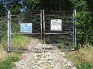 William Penn planned to put his mansion on top of Faire Mount, where the Art Museum now stands. By 1880, long after Penn decided to build Pennsbury Mansion elsewhere, city growth outran the capacity of the new reservoir system which had then been placed on Fairmount. An additional set of storage reservoirs were placed on another hill across East River (Kelly) Drive, behind Robert Morris' showplace mansion now called Lemon Hill (Morris merely called it The Hill); the area was eventually named the East Park Reservoir. In time, trees grew up along the ridge and houses got built; the existence of these reservoirs right in the city was easily forgotten, even though the towers of center city are now plainly visible from them. These particular reservoirs were never used for water purification; that's done in four other locations around town, and the purified water is piped underground to Lemon Hill, for last-minute storage; gravity pushes it through the city pipes as needed. 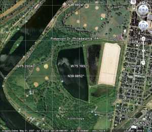 Now, here's the first surprise. Water use in Philadelphia has markedly declined in the past century. That's because the major water use was by heavy industry, not individual residences, so one outward sign of the switch from a 19th Century industrial economy to a service economy is -- empty old reservoirs. Only one-quarter of the reservoir capacity is in active use, protected by a rubber covering and fed by underground pipes. The rest of the sections of the reservoir are filled by rain and snow, but gradually silting up from the bottom, marshy at the edges. Unplanted trees have grown up in a jungle of second-growth, attracting vast numbers of migratory birds traveling down the Atlantic flyway. Although there are only a hundred acres of water surface here, the dense vegetation closes in around the visitor, giving the impression of limitless wilderness, except for the center city towers peeping through gaps in the forest. It's fenced in and quiet except for the birds. For a few lucky visitors, it's easy to get a feeling for how it must have looked to William Penn, three hundred or more years ago, and Robert Morris, two hundred years ago. In another sense, it demarcates the peak of Philadelphia's industrial age, from 1880 to 1940, because that kind of industrialization uses a lot of water. The place, in May, is alive with Baltimore Orioles. Or at least their songs fill the air and experienced bird watchers know they are there. Even a beginner can recognize the red-winged blackbirds, flickers, robins, and wrens (they like to nest in lamp posts). The hawks nesting on the windowsills of Logan Circle suddenly makes a lot more sense, because that isn't very far away. In January, flocks of ducks and geese swoop in on the water surface, which by spillways is kept eight feet deep for their favorite food. Just how the fish got there is unclear, perhaps birds of some sort carried them in. The neighborhoods nearby are teeming with little boys who would love to catch those fish, but it's fenced and guarded much more vigorously since 9-11. In fact, you have to sign a formal document in order to be admitted; it says "Witnesseth" in big letters. Lawyers are well known for being timid souls, imagining hobgoblins behind every tree. However, there are some little reminders that evil isn't too far away. Just about once a week, someone shoots a gun into the air in the nearby city. It goes up and then comes down at random, with approximately the same downward velocity when it lands as when it left the muzzle upward. That is, it puts a hole in the rubber canopy over the active reservoir, which then has to be repaired. No doubt, if it hit your head it would leave the same hole. So, sign the document, and bring an umbrella if the odds worry you. 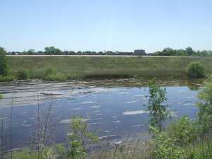 A treasure like this just isn't going to remain as it is, where it is. It's hard to know whether to be most fearful of bootleggers, apartment builders or city councilmen, but somebody is going to do something destructive to our unique treasure, possibly discovering oil shale beneath it for example, unless imaginative civil society takes charge. At present, the great white hope rests with a consortium of Outward Bound and Audubon Pennsylvania, who have an ingenious plan to put up education and administrative center right at the fence, where the city meets the wilderness. That should restrict public entrance to the nature preserve, but allow full views of its interior. Who knows, perhaps urban migration will bring about a rehabilitation of what was once a very elegant residential neighborhood. And push away some of those reckless shooters who now delight in potting at the overhead birds. 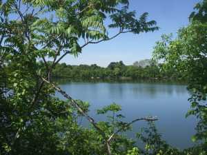 This whole topic of waterworks and reservoirs brings up what seems like a Wall Street mystery. Few people seem to grasp the idea, but Philadelphia is the very center of a very large industry of waterworks companies. The tale is told that the yellow fever epidemics around 1800 were the instigation for the first and finest municipal waterworks in the world. There's a very fine exhibit of this remarkable history in the old waterworks beside the Art Museum. But that's a municipal water service; why do we have private equity firms, water conglomerates, hedge funds for water industries, and other concentrations of distinctly private enterprise in the water? One hypothesis offered by a private equity partner was that the success of the municipal water works of Philadelphia stimulated many surrounding suburbs to do the same thing; it was surely better than digging your own well. This concentration of small and fairly inefficient waterworks around the suburban ring of this city might well have created an opportunity for conglomerates to amalgamate them at lower consumer cost. Anyway, it seems to be true that if you want to visit the headquarters of the largest waterworks company in the world, you go about seven miles from city hall and look around a nearby shopping center. If you are looking for the world's acknowledged expert in rivers, you go to the Academy of Natural Sciences of Philadelphia on Logan Square and look around for a lady who is 104 years old. And if you have a light you are trying to hide under a barrel, come to Philadelphia. Monocacy Creek and Monocacy River
Monocacy sounds like a Greek word for some form of government, but is in fact a Shawnee Indian term, meaning "crooked river". It might well be spelled as the Indians pronounced it, Monnockkesey. Confusion for history lovers is made worse by the existence of a Monocacy Creek about twenty miles long, flowing into the Lehigh River at Bethlehem. But there is a second stream, the Monocacy River, flowing about sixty miles south from Gettysburg, through the town of Frederick, Maryland, eventually merging with the Potomac River a few miles south of Harper's Ferry. Both forms of Monocacy do flow-- but do not connect-- along the base of the first mountain range of the Alleghenies, on its Eastern side. Pennsylvanians refer to this ridge as the Blue Mountain because looking westward it can be hazily seen across the plain from a great distance. In Maryland, it is called the South Mountain. In the early part of the Civil War, General Lee attempted to attack Washington DC from the rear by striking through several gaps (particularly "Fox's Gap") in that mountain. The Philadelphian General George McClellan uncharacteristically surprised him by getting masses of Federal troops through the mountain gaps before Lee could reach and fortify them from West Virginia. Although McClellan did intercept some of Lee's orders, it is now questioned whether this affected the outcome. The culminating result was what the Union side continues to call the Battle of Antietam Creek, but the former Confederates persist in naming the Battle of Sharpsburg. Antietam Creek is one of those many creeks which flow along either side of the long mountain range, fed by runoff rainwater from the ridge, and therefore has steep embankments. Regardless of the nomenclature quarrel, the main point is that both of these placenames refer to the west side of the mountain gap, putting Lee at a disadvantage for an attacker. He got there first, but he did not get there first with enough force to dominate the passes.
A horrendous slaughter of Federal troops took place when General Burnside was ordered by McClellan to get his troops across Antietam Creek immediately, and Burnside chose frontal attacks over a narrow stone bridge crossing the Antietam as the way to get there. Because of the creek's flow along the base of the mountain, once the bridge was crossed under constant sniper fire, the troops faced a sheer embankment which had to be climbed into the face of 500 Confederate sharpshooters shooting down from the top. Burnside and the Federal troops finally did accomplish this suicide mission after four hours of trying, mostly because the Confederate sharpshooters ran out of ammunition. At the end of that day, 23,000 troops on both sides were casualties. Toward the end of the war, similar casualties would be sustained fifty miles north at Gettysburg PA, along a branch of the Monocacy on the east side of the ridge. The two Monocacy streams, Creek and River, are entirely distinct but a natural source of confusion.
It would seem a pity, however, to succumb to a fit of tidiness and change the name of either stream. The Shawnees were once the most important Indian tribe in this region, and at various times have achieved dominance over regions from the Delaware River to Oklahoma. As a major component of the Algonquin federation of tribes, they fought a losing battle with the Iroquois over a period now named the Sixty Years War, eventually retreating from the Eastern Alleghenies to Ohio. Meanwhile, the Iroquois were destroyed by the consequences of the Revolutionary War, while eventually, the Shawnees retreated to reservation areas in Oklahoma. The Monocacy streams, both of them, represent a high-water mark of Shawnee influence. It would be sad to see the last few vestiges of their pre-eminence, even if only names on a map, destroyed by inadvertence or indifference. Delaware Water Gap
When we think of water gaps, we tend to think of Harrisburg or Pittsburgh, with a wide river turning abruptly to run through a sharp cleft in a single mountain ridge. West Point on the Hudson might be a third well-known example. But the frontal ridge of the Alleghenies, variously called Blue Mountain, Blue Ridge Mountain, South Mountain, or Kennesaw Mountains, is several ridges wide. A gap in that sort of complex mountain range must be crooked and several miles wide to let a river of any size find its way through it. Presumably, this gap at Stroudsburg was formed by some huge volcanic action, because thick sedimentary layers are upended and exposed at the river's edge, with the water winding between the towering formations. To avoid going up and over a thousand feet of the mountain, human travel must follow the same path; a railroad, a little town, and several highways are crowded into the base of the cleft now filling up with gravel eroded from the cliffs. Even the birds need to travel several miles through the winding cleft in the formidable forests, with eagles and occasional turkey vultures coasting overhead, enjoying a ride on windy updrafts, casually on the lookout for lesser prey. The Gap is a great intersection between New Yorkers and Pennsylvanians, mostly going somewhere else. The dominant Philadelphians got there first and tended to congregate in Stroudsburg where the Waring Blendor was invented within the once-flourishing Pocono region for fishing and getting away from summer fevers. As the jolly guide at the visitor's center chuckled, the New Yorkers tend to arrive eight busloads at a time and head straight for the bathrooms. After that, nowadays most species of city dwellers buzz off for somewhere else, leaving the Water Gap to darkness, and to me. 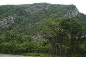 The Water Gap has at least two other outstanding attractions, however. For fifty or more miles along both New Jersey and Pennsylvania sides of the river, a Federal Game Preservation area stretches through the forests and cliffs to the New York border. You have to be pretty determined to get to it, however, because traffic is traveling in herds at eighty miles per hour past the few entrances. You can be hopelessly beyond the entrances before you recognize you are past the point of no return, or at a point where you can if you wish only make another try for it by finding a place to turn around, pay tolls, and risk your life between the cliffs and eighteen wheelers. If you have enough courage and eye/hand coordination, however, once you do get off into the quiet woods, you pretty much have Shawnee America to yourself. The Appalachian Trail crosses at this point, but hikers should remember you must wade the Delaware River to pick up the trail on the other side. The other gem of this area is called the Shawnee, a 19th Century resort hotel of genteel note, with outstanding food and a famous golf course that you reach by footbridge to an island. PGA championships have been played here, and Fred Waring probably played some dance music once. At one time, there was a couple of dozen such mountain resort hotels scattered from Maine to Georgia, all of the American Plan, looking as though Scott Fitzgerald and Zelda would come lurching around the next corner. It's anybody's guess whether recessions and gasoline shortages will ruin these places, or whether the people who deserted this summer custom and went to Europe will remember these mountain resorts are here and save them. Right now, there are the golfers and the mountain hikers during the summer and the skiers in the winter. And then there are a few people who want to write or read novels, some conventions, a few tourists if they own a necktie. This winding, several miles long canyon, once a forest fastness of the Shawnee, was perhaps their main bastion. That most powerful tribe of the Algonquin federation participated in a sixty-year war with the Iroquois and mostly lost. You can certainly imagine what a marvelous fortress this region was, containing protected fertile islands to grow food, interior forests which probably abounded in game, rivers full of fish, sheltering mountains with hidden entrance clefts from which to emerge and dominate the flatlanders in all directions. If you were going to be an Indian, this was surely the best place in the world to be an Indian. Due North of Philadelphia, More or Less
Airplane pilots tell us the main streets of quite a few cities seem laid out as if with a compass, north, and south, east and west. Philadelphia probably started that tradition in America, although Google Earth will show anyone who doubts it that Beijing, China was laid out along the same grid two thousand years earlier. It seems possible that Thomas Holmes was aiming at the Delaware Water Gap when he drew his famous map for William Penn, but there are troublesome objections. Broad Street, itself due North-South, when extended is called Route 611, heading straight for Doylestown, and then for the Water Gap. While there's a second pass through Blue Mountain at Wind Gap, it was a hard climb in the 17th Century. Until the Lehigh Tunnel was built, the water gap was the only practical way to go north for three centuries. The gap's existence had been known to the Indians for centuries, and the dividing line between East and West Jersey terminates at Dingman's Ferry, essentially the same place as the Delaware Water Gap. Since Penn's Proprietorship of New Jersey was seven years older than his ownership of Pennsylvania, he definitely knew about the main landmark of the area which he used as a fixed boundary marker. In fact, it is a tradition among modern proprietors that he unsuccessfully pressured the boundary negotiation in order to get both sides of the Delaware Gap into West Jersey, taking advantage of the sharp bend in the river for the purpose. Since he eventually owned or controlled all of the regions, it seems entirely plausible that he could arrange the direction of the roads as he pleased. There is one big problem with such a unifying hypothesis, however. If the Water Gap was to be made due North of Broad Street, and Broad Street was to be the center of the city, there was no way to accomplish it except by adjusting the location of the whole City of Philadelphia. That was within his power as owner, but it seems an extreme way to get maps tidy. The alternative explanation is that these mapping niceties were just a series of coincidences, and that is equally hard to believe. Present-day proprietors are often engineers and surveyors, so even to mention these issues is likely to lead to indignant dispute. The Allegheny Mountains run from Georgia to the Adirondacks, presenting a sheer face to the East with very few gaps except for the major rivers. The water gap was a busy place for all North-South travel, whether on riverboats, canals, railroads or Interstate highways -- or mocassins. From there up to Canada, the simple explanation for a continued northerly path was there was scarcely any other way to go. The rivers and finger lakes have a due north orientation between mountain ridges as a result of advancing glaciers and receding glacier melt. That's the whole idea of global warming and global cooling; the polar ice cap advances and recedes from the north pole. When you are standing on the North Pole, everything else is South of you. With logic plus a little imagination, it's thus possible then to see why a compass points you from City Hall, Philadelphia to Kingston Ontario, but how fast you go is your decision. The rest of this article argues that this seemingly desolate trail is peppered with an interesting history; even if you drive straight and fast, you ought to know a little about what you are passing. In this suggested trip, the traveler is urged to consider stopping for half a day in Doylestown, followed by the Water Gap, or Jim Thorpe, PA. You might alternatively duck off the Pennsylvania Turnpike extension into Wilkes-Barre and Great Bend, or toward Ithaca and Cornell University's famous bird sanctuary, then onward to Skaneateles and Marcellus over good local roads, tipping your cap toward Apalachin the gangster headquarters as you go. People in a hurry to get to Canada will take Interstate 81 most of the way, but at least consider taking secondary roads along Lake Ontario. It's a very pleasant drive, including a stop in Sackets Harbor for at least a meal. And then, detour to Clayton and Alexandria Bay before going over the international bridge to Canada. Finally, go down along the northern shore of Lake Ontario to Kingston. You're there. Getting home after a long weekend is a hard drive, four-lane highways suggested, stopping at some of the places mentioned on the way home rather than using them all up on the way north. The detours add perhaps a half day to the trip in each direction. If you have the time, a trip westward along the northern or southern sides of Lake Ontario to Niagara Falls would be very nice, but not the subject of this topic. It's pleasant to wander and stop at interesting places on impulse, but it's also nice to have a fairly clear idea of the day's outlines. You can eat in nice restaurants or grab a burger in a fast-food outlet; it often makes little difference which you choose. If you are traveling with children, tell the waitress to bring some crackers for the kids when she brings the menu. But by all means avoid the dreadful experience of watching it get darker and darker in the evening, with all the hotels full and adamant about it. By at least four o'clock in the afternoon, pick out a likely place to spend the night and call ahead for a reservation. If you are traveling on a tight budget, at lunch don't go to a fast-food place, but to a supermarket. Pick up ingredients of tomorrow's breakfast and today's lunch; at the check-out counter, ask where the town park is, for a picnic lunch. With an assured place to spend the night, it's a lot easier to take a bath there, and then go out on the town for dinner. The main reason people drive like demons and thus miss the most interesting parts of a vacation trip comes from not knowing how to manage the children, and the details of travel life. Central Pennsylvania Settlers Before 1700
Dates are unclear, but twenty-five families from the German Rhineland bought Pennsylvania land from William Penn prior to 1700, which is the earliest recognizable date on a gravestone in the Hummelstown Cemetery. Future research may narrow that time interval down, but it can confidently be said they got on a sailing ship bound for Philadelphia between 1682 and 1699. For reasons also unknown, tradition relates the Captain refused to stop in Philadelphia, putting them off in New York. They discovered they were unwelcome among the Dutch settlers in New York, who quite likely reflected the ancient hostility between the Dutch at the mouth of the Rhine River, and the Germans living upstream from there. Augmented by wars and invasions, the feeling persists to some degree even today. The twenty-five families sailed from New York, up to the Hudson River to Kingston the state capital, where they discovered they were even more unwelcome. The British under the command of the Duke of York took over New Amsterdam in 1664, but Dutch cultural control persisted long after the change of political control.
Tradition continues that Governor Keith of Pennsylvania happened to be in Kingston at the time of the stranding of the migrants. He suggested they travel eighty miles overland to the Susquehanna River and then float down to land where topsoil was reputed to be several feet thick. Since Dutchmen everywhere concentrated on fur trading more than farming, it seems safe to guess reliable guides were easily found in Kingston. From there to what later became famous as Three-Mile Island below Harrisburg, the three-hundred-mile route of these pilgrims can be guessed by following valleys between towering ridges. Unfortunately for this surmise, there are two main canyons leading to Kingston from the Susquehanna, which improved Kingston as a choice for fur trading. The more northerly canyon is somewhat longer, but it might have been safer; perhaps the German pilgrims just flipped a coin. Taking either choice it's a hard trip however, even assuming the Indians were friendly and food sources abundant. It must have required at least a month to go the full distance to what is now Harrisburg, passing by a number of places which now support prosperous farms. That potential likely provoked demands of some travelers that they had gone far enough, as kids do today in the back of the station wagon. By luck or stubbornness, however, they kept right on into the wilderness, eventually making permanent settlements along the Swatara Creek in Dauphin County, which proves to have the richest farmland in America. Middletown and Hummelstown are thus the two oldest settlements in Central Pennsylvania. By the time the other German sects made their way up Germantown Avenue, out Germantown Pike, and then onward to the Great Valley beside Blue Mountain, the original settlers had ample time to discover the best land, the surest wells, and the best access to the creeks. Furthermore, they had several generations to notice which families produced the strongest lads, and which families were the best natural farmers. Since later incoming families were mostly penniless, they had to settle for less advantageous farmland and less endowed marriage partners. Dominance by the original farming families continued until the early Twentieth century when it became prestigious to enter one of the professions. Or even to move away from the Dutch Country and go to the city.
Getting back to their days in Kingston, it is not easy to tell what route they took, judging only from a highway map. We look for the largest towns and then the shortest highway route, but it seems likely Kingston was chosen as a trading center because it was the place where the fur traders brought their pelts to the Dutch ships on the Hudson. The roads chose the towns, not the other way. When you observe the valley beginning at Kingston, there remains little doubt the route to Harrisburg must have led that way. The local folks at the museums and stores of Kingston can't help; they never heard of any such migration, and most of them never had reason to travel in that direction. Kingston was burned to the ground (by the British) in 1777, the state capital moved to Albany, and the economic center went south to New York City. Kingston is just a nice little town on the Hudson, across the river from where rich folks put their mansions, and liberal-minded folks send their children to Bard College, a place where no two buildings follow the same architectural style. So when you go West from that nice little town, it is only a mile or two before you are out in the woods, with farms here and there, and scattered cabins which look like fishing and hunting "lodges". There's a creek in the bottom of the valley, and if you look up, you see the road merely winds its way between parallel mountain ridges. Perhaps a glacier carved out this trail, perhaps a mighty river once ran there, perhaps volcanic action tented up and cracked. Anyway, you are not going to get lost if you follow the creek, going steadily uphill from Kingston for twenty or thirty miles. If this were a single mountain ridge, you would be approaching either a water gap or a wind gap. A wind gap is a water gap that has lost its river at the top.
What's at the summit is not a notch, however, it's a bowl. Out of this bowl flow the three main rivers of the eastern seaboard, the Hudson, Delaware, and the Susquehanna. The effect resembles what is said of Switzerland: The Rhine, the Rhone, Danube, and Po; They rise in the Alps, and away they go. The highway from Kingston runs along a creek which flows into the Hudson. At the top of the bowl are some nice dairy farms scattered along ten miles which drain into Delaware. The East Branch and the West Branch of the Delaware River are scarcely more than creeks at this point. At Delhi and Andes there is a further rise in the mountains, and then along twisting decline as you follow a branch of the Susquehanna down to its junction at Oneonta. As you cross the top of the ten-mile mesa you have perceived the answer to a natural question: how did those German families get across the big wide Delaware River that runs between Kingston on the Hudson -- and Cooperstown, where the Susquehanna begins? The answer is pretty evident. Delaware, while a mile wide at Philadelphia, narrows down to two little creeks on this mountain plateau. The Susquehanna system on one side and Hudson on the other have swallowed up the Delaware watershed between them. This might well have seemed a nice place for the German settlers to set up a few dairy farms, but it probably was an even more ideal place for the Iroquois to set up headquarters. Their favorite style of warfare was to occupy the high ground and make lightning raids (or quick escapes) on canoes down the various rivers starting from their origins. If it's of any interest, Charles Evans Hughes began his law practice in Delhi, and a lot of the town boys were killed at the battle of Antietam, thus illustrating the unwisdom of recruiting whole towns into regiments. Down the mountain we go, into the broad Susquehanna valley. It was probably troublesome to manage wagons down a mountainside. But from here on the German families could stop walking, and float. Dingman's Ferry, Below Port Jervis
Because the area was once covered with a glacier, the northeast corner of Pennsylvania is fairly deserted. That's always been good for hunting and fishing, and more recently is good for skiing. Although the topsoil is poor, it's a beautiful area, practically guaranteed to provoke confrontation between the environmentalist movement and the Marcellus shale-gas extraction industry. The history of anthracite coal demonstrates locally that the mineral extraction industry always wins these arguments in the short run, but ultimately the land seems to heal itself without much help from people living in city apartments. The followers of Gifford Pinchot and Teddy Roosevelt are slowly learning to concentrate on minimizing the damage and forcing the extraction industries to pay for clean-up afterward. Right now, this semi-wilderness area is a remarkably beautiful but deserted forest within two hours drive of Philadelphia and New York City. It contains the headwaters of the three main rivers of Northeastern United States. Crossing those three rivers was the main geographical problem for the Connecticut invaders of Pennsylvania. Today, the landscape is not a great deal different except for the absence of Indians, and crossing the three rivers is the main event. There's a Hudson River bridge at Newburgh, and crossing the Susquehanna at Wilkes-Barre is a placid bridge within a town park. From the point of view of the Interstate highway, crossing Delaware occurs very near the highest point in New Jersey, over a deep rocky gorge with boaters deep below. Since the traveler is at a peak point within a long wide mountain valley, the view is spectacular in several directions. However, for centuries the builders of roads had to operate on a modest budget, and the only reasonable place to cross Delaware in that region is a few miles south of Port Jervis, at Dingman's Ferry. The Dingman family prospered at their trade for many generations before they modernized and constructed a toll bridge, which is now one of the few remaining toll bridges in private hands, and possibly the oldest one. You don't have to ask the two jolly old toll collectors whether they are part of the Dingman family because they certainly act like it, adding to the wad of dollar bills in their left hand as they greet the fellas, josh the girls, and wave directions with a free hand. A quarter-mile to the south of the bridge on the Pennsylvania side is the entrance to a trail leading to a National Park Service station. The Park Guards are a friendly sort, most of them freely admitting they are members of the Dingman clan, available to help tourists interested in a trail walk, including a visit to the local waterfall. In spite of all this family connection, and Park Service training, nobody at the station had ever heard of the march of the Connecticut invaders. Or of the Proprietorships of West and East Jersey, or of the line between them which allegedly ends at Dingman's Ferry. The best they could do was the point to the local cemetery, which has a big rock at the entrance that somehow has some particular significance, or other. As it turns out, the cemetery is quite large, with surely a thousand or more gravestones, a great many of which fly American Legion flags for veterans of one war or another, and many more are decorated with fresh flowers. Only a corner of this graveyard touches the curving road to The Bridge, and just inside the entrance is a very large, unmarked stone. Trees have been planted nearby, and their roots have half-covered the rock. But the roads and the cemetery, in general, seem designed around it. There's no marker to explain it, any more than there is a plaque at Stonehenge. As the Park Ranger said, it has clear significance, but no one now seems to know what it is significant of. Well, if no one is likely to contradict, let's make the timid suggestion that this may be the terminus of the line dividing East from West Jersey. Yes, it's in Pennsylvania. But there is nothing more likely on the New Jersey side of the crossing, and the current Surveyor-General of West Jersey, William Taylor, is firm in the belief the line terminated at Dingman's Ferry. William Penn had hoped to control land on both sides of the river, and when he acquired Pennsylvania in addition to New Jersey, the issue became moot. The style of the survey had been to start at Beach Haven ("Ye inlet of ye beach of Egg Harbor") and follow the compass until it hit something large and heavy. That rock was marked, and another survey went the next step. About fifty of these markers have been discovered by later explorers, and officially represent the underlying fixed line which serves as a survey basis for every property in the state of New Jersey. Since I own some property in New Jersey myself, it seems important to be sure I know where it is, or else some trial lawyer may try to take it away. South Philadelphia: Ideal Intermodality Transportation SiteThe Right Angle Club was recently visited by Troy Adams, representing the Greater Philadelphia affiliate of the regional Chamber of Commerce. Sustained by contributions from sixty local corporations, the Greater Philadelphia organization is a major storehouse of data useful for businesses, supported by a staff of analysts and computer experts. The purpose of this institution is to help businesses who are trying to decide whether or how to locate in the Philadelphia region. With such an organization behind him, Mr. Adams was able to show a number of slides displaying the demography, geography, and statistics about our region, and his appearance is greatly appreciated. This is definitely the place to go if you have questions of that sort. It would probably also be a good place to go for opinions and gossip about the politics and inside baseball of the town, but the Chamber has a strict rule about avoiding any involvement in business moving from one district to another within the region or hearsay that might lead to such internal friction. One really important insight into the potential of our region concerns South Philadelphia. Historically, this was the place where the Schuylkill and Delaware Rivers met, and was once a very big swamp (wetland, nature sanctuary or whatever). Over time, the swamp became a trash and garbage landfill, and over still more time it became a big flat uninhabited area right next to a big city. But then an Interstate Highway (I95) was built on its circumference, and several rail lines, and an international airport, not to mention extensive port and shipping terminals for ocean transport. While it is true that a certain number of houses would have to be purchased and demolished to accomplish it, the potential exists for the construction of an intermodal interconnection which would be almost unique in the world.
There would be plenty of lands left over for industries related to freight forwarding and the like (the food distribution center is a good example of the general concept), and all of this would be within twenty minutes of the center of a major city. SEPTA already sends a passenger rail spur from the very heart of the city to the very center of the airport, and there is no reason it could not be extended to include ocean, bus, and distribution terminals. Whether this exactly fits with the extensive sports stadium complex in the area is unclear, but these entertainment features are doing no harm to the intermodal interchange idea in the meantime. Judging by the city government's willingness to tear these structures down every five or ten years, there should be no great resistance to moving them elsewhere if the need should arise. Reviving Schuylkill: Eight Miles From the Dam to Ft. Mifflin
Joshua Nims of the Schuylkill River Development Corporation recently addressed the Right Angle Club about current activities of that organization. It's a non-profit corporation, but in a sense is a quasi-City agency, spending State and Federal funds, plus remediation funds. Just what remediation funds are was not clearly explained, but seem to be fines or assessments on companies who are thought to have fouled up the environment. Whether those assessments are fair or unfair, too small or too large, are political issues largely avoided in Mr. Nims' presentation, and hence are avoided here.
The Gray's Ferry area is certainly an urban tragedy of epic proportion, but since its deterioration began in 1856, the events of the Civil War probably had a lot to do with it. Up until the Civil War, the western banks of the Schuylkill, especially around Gray's Ferry, were famously upscale and beautiful. The South Street Bridge, for example, was originally envisioned as leading into a boulevard of the Arts, with the University Museum, Irvine Auditorium, the University Hospital and the mansions on the top of the hill setting off what promised to become a striking cultural statement. Anthony Drexel himself lived up there, walking it to work at Third and Chestnut. And that's just one famous example. It's hard to know what started the blight, but Harrison Brothers White Lead, Color and Chemical Works might be a good candidate and the fact that the area soon developed the tracks often (10) smoke-belching railroads was certainly another major issue. The western bank of the Schuylkill rose to a high rocky promontory at Gray's Ferry, crowding wartime industrialization into a narrow place. Before that, Gray's Ferry Bridge had been the main artery to the South, traveled by George Washington many times, often stopping at Woodlands, that palatial home of Andrew Hamilton the original Philadelphia lawyer. A century before that, the Dutch fur traders had found it to be the first firm land after they sailed inland through the swamp, while the Indians knew it was the last forest area before you reached the (South Philadelphia) area of malaria, yellow fever and other mysterious vapors that must be avoided. In the sense of land travel, Gray's Ferry was, therefore, the most prominent part of the Philadelphia landscape for two centuries. The ferry itself was a floating bridge, pulled back and forth by ropes on each shore of the river. Given a choice of pretty much all of the North American continent, John Bartram placed his farm just south of this promontory. Where it still stands today but surrounded by slums and urban decay. It's a little hard to judge whether the Civil War pushed railroad construction into the only rocky crevice suitable, and then industrial pollution followed with vile and noxious effluents, or whether the Harrison Lead, Color, and Chemical factory simply started it across the river in the river bend. That's where the DuPont paint factory relocated in 1916, and in fact, the Duponts get local blame as polluters when in fact they made considerable effort to clean things up after they acquired it. The area had a major slaughterhouse abattoir, and an asphalt plant and several other major inducements to the populace to abandon their elegant mansions and run for their lives. The place now has old rusting bridges, tumble-down concrete pilings, lots of weeds, and not a single living fish for a century in that water. To diffuse the blame somewhat, it should be remembered that after the War of 1812, the Schuylkill was the main transportation artery for coal coming down from Pottsville and the rest of Schuylkill County. The river didn't have a sandy bottom, it was pulverized anthracite which releases acids and toxins when washed. So that's the river region the Schuylkill Development Corporation plans to line with grassy running paths and benches to admire the view. Maybe the Wilson Steamship Line or something like it can again be persuaded to bring tourists here, or maybe the riverbanks can be lined with hotels to house people who take rides on river flatboats, as they do in San Antonio. Or dare we mention it, maybe Paris. Maybe Philadelphia can once again be a tax collector's idea of heaven, together with five-day weekends.
At the moment, this little non-profit city agency is run on a $500,000 operating budget, and has about $20 million worth of projects in progress. Some of that is reparation money pried from the grandchildren of the owners of those factories who did the damage over a century ago, and some large part of it is Philadelphia's share of the boodle from the Stimulus package. There's no doubt the area will look immensely improved in the next year or two, and a lot of hope that private investment will be attracted to an area previously shunned vigorously. The area which has already been cleaned up, from the Wissahickon to the Dam, really must be called a great success; there's lots of foot traffic and joyousness. And the area can also be praised in what unfortunately is the measurement of modern urban development: it has only had two lawsuits for sprained ankles, and only two muggings, quite a commendable record. But now development is going past South Street, into much murkier areas, with more low-income residential spaces. Surveillance cameras are planned, and bright lighting, but it's far from certain that a little strip of gentrification can defeat miles of surrounding decay. Only if they pull it off will private investment creep into the area, and the parents of University students permit their children to run there. If private investment arrives, this organization can do no wrong, because only then can it fairly be described as "Infrastructure". My own definition of infrastructure as an economic stimulus is of early public spending on projects which would have eventually consumed the money anyway, except later. By that standard, infrastructure spending's only true cost would be the interest on borrowed money to do it sooner. Let's make a note to revisit this experiment in a couple of years, cautiously wishing everyone the best, in the meantime. Not a Single Red Knot
A full moon brings high tide, which for centuries has brought vast numbers of horseshoe crabs to the banks of the Delaware River, toward the end of May. Marine biologists tell us these ugly-looking beasts have evolved very little for thousands of years. Horseshoe crabs transport oxygen through their blood as a blue copper compound instead of that iron-containing hemoglobin the rest of us use. That's red, of course. Somewhere in the evolutionary path, these ancient animals also neglected to develop an immune system, but defend themselves against bacteria by precipitating sediment when they encounter endotoxin. By luck, this reaction takes place even though the bacteria are dead, so it is routinely employed as a way of detecting and eliminating endotoxin in intravenous fluids, which would otherwise go undetected by failing to grow the original bacteria in conventional culture media. Unfortunately, those of us who have never experienced a temperature spike to 106 degrees from an intravenous infusion of "sterile" water is more or less indifferent to the contribution of the Delaware crabs to our well-being. As well as being sadly indifferent to the unique nature of their nerve cells, in long single neurons, which make a number of important experiments possible.
The horseshoe crab offers still other attractions. When they come ashore to lay eggs (at a full moon, or high tide, in May), they lay incredibly large quantities of them, attracting astonishing swarms of birds, which can be seen gliding a few feet above the water surface in groups of hundreds or even thousands. The Red Knot sandpiper is certainly not the only egg-eater at Bombay Hook, but there are some unique features of that bird to be mentioned in a minute. A lot of people object to being attacked by monster swarms of mosquitoes in the summer, but screens and air-conditioning have encouraged a large number of rather prosperous houses to be built along the shore, particularly where there are sandy beaches. In fact, it is so crowded the Fish and Wild Life Service has placed street lights at such public places, with a narrow driveway to lead you to the beach. If you don't know how to recognize such amenities, well, too bad for outsiders. Although there are plenty of naturalists and bird-watchers who come in the early spring, most of the houses along "Slaughter Beach" seem to belong to fishermen and duck hunters, the two outdoor sports with most popularity. Different migrations of different food-producers bring different prey for the sportsmen, but somehow the most up-scale members of this fraternity tend to go there in May, looking for Red Knots. A Red Knot is a form of sandpiper, with a red head and breast. The birds are born in the Arctic tundra, eating vast amounts of mosquito eggs and larvae, migrating south in the fall. They winter over in Tierra del Fuego at the opposite end of the earth and then migrate north to Bombay Hook on Delaware. For these long migrations, they must eat voraciously when they do eat and somehow have learned to look for the horseshoe crab eggs at just the right time, presumably following cycles of the moon for timing. Residents of the area for centuries have remarked on the timing of the birds and the tides and the crabs. Unfortunately, the two-continent migration was only recognized fairly recently, and when the supply seemed endless, the crabs were scooped up and used for fertilizer until their supply began to dwindle; both Delaware and New Jersey now have protective legislation, and Virginia is being verbally excoriated by bird watchers, to do the same. The crabs have started to come back, but the Red Knots are slower to respond, and now the threat is Sushi. Another ecological damage has reduced the supply of crabs in the Pacific, so the crab fishermen have migrated to the Atlantic to catch the crabs as bait for conch and other ingredients of Sushi. Once again, the abundance of crabs has declined, although to a much smaller degree than the Red Knots. This year, on the very best day of the year for this sort of thing, with dozens of out-of-state license plates wandering aimlessly up and down thirty miles of shoreline, the shouted greetings among serious bird watchers returned the sad news, "No Red Knots today. Try the beach." It was generally agreed there was a bit too much wind for good Red Knot sighting, and that oil spills in the Gulf of Mexico were to be suspected, and that perhaps tomorrow would be a better day. But judging by the very expensive optical equipment these people were carrying around, these were serious birders, indeed. If they couldn't find Red Knots, the rest of us might as well give up. The most plausible theory for the latest decline centers around the old-timer birds. When the first-timers start their northward migrations, they are guided by the old-timers who have made the trip at least once before. If something injures the flock, it may be a few years before the supply of old-timers revives enough to supply the first-timers with guides. That's just a theory, of course, but currently the most popular one. Just what it would take to eliminate the Red Knot migration completely, may now be close to being tested. Just on principle alone, it does seem a pity to eliminate a phenomenon which took thousands of years to develop.
When you finally give up on Red Knots, you might as well wander around this enormous wildlife sanctuary. A few miles up the road is the former location of Whitehall, the plantation house of Benjamin Chew, lawyer for the family of William Penn, and owner of the stone fortress on Germantown Avenue in Philadelphia that thwarted George Washington's attempt to stall and starve the British before they could join up with their ships in the harbor below Fort Mifflin. The original buildings on the plantation have disappeared, but the spongy plantation trails have been replaced by elevated gravel roads. So it is possible to roll up the windows of your car in mosquito season, turn on the air conditioning, and cruise around the spectacularly beautiful ponds and inlets. Further south is the plantation of Caesar Rodney, who rode to Philadelphia in the rain to cast the deciding vote for the Declaration of Independence. And further south of that is the plantation of John Dickinson, who made Rodney's ride necessary by refusing to sign the Declaration, on the grounds that the colonies showed insufficient unity, in his eyes, to be able to win a war with England. And anyway, the argument was largely economic, hence more likely to be won by economic means than military ones. To the west of these historic plantations are some pretty impressive farms, new style. The houses give them away since no farmer will spend a cent on his house if he can profitably expand his farm; these houses belong in glossy magazines. The silos are grouped in clusters of ten or twelve, the irrigation sprinklers are a quarter-mile long, attachable to what resembles a fire hydrant in the center of the field. There are over a hundred sheds on some farms, filled with chickens fattening up. And do you know what? You can drive for miles without seeing a single chicken. Eventually, the road leads to the Dover Air Force Base, very large indeed. No planes are in evidence, as is true on most days. But one day in 1962 Mr. Kennedy was talking to Mr. Castro, and overhead at Dover you could see dozens, maybe hundreds, of eight-engine bombers. Just circling, circling, waiting for orders to go lay an egg on the Kremlin. It wasn't clear to onlookers at the time, just what this was all about. But the idea can now be entertained that perhaps Red Knots weren't the only species flirting with extinction. Weather Man
PAUL Walsh, our local weatherman, recently addressed the GIC (Global Interdependence Center) at the Federal Reserve, and presumably because everyone talks about the weather, the meeting was well attended. While he is too experienced to get drawn into a global warming controversy, we get the general outline of his views. What we call the weather is largely a result of various clouds and wind currents blowing around the planet in response to the rotation of the planetary mixture of oceans and land masses. The familiar landscape visible to astronauts makes it easy to accept this view of things. The global warming issue, however you explain it and where ever it may be going, is a weather cycle to be measured in centuries. Shorter cycles of about eight years in duration tend to result in American weather patterns sometimes blowing Canadian cold air toward the East Coast, and sometimes blowing California winter weather Eastward. In 2011-12 we seem to be experiencing a California winter, while the preceding two winters were unusually cold, reflecting Canadian conditions. What may or may not be happening with the hundred-year global warming cycle is not easily slipped into our daily conversations. It is probably quite irrelevant to global trends whether or not last year was a cold one, or whether our sidewalks are unusually slippery this morning. Inquiries about the weather are the number one topic to be clicked on the Internet, reaching 17% of queries. That's nearly double the second largest category and four times the number of inquiries about the stock market. Ordinary variations of the weather have been calculated to have an economic value of $384 billion, or 3.4% of the Gross Domestic Product (GDP). Insurance claims for more severe weather abnormalities run between ten and fifty billion dollars a year. The number of hurricanes and similar disasters is highly variable, sometimes running as high as fifty in a bad year. Predictions are improving, but ridicule of weatherman errors is still highly embarrassing to the professionals in the business. A generation ago, it was almost impossible to get a one-minute warning of an approaching tornado, but nowadays we average fourteen minutes warning for them. That's almost long enough to be useful. Hurricanes seem to be increasing in frequency, but decreasing in average intensity. But insurance claims are getting steadily higher, largely because more people are building more structures in harm's way. Small wonder that weathermen are a cautious lot about predictions. The present party line, in case you wanted to ask, is that predictions more than ten years in advance -- are just about impossible. Conowingo
IT was once a major hazard of travel between Philadelphia and Virginia, to cross the Susquehanna River along the way. The river is wide at the top of Chesapeake Bay, and the cliffs are high on both sides. Consequently, the cute little towns of Port Deposit and Havre de Grace grew up as places to stay in inns overnight, perhaps to throw a line into the water and catch your breakfast. Today, these little towns can be seen to have millions of dollars worth of cabin cruisers and sailboats at anchor, at least during certain seasons of the year. In 1928 the Conowingo Dam was built about ten miles north of the mouth of the river in order to harness the water power, and the Philadelphia Electric Company put a power station there as part of the dam, to generate electricity for Philadelphia. It doesn't seem so long ago, but it gave a mighty boost to the electrification of Philadelphia and its industries at the end of its industrial decline from 1900 to 1929. Unfortunately, competitive forms of power generation have now reduced the dam's output of electric power to periodic bursts during the day, and Philadelphia no longer enjoys a reliable cheap water-powered electricity advantage. Coal and nuclear came along, and now shale gas looks like the coming future.
Although water power could be claimed to be not merely cheap but environmentally friendly, the unvarnished fact is fish get caught in the turbines and rather chewed up by being sucked from the tranquil lake on the upside, emerging at the bottom as a diced fresh fish salad. That attracts seagulls and other fish lovers to the base of the dam. Some fish escape the meat grinder and merely are stunned by the experience, floating downstream to be attractive to eagles, turkey vultures, hawks, and owls. The consequence is that many thousands of gulls sit on the downside of the dam, while hundreds of turkey vultures and eagles sit on the higher levels of the power generation apparatus. And hundreds of bird-watching nature lovers stand on the southern shore below the dam, poised with many thousands of dollars worth of camera equipment and binoculars. If you don't have a pair of binoculars, your visit there will certainly be substandard. Lots of fishermen are there, too, but depending on the waves of spawning fish at different seasons of the year; shad is particularly favored. You can now begin to see the prosperity of Port Deposit and Havre de Grace has a wider variety of attractiveness than merely sailboating and crabbing. There is, however, a large and ominous yellow warning sign. The sign says you are standing on a riverbank where the water can suddenly rise without warning; if the red lights start blinking and the warning siren starts honking, immediately gather up your tripods and head for higher land. It looks pretty peaceful, however, and the people with tripods are mostly chatting happily with their friends. It can be pointed out, however, that about two hundred bald eagles are perched on the superstructures roundabout. Cameras are mostly digital these days, attached to the rear of a telescopic lens three feet long, and when they shoot bursts of exposures they sound like a machine gun. So, the bird photographers follow a swooping eagle eagerly, shooting away and hoping to catch the bird in an attractive pose, throwing away the rest of the pictures. Good shots are called "keepers", which the photographer is happy to show onlookers on the rear view screen of the camera/machine gun. More sedate bird watchers carry binoculars made in Germany or Switzerland, which cost thousands of dollars and produce really spectacular images. It's unclear whether all this expenditure is worth it, but there is little doubt in the bird lovers' minds you are wasting significant parts of the trip without some kind of binocular. Suddenly, ye gods, the lights start to flash and the siren starts to honk loudly. Not knowing exactly what to expect, first-time visitors head for the hills. The old-timers with a Gatling gun on a tripod are much more casual, picking up their apparatus and scuttling several feet up the river bank. The birds seem to know what the signals mean, scramble into the air, or start to arrive from far perches. The electric company seems to have received a notice that more electric power generation is needed, so the gates at the bottom of the dam are lifted and water gushes forth; the water does indeed rise rather rapidly. The birds divide themselves into two groups: the gulls' circle in a thick spiral at the base of the dam, while the eagles and vultures circle independently in a second spiral, several hundred yards below the dam. One group looks for fish salad, and the other group prefers stunned whole fish. Photographers however much prefer the eagles downstream, circling and then swooping to the water's surface to grab a wiggling fish and running off with it. Some of the bigger bullies prefer to let others do the fishing, simply swooping to steal the fish. Ratta-tap-ratty tap goes the digitals. After twenty minutes it is all over, and the birds seem to realize it before the water stops gushing into geysers. The river recedes, birds go back to their perches, and quiet again rules the land. On the way home, you notice something you perhaps should have known. Interstate 95 takes people speeding down the turnpike, just out of sight of the dam. You get there quicker, but don't see the sights. Coming back from the bird watching parking area which the electric company provides, you are more or less compelled to recognize that U.S. highway Number One goes right across the top of the dam, up to the hill and over the charming rolling countryside. Back to Philadelphia. One Big Brewerytown
RICH Wagner, the author of Philadelphia Beer, recently visited the Right Angle Club. It's hard to imagine that Philadelphia was once the American center of beer production, with hundreds of breweries and their associated bottlers, beer gardens, brewing equipment, and horse-drawn beer delivery systems, dominating the city scene. Equally hard to imagine that the last Philadelphia brewery closed in 1987, and the biggest American brewer, Budweiser, was sold to the Belgians in the past year. What's this all about?
In the early wilderness days, water supplies were tainted and unsafe, so most prosperous Quakers had their own little brewery just to avoid typhoid fever. The first American brewery was started by Anthony Morris (the second Philadelphia Mayor) in 1687, in a little brewery on Dock Creek, which became the early Brewerytown of the city, with several dozen brewpubs for sailors and the like. In 1797 there were over a hundred breweries in Philadelphia, and in 1840 there were over three hundred of them. Perot's brewery was prominent for a long time since an early Perot married a daughter of Anthony Morris. Since Philadelphia developed the first and famous city water supply in 1800, beer drinking lost its position as a safe beverage in an unsafe city, and gradually water-drinking became the dominant beverage for the strict and upright. At one time in the early Eighteenth century, gin was cheaper than beer, so even the intemperate multitudes deserted beer for a while, although the effect of the higher alcohol content of gin was apparently fairly dramatic.
In 1840 John Wagner imported the yeast for lager beer from Bavaria, at considerable personal risk if he had been caught at it. Prior to 1840, Philadelphia beer was either stout or Porter, a very dark and bitter dose, or else ale, which had the advantage of storing fairly well and thus was popular for sailing vessels and among sailors. The yeast for ale floats to the top and ferments, whereas lager yeast sinks to the bottom of the barrel and requires some refrigeration to slow it down. In all forms of beer, the suds are created by later adding some unfermented beer to the barrel for the purpose of generating carbon dioxide. That's what is going on when you see the bartender in a British pub pulling on a lever to pump it up from the basement. Lager tastes much less beery than other beer and is by far the dominant form of beer in consumption -- a considerable improvement, in the view of most people. But it has to be cooled, and Philadelphia had a system. Brewerytown moved to Kensington, dominating the local scene. It was produced in barrels which were trucked to the east bank of the Schuylkill where ice formed on the surface of the river, stilled by impoundment above the Fairmount Dam. Caves were dug in the banks of the Schuylkill where the barrels full of fermenting beer were hauled to be cooled by the ice for the rest of the process. From there, it was trucked again to bottlers in a general ratio of one brewer for thirty bottlers. More directly, it was trucked to the beer gardens of Spring Garden to Girard Avenue, which gave that area a different sort of reputation as a brewery town. By this time, most of the breweries had moved to the region between 30th and 33rd Streets, near Girard, and most of them still survive, made into condominiums by rehabilitation money. One by one, many sections of downtown Philadelphia acquired a beer environment. A dramatic moment in this process was the advent of the 1876 exposition, which caused many of the Schuylkill fermenting vaults to be acquired by eminent domain. A second momentous change was introduced by the invention of refrigeration, apparently invented in Germany near Berlin, but imported and refined by York and Carrier. Philadelphia was particularly suitable for the importation of coal to fuel the heating of the brew, and the chilling of the fermentation. All of this required large numbers of brewers, bottlers, makers of bottles and inventors of brewing equipment. It took many horses to haul all this material around town, and many teamsters to drive the horses. This was a beer town, until Prohibition. During the long period of beer ascendency, the advantages of big breweries over small ones were gradually making this a major industry, rather than a local craft. Prohibition completed the destruction of the small craft brewers and brew-pubs. Only 17 of the major brewers survived Prohibition, and then even the big ones went out of business, ending with Schmidt's in 1987, almost exactly three hundred years after the first little one started by that famously convivial Anthony Morris on Dock Street. Evidently, the same competitive disadvantages continue as even Budweiser moves to Brussels, where you would ordinarily expect the wine to be the popular drink. Changing tastes have been cited as the reason for this shift, but differential taxes seem more probable as an explanation. In most industries, you are apt to find that most of the competition takes place in Washington and Harrisburg, rather than the saloons of Main Street or the salons of Madison Avenue. But perhaps not. We hear that little Belgium is about to have a civil war because the Flemish can't get along with the Walloons. And somebody in Portland, Oregon got the idea that beer was trendy, and started up the growing phenomenon of craft brewers, usually flourishing in brewpubs. We are apparently going back where we started in 1687. REFERENCES
U.S. Army Corps of Engineers in the Delaware Valley
It seems unlikely a peanut farmer from Georgia would have much interest in Philadelphia, let alone the activities of its local Army Corps of Engineers. But it seems there is some sort of story, there. An acquaintance chairing a local meeting of Americans for Democratic Action at the time remembers an episode dating from the 1976 presidential nominating campaign. Morris Udall was the main opponent of Jimmy Carter for the Democrat nomination. You might suppose an out of town politician would have instincts tell him to be nice to the local mayor of his own party, but Jimmy Carter went out of his way to attack Frank Rizzo. Udall took the path of conventional wisdom and refrained from joining Carter in the attack. Since Pennsylvania votes were considered pivotal in that particular race, it was watched with considerable interest. But to the surprise of the insiders, Carter won the Pennsylvania votes, suggesting that hidden animosity to Rizzo was extensive. Furthermore, from that event, it would be possible to suppose either of two conclusions. Either Carter would be grateful to Pennsylvania for putting his nomination over the top, or else he had some sort of grievance against Rizzo. Subsequent events suggest he had a grievance, but it would be very hard to imagine where the two would even have met each other in the past. More likely, he made some slighting remark to an aide, who took it on himself to curry favor when in fact Carter had forgotten all about it.
In any event, the local division of the Army Corps of Engineers went into some sort of decline, dating from about that time, which might well have been over-reacting to the so-called Love Canal episode. The chief of the division was to have no higher rank than Lt. Colonel. The activities of the division had been centered on building dams and flood control projects but began to be mostly environmental protection, particularly repair of hurricane-damaged ocean beaches. The headquarters was moved from the Custom House to the Wanamaker Building because the personnel and budget had declined. There was the talk of merging the district with another district. The Delaware Division is the smallest district in the country, almost difficult to find on a map whereas some other districts enclose eight states. When you get more states you get more Senators, so you get more budget, and so on. It was sad that the Navy and Marines were founded here, the Revolution and the War of 1812 caused many fortifications to be centered here, the capital of the country. From that point to the present, there has been a long decline. It was particularly painful that West Point is primarily an engineering college, with a tradition that the top five percent of every class is offered a place in the Corps of Engineers. In Army politics, it is clear that a heavy proportion of the generals were West Point graduates, just as it is almost exclusively true that all admirals have Annapolis in their background. Jimmy Carter went to Annapolis, but so what?
Rather than follow a line of thought which leaves many uncomfortable, perhaps it is more relevant to notice that all of our rivers seem to be drying up. Colorado and the Rio Grande are mere trickles, the Mississippi now has wide banks of mud. Delaware has long been recognized as having a wide mouth and a short length, reflecting its origin as a small river emptying (at Trenton) into a wide bay which is really the back bay of the huge barrier peninsula of Southern New Jersey. What might have been its extensive watershed runs instead into the Susquehanna, about a hundred miles north of Philadelphia, probably because of volcanic shifts? But what was once a thriving port has dwindled as a result of labor troubles and some unfortunate legislation. That's where the number of Senators in your district makes a difference.
Wilmington, Delaware has the largest port for bananas in the nation; Delaware points southward, toward all of Latin America. The Chinese are financing, and probably engineering, a widening of the Panama Canal to accommodate giant container ships that now can't get through. The first port on the Atlantic seaboard to deepen its harbor accordingly, will probably get first-mover advantage and hold it because it is expensive to play catch up. Philadelphia is about half-finished in the deepening of the channel to forty-five feet. But New York's deepening of the Hudson is almost complete. New Jersey politics involves both channels on its north and south borders, but New Jersey has long since thrown in its lot with New York. Now that it probably won't matter, the Pennsylvania dredging will probably be permitted to finish. If that happens, the only hope for Philadelphia in the race to be a big container port will depend on a recession in China slowing down their import traffic until we catch up. After all, Philadelphia is blessed with an almost world-unique combination of rail, highway, airport, and ocean shipping interchanges at a single point, on relatively undeveloped land close to a major city. Without wishing any evil on China, we do have to wish they would encounter some reason to slow down for us. Slow down, that is until our natural advantages can overcome the foibles of our politicians.
Dear Mister Bob Crozier I believe I saw this Gas Flare in Philadelphia when I was a kid sitting in a moving automobile that it looked like An Tall Tower with an black circle on the ground and a black pipe on top that I had very short glimpses of this Flare Stack in Philadelpha that it's flickering on and off alot that if you can find this object and take a picture and Email me a copy of it up close only when it is burning doring the day
Thank you so much! I've already corrected the sloppiness about Kelly and the Mayor office. I only
came to Philadelphia to live in 1948, so I had no personal recollection to help guide me, although I did watch him in action at the Bellevue in the '50s. The Kelly brothers are quite unfamiliar to me; I'll have to get that article and putter around with it. The Franklin Inn is closed in the summer, but that's the sort of place that knows all about this kind of matter. My office partner, Bob Gill, happened to mention that he had a Crozier family for patients, living at 21st and Delancey. He was very impressed with the kitchen hidden behind a revolving bookcase. He said he had no idea what the purpose was. Do you?
Fascinating post on the Schuylkill Navy, Dr. Fisher. But I think there's an elision in the part about John B. Kelly. Although he had aspirations, I don't think he ever became Mayor of Philadelphia.
Speaking of the John B. Kelly, as a future topic you might consider the lives of his brothers, George and Michael. George was the Pulitzer winning playwright who wrote Craig's Wife (and a closeted homosexual). Michael Kelly starred in vaudeville with his Virginia Judge impersonation (which would now be considered irredeemably racist). 'Those Philadelphia Kellys, with a touch of Grace' by the old Bulletin reporter Arthur Lewis has some fascinating biographical bits about the brothers Kelly.
69 Blogs
New Phillies Stadium
Germantown Nurses the Yellow Fever, 1793
John Bartram's Garden
Lambertville and Lewis Island
Life On The River (3)
Look Out For That Ship!
Nature Preservation
Philadelphia Green
Philadelphia Food: Ingredients
Philadelphia Food: Traditional
Riverline: Camden and Amboy Revival
Stephen Girard 1750-1831
The Houses in the Park
The Walking Purchase
Ownership of the Port
River City
Founding Fish
Fair Mount
Gunk, 27 Million Tons of It
Battleship New Jersey: Home is the Sailor
Brandywine Museum
Bristol, PA
Corinthian Epistle
Home of the U.S. Naval Academy
Pea Patch Island
Skating and Humane
The Philadelphia Bay (1)
The Swamps of Philadelphia
Where Do Shad Go, When They Aren't Around Here?
Market at Schuylkill
Shad
Helis the Whale
Radioactive River Bend
New Castle, Delaware
Why Did Admiral Howe Choose the Chesapeake?
Encampment At East Falls
The Final Capture of Philadelphia (6)
Delaware Bay Before the White Man Came
Canada's Southern Seaport
Perth Amboy to Trenton (2)
Brewerytown
Greenwich, Where?
La Fayette, We Are Here
Battle of the Clouds: September, Remember
Pirate Lair
Meschianza
Finances of the Girard Estate
Draining Suburbia
Tony Junker: Tunnell's Boys
Port of Philadelphia
Nation's First Hospital, 1751-2016
Hidden River
Saving the United States
Water Works, Emblem of the Past
Heron Rookery on the Delaware
Reservoir on Reservoir Drive
Monocacy Creek and Monocacy River
Delaware Water Gap
Due North of Philadelphia, More or Less
Central Pennsylvania Settlers Before 1700
Dingman's Ferry, Below Port Jervis
South Philadelphia: Ideal Intermodality Transportation Site
Reviving Schuylkill: Eight Miles From the Dam to Ft. Mifflin
Not a Single Red Knot
Weather Man
Conowingo
One Big Brewerytown
U.S. Army Corps of Engineers in the Delaware Valley
|
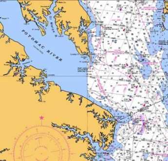
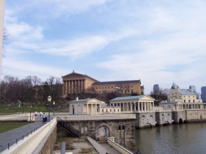
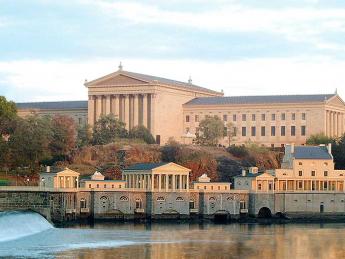
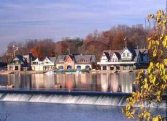
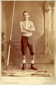
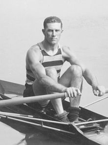
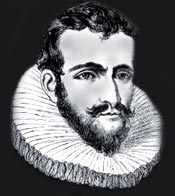
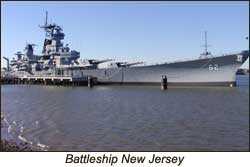


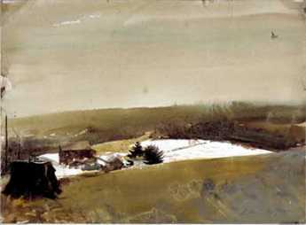
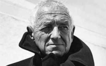
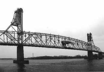
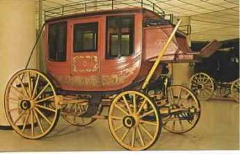
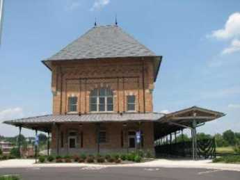
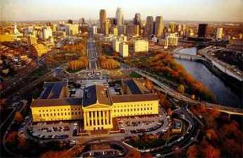
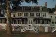

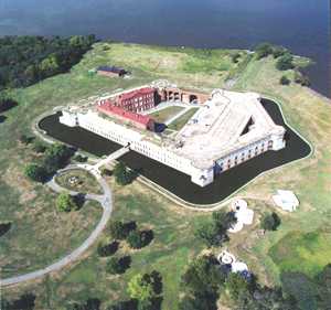
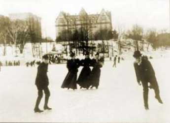
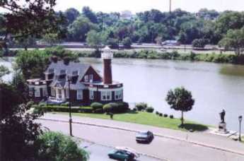

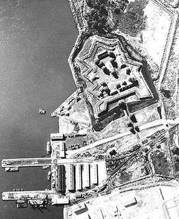
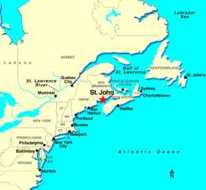
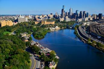
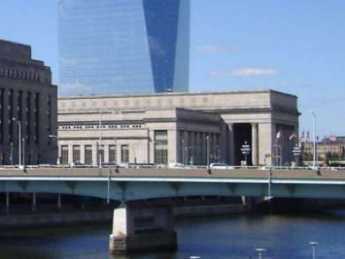
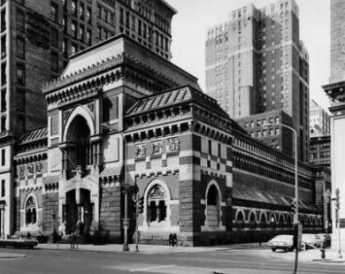
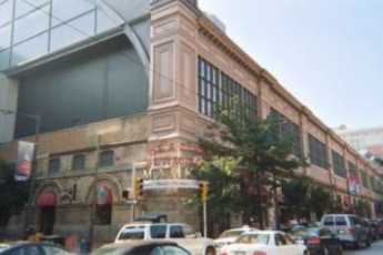
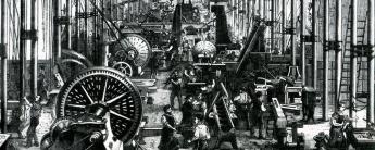

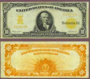
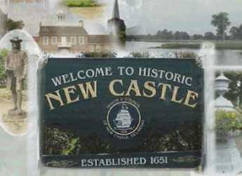
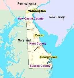
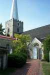
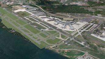
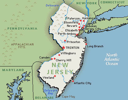
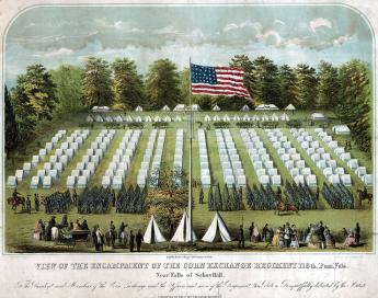

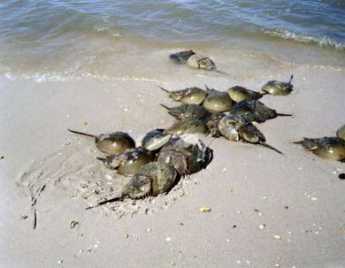
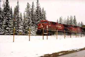
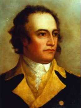
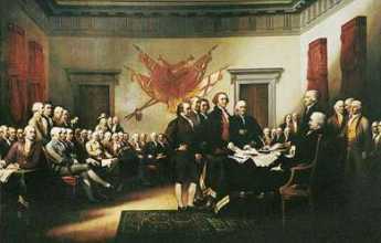
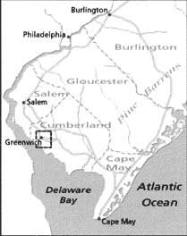
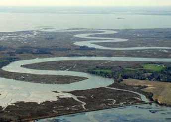
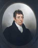
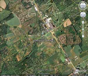

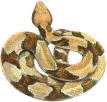
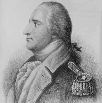
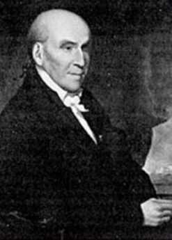
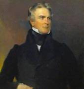
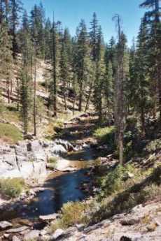
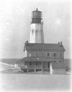
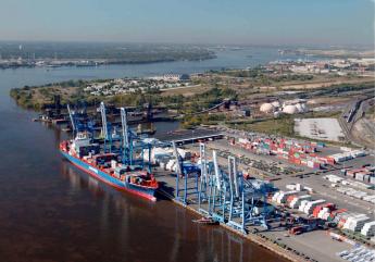
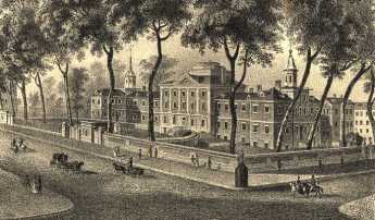
.jpg)
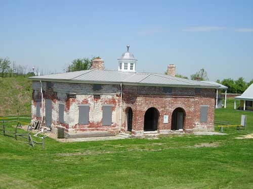
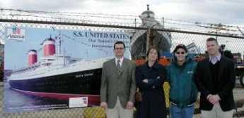
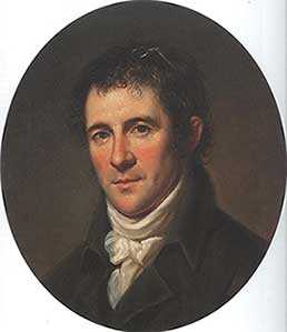
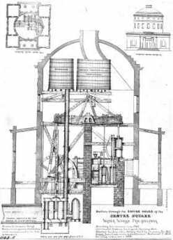
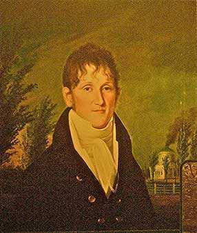
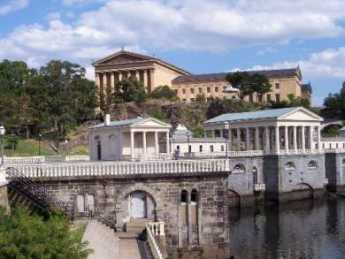

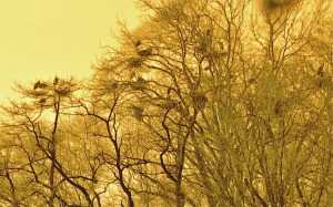
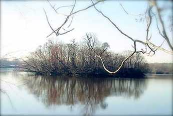
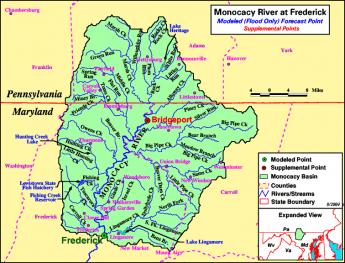
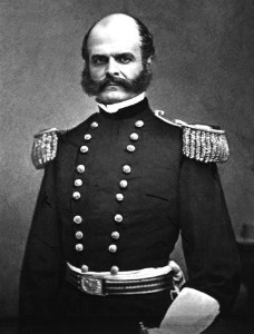
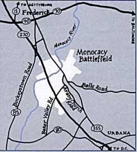
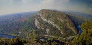


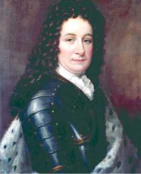
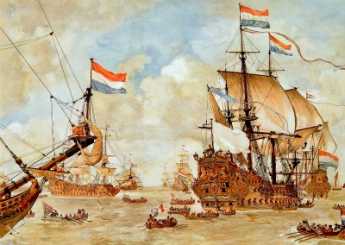
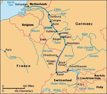
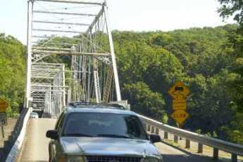
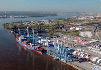

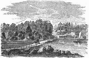
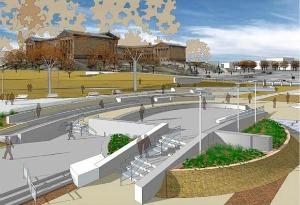
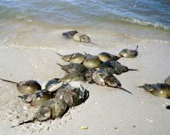
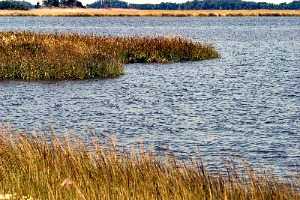
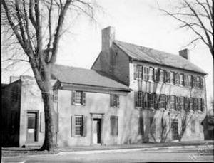

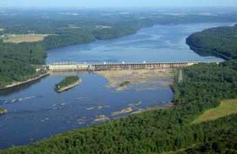
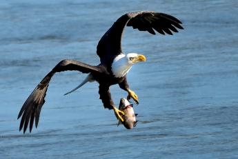

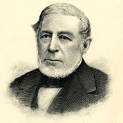
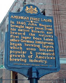

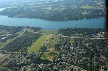
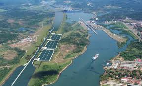
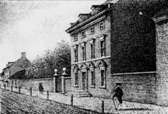 Refugees from Haiti slave revolts brought Yellow Fever to south Philadelphia.
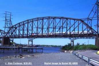 Tales of the Sea abound, even a hundred miles from the ocean.
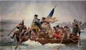 One of the oldest rail lines in America is coming back to life, and maybe bringing the towns along with it back to life, too.
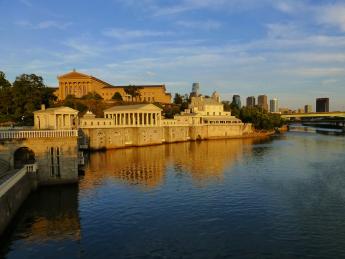 Philadelphia's acropolis is Faire Mount, where the Art Museum marks the entrance to Fairmount Park. Stretching beyond is Boathouse Row and its rowing races. When the azaleas are in bloom, it's the match of any place in the world.
 The Naval Acadamy now in Annapolis originally was on Gray's Ferry Avenue. It's still a handsome building, in some danger of destruction by real estate developers.
 It's now a little hard to remember that the swamps began at what is now the Airport, and extended to what we now call Gray's Ferry. A lot of garbage got dumped there.
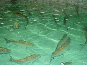 The Bay of Fundy.
 The river geography around Pottstown created a lot of history.
 Brewerytown is an unofficial term for the North Philadelphia area which filled with a hundred breweries and ethnic German residents after the Civil War. Prohibition destroyed that industry and created slums. Gentrification is now in progress.
 Pilots once had to race from the mouth of Delaware Bay to meet incoming ships. First one there got the job.
 For the past 13 years the SS United States has lain idle at a dock in Philadelphia and is facing the scrap heap should efforts by volunteers in several conservancies to save her not succeed.
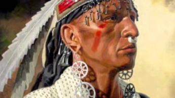 An ancient Shawnee Indian word causes confusion along the Blue Mountain.
 It's hard to realize that Philadelphia was the center of beer production in America until fairly recently. It's been argued it is still the center of consumption.
You've done an excellent job of presenting the material about Philadelphia. I was just admiring your webpage at:
www.philadelphia-reflections.com/reflections.php? content=topics_php/city_of_rivers_and.php
In the interest of keeping your links up to date, you may wish to know that the link you have for Fort Mifflin is obsolete. In addition to the page above, it appears the link may also appear on an additional 23 pages of your site. The "pn" directory was dropped and that site is now being served directly from:
www.fortmifflin.com
Thank you in advance for the correction; and again, great site!
--
Pete Lamb
Webmaster
FortMifflin.com
webmaster@fortmifflin.com