Related Topics
Philadelphia's River Region
A concentration of articles around the rivers and wetland in and around Philadelphia, Pennsylvania.
Historical Preservation
The 20% federal tax credit for historic preservation is said to have been the special pet of Senator Lugar of Indiana. Much of the recent transformation of Philadelphia's downtown is attributed to this incentive.
City of Rivers and Rivulets
Philadelphia has always been defined by the waters that surround it.
Nature Preservation
Nature preservation and nature destruction are different parts of an eternal process.
Touring Philadelphia's Western Regions
Philadelpia County had two hundred farms in 1950, but is now thickly settled in all directions. Western regions along the Schuylkill are still spread out somewhat; with many historic estates.
Railroad Town
 It's generally agreed, railroads failed to adjust their fixed capacity to changing demands. It's less certain Philadelphia was pulled down by that collapsing rail system.
Right Angle Club 2011
As long as there is anything to say about Philadelphia, the Right Angle Club will search it out, and say it.
Philadelphia Places
New topic 2017-02-06 20:19:14 description
Reviving Schuylkill: Eight Miles From the Dam to Ft. Mifflin

|
| Joshua Nims |
Joshua Nims of the Schuylkill River Development Corporation recently addressed the Right Angle Club about current activities of that organization. It's a non-profit corporation, but in a sense is a quasi-City agency, spending State and Federal funds, plus remediation funds. Just what remediation funds are was not clearly explained, but seem to be fines or assessments on companies who are thought to have fouled up the environment. Whether those assessments are fair or unfair, too small or too large, are political issues largely avoided in Mr. Nims' presentation, and hence are avoided here.
|
| Gray's Ferry Bridge |
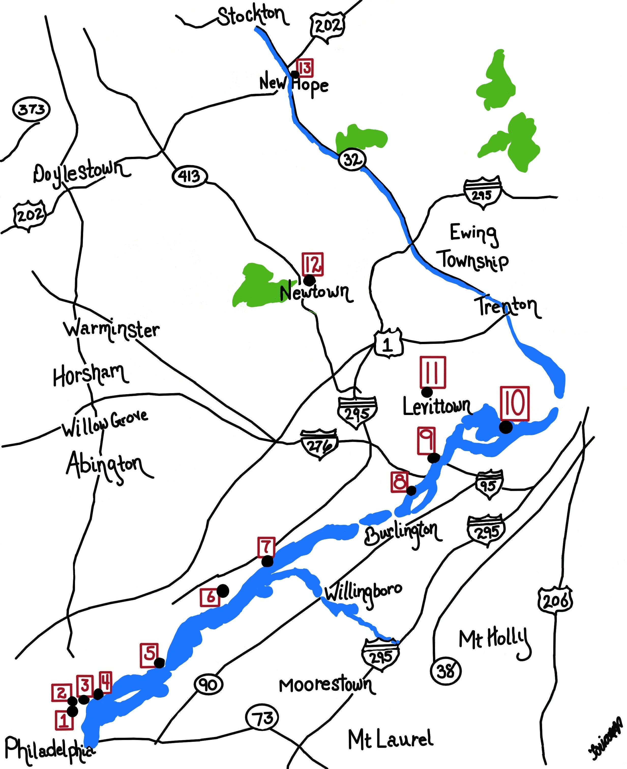
The Gray's Ferry area is certainly an urban tragedy of epic proportion, but since its deterioration began in 1856, the events of the Civil War probably had a lot to do with it. Up until the Civil War, the western banks of the Schuylkill, especially around Gray's Ferry, were famously upscale and beautiful. The South Street Bridge, for example, was originally envisioned as leading into a boulevard of the Arts, with the University Museum, Irvine Auditorium, the University Hospital and the mansions on the top of the hill setting off what promised to become a striking cultural statement. Anthony Drexel himself lived up there, walking it to work at Third and Chestnut. And that's just one famous example. It's hard to know what started the blight, but Harrison Brothers White Lead, Color and Chemical Works might be a good candidate and the fact that the area soon developed the tracks often (10) smoke-belching railroads was certainly another major issue. The western bank of the Schuylkill rose to a high rocky promontory at Gray's Ferry, crowding wartime industrialization into a narrow place. Before that, Gray's Ferry Bridge had been the main artery to the South, traveled by George Washington many times, often stopping at Woodlands, that palatial home of Andrew Hamilton the original Philadelphia lawyer. A century before that, the Dutch fur traders had found it to be the first firm land after they sailed inland through the swamp, while the Indians knew it was the last forest area before you reached the (South Philadelphia) area of malaria, yellow fever and other mysterious vapors that must be avoided. In the sense of land travel, Gray's Ferry was, therefore, the most prominent part of the Philadelphia landscape for two centuries. The ferry itself was a floating bridge, pulled back and forth by ropes on each shore of the river. Given a choice of pretty much all of the North American continent, John Bartram placed his farm just south of this promontory. Where it still stands today but surrounded by slums and urban decay.
It's a little hard to judge whether the Civil War pushed railroad construction into the only rocky crevice suitable, and then industrial pollution followed with vile and noxious effluents, or whether the Harrison Lead, Color, and Chemical factory simply started it across the river in the river bend. That's where the DuPont paint factory relocated in 1916, and in fact, the Duponts get local blame as polluters when in fact they made considerable effort to clean things up after they acquired it. The area had a major slaughterhouse abattoir, and an asphalt plant and several other major inducements to the populace to abandon their elegant mansions and run for their lives. The place now has old rusting bridges, tumble-down concrete pilings, lots of weeds, and not a single living fish for a century in that water. To diffuse the blame somewhat, it should be remembered that after the War of 1812, the Schuylkill was the main transportation artery for coal coming down from Pottsville and the rest of Schuylkill County. The river didn't have a sandy bottom, it was pulverized anthracite which releases acids and toxins when washed.
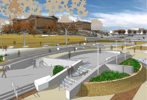
So that's the river region the Schuylkill Development Corporation plans to line with grassy running paths and benches to admire the view. Maybe the Wilson Steamship Line or something like it can again be persuaded to bring tourists here, or maybe the riverbanks can be lined with hotels to house people who take rides on river flatboats, as they do in San Antonio. Or dare we mention it, maybe Paris. Maybe Philadelphia can once again be a tax collector's idea of heaven, together with five-day weekends.
|
| Schuylkill River Development Corporation |
At the moment, this little non-profit city agency is run on a $500,000 operating budget, and has about $20 million worth of projects in progress. Some of that is reparation money pried from the grandchildren of the owners of those factories who did the damage over a century ago, and some large part of it is Philadelphia's share of the boodle from the Stimulus package. There's no doubt the area will look immensely improved in the next year or two, and a lot of hope that private investment will be attracted to an area previously shunned vigorously. The area which has already been cleaned up, from the Wissahickon to the Dam, really must be called a great success; there's lots of foot traffic and joyousness. And the area can also be praised in what unfortunately is the measurement of modern urban development: it has only had two lawsuits for sprained ankles, and only two muggings, quite a commendable record. But now development is going past South Street, into much murkier areas, with more low-income residential spaces. Surveillance cameras are planned, and bright lighting, but it's far from certain that a little strip of gentrification can defeat miles of surrounding decay.
Only if they pull it off will private investment creep into the area, and the parents of University students permit their children to run there. If private investment arrives, this organization can do no wrong, because only then can it fairly be described as "Infrastructure". My own definition of infrastructure as an economic stimulus is of early public spending on projects which would have eventually consumed the money anyway, except later. By that standard, infrastructure spending's only true cost would be the interest on borrowed money to do it sooner. Let's make a note to revisit this experiment in a couple of years, cautiously wishing everyone the best, in the meantime.
Originally published: Friday, March 04, 2011; most-recently modified: Tuesday, June 04, 2019