Related Topics
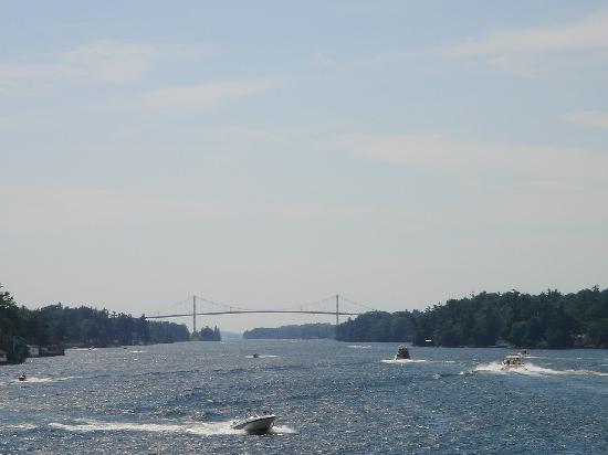
City of Rivers and Rivulets
Philadelphia has always been defined by the waters that surround it.
Northern Overland Escape Path of the Philadelphia Tories 1 of 1 (16)
 Grievances provoking the American Revolutionary War left many Philadelphians unprovoked. Loyalists often fled to Canada, especially Kingston, Ontario. Decades later the flow of dissidents reversed, Canadian anti-royalists taking refuge south of the border.
Due North of Philadelphia, More or Less
|
| Google Earth |
Airplane pilots tell us the main streets of quite a few cities seem laid out as if with a compass, north, and south, east and west. Philadelphia probably started that tradition in America, although Google Earth will show anyone who doubts it that Beijing, China was laid out along the same grid two thousand years earlier. It seems possible that Thomas Holmes was aiming at the Delaware Water Gap when he drew his famous map for William Penn, but there are troublesome objections. Broad Street, itself due North-South, when extended is called Route 611, heading straight for Doylestown, and then for the Water Gap. While there's a second pass through Blue Mountain at Wind Gap, it was a hard climb in the 17th Century. Until the Lehigh Tunnel was built, the water gap was the only practical way to go north for three centuries. The gap's existence had been known to the Indians for centuries, and the dividing line between East and West Jersey terminates at Dingman's Ferry, essentially the same place as the Delaware Water Gap. Since Penn's Proprietorship of New Jersey was seven years older than his ownership of Pennsylvania, he definitely knew about the main landmark of the area which he used as a fixed boundary marker. In fact, it is a tradition among modern proprietors that he unsuccessfully pressured the boundary negotiation in order to get both sides of the Delaware Gap into West Jersey, taking advantage of the sharp bend in the river for the purpose. Since he eventually owned or controlled all of the regions, it seems entirely plausible that he could arrange the direction of the roads as he pleased. There is one big problem with such a unifying hypothesis, however. If the Water Gap was to be made due North of Broad Street, and Broad Street was to be the center of the city, there was no way to accomplish it except by adjusting the location of the whole City of Philadelphia. That was within his power as owner, but it seems an extreme way to get maps tidy. The alternative explanation is that these mapping niceties were just a series of coincidences, and that is equally hard to believe. Present-day proprietors are often engineers and surveyors, so even to mention these issues is likely to lead to indignant dispute.
The Allegheny Mountains run from Georgia to the Adirondacks, presenting a sheer face to the East with very few gaps except for the major rivers. The water gap was a busy place for all North-South travel, whether on riverboats, canals, railroads or Interstate highways -- or mocassins. From there up to Canada, the simple explanation for a continued northerly path was there was scarcely any other way to go. The rivers and finger lakes have a due north orientation between mountain ridges as a result of advancing glaciers and receding glacier melt. That's the whole idea of global warming and global cooling; the polar ice cap advances and recedes from the north pole. When you are standing on the North Pole, everything else is South of you.
With logic plus a little imagination, it's thus possible then to see why a compass points you from City Hall, Philadelphia to Kingston Ontario, but how fast you go is your decision. The rest of this article argues that this seemingly desolate trail is peppered with an interesting history; even if you drive straight and fast, you ought to know a little about what you are passing. In this suggested trip, the traveler is urged to consider stopping for half a day in Doylestown, followed by the Water Gap, or Jim Thorpe, PA. You might alternatively duck off the Pennsylvania Turnpike extension into Wilkes-Barre and Great Bend, or toward Ithaca and Cornell University's famous bird sanctuary, then onward to Skaneateles and Marcellus over good local roads, tipping your cap toward Apalachin the gangster headquarters as you go. People in a hurry to get to Canada will take Interstate 81 most of the way, but at least consider taking secondary roads along Lake Ontario. It's a very pleasant drive, including a stop in Sackets Harbor for at least a meal. And then, detour to Clayton and Alexandria Bay before going over the international bridge to Canada. Finally, go down along the northern shore of Lake Ontario to Kingston. You're there.
Getting home after a long weekend is a hard drive, four-lane highways suggested, stopping at some of the places mentioned on the way home rather than using them all up on the way north. The detours add perhaps a half day to the trip in each direction. If you have the time, a trip westward along the northern or southern sides of Lake Ontario to Niagara Falls would be very nice, but not the subject of this topic.
It's pleasant to wander and stop at interesting places on impulse, but it's also nice to have a fairly clear idea of the day's outlines. You can eat in nice restaurants or grab a burger in a fast-food outlet; it often makes little difference which you choose. If you are traveling with children, tell the waitress to bring some crackers for the kids when she brings the menu. But by all means avoid the dreadful experience of watching it get darker and darker in the evening, with all the hotels full and adamant about it. By at least four o'clock in the afternoon, pick out a likely place to spend the night and call ahead for a reservation.
If you are traveling on a tight budget, at lunch don't go to a fast-food place, but to a supermarket. Pick up ingredients of tomorrow's breakfast and today's lunch; at the check-out counter, ask where the town park is, for a picnic lunch. With an assured place to spend the night, it's a lot easier to take a bath there, and then go out on the town for dinner. The main reason people drive like demons and thus miss the most interesting parts of a vacation trip comes from not knowing how to manage the children, and the details of travel life.
Originally published: Tuesday, August 03, 2010; most-recently modified: Thursday, May 16, 2019