Related Topics
Particular Sights to See:Center City
Taxi drivers tell tourists that Center City is a "shining city on a hill". During the Industrial Era, the city almost urbanized out to the county line, and then retreated. Right now, the urban center is surrounded by a semi-deserted ring of former factories.
Touring Philadelphia's Western Regions
Philadelpia County had two hundred farms in 1950, but is now thickly settled in all directions. Western regions along the Schuylkill are still spread out somewhat; with many historic estates.
The Main Line
Like all cities, Philadelphia is filling in and choking up with subdivisions and development, in all directions from the center. The last place to fill up is the Welsh Barony, a tip of which can be said to extend all the way in town to the Art Museum.
Rubberneck Tours of Philadelphia (1)

|
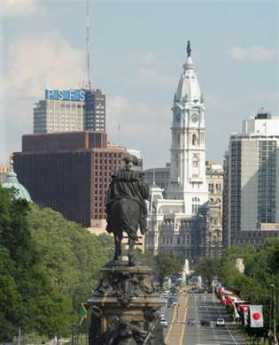
| Center City Philadelphia |
To qualify as a rubberneck tour, a route can be traveled in two hours by car, avoids the unsightly parts of town, strings together a lot of interesting sights which are of interest to visitors from out of town -- and educates the life-long residents as well. Several tours qualify, and it's a pity you can't go to someplace near City Hall and select one of them from a line of buses. Perhaps in time tourism will reach the point where this is possible.
For a start, go West from the center of town, out Walnut Street to 33rd Street, turn right. You won't see all of the University of Pennsylvania, but you will see a lot of it, followed by the campus of Drexel University. This was once a very elegant district, and many Victorian mansions can be seen as you go out to the Zoo. Navigate around a little with a map and get on Belmont Avenue. Be sure to get a glimpse of Sweet Briar mansion, peeping through on the right. You will be able to see Memorial Hall and other remnants of the 1876 Exhibition, soon to be the site of the Please Touch Museum. Keep going on Belmont, past the Ohio House which dates from the Exhibition, and on out Belmont Avenue to City Line Avenue. Here's the surprise.
Cross over City Line Avenue into Montgomery County and keep going. You will go past some lovely houses on the left, and the borders of Laurel Hill Cemetery on the right. You are going downhill now, through the woods, and you sweep around the right to the bridge over the Schuylkill. Didn't expect to go out of the city into the woods so abruptly, did you?
And now, crossing the Schuylkill, turn abruptly right on to Main Street in Manayunk. Another scenic shock, as you emerge from a country lane onto several miles of a gentrified abandoned factory town. In the summer, there are an awful lot of people sitting at sidewalk tables, talking about who knows what. Perhaps they are mostly resting their feet from shopping, whatever that means, in all the little stores now selling shoes and kerchiefs, apartment furniture, and knick-knacks. After a while, Main Street turns into Ridge Avenue, which eventually leads you back to the Benjamin Franklin Parkway, and back to City Hall. A somewhat prettier drive is closer to the river, with the landscaping and boathouses of the Schuylkill Navy.

|
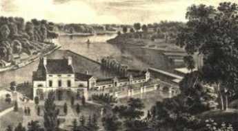
| Fairmount Park |
But continuing on Ridge Avenue allows you the option of an abrupt turn left on Schoolhouse Lane, where it's admittedly a little hard to find and navigate a left turn, scooting you abruptly back up a steep hill and into the woods again. Turn right on Vaux, right again on Warden Drive, and then left to Midvale, following it down to rejoin Ridge Avenue at the bottom of the hill. This little side-trip allows you to see some pretty unexpected woody suburbs, and if you have been told where to look, the former home of Grace Kelly, and the homes of Senator Spector and Governor Rendell.

|
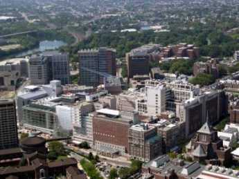
| UPENN |
Give it a few years, and Ridge Avenue at this point is sure to get gentrified like Main Street, back up that hill in Manayunk. Now, either take Kelly Drive back into town, or continue down Ridge past old (East) Laurel Hill Cemetery and a brief spin into Sedgely and the mansions along the cliff in East Fairmount Park. Or a brief detour over the Girard Street bridge to the edge of West Fairmount Park is worth a few minutes, returning by the Spring Garden Street bridge to the back of the Art Museum, and then down the Parkway.
You've just had a pleasant two-hour tour, researched and designed by the history department of the University of Pennsylvania to illustrate Philadelphia's role in the days of the Civil War. Back then, the area roughly enclosed by our rubberneck tour #1 was just beyond the edge of the town, an ideal spot for many training camps for the Union Army. Further south on the Schuylkill at that time was a collection of factories known as the "arsenal of the North". This more northerly part of town, now filled with thousands of brick row houses, was once let us say, the boot camp of the North.
Originally published: Wednesday, June 21, 2006; most-recently modified: Wednesday, June 05, 2019